Laguna Trail to Bayview Trail (5.3 mile loop), May 20, 2012.
Trail notes: Moderately strenuous in either direction with an elevation change of about 1200 feet. Though never steep, the Bayview Trail can cook on a hot day. In winter, crossing the creek near the junction of the Muddy Hollow Trail and the Bayview Trail can be challenging. On this May day, it was about five feet wide and required tricky balancing on a makeshift bridge of limbs and stones.
Check out this and other hikes Jules has taken on this Google map. The most recent hike is in blue; others are in red.
From the Sky Trail parking lot, Laguna Trail parallels the Limantour Road for the first 0.7 miles, traversing the upper watershed of Laguna Canyon. This is the mid-point of Inverness Ridge, roughly halfway between Tomales Point to the north and Pablo Point to the south. It’s also a transition zone between soil types. From here south the granitic spine of the peninsula is cloaked in a blanket of shale that it picked up as it dove beneath the sea on its northward migration. Shale has a clayey consistency that retains water, a condition favorable to the Douglas-fir that dominates the ridge from here south. Northward, the spine is nearly exposed, covered only by a thin skin of decomposed granitic soil that is extremely well-drained. Bishop pine does well on the drier, well-drained substrate and dominates the plant community from here north through Tomales Bay State Park. These differing soils types also explain why Laguna Canyon marks the southern edge of the 1995 Mount Vision Fire zone. To the north the fuel was much drier and more volatile. When the advancing fire, driven by winds out of the northeast, reached the edge of the fir forest, it died out.

-
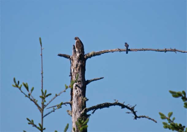
A red-tailed hawk perched atop a bishop pine snag could easily be overlooked, except by the scrub jay who is scolding from the branch to the right. Photo by Jules Evens.
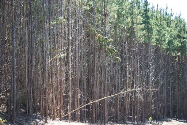
Bishop pines are considered fire dependent for regeneration; that is they “need” fire to reproduce. (There is some disagreement on this concept; some consider this a “pyrofungal” species that evades post-Pleistocene fire regimes in landscapes where natural fires are rare. See http://www.sscnet.ucla.edu/geog/downloads/969/113.pdf)
Bishops are relatively short-lived trees, about 60 to 80 years. Prior to the Vision Fire, there had not been a wildfire on Inverness Ridge since October 1927, and the forest was getting decadent–lots of mature trees, almost no young ones. After the fire, the regeneration was phenomenal, averaging about 25 seedlings per square meter in the first year. Now, 17 years later, these young trees are so densely crowded that it is impossible to walk through the thickest parts of the forest.
-
Bishop pine saplings along the Limantour Road. Photo by Jules Evens.
In time, some individuals will probably outcompete others, and the forest will begin to open up. Then again, the “average” fire cycle in bishop pine forests is thought to be about 15 to 20 years. Maybe another fire will reduce the already impressive fuel load and thin out the crowded stands.
“All that doesn’t burn is tinder.”–Annie Dillard in Pilgrim at Tinker Creek.
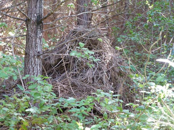
The densest sections of forest along the trail support a fairly high density of lodges of the dusky-footed woodrat. These stick tepees can be quite large, up to about six feet tall. Although the woodrat’s lifespan is only two or three years, the lodges are maintained for years by a succession of tenants. Most lodges house only one individual at a time, but research from Laguna Canyon suggests some social interaction among neighbors.
-
Dusky-footed woodrat lodge in bishop pine jungle. Photo by Jules Evens.
Woodrats are generous landlords, sharing their homes with other smaller creatures. On this hike I saw a wrentit provisioning a nest it had woven into a woodrat lodge; other “commensals” include arboreal salamanders, deer mice, shrews, and undoubtedly various insects.
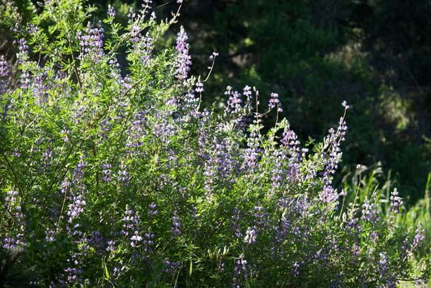
The second year after the Vision Fire, about 85 percent of vegetative cover in the fire zone was composed of three nitrogen-fixing plants–ceonothus, lotus, and bush lupine. These pioneering species restore the soil and provide nutrients for future colonists. ceonothus is still abundant on these hillsides, lotus and lupine much less so.
-
Bush lupine (Lupinus arboreus) in full bloom catching the morning light. Photo by Jules Evens.
Two miles downhill through forest and shrub, the Laguna Trail opens up near the Environmental Education camp. Swallows and dragonflies are coursing low over the freshly mowed field, both harvesting insects. A common yellowthroat sings from the riparian corridor that borders the south side of the opening; a black-headed grosbeak too. It’s about a half-mile past the education center and the hostel to the Muddy Hollow Trail and its junction with the Bayview Trail. By now it’s midmorning. The birdsong is starting to feather off, but another yellowthroat is singing from the swale and a pair of ravens can’t resist scolding me and showing off their aerobatic skills overhead.
It occurs to me that other than some activity around the hostel, I have not seen one person on the trail on this beautiful Saturday morning.
After half a mile up Bayview Trail is it crosses Muddy Hollow Creek and the junction with the Drake’s View Trail. Quiet, almost eerily so. A bench by the trail; a perfect place for a snack break where I sit and listen to the quiet murmur of the creek and the even softer rustle of the alder leaves, a good place to compose a short poem; maybe a haiku, but my mind is empty. But I remember a haiku by Issa, translated by my friend Bob Hass:
Even with insects—
Some can sing
Some can’t
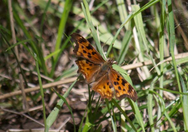
As I leave, a rustic anglewing lights on the trail.
-
Rustic (or is it a satyr) anglewing? (Polygonia spp.). Photo by Jules Evens.
From here the Bayview Trail is an uphill trudge. A few flowers are still in bloom along the trail’s edge–Indian paintbrush, blue-eyed grass, and an out-of-place pussy ears. While I’m photographing them, three runners come huffing up the trail, first folks I’ve seen all day.
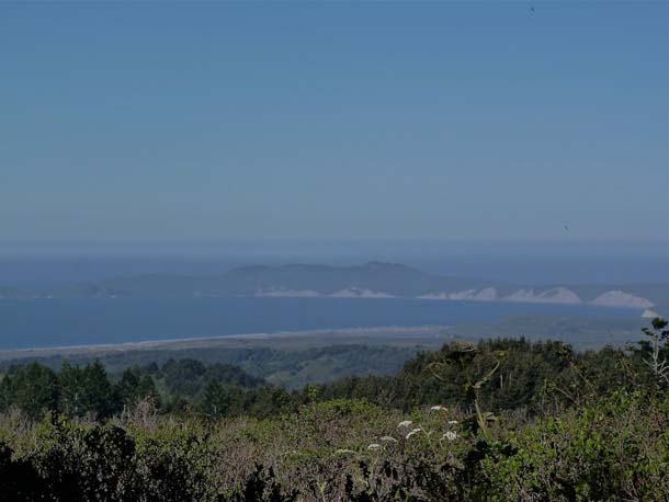
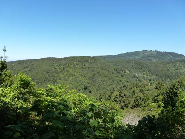
The Vision Fire made this trail’s name obsolete–barely a view to be had. Near the crest of the ridge there is a break in the dense forest that borders the trail for most of its length affording a view of the distant ridge that separates the Muddy Hollow and Glenbrook watersheds
-
The only view from the Bayview Trail looks northward toward Point Reyes Hill (1336 ft) in the distance. The closer ridge is the northern boundary of the Muddy Hollow watershed. It is blanketed heavily with Ceonothus thyrsiflorus, or wild lilac; this legume that came in so vigorously following the fire persists today, 17 years later.Photo by Jules Evens.
“A naturalist, like an artist, takes a vow of obedience to awareness.” —Jim Harrison
Critter list
Butterflies
California Ringlet
Pale Swallowtail
Red Admiral
Satyr or Rustic Anglewing
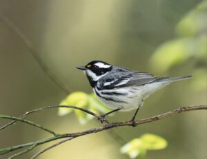
Birds
Allen’s Hummingbird
American Goldfinch
American Robin
Anna’s Hummingbird
Band-tailed Pigeon
Barn Swallow
Bewick’s Wren
Black Phoebe
Black-headed Grosbeak
Brown Creeper
Brown-headed Cowbird
Bushtit
California Quail
California Towhee
Cassin’s Vireo
Cedar Waxwing
Chestnut-backed Chickadee
Cliff Swallow
Common Raven
Common Yellowthroat
Dark-eyed Junco
Downy Woodpecker
Golden-crowned Kinglet
Hairy Woodpecker
Hutton’s Vireo
Olive-sided Flycatcher
Orange-crowned Warbler
Pacific-slope Flycatcher
Pine Siskin
Purple Finch
Pygmy Nuthatch
Red-tailed Hawk
Sharp-shinned Hawk
Song Sparrow
Spotted Towhee
Steller’s Jay
Swainson’s Thrush
Tree Swallow
Turkey Vulture
Violet-green Swallow
Warbling Vireo
Western Gull
Western Scrub-Jay
Western Wood-Pewee
Winter Wren
Wrentit
Yellow-breasted Chat
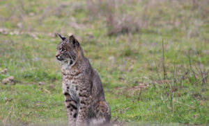
Mammals
Bobcat (scat)
Coyote (scat)
Dusky-footed Woodrat (sign and nest)
Gray Fox (scat)
Horse (scat & tracks)
Human Being (3)
Sonoma Chipmunk
Western Gray Squirrel

-
Indian Paintbrush (Castilleja affinis), one our most common and most vivid wildflowers. Photo by Jules Evens.