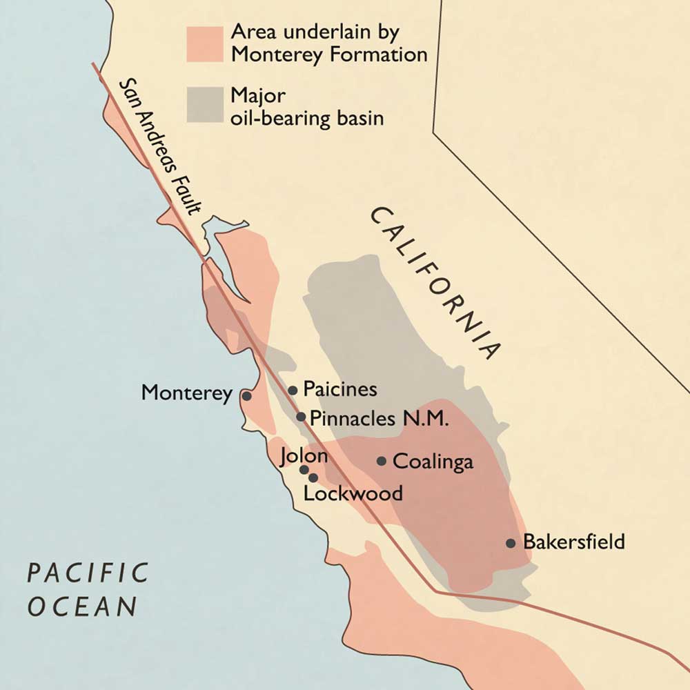
Often missing from discussions about the potential Monterey Shale oil rush is a sense of the landscape that sits above the shale, a complex and tightly folded geological formation that underlies 1,750 square miles from Southern California to Monterey through Alameda County and north to Mendocino County.
Much of the extraction is taking place in pre-existing oil fields in the Central Valley. But some leases are close to rural communities, causing environmentalists and farmers to fret about the wisdom of using large volumes of water to fracture subterranean rock. The activity generates wastewater, which then must be stored underground elsewhere, in this earthquake-prone, water-starved region where native wildlife has already been marginalized, primarily through loss of habitat.
In this story in the Bay Nature series on the impacts of extreme energy, we’re focusing on Lockwood in southern Monterey County; Aromas, which lies at the intersection of Monterey and San Benito counties; and Paicines in San Benito County. These communities have witnessed seismic survey trucks and well-drilling crews pull into town, putting them potentially at risk for oil drilling operations.
The grapes of Lockwood
Paula Getzelman and her husband own Tre Gatti Vineyards, a small grape-growing operation in Lockwood, in south Monterey County and just a stone’s throw from Lake San Antonio, a major tourist magnet.
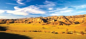
Rolling hills dotted with scrub oak and pines, and grasses that turn golden in summer and lush green in winter surround this community of ranchers and, more recently, grape and olive growers.
“It’s land you’d expect to see cattle grazing on,” Getzelman says.
From her living room, she can see San Antonio Lake, at least in non-drought years. It was once a river that emptied out of the Coastal Range and drained into the Salinas River, which runs north to Monterey and the Pacific Ocean. But San Antonio has been turned into a reservoir that farmers rely on to irrigate their crops.
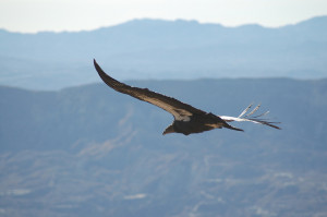
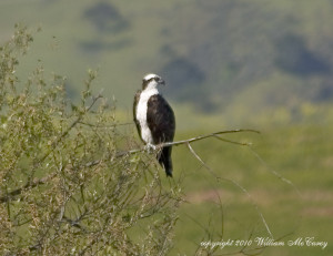
Condors, golden eagles, red-tailed hawks and owls sweep the skies. And badgers, coyotes, deer, elk, kit foxes, and squirrels cross the land.
“You can see their trails down to the lake,” Getzelman says.
She started educating herself about fracking two years ago, when an exploratory oil well was drilled ten miles from her place, and like most of the farmers here, she is concerned about water.
“Oil is important, energy is important, but once you’ve ruined the environment you are done,” Getzelman says. “In an area where agriculture drives the economy, that’s a harsh reality.”
She said that Monterey County planners seem more concerned about seismic issues related to injecting wastewater underground after wells are fracked, than water depletion and contamination. The extreme energy debate is mired in complexity.
“What’s missing from the conversation is an integration of all these separate facets,” she says. “ It’s like Chinese water torture.”
Fields of gold
Pat Lerman lives in Aromas, a small unincorporated community at the intersection of Monterey and San Benito County, close to Santa Cruz and Santa Clara county lines.
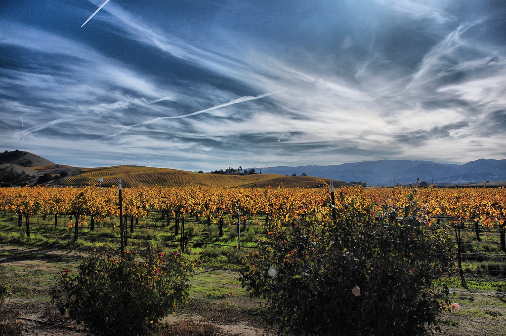
“It’s a hamlet in a valley, surrounded by soft rolling hills that turn golden in the summer,” she says.
The Pajaro River flows through town, which is surrounded by fields of artichokes, raspberries and strawberries.
“Up here in the northwest corner of the county, it’s berries and row crops like lettuces, spinach, and bell peppers, and apples and apricots,” Lerman says.
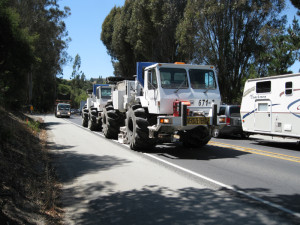
She’s the spokesperson for Aromas Cares for our Environment (ACE), a watchdog group that formed in June 2012, after “thumper” trucks rolled into town and started to simulate earthquakes and collect data showing underground locations of oil. So far, the seismic survey data has not translated into applications to permit oil drilling, but the community nevertheless began to organize.
“That was our warning, even though it turned out to be a false alarm,” Lerman says.
ACE fears Aromas could become an industrial zone, with roads clogged by trucks carrying heavy equipment and steel pipes for drilling.
“We learned that extraction would require ‘enhanced recovery’ methods, including fracking,” Lerman says. “It’s a stimulation technique. Now you can get oil you couldn’t get before. It’s like leaving pennies or, in this case, silver dollars, in the couch.”
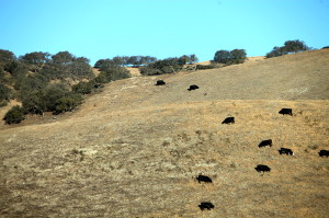
Where the cattle roam
Kathy Spencer’s family raises cattle on a ranch in Paicines, a rural community in the Gavilan Mountains in San Benito County, 6 miles south of Pinnacles National Park on the foraging path of the condor.
“The land has been in the family since 1880,” says Spencer, who sees wild turkeys and feral pigs in the golden grass, oaks and black chamise brush that surround her family’s three ranches.
Spencer used to see condors drinking from cattle troughs and scavenging for carrion on her family’s land.
“But now they feed them at Pinnacles,” she says.
Spencer has been tracking proposals to construct test wells that use “cyclic steam,” or “huff and puff” methodology–steam is periodically injected into wells to heat up and help oil flow –just one mile from one of her family’s three cattle ranches in Paicenes on a neighbor’s property.
“Some people are thinking that [oil exploration] will save our culture,” Spencer says. “We’re not necessarily against people getting money, we just want them to do so it will be a safe environment. Water is really precious to us in this arid part of the country.”
She also worries that oil development will increase truck traffic on Highway 25 towards King City or Hollister.
“It’s a twisty two-lane road,” Spencer said, noting that the road currently sees trucks full of grapes and vegetables. “They beat up the road to pieces.”
[slideshow exclude= 87424]
Preview of our next installment: Fox, rat, lizard.
As farmers and ranchers worry that extreme energy extraction could compromise open working landscapes that are essential to rural traditions, economic stability and food production, environmentalists fret about the impacts of unfettered fracking on a long list of species of concern.
Read our first story in Bay Nature’s fracking series: In condor country comes a California oil boom.
Sarah Phelan is a contributor to Bay Nature and is leading our coverage on Extreme Energy in the Monterey Shale.