For over 130 years, Lobitos Ridge has been climbed only by cattle.
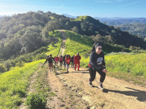
So when we push open a stiff gate and ascend a steep pasture, tall grasses snap at our ankles. We sidestep old fences and prickly thistle. In a gentle swale, we admire a muddy stock pond, rich with tadpoles.
It’s a sneak peek at the setting of a future ridge-to-coast trail, a 1,300-acre payoff for three decades of patient planning, purchase, and political compromise.
The long-awaited Purisima to the Sea trail will be the first recreational route on the Peninsula that spans the entire distance from the Santa Cruz Mountains to Highway One. It also spans many decades of ranching, logging, and, lately, conservation.
The recent acquisition of four historic parcels finally completes a multimillion-dollar chain of protected property anchored by Purisima Creek Redwoods Open Space Preserve. At its peak are the redwood forests along Skyline Boulevard; at the base are fertile artichoke fields near the ocean. Gradually, over time, each property has been secured by the Midpeninsula Regional Open Space District (often called Midpen), now the largest owner of protected lands on the Peninsula. These new acquisitions are indeed just cause for celebration on the agency’s 40th anniversary.
“Use your imagination,” says Midpen docent Lynn Jackson, who is leading our hike along coastal Lobitos Ridge, in a pasture bracketed by two wild creeks. “You can see how wonderful this will be.”
The entire route isn’t yet open to the public, although docent-led tours are offered. There’s no trail. No signs. No parking lot. No restrooms.
But its promise can be visualized now on a hike through Purisima Creek Redwood Open Space Preserve, a 3,360-acre showcase for the rugged diversity of the Santa Cruz Mountains’ western slope, with more than 20 miles of trails that weave from the crest at Skyline Boulevard, down through redwood and hardwood forests to the lush riparian habitat along Purisima Creek.
Even on a Saturday afternoon, Purisima has relatively few human visitors–but you’ll find multitudes of cigar-size banana slugs and tall trees beyond counting. We start our route atop the ridge at Skyline Boulevard (Highway 35) roughly six miles south of Highway 92, near the headwaters of the creek. An equally lovely access point for the Purisima Creek watershed is the preserve’s main entrance, about a mile and a half farther north.
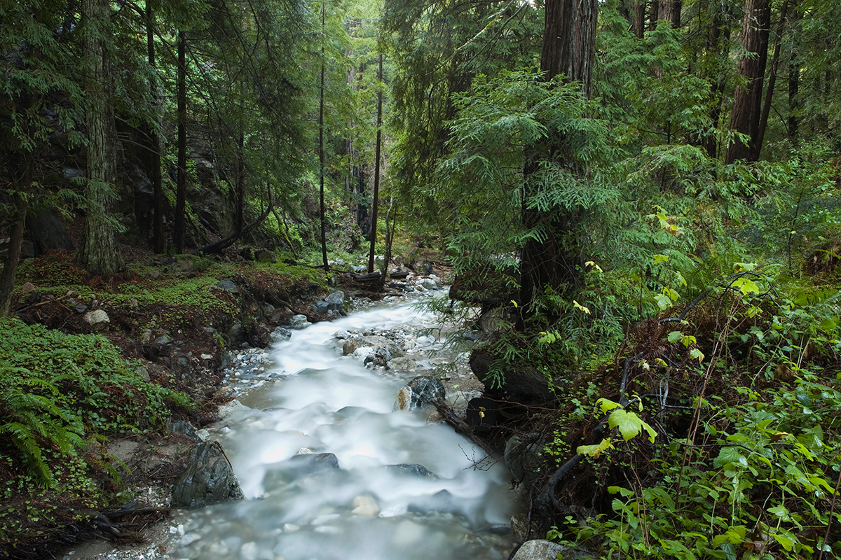
A dense mix of redwoods, tanoak, and madrone creates a shaded canopy of broadly arching branches. As we walk, the warm, dry air turns cool and dewy-sweet; the trails are rich with needles, leaves, and those banana slugs. California polypody fern, giant chain fern, and sword fern form a lush understory, with dense thickets along the trail, curving over fallen logs.
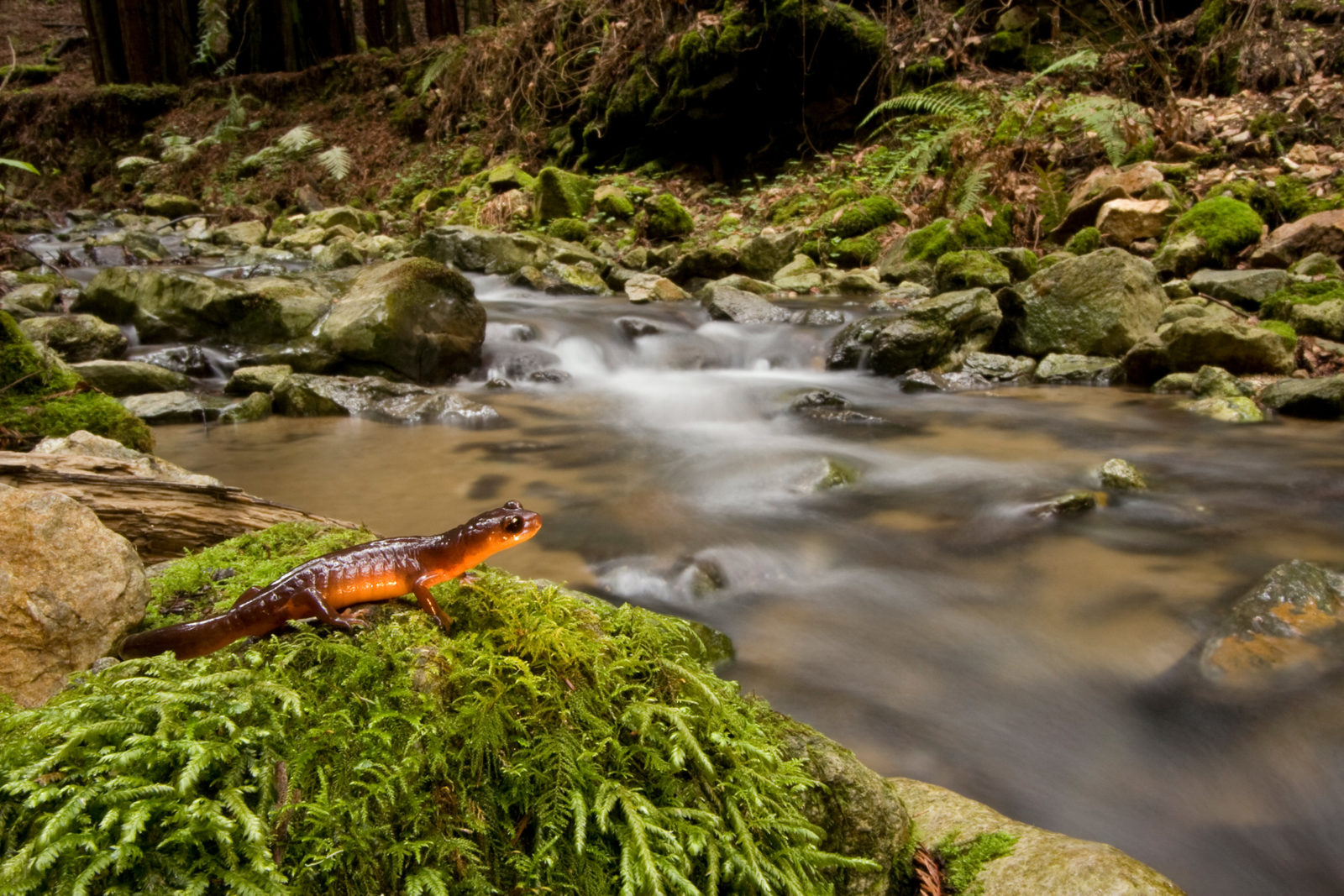
At each wooden bridge crossing Purisima Creek, we stop to admire the furry moss that carpets the banks. This forest feels cool and primeval, with deep shade that is home to hazelnut, stream violet, trillium, and sorrel.
The name Purisima is Spanish for “most pure,” yet clues to a not-so-pure or peaceful past surround us. These redwoods are lush and tall, strong and hardy — but they’re mere youngsters, conceived in the late 1800s after logging denuded this landscape. This now-serene valley was once the center of a massive redwood harvesting operation, with loggers slicing the first-growth redwoods into shingles at steam-powered mills and hauling them out with pack animals.

The logging industry’s impact on this preserve’s landscape can still be glimpsed alongside some trails, in remnant ditches, clearings, and surviving trees still charred from slash fires set by loggers to burn bark and other debris. You can also see the remains of skid roads: heavy wooden crossbars laid across this path to keep the butt ends of logs from digging into the dirt as they were dragged out of the forest, according to University of California Santa Cruz historian Tonya Huff.
Today, the eight-mile-long Purisima Creek is mostly pure again, flowing down the ridge year-round through steep-sided gulches. But in the 1880s, its water was appropriated to drive the steam-powered saws and the “donkey engines” that hauled logs to the half-dozen mills then operating here.
We pause at wider spots in the already-wide trail, where lumber mills once stood. The Borden and Hatch families owned most of the mills in this area. A Borden mill was located where Purisima Creek Trail intersects with steep Grabtown Gulch Trail — an evocatively named route that memorializes the 1880s-era lumber camp residents who laid claim to land and anything of value on it. The ridges were depleted and lumber prices fell, and all the mills were closed by the 1920s.
Big-leaf maples and western sycamore now flourish in clearings, along the creeks where mills once stood. By autumn, as the days shorten and evenings grow crisp, these deciduous trees turn from bright green to shades of brilliant yellow, subtle gold, and dark brown. Their fallen leaves mingle with redwood litter to form a thick duff that helps to absorb the water from the winter rains and keeps the trails from turning into mud. The returning rains will also recharge creek waters slowed by summer drought. The understory is rich with coffeeberry, thimbleberry, and gooseberry. Wintering ladybugs, numbering in the tens of thousands, gather on the branches of shrubs in spots of sunshine along the creek.
To continue our trek toward the sea, we climb out of the Purisima Creek watershed along an old logging road. The wide and well-graded Borden Hatch Mill Trail climbs 1,000 feet over 2.5 miles and offers scattered views to the east. It’s a rewarding workout.
This is a hushed landscape, with few hints of birds or beasts. But it is precious habitat — home to the elusive and endangered marbled murrelet, a seagoing bird that makes its nest in old-growth trees. Midpen staff found and saved a fledgling murrelet near this trail in 2002, the last time the area was surveyed for these rare birds.
In autumn the skies turn clear, and the marine fog retreats. On the more open hillsides, coyote brush erupts in fuzzy white masses of windblown seeds, while in the drainages the willow and alder turn yellow. By mid-October, the fields below will wear a blanket of orange pumpkins.
To reach the park’s highest point, the summit of Bald Knob, we take a narrow hiking-only trail with switchbacks that propel us quickly up 200 feet. This western flank of the preserve, obtained by Midpen only a decade ago, offers no through access to other parts of the preserve, so this is Purisima’s quietest corner.
The drier landscape here is home to chaparral species such as chamise, blue-blossom ceanothus, and sticky monkeyflower. Bald Knob Trail edges 1.3 miles along an eroded ridge of chalky sedimentary layers, sand and mud deposited in an ancient sea and then uplifted. Giant, wind-battered Douglas firs cling to thin soil and sandstone outcrops, their branches draped in lichen. Broken branches litter the ground.

With disappointment, we discover that this trail never ascends to the top of the 2,012-foot hill. This area was lumbered as recently as the early 1990s and still feels bruised and blemished.
Today, the Purisima to the Sea route ends in the southwestern corner of the preserve. The district is just now beginning the long and complex process of plotting and building the future trail through the four new jigsaw-puzzle pieces of forest, farm, and ranch land.
But here we see glimpses of the soft rolling hills farther west–the route of the future trail. Energized, we drop down the sun-drenched hill, along the wide and grassy Irish Ridge Trail, named after a series of Irish families that settled there early in the mid-19th century.
The open landscape comes alive with the stiffly accented Chi-ca-go calls of a covey of California quail, flushed and fleeing for cover. Western fence lizards scurry across the trail. From the scrubby brush comes the accelerating trill of a wrentit.
The exposed crest of Irish Ridge offers unparalleled views of land that will someday be open to hikers on the new ridge-to-sea route: the watersheds of Lobitos and Tunitas creeks, coastal ranches, and finally the ocean.
Taken together, this is a majestic landscape and remarkably free of development, given that Silicon Valley is just over on the eastern side of the ridge. The Lobitos watershed hosts the tallest tree that Midpen owns — more than 255 feet to the top, according to local historian Ken Fisher. This same watershed also has the twistiest known redwood in the region — a 217-foot-tall tree with six full circular twists from root to crown. Near the intersection of Irish Ridge and Lobitos Creek trails is yet another anomaly — a large redwood with a major branch extended over the trail like an arm, elbow bent, forearm up.
The trail ends rather abruptly soon after the junction with the Lobitos Creek Trail, at the southern edge of the preserve. So we have to retrace our steps. At least for now. But we can stop to imagine, for a moment, the completion of this Purisima to the Sea hiking corridor that has been a shared dream of so many Peninsula-based environmentalists since the 1980s.
The Bay Area has only one major ridge-to-ocean trail south of the Golden Gate: the 34-mile Skyline to the Sea Trail from Castle Rock State Park to Rancho del Oso in Santa Cruz County.
Until recently, the vast landscape along the coast was off-limits to the district, whose original charter was focused, for political reasons, from the Santa Cruz Mountains east to San Francisco Bay. But between 1999 and 2005, local environmentalists worked with agency officials on a deal to incorporate 220 square miles of the coast into Midpen’s jurisdiction. That cleared the way for the potential acquisition of thousands of acres of forests, rolling ranchlands, and fertile fields — from Pacifica south past Half Moon Bay and Pescadero to the Santa Cruz County line.
With that expansion, the Purisima to the Sea trail went from dream to possibility, though no completion date has been set. The route will cross Lobitos Creek by bridge, then skirt the corner of 260-acre chaparral-studded Blue Brush Canyon property, purchased in 2009. It will proceed west and climb out of Lobitos Creek canyon, ascending the grassy 340-acre Lobitos Ridge.
Cattle will continue to graze these hills and valleys because the district has decided to lease these parcels to local ranchers. This is a reversal in philosophy for the district, reflecting new evidence that cattle are one of a few effective ways to manage large grassland areas. “We’re using grazing as a tool,” says docent Jackson.
From Lobitos Ridge, the trail will descend through the upper pastures of the Richard J. Elkus Ranch, donated to the University of California Cooperative Extension Service by the family of the Silicon Valley chip innovator. Three years ago, UC sold the unused 450-acre uplands portion to the district, retaining the educational barns, gardens, and conference center on the lower parcel.
The future trail will conclude at sea level, on the edge of Purisima Farms, a property sold to Midpen by the John Guisti family. This rich bottomland, used for row crops since the 1860s, was once one of the nation’s largest producers of artichokes and brussels sprouts.
Before the route is built and opened, there’s still a lot to do, from fixing fences to improving water troughs and installing spring-loaded gates. Invasive brush like poison hemlock will be eradicated, over time. And some stock ponds must be relined with clay to make them more reliable habitats for the threatened California red-legged frog.
But the hardest job is done. Over our heads, a red-tailed hawk sweeps a circle in the sky, as if doing a victory lap.