.jpg)
Niles Canyon is one of the great natural gateways in the San Francisco Bay Area landscape. It is here that Alameda Creek breaks out of its wide interior drainage through a slot in the westernmost rank of the East Bay hills. Though altered by road and railroad and flood control embankment, the water gap remains a place of drama, where the stream falls quickly enough to afford a modest whitewater run, and a few salmon (and lots of steelhead/rainbow trout) still seek their spawning grounds. The steep slopes rising from the waterline look fairly pristine. A good site, you would think, for a regional park. But there isn’t a park—or is there?
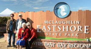
In the 1990s, the East Bay Regional Park District bought a thousand acres of land covering the south slope of the canyon and a green basin perched on the ridgeline above, the Vargas Plateau. From the heights you look west over bayshore salt ponds and wetlands, south to Mission Peak, east to the Diablo Range. But nobody much has seen this view. Planning for public use is only now getting under way. In the interim, this site, like many other key East Bay open spaces, has been in a kind of protective limbo called the land bank.
It’s nothing novel for future parkland to sit awhile between the close of escrow and the start of public access. For any new park, says district General Manager Pat O’Brien, there are plans to be drawn and presented for public review, parking areas to be laid out, trail systems to be designed, rangers to be hired. The waiting period can lengthen from years to decades if the money available to buy land is not matched by the money to manage it, which is often the case.
In the Bay Area, notable parks-in-waiting include the Willow Creek addition to Sonoma Coast State Beach, open to guided groups only, and the planned Cowell Ranch State Park near Brentwood, purchased for the public after the defeat of a sprawling development plan. But the champion holder of future parks is the East Bay Regional Park District, which coined the term “land bank” to describe this status. Banked properties are scattered over the district’s territory in Alameda and Contra Costa Counties, from the Vargas Plateau in Fremont to the Falman asparagus farm near Discovery Bay in the Delta. At one point fully a fifth of the district’s property was “in the bank,” and some chunks have been there for 15 years or more.
Why so much land in the bank for so long? District officials point out that much of the lag is built into the park-making process. Assistant General Manager of Management Services Dave Collins says: “We are in the midst of a lot of projects, some of which take 20 years to complete.”
Building a park by purchase from willing private owners, says Assistant General Manager for Land Acquisition Bob Doyle, “is like assembling a big puzzle. We’re knitting together pieces all the time.” The first parcel acquired may lack public access or a suitable parking area, for example, or the necessary land for a trail connection, or a defensible boundary. The properties that have been longest in the bank are often simply those waiting for a missing piece. “We have to acquire enough to make it usable,” says Doyle.
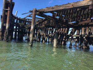
Take the case of Big Break Regional Shoreline, an ecologically valuable area in the Delta at Oakley. The district has had property here since 1987 and picked up a big chunk in 1995, but all of this territory was under three to seven feet of water. The necessary dry land for a staging area, without which there could be no park, wasn’t purchased until 2000.
Once a critical mass of land is assembled, the planning process can begin. The district must draft a development plan and an environmental impact report analyzing the effect of projected “improvements” on the natural and cultural resources. After one or more rounds of review by regulatory agencies, the package is put before the public for comment, a process that alone takes 12 to 18 months. Big Break’s land use plan became final in late 2001.
Then any facilities proposed—trailhead parking is usually the big item—must be constructed. Even if funds are in the pipeline, this phase can add another three to four years. At Big Break, a much-anticipated Delta learning center is now scheduled to open in 2008 in a partnership with Los Medanos College.
Finally, the district has to hire or reassign staff to run the new park. A semi-wild area may require only part of a single ranger’s time and a few other services; a more intensively used park, perhaps a full position or two. A political element affects timing as well. The park district is committed to sharing the wealth among its seven electoral districts or wards, buying and opening parks at about the same pace north and south, east and west. Similarly, it prefers to open units at the rate of three or four a season at most, giving staff and the public time to adjust.
But if prudent practice accounts for some of the backlog, there’s no denying that the present size of the land bank has everything to do with a more obvious constraint: funding, or the lack of it. In 1978, California voters passed the constitutional amendment called Proposition 13, which rolled back property tax rates and required most future tax increases to be approved by a two-thirds popular vote. Like other local government bodies, the district had to tighten its belt. With funds short and land development pressures high, buying land seemed the obvious priority. Building facilities and funding park management could wait their turn.
The informed public seemed to see things the same way. When the district went to the voters in 1988 for a $225 million bond issue, it earmarked the bulk of the funds for land purchase, not park management. This emphasis probably helped the measure clear, by a hair, the difficult two-thirds hurdle.
Quite by accident, the bond issue was very well timed. The slumping real estate market of the early 1990s made the money go further than advocates had dared hope. In the next ten years park buyers acquired some 30,000 acres of new land. As the 20th anniversary of the bond vote victory approaches, the district’s holdings have grown by almost one third, to 97,600 acres. That quick growth is both a hallmark of the district’s success and an operational challenge for its day-to-day management.
Getting voters to approve ongoing administrative funding can be a more difficult proposition. In 1998, the district floated Measure W, a parcel tax earmarked for opening the new lands and hiring 20 new rangers. It did not quite reach the required two-thirds level. Jean Siri, then president of the district board, remarked dejectedly that property would still be acquired, “but it’ll be landbanked. It won’t be open.”

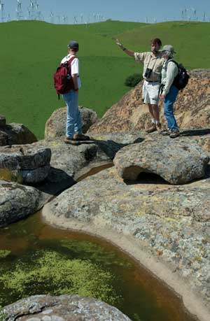
- EBRPD’s Bob Doyle (center) is in charge of acquiring landfor future parks. Funds from 1988’s massive Measure AA bond paid forthe initial acquisition of Vasco Caves Regional Preserve, seen here.The seasonal pool in the foreground is one of the preserve’s manysignificant natural features. Photo by Scott Hein
Since then the district has worked hard to bring some parks out of storage, relying on state funds, private grants, and partnerships with other agencies. From a high of 21,000 acres, the land bank balance has declined to about 15,000 acres. It is probably the district itself, far more than the public, that chafes at the delay in getting parks on line. The Regional Parks Association, a citizens’ watchdog group, doesn’t list landbanking among its concerns. President Amelia Wilson agrees with the emphasis on acquisition over development: “Most people understand that if you have a chance, you grab it.” In some instances, she adds, “there’s a good case for not doing anything for a good long time.”
Outings leader Bob Solotar of the Sierra Club’s San Francisco Bay Chapter concurs. “As a [trip] leader, I’d like to see the land open up. But the fact that it’s landbanked and out of the hands of potential developers—that’s OK. We’ll get it eventually.”
It helps that the district already has so much publicly accessible land. “There are so many options around here,” Solotar says, “that someone could go out for years without repeating.” The situation is rather different where public lands are scarce, as in Sonoma County, or where some of the very best land is off limits, as in San Mateo County, where the long-standing closure of the San Francisco watershed lands has only recently begun to ease.
One area that did prompt some arguments during its years in the land bank was Sycamore Valley Regional Open Space Preserve at Danville, which opened in 2005, 16 years after the first parcel was acquired.
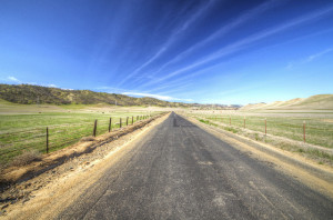
The park lies in two hilly units amounting to some 700 acres on either side of Sycamore Valley Creek and Camino Tassajara. Choose a vantage point on one of these green slopes and look across the valley at the other, and you can imagine yourself in the old Contra Costa ranch landscape, spotted with grazing cattle. The urban strip in the valley between seems a break in a sea of grass. Climb to a higher summit, however, and the proportions reverse: You see that the green areas are the islands, urbanization the sea. Attracting few visitors from far away, these hills are welcome refuges for those living within a few miles, and the views of Mount Diablo from the ridgelines are stunning.
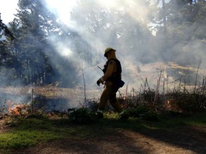
When the district took title to the land, two things occurred: Gates that had been open to casual trespassers now were locked; and cattle that had been off the hills for some years during the urbanization phase were put back on the grass as a vegetation management tool. Those neighbors who paid attention reacted in two contrasting ways. Many shrugged their shoulders and continued using the land—gates can be climbed over. A few complained, both about the closure and about the cattle: A local Friends of Sycamore Valley group arose to push for opening the property, as well as for changes in grazing practices. But in 2005, when the district offered a plan for the property as a prelude to formal opening, the people who spoke at the hearing tended to favor the status quo, fearing that greater access and publicity would only spoil the charm of an area they had quietly (though technically illegally) enjoyed. Since the locks came off the gates about a year ago, little, in fact, appears to have changed: The park is open but remains lightly used.
No such tensions have attended the opening of the fascinating Vasco Caves Regional Preserve in eastern Contra Costa County. Vasco’s 1,340 acres adjoin lands owned by the Contra Costa County Water District (Los Vaqueros Reservoir) and form part of a 50,000-acre sweep of public lands extending from the Brushy Peak Preserve to Mount Diablo and the Black Diamond Mines. The key feature at Vasco is a sandstone formation in which wind and water have eroded horizontal caves and vertical sockets. Native Americans of several groups made use of the caves, leaving bedrock mortars and some of the region’s best-preserved petroglyphs and pictographs. In other cavities, raptors nest. The sockets fill with rainwater to form seasonal pools called tanks. In these evanescent waters live several rare and endangered species of fairy shrimp, a creature that hatches, grows, lays eggs, and dies in the few weeks the habitat exists. It’s a scene you might expect to find somewhere in Utah.
The park district took responsibility for Vasco in 1995. The special values of the place made for a lengthy inventory and planning process. Six field surveys were done by the end of 1996. Fencing was completed in 1999. A plan was completed in 2000. Finally, in 2005, the preserve was opened, but not all the way. To protect its extraordinarily fragile natural and cultural treasures, the area is and will be accessible only on guided tours.
In 2004, a grant from the Gordon and Betty Moore Foundation allowed the district to nearly double the size of the preserve and round out its boundaries. The new property brings something unique into park holdings: a wind farm. Under two separate leases, dozens of wind turbines will spin until 2014. Safety issues preclude public access before that time. Meanwhile, park biologists will monitor the turbines—the older kind blamed for many raptor deaths—to gather valuable data on the extent of the problem and its possible solutions. (Energy sales in the interim will bring in about $80,000 a year for management of the property.)
Maybe the most tantalizing of the properties still in the land bank is the Vargas Plateau, which brings us back to Niles Canyon. District master plans since 1973 have called for a park here. After a close brush with development in the 1980s, the area was singled out by name in the 1988 bond measure. In 1993 and 1996, the district bought over 1,000 acres, and it has hopes for more. When open, Vargas should be among the keystone parks of the entire system.
The Vargas Plateau is also an indispensable link in the Bay Area Ridge Trail, and this fact has helped it move to the head of the planning line. In 2005, the San Francisco Bay Conservancy and the Ridge Trail Council granted the district $110,000 of state bond money to get things going. A land use plan is now expected by the end of 2006, and opening should come in another two to three years.
Anybody impatient with the land bank has only to wait—and pay a visit to some of the more than 80,000 acres of regional parks that are already accessible. At some point, perhaps not very far off, virtually all land in the region will be either urbanized in some form or protected in some form. Parkland will still be acquired, but in ever smaller and more expensive pieces. The task of the future will be to make the best of what we’ve got—and all we’ll ever have.
Meanwhile, the need remains to buy what can be bought while the buying is good. And the landbanked properties are waiting for us like birthday presents or packages under a Christmas tree. We look forward to the day we open them. But we may also miss their promise, just a little, when the mystery is gone.