Back in the mid-1970s, as a newcomer here, I felt a certain pride in learning to orient myself by sighting either Mount Tamalpais or Mount Diablo (or even better, both). While Tam is a more constant presence for those of us living around the inner Bay, you don’t have to go too high up a San Francisco hill to see the triangular peak of Diablo poking up behind the rim of the East Bay hills.
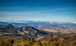
Though Mount Diablo is not the Bay Area’s highest peak (can you guess what is?), like Mount Tam, it stands head and shoulders above its surroundings and is visible from miles around in any direction. It can look quite different depending on your vantage point. From San Francisco, it’s a single pyramid. From Benicia, it’s a two-peaked ridge. From the Central Valley, it’s an angled massif squatting in the distance, signaling the Bay Area’s eastern edge. A view that still takes my breath away is the one from Highway 24. Shortly after Orinda, the road crests and there, looming before you, is the impressive bulk of the mountain towering over Walnut Creek and filling the field of view.
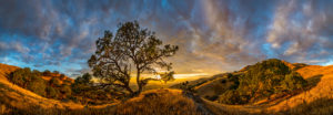
It was a long drive to Diablo from the Mission District in the City where I lived in the 1970s, but I particularly liked to go in the fall, when the turning leaves reminded me a little of autumn back East. It didn’t take long driving up South Gate Road to feel transported to another world. The steep hairpin turns quickly elevated us above the surrounding countryside, leaving “reality” pleasantly behind. The tilted sandstone fins of Castle Rock and Rock City only reinforced the otherworldly effect.
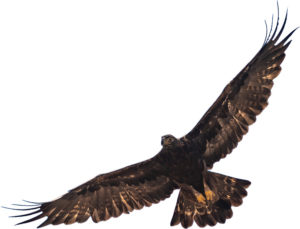
In this issue’s special section on Mount Diablo, we hope to give you some inkling of the multiplicity of habitats and stories found on and around the mountain, and to highlight it as the core of a large and accessible swath of critical open space. The work of groups like Save Mount Diablo to protect and expand this resource-with its endemic species and intact wildlife corridors-on the eastern edge of the Bay Area, is one of those compelling stories. Take a look at the centerfold map (in the print edition, on page 24) and note both the nearly complete ring of preserves already in place and the equally large block of unprotected land in the middle. That means our work isn’t done, not by a long shot. But there is plenty to see and explore there now, so head on out to the mountain, and be sure to tip your sun hat to those who’ve made it possible.
P.S. Still wondering about the highest peak? The highest summit is Copernicus Peak (4,360 feet) on Mount Hamilton in Santa Clara County. But the highest point in the nine counties is the west rim of Cobb Mountain (4,480 feet) on the border between Sonoma and Lake Counties; the actual summit is in Lake County. Mount Diablo stands “only” 3,849 feet.