.jpg)
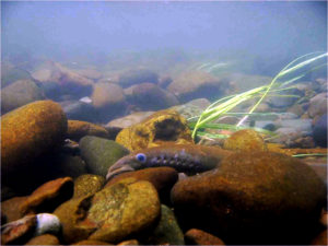
In another recent victory for wetland habitat, Marin Superior Court Judge Lynn Duryee ruled in early November that the County of Marin had failed to meet the requirements of the California Environmental Quality Act (CEQA) when it issued a development permit to a private landowner, allowing him to build within the 100-foot stream buffer zone on San Geronimo Creek in the Lagunitas watershed. In most years, the San Geronimo Valley supports more than half of the watershed’s spawning coho salmon population. Coho are an endangered species, and the run in this watershed is the largest in the Bay Area. The resolution of the suit brought by the Salmon Protection and Watershed Network (SPAWN) and the Tomales Bay Association requires the county to follow the provisions of CEQA before permitting development in such “environmentally critical habitat.” According to SPAWN watershed biologist Reuven Walder, the effect of the decision will be “to stop Marin County from its recent trend of disregarding CEQA in several development projects.”
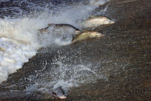
With the return of the rainy season, SPAWN is once again offering its naturalist-guided walks to view spawning coho, chinook, and chum salmon, as well as steelhead trout, in the Lagunitas watershed. The creek walks continue on weekends through January 31st. The best time to see salmon is shortly after a good rain. Tours are free for SPAWN members, $4 for nonmembers and $2 for kids. Reserve a spot before they fill up at (415)488-0370.
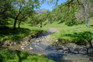
For other field trip sites in Marin County, pick up a copy of the just released, updated Trails of Northeast Marin County from Pease Press. The full-color map reflects the many changes in the area’s trails since the first edition. The map guides users across 120 miles of trails on public lands and introduces visitors to the area with descriptions of parks, logistical information such as bus schedules and accessibility, and much more. Pease Press also has maps covering Peninsula parklands, Pacifica, and other Bay Area destinations. Ben Pease, owner and cartographer at Pease Press, also creates “On the Trail” maps for Bay Nature. Check out more of Ben’s work at www.peasepress.com.