t’s mid-afternoon and I-80 heading into Berkeley is clogged again. The ride was supposed to start exactly six minutes ago, but I’m in four lanes of humanity feeling like a can on an endless grocery store shelf. I take out the phone and text my regrets, hoping I don’t get left behind. Without my mountain biking partner, I’d be as lost on the trails we’re riding today as I am in this maze of freeway exchanges lining the Bay.
As it eventually always does, the traffic eases and I meet my friends at the West Berkeley offices of NICA, the National Interscholastic Cycling Association. The group is helmed by Austin McInerny, a former environmental planner and mediator who now shepherds the growth of youth mountain biking across the country. Austin resembles a piece of razor wire; his long, lean, and sharp features have been a fixture around the land management tables of the Bay Area. He’s advised agencies at the local, state, and federal level about public access to open space, most recently during his time on the board of the Bay Area Ridge Trail Council. And he’s no slouch on the bike, being a longtime high school cycling coach. Today his assignment slides considerably higher up the age scale. He’s agreed to introduce me to the joys of trail riding along the urban-wildlands interface in the East Bay Regional Park District, starting with Tilden Park and later Crockett Hills Park, where trails designed with mountain bikers in mind opened this spring.
We take off in the late afternoon sun and begin winding our way through Berkeley city streets—up, up, up, and up—to Tilden Regional Park, one of the oldest and best-known parks in the East Bay. Its proximity to a dense, urban environment makes it a convenient refuge for those seeking a break from the aforementioned traffic snarls and other rigors of shoulder-to-shoulder human living conditions. Comb its more than 2,000 acres and you’ll find a sufficient sliver of solitude. While mountain biking wasn’t even a notion when visionary planners created the park in the mid-1930s, the wheeled sport is among the fastest growing recreational activities in the East Bay Regional Park system. With Austin as my guide, I’ll get a firsthand look at what’s drawing the two-wheeled species.
As we ascend out of the flatlands into the hills, Austin regales me with stories of Berkeley cycling personalities from mountain biking’s humbler, wilder days in the late 1970s and ‘80s, specifically the famed downhill runs in Redwood Regional Park by BMX and clunker-riding cyclists identifying themselves as the Berkeley Trailer Union. “We were a part of something new and different then. It was supposed to be disruptive and nonconforming,” recounts Austin. Marin gets a lot of press as the birthplace of mountain biking, but the East Bay had no shortage of people—like Austin—attracted to the green spaces on the map and excited to bike there. “Mountain biking’s come a long way since then,” Austin continues, “not only as an industry, but also as an answer to how to get (and keep) people outdoors.”
We hit the park boundary, and Tilden lies before us as if someone pulled back a curtain to reveal it. We’re surrounded by green, bathed in cool, salty Bay air, our skin infiltrated with eucalyptus and laurel. I can relax now that the city’s behind me. Momentarily, anyway. After dropping down into the park, we have to once again fight gravity up Meadows Canyon Trail. But with dirt under our tread, it seems far less of a labor.
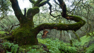
As we climb, I feel myself opening to the sights and sounds: the red-tailed hawk circling overhead getting mobbed by crows. The monkeyflower and willow betraying a hidden seep. The elegance of a small patch of cobweb thistle. The buzzing of pollinators around stands of bee plant. The raccoon tracks, coyote scat, and owl cavities in the live oaks, all suggesting the world that comes awake as we sleep.
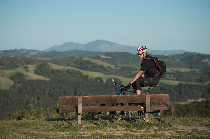
When we reach the top of Meadows Canyon, we cross over to Seaview Trail and keep climbing to the spectacular 360-degree view at the high point on the ridge. Austin’s wife, Celeste, has finished her nursing shift and rides up to join us. Looking west, the three of us revel in the view of a shimmering Bay, its islands arranged precisely, its gate open wide.
ack on our bikes, we head north toward Inspiration Point. Along the way, we pass people either on foot, wheel, or hoof, enjoying the late afternoon sunshine. All are cordial, which is frankly unexpected given that mountain bikers are often poorly understood by other park users, which can lead to some acrimony on the trail. While Marin County may hold the record for the most vehement head-butting between user groups, the East Bay is not immune. Official guidelines, both from EBRPD and the International Mountain Bike Association (IMBA), dictate that in cases of narrow passage, cyclists should yield the trail to foot and horse traffic. The best examples of trail user interaction come from friendly engagement and a willingness to acknowledge and listen to one another, even if only for a few seconds.
Austin stresses that approach with the youth he coaches. “We launched ‘Spirit of Howdy’ in 2010 because we wanted to teach kids that being on a trail isn’t simply about their experience,” says Austin. “It’s about using your time in nature to be an ambassador for cycling and to help people understand why someone would do what we do.” Spirit of Howdy and its parent initiative, the Teen Trail Corps, are joint projects of NICA and IMBA. The Teen Trail Corps promotes responsible stewardship of trails, both on and off the bike, and is integrated into the curriculum for young student athletes. Started here in Northern California, NICA fosters cycling leagues across the U.S. to get more kids riding and exercising outdoors. “We want to impart respect, empathy, and compassion to these up-and-coming cyclists,” says Austin, “not only because it’s the right thing, but also because we want our sport to lead the way in trail advocacy and access.”
Programs like this could prove vital as park visitation continues to rise across all demographics. According to recently-retired EBRPD Trails Development Program Manager Jim Townsend, “Youth participation is up across all activities, including mountain biking, which is now a top three activity for park users of all ages. Groups like NICA, the Bicycle Trails Council of the East Bay (BTCEB), and others are all having a positive effect on parks use.”
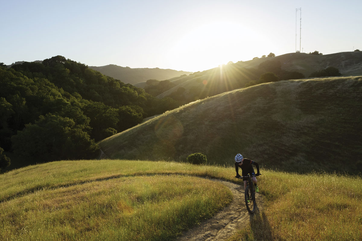
This is evident as we head north on one of the most popular stretches of trail in Tilden Park: the rough road known as Nimitz Way that winds along the ridgetop into Wildcat Canyon Regional Park. We’re in the wind now, which buffets us as we roller-coaster along an exposed ridgeline dotted with cattle. We pedal over the Nimitz’s torn asphalt for a nearly effortless four miles before coming upon the turn to Havey Canyon. From here, the escalator points down, though there’s no handrail to hold. “Careful,” Austin says. “This stretch’ll outrun you if you let it.” His words hang in the air as he disappears into a chute lined with oak, fir, and sword ferns.
It’s a fast drop, just over a mile and a half, and we quickly shed 500 feet. It ends at a creek where a bridge certainly should be, but isn’t. We dismount, toss bikes onto shoulders, and dance across the rocks in our stiff-soled, metal-cleated cycling shoes. This is likely the most dangerous part of the ride, as anyone who’s walked in such footwear can attest. It’s also the part of the ride where we feel farthest afield, precisely because there’s no bridge to aid our crossing. On the other side, we remount and meander along a well-tended double-track that hugs Wildcat Creek. Having climbed, traversed, and descended, we’re now coming full circle.
We head back into the city, soaring down streets we had scaled only two hours prior. We’ve explored an array of habitats and vistas in short order, covering a third of the almost 40 miles of trails that stretch across Tilden, a journey that would have taken a full day on foot. Soon, we’re back in civilian attire, sipping beer and ordering Thai food. Our excursion didn’t have to wait for the weekend and shouldn’t be saved for days off; it should and can be everyday life.
Over curry, we discuss the possibility of a trans-East Bay ridge route, starting as far south as Lake Chabot and heading north to the Carquinez Strait, at Crockett Hills Regional Park. Phones flop out on the table, websites are consulted, maps are scanned and scrolled. Most of the route could follow the Bay Area Ridge Trail and potentially be covered in one very long day. By the time the check drops, we’ve determined that a route like that, while exceptional, would have to be conducted at least partly on city streets. Not exactly what we were after, but the Bay Area Ridge Trail is a living thing. Connectivity is its currency and, someday, a (mostly) off-road route seems likely.
By way of substitution, we opt to reconvene our little crew for a ride at Crockett Hills. Much buzz has been building about new trail construction there and, while not quite offering the lengthy adventure that began our conversation, a park with trails optimized for mountain bikes is too good to ignore.
ust over a week later, Austin, Celeste, and I meet up again in the northeast pocket of the San Francisco Bay. It feels a world apart from the cosmopolis that rings its larger shoreline. The towns of Crockett, Hercules, and Martinez are more reminiscent of small-town California — former industrial towns where time clocks in a bit slower. Crockett Hills Regional Park, overlooking the Carquinez Strait, traffics in a similar humility, but quietly exhibits an innovative approach to land management.
Crockett Hills is one of the East Bay’s newest public lands, having opened to the public in 2006. Visitation on the former ranchland has remained low. “Almost no one went there,” says Townsend. “It was pretty empty.”
In late 2014, however, a push for new trail construction began, incorporating design elements to entice a highly mobile user group. Soon six miles of new trail appeared in Crockett’s oak-dominated rangelands, trails that didn’t follow fall lines across the land, but rather clung in moderate grades to the contours of the hills. “We worked to specifically make our new trail design in Crockett mountain-bike friendly,” Townsend says. “Crockett is not as environmentally sensitive as many of our parks are, and a land use plan and environmental impact report had been completed. This allowed us to readily build new trails to accommodate mountain bikers rather than struggle to increase access on existing trails in other parks.”
The new alignments feature mid-trail erosion control installed to accommodate a descending mountain biker but also to reduce speed. Sight lines were carefully considered. Sharp switchback turns were made more gentle and, most importantly, bermed. These bermed turns enable mountain bikers to come into turns with more control, reducing the need to slam on brakes and skid, damaging the trail surface and potentially causing injury.
“Response has been incredibly positive,” Townsend notes. “Parking lots are full now and we’re seeing a huge difference in park usage. The new trails are fully multiuse, and we’ve seen an increase in hikers as well as cyclists. We made a promise for more trail access for park users with the passage of [2008 parks bond extension] Measure WW. The trails in Crockett Hills are part of keeping that promise.”
To those who cry foul over mountain-bike-optimized trail construction, Townsend says, “We have nearly 119,000 acres of parks, a number of equestrian facilities, hundreds of miles of foot traffic-only trails, and camps and playgrounds for the disabled. We’re here to accommodate all users who have a right to use their public parks. Mountain bikers are part of that. We need to attract a new generation of outdoor enthusiasts so they will grow up loving these places.”
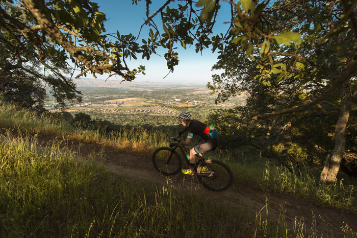
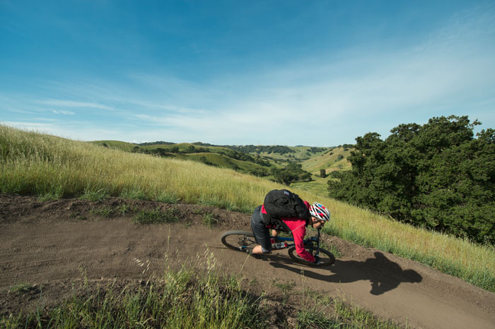
Our time in Crockett Hills is exemplary. We leave our vehicles in a parking lot just off the Carquinez Bridge in the town of Crockett. We climb past dilapidated barns and quickly find our words lost to our increasingly heavier breathing as we ascend through oak and bay laurel to a small tunnel underneath the Cummings Skyway. Once on its southern side, we see the promise of Crockett come to light. The hills are rippling with emerald grass, broken by clumps of oaks like stones in a slow, wide river.
We look out on a valley and, from our vantage at the old cattle staging slab off the Crockett Ranch Trail, descend the new trail into the trees below. We glide down switchback after switchback, trying out the new trail features before meeting up with Big Valley Trail near a small creek bed along the valley floor. Once at Big Valley, we begin a grueling ascent onto the opposite side of the canyon. A third of the way up, we see one of our trail options closed to protect nesting eagles. We quietly commend our winged friends for their choice of residence and continue to grunt upward toward the top of the South Tree Frog Trail.
Once we reach this summit, we stop to look out over the Carquinez Strait, turning full circle to take in views of mounts Diablo and Tamalpais. Satisfied, we again point our bikes downward. We roll toward the valley floor, alternating between stands of trees and open grassland. Again the trail surfaces seem tailor-made for mountain bikes, with high-sided turns and grade structures that favor steady handling and strong control. Over the course of the three-mile descent, our bodies fatigue from the effort of engaging every muscle group we have to maneuver the bikes. Our necks ache. So do our inner thighs, our feet, our triceps.
We pass two riders sitting on the side of the trail, looking west down the valley. “Perfect day,” they say. We smile and agree. They were the only people we’ve seen that morning other than a woman walking her dog near the parking lot.
Back at the car, we calculate we had logged almost 14 miles in under 90 minutes. On foot, it would have taken the better part of a day to cover that distance; we had done it in time to arrive at the office for 10 a.m. meetings. While time spent in nature isn’t measured by the clock, it is in the rest of the world. We had something that we’d carry with us as armor against the mundane demands of daily life: the beautifully decaying barns, the eagles building a home, the wind in the grass, all offering some comfort.
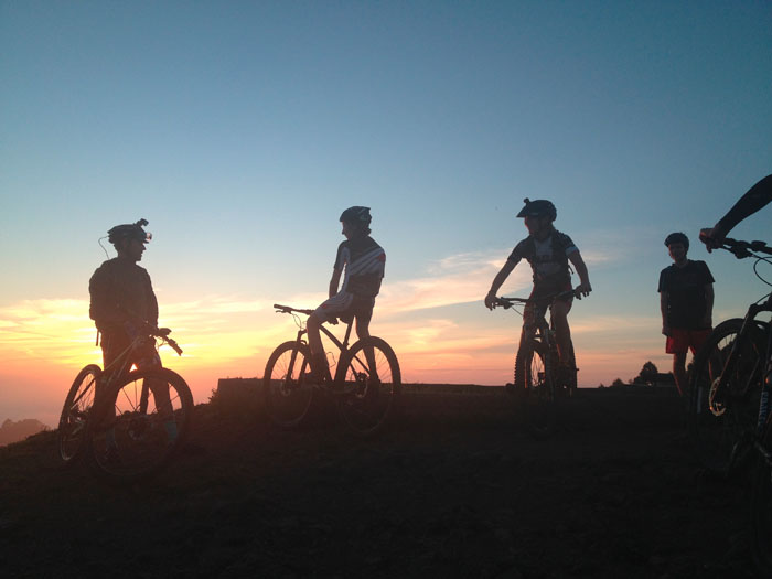
When leaving Tilden the prior week, we had seen the mountain bike team from Berkeley High School filing into the park for practice. This was their scrimmage, their spring training, but it was in the woodsy wilds rather than in the confines of a gymnasium. I think about the challenges of being caught between childhood and adulthood and then consider the solace we three were able to find in just a couple hours, right out the back door. I think about the clarity one gets from an engaged and tired body and how the brain thrives when the brawn is pushed to its edge. I think about all the video games they could be playing right now.
It’s often assumed mountain bikers are one-dimensional, that we seek only the biochemical surges brought on by high-speed antics at the expense of anyone who’d get in our way. Let it be said here: We’re not the “other.” Where it counts, mountain bikers share immense commonality with those who favor hiking, bird-watching, riding horseback, or simply sitting in the grass watching the sun go down. Though we all glean some tribal pleasure from consorting with our own, placing yourself in nature is not a matter of gear, nor is it limited to a recreational discipline. It’s an awakening of our connection to the planet that nursed us, and it happens regardless of how we choose to be outdoors. Pace, clothing, culture all fade when our ancient DNA rewires itself into the great green expanse.
Greg Fisher was a habitat restoration specialist before diving full time into the world of trail riding. He was editor in chief of Bike Monkey magazine and is now part of a team that produces competitive cycling events. He lives and rides in Sonoma County.
Karl Nielsen is a Berkeley-based freelance photographer shooting for regional transportation agencies, the San Francisco Chronicle, and UC Berkeley. He is also an assistant coach for the Berkeley High School mountain bike team. Find him at karlnielsenphotography.com.
-300x221.jpg)