A visit to Kehoe Beach takes you on a geologic journey to one of the Bay Area’s most dramatic geologic sites, where you can see rocks that have traveled far through time and space to pause temporarily in the Bay Area. Your journey takes you across the boundary between two of Earth’s huge tectonic plates, from the western edge of the North American plate across the San Andreas Fault to the eastern edge of the Pacific plate.
The bedrock of Point Reyes is part of the Pacific plate’s Salinian Block, and quite different from the bedrock underlying most of the Bay Area east of the San Andreas. This rock is granitic, formed millions of years ago during a time of plate collision. Transported by the San Andreas Fault system, it has come over 350 miles from Southern California, jolting its way northward in a succession of earthquakes for some 30 million years.
These rocks record a long history of the upheavals and paroxysms of the San Andreas Fault. Along the way, layer after layer of sediment was deposited onto the granitic rocks and joined them for the ride. Some of these layers can be seen at Kehoe; others you can visit at the south end of the Point Reyes Peninsula.
On the Way to the Beach
At the Kehoe trailhead the first rock you see is the Laird Sandstone, the oldest of the sedimentary rocks in this area. We will meet it again at the beach. Here step carefully up the outcrop to view California Indian mortars carved into the sandstone, a fine place to grind acorns, close to fresh water and sheltered from the often fierce winds.
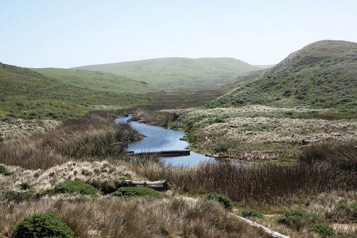
The rest of the 0.6-mile trail lies on the younger Monterey Formation, mostly hidden from view by coastal scrub; you will get a close-up look at the beach. As you walk the trail along a marshy creek, the trilling of red-winged blackbirds serenades you from the cattails. This rich freshwater wetland is filled with bog lupine, watercress, and other marsh plants that attract buzzing insects and singing birds. Keep an eye out for a great blue heron patrolling the lower reach in search of edible morsels.
The trail is level and easy, and the sound of the surf gradually becomes louder, more beckoning. Notice the huge driftwood logs in the creek far upstream from the beach. What force could have carried them inland? Come at a king tide, especially after a major winter storm, and you may get an answer. High waves back water up the creek, floating the huge logs so that they slosh back and forth with each incoming pulse. Imagine the energy of the winter storm that carried such large driftwood so far upstream and you get a sense of the power of the forces that have sculpted the cliffs that await us at the beach.
The Cliffs
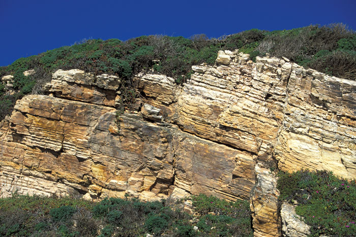
As you near the beach, a sand dune turns an easy stroll into a two-steps-forward, one-step-back climb. The rock at the top of the dune is a fine outcrop of the Monterey Formation, a rock unit that occurs widely along the California coast, but its composition and appearance vary from place to place. Here it is composed mostly of the microscopic skeletons of diatoms, single-celled plankton that float in the sea. When they die, their skeletons, which are made of silica, drift slowly to the seafloor.
Eight to six million years ago, when ocean conditions were favorable for high productivity, the skeletons accumulated in vast numbers. The ocean basin where they settled was far from shore and therefore very little sediment from land accumulated with them. Over millennia, as more and more skeletal grains settled on the ocean floor, they were compressed and turned into the marine sedimentary rock we see today. The fractured appearance of the rock is due to changes that occurred as the sediment became rock and was later uplifted and subjected to other stresses during its long eventful trip north on the Pacific plate.
Heading north along the beach, you walk back several million years in time to the Laird Sandstone. The fossil barnacles, mollusks, and other invertebrates in a layer near the base of the formation tell us that the Laird was deposited about 10 million years ago in a shallow marine environment near shore. A look at the Laird sand grains shows that they eroded from terrestrial granitic rocks that are similar to the rocks on which they rest. Here the Laird has been folded into a gentle syncline (a downwarp with layers tilted toward each other) and is highly fractured, evidence of its long travels with the Pacific plate. Try to follow one of the prominent layers along the sea cliff and you will see how disrupted the rocks are.
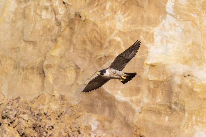
The Laird Sandstone cliffs are also a splendid place to see peregrine falcons. For several years now, a pair has nested near the top a few hundred feet south of the contact between the Laird and granitic rocks to the north.
A small but obvious landslide marks the contact between the Laird Sandstone and the underlying granitic rocks along a small fault. As demonstrated here, contact between two rock types commonly results in zones of weakness that are often marked by landslides. If you look closely at the cliff on the south side of the fault, you can see granitic rocks beneath the wall of Laird Sandstone. On the north side a small amount of Laird Sandstone lies on the granitic rocks at the top of the cliff. Thus you can get a sense of relative movement along this fault—the rocks to the north have been uplifted relative to those on the south.
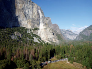
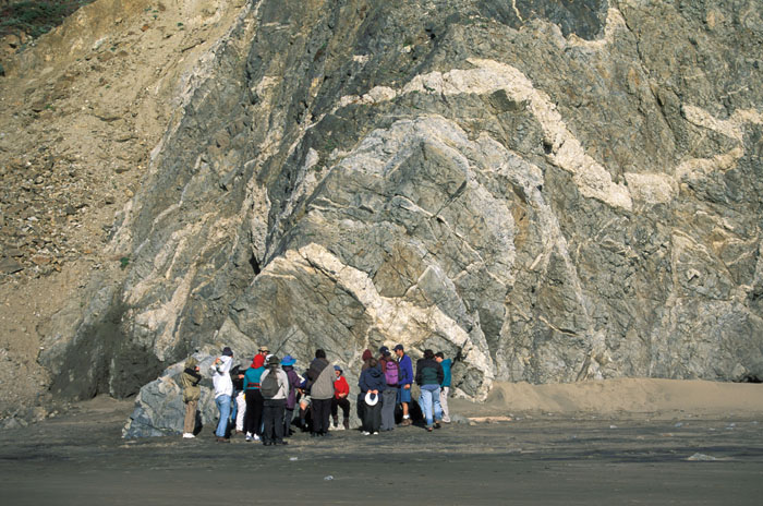
If Yosemite comes to mind when you think of granite, this outcrop of granitics north of the landslide may puzzle you. No high cliffs of light-colored rock; no straight white dikes—bands of lighter, younger rock—cutting through the granitic rocks for hundreds of feet. Here you see a jumble of multicolored rocks, cut by contorted and faulted white dikes. The rocks are so mixed up and fractured, so different, that you would think there is no connection to Yosemite. However, these granitic rocks once formed the southernmost end of the Sierra Nevada, about 350 miles south of their present location; they ended up on the other side of the San Andreas Fault system and got hijacked by the Pacific plate on its way north.
This is Kehoe’s most interesting outcrop. The rock here, formally called the Granodiorite and Granite of Inverness Ridge, is different from the sedimentary rocks we have seen until now. It is a plutonic igneous rock that formed about 85 million years ago deep in the crust from magma produced during long-ago plate collisions. At that time the entire west coast of North America was in tectonic turmoil from plate collisions that extended from Alaska to Mexico and beyond. You can see other granitics that originated from this same process at several places on the Point Reyes Peninsula—farther south at the lighthouse and north at Tomales Point—but they vary somewhat in appearance because of different proportions of the light and dark minerals.
This Kehoe Beach outcrop is particularly interesting to geologists because of its great complexity and the variety of features revealed in the rock. Half a dozen variations on the granitic theme are jumbled together here, each with a different assortment of minerals. In addition to the relatively light-colored granitics, you will find a darker rock called diorite and white dikes cutting through the older rocks. You can also see inclusions of the older “country rock” into which the granitic melt (magma) intruded, breaking off pieces and altering them by heat and pressure. These metamorphosed rocks are the oldest on the peninsula, probably displaced relatives of Paleozoic rocks (more than 400 million years old!) seen today in the Southern Sierra.
These granitic rocks have been extensively folded and faulted—one might almost say tortured—by their travels with the San Andreas Fault. Try to follow a single dike, and its twists and turns are breathtaking. Many a geology student (and professional!) has stood here trying to figure out which rock is the oldest, which the youngest, and how they interacted.
A Brief History of the Pacific Plate at the Beach
Now that we’ve reached the oldest rocks, let’s walk back along the beach, putting the story told by these rocks into its proper chronological order. The granitic rocks formed 90 to 80 million years ago, as an earlier plate—called the Farallon plate—was colliding with the North American plate. In a process called subduction, the Farallon plate sank beneath the North American plate and began to partially melt. The hot and less dense magma flowed up into the crust and formed magma chambers, which eventually hardened into granitic rock.
After the plate collision ended about 30 to 25 million years ago with the entire Farallon plate getting subducted beneath the North American plate, the geologic regime of California changed dramatically. Millions of years of uplift and erosion of the miles of rock overlying the magma chambers eventually exposed the granitic rocks that had formed in those magma chambers. As subduction ended, plate motion changed and the massive Pacific plate replaced the disappearing Farallon plate and began moving northward past the North American plate. The granitic rocks at the southern end of the Sierran chain were captured by the Pacific plate and traveled with it. Over more millions of years, the land composed of these granitics sank and was covered by the sea. Some 10 million years ago, as the Pacific plate continued its slow voyage northward, rivers washed sediment off the North American continent and deposited sand and silt in the ocean onto the granitic rocks. This sediment compressed and hardened into the rock we call the Laird Sandstone.
As the Pacific plate continued its travels, ocean conditions changed, and some eight to six million years ago, local marine basins formed, many of them thousands of feet deep. Those far from land or separated from land by island barriers did not receive sediment washed off the continent. Instead, skeletons of diatoms and other microorganisms accumulated, and over time they were compressed (and later uplifted) to become the Monterey Formation we see at Kehoe Beach. Somewhat different sediment accumulated in other basins during this extended period, forming the Monterey rocks found elsewhere in the state.
A subsequent change in geologic processes along the San Andreas Fault uplifted the granitics and overlying sediments above sea level but continued to carry them on their northward journey. A hike to Kehoe Beach today reveals this story of the far travels in time and space of these beautiful rocks.
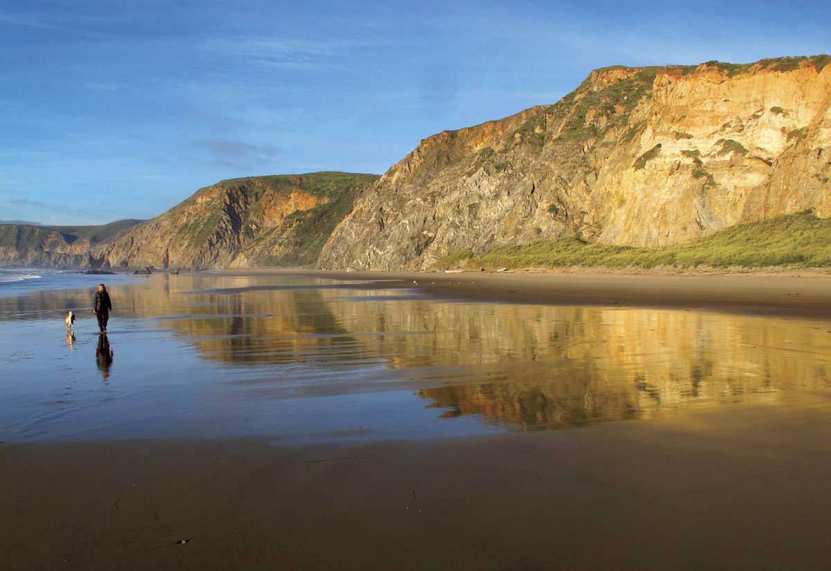
The Beach
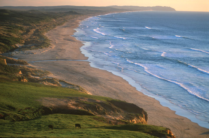
Now, before you take the trail back to the trailhead, look south down the beach. Kehoe lies at the northern end of one of the longest unbroken stretches of sand beach in the Bay Area, 11-mile-long Point Reyes Beach. You can walk the entire way from here to the Point Reyes headland on which the lighthouse sits, with nothing obstructing your way. (But don’t be tempted into the water along the way; the strong surf, sleeper waves, and riptides make this a dangerous place to wet your feet.) If a long walk on shifting sands isn’t your cup of tea, you can stand here and wonder about the forces that have built, and continue to build, this magnificent beach, forces that are an example of geology in action on a much shorter time scale than the formation of the cliffs behind us.
You are fortunate if you visit Kehoe on a day that is not windy. On many days the blowing sand will sting bare legs up to the knees. The winds blow mainly from the northwest, driving the swells that move sand grains southward down the beach and pile them up into small dunes at the base of the rocky cliffs. Take along a hand lens so that you can enjoy a close look at this beautiful sand. The grains consist largely of sparkling clear quartz, yellowish translucent feldspar, and a scattering of dark minerals, including black magnetite; all have eroded out of the granitic cliffs, including those farther to the north, up to the tip of Tomales Point. Occasional reddish chert grains tell you, however, that some of the sands have come from the “mainland” of North America, on the other side of the fault, most likely from the large Russian River watershed, which drains into the ocean some 20 miles north.
The sandy beach in winter after a big storm or two can be a surprise to those who have visited only in summer. Waves crash against the cliffs, relentlessly eroding them back. Last winter during the early December storm of 2014, which occurred at a time of king tides, waves beat directly against cliffs, washing away dunes and exposing rocks rarely seen in summer. A great quantity of sand was carried off the beach and deposited offshore. A waterfall dropped to the beach through a notch in the Laird Sandstone and shallow pools formed in low spots at the base of the cliffs. The wrack line lay high up the beach, a jumbled tumble of bull kelp and other seaweeds. This pattern of sand removal in winter is typical of California beaches. The high-energy waves of winter carry sand out a few hundred feet offshore; summer waves are only strong enough to bring it back onto the beach, not carry it away again.
At any time of year, stop a moment before you leave the beach to watch the feather-like branching of the ocean water as it advances and retreats over the barely perceptible swells in the sand. As the waves retreat, small holes may suddenly appear in the wet sand, made by mole crabs (Emerita analoga), small crustaceans also known as sand fleas or sand crabs; flocks of sandpipers rush in to feast before the next wave rolls in and covers the holes.
No matter what time of year you visit Kehoe, there will always be surprises and delights from the rocks and the constantly changing sea. Stay for the sunset as the colors of sea, sky, and rocks intensify. Think of the far travels of the rocks you have seen. A stroll to Kehoe Beach takes you back into a dynamic geologic past and at the same time gives you a fine setting to observe present-day geologic processes where land meets sea.