.jpg)
It’s 1701, 68 years before Portolá’s crew first glimpses San Francisco Bay. The tip of the peninsula that separates the vast inland sea from the vaster ocean is covered by extensive dunes and grasslands, with areas of coastal scrub and trees kept low by prevailing west winds and fog. Water is all around, framing the land on three sides and streaming down from the central highlands in creeks that meet the Bay in broad expanses of marsh. Three hundred years later, that landscape is mostly gone, buried beneath the armor of a city with so much money and so little time. Artist Mark Brest van Kempen has used imagination, thorough research, and composite photography to peel back that shell and show us the shape of the landscape that was.
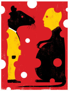
This busy downtown intersection (Sacramento and Kearny) was once dune scrub dotted with coyote bush, mock heather and other shrubs, and scattered wildflowers. There was a small stream running down to the Bay, which met the land about where Montgomery Street is today. Grizzly bear, coyote, fox, and bobcat lived off the abundant prey, such as rabbit and quail, as did the Ohlone people who had settlements nearby. In 2001, the site still abounds with life, but of a different kind. Organized by humans, this place now has few plants growing anywhere except in planters. Several hardy species that can live in the controlled environment are Norway rats, German cockroaches, and rock doves (pigeons). An occasional peregrine falcon uses the tall buildings as cliffs from which to hunt pigeons and other small birds….
How Did He “Photograph” San Francisco in 1701?
How did Mark Brest van Kempen recreate those scenes of San Francisco in 1701 without inventing a time machine? The answer is, through a time-consuming combination of research, imagination, legwork, and computer time. With the following steps, Brest van Kempen was able create composite photographs that represent, to the best of his knowledge, what we might well have found at those sites 300 years ago.
First, he scouted around San Francisco, looking for sites that would be most interesting topographicall, and that had experienced some significant change in the intervening centuries. He was particularly interested in former creeks, marshes, and altered shorelines, as well as habitat that might have been home to animals that we would be surprised to see in the same spot today. He settled on five different locations, two of which are reproduced in the April-June 2002 issue of Bay Nature. The five were: Mission Creek (16th Street and South Van Ness), Mission Bay (just south of the CalTrain Station at 4th and King Streets), Kearny Creek (Sacramento and Kearny Streets), the Concourse (Golden Gate Park outside the California Academy of Sciences), and the summit of Twin Peaks.
He then studied the sites as they are now, with particular attention to their topography. He scoured the historical record for journal descriptions, old drawings, paintings, and photographs. He consulted local scientists and naturalists to find out which plants and animals could have been found at each location.
He then photographed the sites as they are now, and used those images to create a rough outline of the contour of the land that would have to be matched in his 1701 images. This was complicated by the fact that the topography has changed in some unexpected ways. For example, Telegraph Hill is not what it used to be. Much of the hill was quarried and removed for use as ballast by Gold Rush era sailing ships on their return trips after bringing supplies to San Francisco.
The next step was to find existing open space that might reflect, in terms of topography and vegetation, what had existed at the San Francisco sites 300 years ago. The locations Brest van Kempen has used in the photos are the Pescadero Creek area of the San Mateo coast (including Gazos and San Gregorio watersheds), the Palo Alto Baylands, Mount Tamalpais, China Camp State Park, the Marin Headlands, and Suisun Marsh in Solano County.
Brest van Kempen then had to work extensively with the images in Photoshop to “sculpt” them in to the topographic templates he had already created. For example, the creek in the Kearny Street panel above was assembled from a small creek in the Headlands and a small tributary of Pescadero Creek in San Mateo. The hillsides seen in the Twin Peaks panel (in the magazine) come largely from photos of the Marin Headlands and the open slopes of Mount Tam. The deer above was found munching on lawn plants outside one of the houses near Rodeo Lagoon in the Headlands. Brest van Kempen used Photoshop tools to stitch and blend together the edges of the photos and also to remove clumps of invasive non-native plants, such as star thistle and broom, that he found in some of the photos.
The final images were reviewed by scientists at the California Academy of Sciences, where they were put on display in January 2002. They will remain on display there through April 14. To see some of Mark Brest van Kempen’s work online visit www.infoflow.com/mbvk/.

-300x225.jpg)