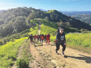
It’s that time of year when the New Year’s resolutions start to falter, especially the one to “get in shape.” Maybe you’ve bought a gym membership and it’s now collecting dust on a table, or your new running shoes haven’t made it through the breaking-in phase. It’s times like these when nature can be the inspiration.
If you find yourself slowing down a bit more than you would like, check out these get-out-and-go hikes from around the Bay Area on Bay Nature’s Trailfinder.
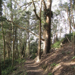
Cataract Falls Loop Hike — Marin
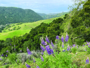
What can be more magical than a waterfall? For a picturesque hike with a multitude of views and ecosystems, pack your bag for this trail in the Mount Tamalpais ridges. Not exhausting, this moderately difficult 7.5 mile loop will get you back into to reach your New Year’s target. There are a couple shorter trail options if you want to explore the various plants, creeks, animals, and habitats but don’t want to push yourself too hard.
Sutro Secret — San Francisco
For a great contrast between city-life and wildlife, check out this easy 2-mile hike right in the heart of San Francisco. Whether in fog or sun, the vast forest of ivy-wrapped eucalyptus is a beautiful oasis embedded in the bustling city (ok, it does need a little restoration TLC). The trail opens up to a meadow at the peak, perfect for a picnic or snack before winding back down the trail.

Tilden Tour — Berkeley
If you don’t want to “suffer” alone, bring the kids along in this easy family-friendly 2-mile hike across the southern edge of Tilden Park in Berkeley. The trail is dotted with various picnic sites (for a snack or lunch stop) and is complete with a Merry-Go-Round near the end of the hike. Inspiration for all!
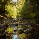
Tarwater Trail Loop — Pescadero Creek/Cupertino
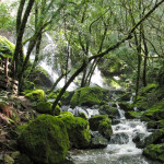
This 4-mile moderately difficult trail sits on a deposit of natural gas and oil, which stains the rocks of Jones Gulch Creek. A vast damp forest of oak, maples, alder and huckleberry surrounds the multiple creeks, giving home to various birds, fungi and small animals.
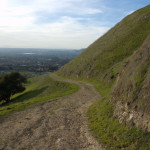
Mission Peak via Ohlone Wilderness Trail — Fremont
If you’re feeling really adventurous, this 38-mile trail takes an estimated three days. You are guaranteed to shed all your extra pounds in that trip. But if you don’t have as much time to spare, follow the Peak Trail from the Anza-Pine trailhead as shown. When you reach the OT 5 trail post, fork right to continue on Peak Trail to the summit. This shorter, moderately difficult 8-mile hike is the most gradual incline (and the most shaded) to the Mission Peak Summit. For a more intense 5-mile hike to the summit, take the Stanford Ave. trailhead and follow Hidden Valley Trail to Peak Trail. Great views await those who make it to the top (whichever way they come from).