This is part of a year-long effort to hike every trail at Point Reyes National Seashore, which turned 50 in 2012. Learn more.
Tomales Point. September 14, 2012. High overcast, calm & cool. Check out this hike on our Trailfinder.
Walking takes longer… than any other known form of locomotion except crawling. Thus it stretches time and prolongs life. Life is already too short to waste on speed.
—Edward Abbey, “Walking”
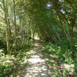
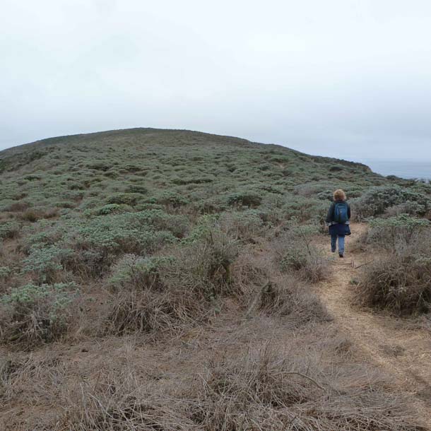
The Tomales Point Trail starts at the historic Pierce Point Ranch and stretches northward nearly five miles to a narrow reef at the northernmost point on the peninsula. The point is so narrow that it was named “the bill of the hummingbird” by the first people, the Coast Miwok, the Hookooeko. Cloaked almost perpetually in fog, the point evokes a certain undefined mystery, a mystery that is embellished by an unnaturally straight line of small granitic boulders that crosses the peninsula about a third of the way out the trail.
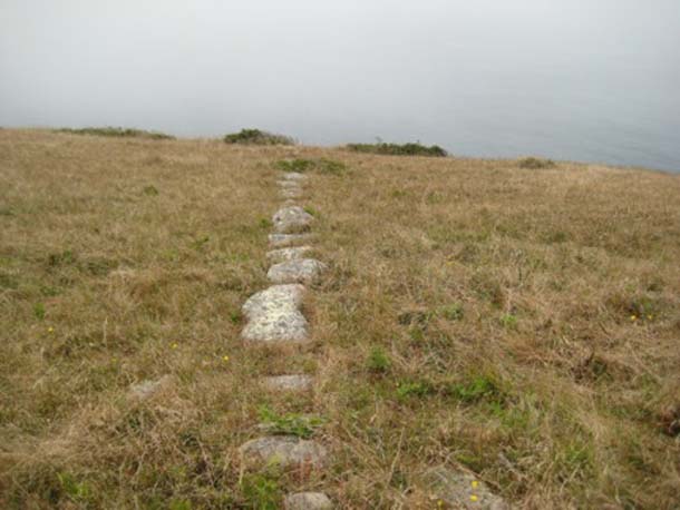
Today hikers encounter this mysterious low row of granite stones, 820-foot-long about 1.5 miles out the Tomales Point trail.
“The boulders are aligned to Mount St. Helena in the northeast and run to the cliff edge, pointing to the Farallon Islands in the southwest. They are named the “Spirit Jumping-Off Rocks” by the Coast Miwok tribe, who believe when a person dies their spirit walks west. The rock line is man-made and appears on an 1862 Coast Survey map, just four years after Solomon Pierce began ranching on the point. However, who placed the stones, for what purpose, and when still remains uncertain.”
(DeRooy, Carola and Dewey Livingston. Images of America. Point Reyes Peninsula: Olema, Point Reyes Station, and Inverness. Charleston South Carolina: Arcadia Publishing, 2008.)
Whether this line of stones marks the “path of the ghosts” that the Miwok spirit takes when it leaves this world is a question worth considering as one follows the trail to the end of the point.
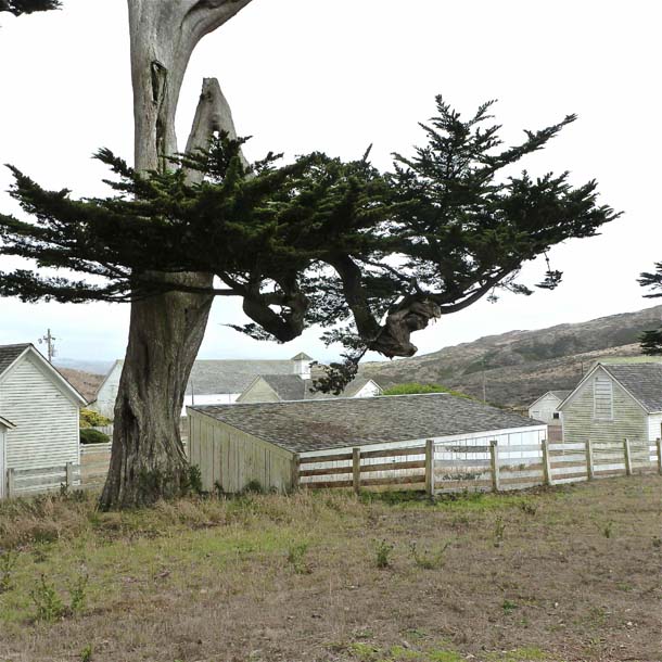
Transplanted Vermonters (like myself), the Solomon Pierce family was the first to try ranching on this site, beginning in the 1860s. They did so with some success, running the “butter rancho” until 1936. Thereafter, the McClure family ranched here until 1973. Three years later, Congress authorized creation of the wilderness area and the Park Service established the Tule Elk Reserve that now encompasses more than 2,600 acres of the peninsula. The ranch itself was designated as a National Register of Historic Places in 1985 and the Park Service maintains the buildings. Other than the ranch, the entire reserve is given over to the elk, the fog, and the wind. The trailhead begins at the restored ranch buildings that include the original house, several barns, as well as a blacksmith shop, school, carpenter shop, slaughterhouse.
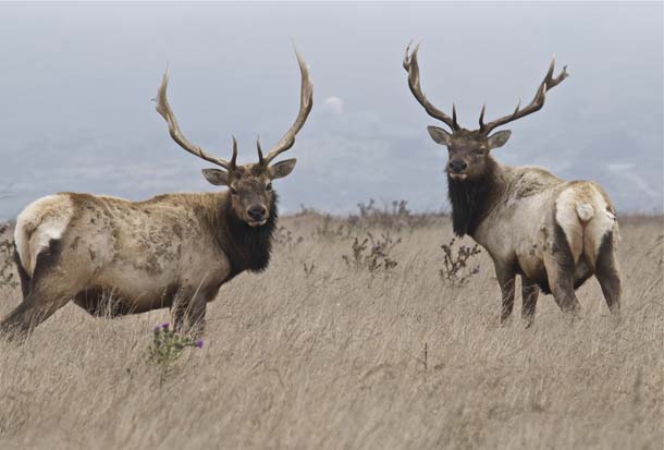
Within the first mile of leaving the ranch, elk are visible in the shrub and grasslands along the trail. By late September the herd’s social hierarchy has been worked out. The alpha males, with their remarkable racks, are usually sitting at the edge of their harem, watching over a dozen or so of their sister wives. Some calves have been born, and they are there too, surrounded by the females. Away from the family groups, smaller herds of females, immature males, or bachelor bulls seem to segregate from one another, hanging with their own kind.

Originally, the tule elk ranged throughout California’s Central Valley westward to the coastal prairie and grasslands. This subspecies (nannoides) is only about two-thirds the size of the Rooseveldt elk of the north coast, yet at about 500 pounds, this is still a substantial beast.
Once abundant here, tule elk were hunted nearly to extinction early in the European period. (Historically, there were six subspecies in North America; of those, only four remain.) The Park Service reintroduced 33 adults to the newly established elk reserve in 1978-9, ending a century of absence. Recovery of the herd faltered at first but eventually found a footing and grew to more than 500 animals. (Some of the herd was then “translocated” to the coastal scrub and grassland slopes above Limantour Estero.) Reproductive success and survivorship depends on the availability of forage, and plant biomass varies with rainfall. In drier years, reproduction is low, in wetter years more successful. On this September visit, there were only a few calves amidst the female harems, and my sense is that it was a relatively poor reproductive year.
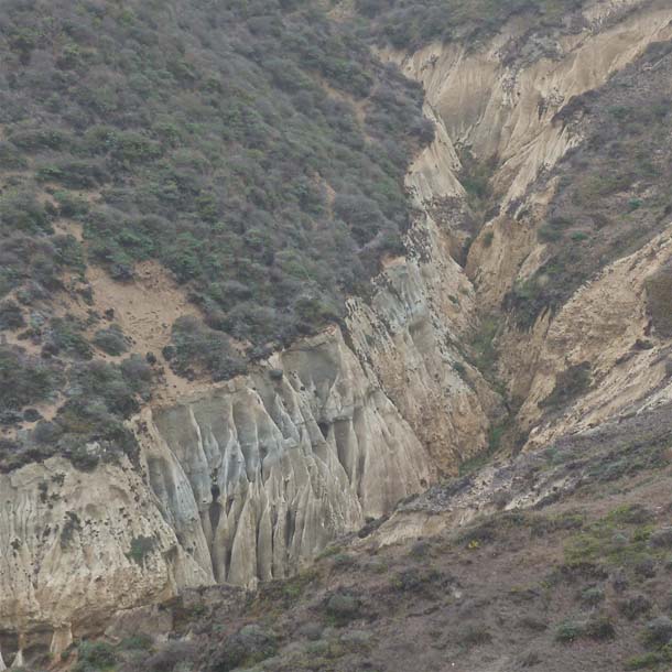
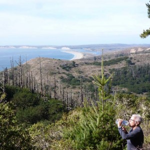
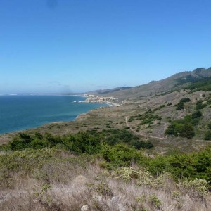
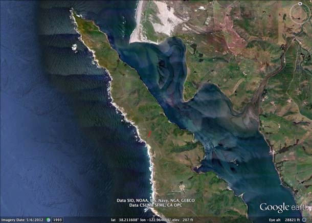
For most of the journey, the trail follows the spine of the peninsula over fairly well compacted decomposed granitic soils, but toward the end, for the last mile or so, the persistent winds have deposited sand atop the bedrock and the trudging becomes a little labored. This is the same depositional process that accounts for the sand dunes at Dillon Beach, which is visible to the east for the last segment of this hike, and the extensive dune system along 11-mile beach to the west.
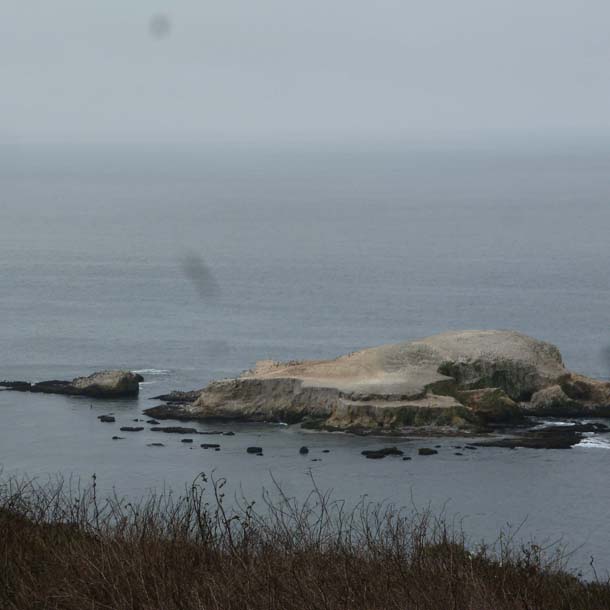
Nearing the end of the peninsula, there is a small, guano-covered island off to the west that is shaped sort of like a turtle. This is “Bird Rock,” a refuge for nesting seabirds and roosting flocks of pelicans, cormorants, murres, and sometimes shorebirds. Bird Rock and Double Point (also at Point Reyes) are two of only three known nesting areas on the immediate coast for Ashy Storm-Petrels (Oceanodroma homochroa); about half the world population (less than 10,000 birds), nests on S.E. Farallone Island. Like other storm-petrels, the Ashy arrives and departs its breeding colonies only at night and feeds on ocean surface organisms (“neuston”) above the continental shelf or highly productive areas such as the Cordell Bank or Monterey Bay. (In fact, nearly the entire population gathers in Monterey in the fall, an impressive phenomenon for those fortunate enough to witness it.) This rare bird is known to breed at only 17 locations, all but one in California, always on islands safe from predators (rats), although gulls also prey on these small seabirds. They are obligate cavity nesters, using crevices in the rocks or abandoned burrows as nest sites.
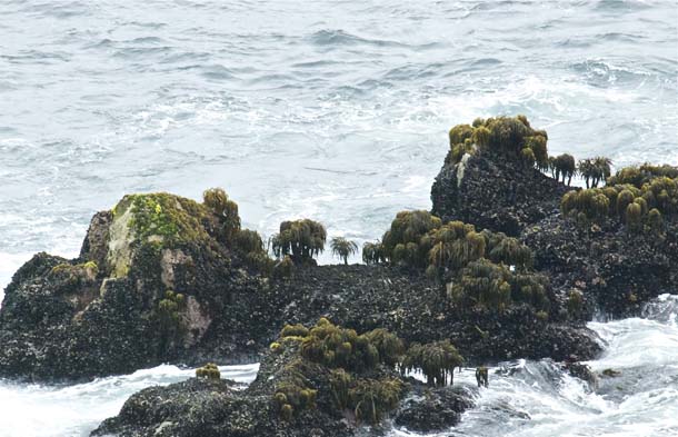
The peninsula’s hummingbird beak narrows to a tip with low rocky reef that points toward northwesterly toward Bodega Head. What a spot. Sitting here, perched on the shore, the rhythms of the Pacific are fully engaged. On a still day like this there are dozens of fishing boats swaying in the swells offshore. There is a spawning frenzy of squid (occurring all along the California coast) that is feeding a delerium of predators right now. Pelicans wheel and dive, followed by pirating gulls. Elegant Terns patrol the breakers followed by Parasitic Jaegers. Rivers of Sooty Shearwaters swirl by on their vast Pacific journey, a counterclockwise gyre from their nesting islands in the South Pacific, circumnavigating the north Pacific with their elegant aerobatics. Harbor porpoise swim past in tandem, their small fins visible momentarily before diving again. Swells overwash the rocks with a consistent pulse that connects us to the ancient past and the formidable future . . . we are in our place.