Why was it so cold this winter?
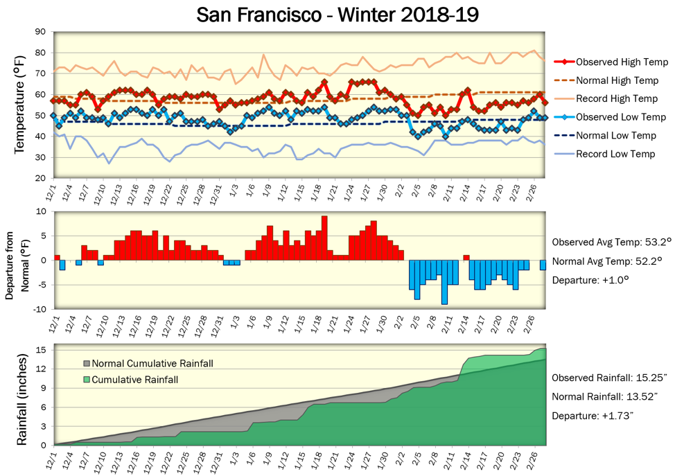
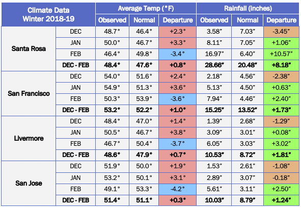
Temperatures this February in the Bay Area were colder than we’ve been accustomed to as of late, and this will go down as the coolest February in 30 years for some locations. But temperatures for the winter overall were near to slightly above normal while rainfall was above normal. “Meteorological winter” is defined as the calendar months of December, January, and February, and for that three-month period, the average temperature in San Francisco was about 1°F above normal. How can that be? Temperatures in December and particularly in January were well above normal. In fact, January 2019 was the 6th warmest January on record in San Francisco, which made the cool February “feel” even colder by comparison. Similar temperature patterns were reported at other Bay Area locations.
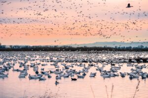
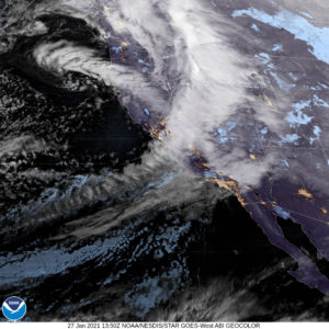
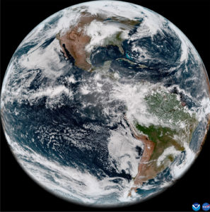
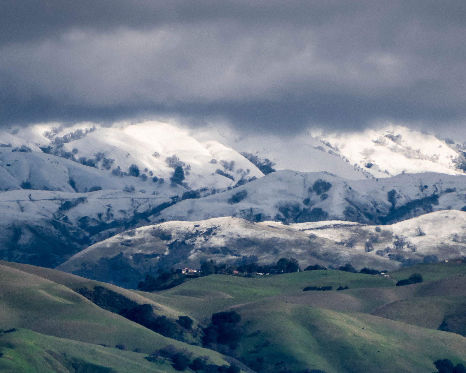
So why was February so cold? We can look to the jet stream for some answers. The jet stream is a ribbon of fast-moving air about 30,000 feet above the ground, and typically separates much colder air to the north from milder air to the south. In February, the jet stream took a pronounced and persistent dip southward across the western United States, forming a trough of low pressure. This allowed for cold storm systems originating well to our north in the Gulf of Alaska or western Canada to move southward into the Pacific Northwest and California, which brought several bouts of heavy rain, mountain snow, and reinforcing shots of cold air. As a result, abnormally significant snowfall occurred in places like Seattle and Spokane, and even in Redding and Las Vegas. Here in the Bay Area, saturated soils and strong winds resulted in downed trees and power outages, and a significant mudslide occurred in Sausalito. Several inches of snow also accumulated on the higher hills and mountains in the Bay Area, such as Mount Diablo and Mount Hamilton.
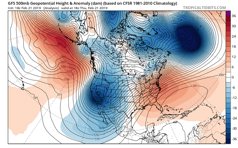
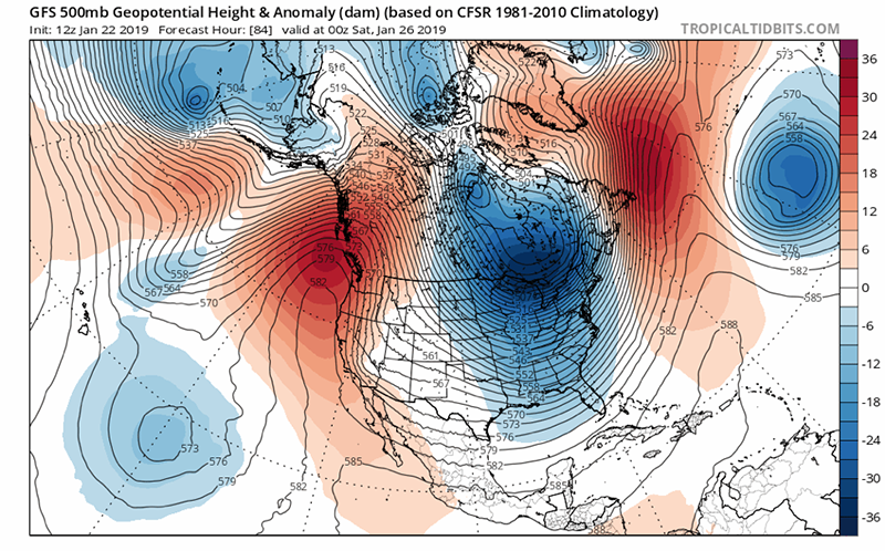
In a longer-term context, the persistent upper-level trough over the western United States this February was a marked departure from some of our recent drier, milder winter seasons, when a ridge of high pressure was often locked in place over the western United States. Coined the “Ridiculously Resilient Ridge”, the frustratingly-persistent pattern was present during our severe drought winters of 2013-14 and 2014-15, and winter 2014-15 was the warmest winter on record for San Francisco. In contrast, the eastern United States was often under a trough of low pressure and experienced colder, stormier winters. This West Coast ridge / East Coast trough pattern is referred to as the North American dipole, a pattern that has become increasingly frequent. The subsequent winters of 2015-16, 2016-17, and 2017-18, while not as dry, also featured above-normal temperatures with some reemergence of the dipole pattern. So, the recent extended spate of colder temperatures this February is something we just haven’t experienced much during our recent milder winters in the Bay Area.
The combination of cooler temperatures and ample moisture this February was particularly favorable for building up an extensive snowpack in the Sierra Nevada, alleviating drought concerns at least for now. March is also starting off on a wet note, though temperatures will not be nearly as cool. The overall jet stream pattern has shifted to a more-typical west-to-east pattern, bringing milder, Pacific-based storms into the Bay Area, as opposed to the highly-amplified, colder north-to-south pattern that was in place during February.

Ask the Naturalist is a reader-funded bimonthly column with the California Center for Natural History that answers your questions about the natural world of the San Francisco Bay Area. Have a question for the naturalist? Fill out our question form or email us at atn at baynature.org!