Much of California enjoys a mild Mediterranean climate where the weather typically swings like a pendulum from warm, dry summers to cool, wet winters. Year-to-year, this pendulum can swing with great variation. If it doesn’t swing toward rain and snow between October and March, it leads to drought; if it does, we might see record-breaking precipitation. In the dry season the pendulum can swing too far into fire weather, creating hot, dry, and windy conditions prime for wildfires.
While the pendulum has always swung here, there’s evidence that its swings are now getting more dramatic, and anyone who’s lived here in the last few years has seen it firsthand. Between 2012-2016, California was baked by a persistent and intense drought. The drought ended in record-breaking, torrential precipitation during the winter of 2017, which resulted in statewide flooding and the evacuation of 200,000 people living beneath the Oroville dam. The following year, a swing into the dry extremes during the summer months combined with a delayed start to fall precipitation led to intense fire weather, and record-breaking wildfires raged throughout California into Thanksgiving. We’re living it again in the fall of 2019, as unusually dry weather continues well into November, typically the start of the rainy season.
Atmospheric Rivers
In a 2014 paper in the journal Nature Climate Change, climate scientist Daniel Swain concluded that California could expect increases in the frequency of wet and dry extremes, with both continuing to grow more intense with increasing atmospheric carbon dioxide concentrations and global warming. Swain labeled this phenomenon “precipitation whiplash.” A warming climate in part explains both: a warmer atmosphere holds more water, leading to more intense precipitation, but also increases drought risk.
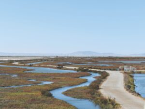
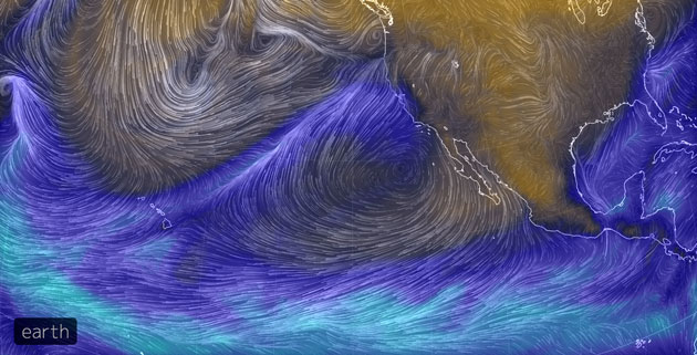
An area of particular concern for scientists and water managers has been “atmospheric rivers,” ribbons of moisture in our atmosphere extending over 1,000 miles across the Pacific. In a given year, perhaps a dozen of these rivers make landfall in California. They can deliver 30-50 percent of the annual precipitation to much of California. Too few and California may have a drought year, too many and we could face flooding. In the future, we expect atmospheric river events to decrease in frequency but increase in size and intensity, according to a 2018 paper in Geophysical Research Letters by climate scientist Vicky Espinoza.
Since long-term annual precipitation means are not projected to change much, we expect our precipitation to fall in fewer, more intense events. In addition, Swain shows that California’s wet season is projected to sharpen — meaning we can expect to receive less precipitation during the spring and fall months, and more during the core winter months. That’s seemingly happened in 2019, as much of Northern California hasn’t seen measurable rain this fall through mid-November.
Stronger atmospheric rivers and shorter wet seasons pose challenges for not only water resource managers but for public safety. Reservoir operators in California have to balance reservoir levels in a climate where extreme precipitation can lead to risk of overflow and multi-year droughts can lead to severe demands of scarce water resources. If a dam is almost full, do you release water so that you can manage the flooding from the next atmospheric river event, or do you save the water so that you have more water available in the following summer?
To respond to these changing factors requires more reliable atmospheric river forecasts – both short-term and seasonally; will we get an atmospheric river in the next few days, and how many can we expect this winter? Current forecasts rely on physical models that attempt to predict how weather will evolve given current weather information. However, forecasts struggle to narrow an atmospheric river’s landfall to within 500 miles at a 10-day lead time; this means an atmospheric river forecasted to make landfall in San Diego could actually touch down in San Francisco.
We hope to improve on short-term predictions by investigating how well machine learning models can predict when an atmospheric river will make landfall when given a snapshot of the atmosphere over the Pacific Ocean and off our coast. The model is trained to recognize patterns in a variety of atmospheric variables at various lead times prior to atmospheric rivers making landfall in California. There are distinct signatures in the atmospheric state that result in atmospheric rivers over California, and we hope that machine learning methods can provide improvement in prediction skill over the current forecast models.
Fires
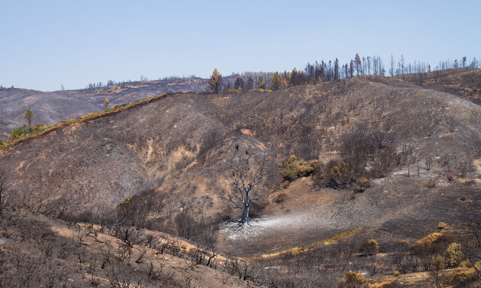
The other side of the precipitation whiplash is our dry fire weather. Wildfire has always played an important role in shaping California’s ecology and socio-economic structure, but changing conditions are pushing fire toward extremes. The four most destructive wildfires in state history have all occurred in the last three years; this fall, in an overall mild year, fires still burned more than 198,000 acres and 730 structures.
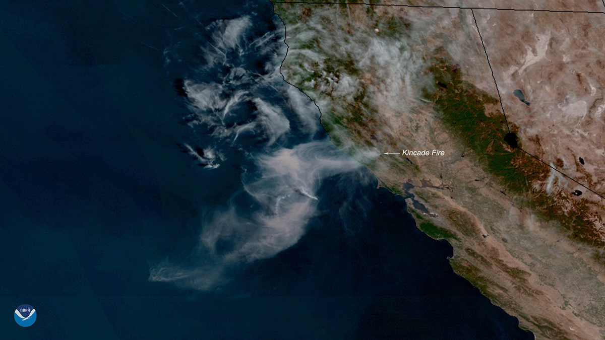
Several factors contribute to ongoing change in California wildfires, including land use change, policy, urbanization, and climate change. Climate change produces a degree of uncertainty as scientists attempt to predict what future California wildfires might look like. On the one hand, warming patterns across the state prolong the fire season during which most California wildfires occur, which has been almost year-round in recent years and might once again continue through December or even January in Southern California. On the other hand, large swings in precipitation that may be linked to climate change can delay the onset of fire season. We’ve seen some of these scenarios play out over the last few years. The relatively wet winters of 2018 and 2019 promoted an abundant growth of vegetation and delayed the time it took for that vegetation to dry. Once this vegetation does dry, however, it becomes high-risk fire fuel, which can lead to extreme wildfire conditions like what was seen in the 2018 Camp Fire or 2019 Kincade Fire.
Fire policy plays another important role in shaping how and where fires occur throughout California. In the past, fire management has been geared overwhelmingly toward forest fires, but these practices, including thinning and prescribed burning, are inappropriate for managing fires in California’s other non-forested ecosystems such as the chaparral shrubland. Fires in shrubland have produced major fires in recent times, including the 2017 Thomas fire and the 2017 Tubbs fire. Our research has found that California fires occur mostly in non-forested areas (59 percent of all burned areas since 2000), but current management policies do not reflect this proportion in their planning.
Extreme weather patterns make fire frequency and behavior increasingly difficult to predict, and can lead to the production of megafires, fires that surpass the historical size and severities of natural fires and have dramatic economic and ecological consequences. Direct damage to human livelihoods is very clear in the wake of these events, but the ecological impacts of these fires on native wildlife largely remains a mystery. Megafire causes sudden shifts in vegetation and land cover that can potentially have long-term consequences on the movement, behavior, and space-use of many species. Following the 2013 Rim Fire near Yosemite, for example, the park’s ancient giant sequoias did not re-sprout, and scientists suspect more heat-tolerant trees will begin to replace the sequoias.
Using a variety of GPS collars, camera monitors, and acoustic monitors, the Brashares lab’s research at the Hopland Research and Extension Center observes how large mammals, birds, and bats respond to the 2018 Mendocino Complex fire, now the largest wildfire in recorded California history. Understanding how these species adapt their habitat usage and behavior following megafire can help us predict how their conservation may be affected if fires continue to escalate. This work in Hopland offers an opportunity to assess how species around the state may be impacted by ongoing wildfires and is an important first step in conserving California’s unique ecological systems.
Adapting for the Future
As California heads into a future of more frequent extremes, both dry and wet, we can expect increased risks of flooding and wildfires. Both of these extreme events have cost the state billions of dollars in damages already, and have caused irrevocable damage to livelihoods, wildlife, and landscapes. Knowing this, California needs to act and adapt.
For extreme precipitation, California must improve infrastructure to handle precipitation being delivered in shorter, more intense durations. For wildfires, accounting for the ways a shifting climate may be altering fire season and severity is critical as we move forward and craft solutions for our current fire dilemma. Improved land and fire management along with further research into these processes may be some of our best tools for tackling these issues.
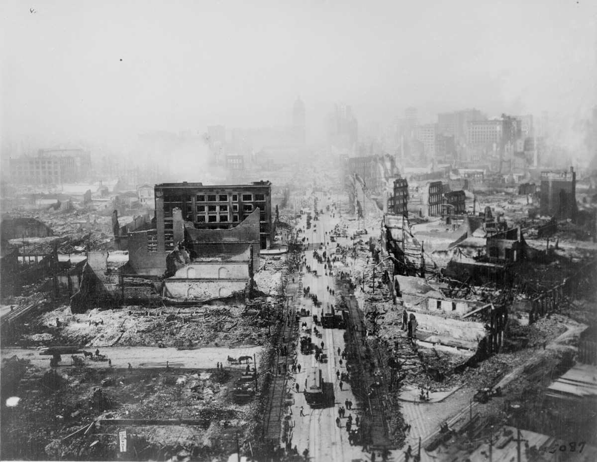
Now is our chance to prepare California preemptively for these climate swings. Following the devastating 1906 San Francisco earthquake, California took serious action to prepare the state for future earthquakes. These actions have largely succeeded, reducing our vulnerability to future major earthquakes. We need a similar response to address the growing threats we will face with increasing drought, flood, and wildfire occurrences.
Correction: Due to an editing error, an earlier version of this post stated that 2019 could be the first fully dry October and November in San Francisco since 1875. If November is completely dry it would be the first time both months had recorded zero precipitation since 1959.