Editor’s Note: Following the March 23 announcement of more widespread park closures and requests that people stay home, we’re no longer updating this story. Instead, find the latest information about closures and policy in our March 24 story, which we will continue to update.
March 23 at 6:30 p.m.
“Effective immediately, State Parks has temporarily closed vehicular traffic to parks experiencing high visitation. Below is a list of the impacted parks. This list is dynamic and will be updated regularly.
“For those wishing to take a break in the outdoors, public health officials are advising them to walk, run, hike and bike in their local neighborhoods and walk to parks. Most importantly, the public is being asked not to congregate in the outdoors. Everyone has the responsibility to “Flatten the COVID-19 Curve at Parks” by maintaining a social distance of 6 ft. or more when recreating in the outdoors, and staying home if they are sick. If visitors cannot maintain social distancing, they need to leave the park.”
Parking lots are now closed at the following Bay Area state parks:
Marin County: Angel Island SP, China Camp SP, Marconi Conference Center SHP, Mount Tamalpais SP, Olompali SHP, Samuel P. Taylor SP, Tomales Bay SP.
San Mateo County: Año Nuevo SP, Bean Hollow SB, Burleigh Murray SP, Cowell Ranch, Gray Whale Cove SB, Half Moon Bay SB, Montara SB, Pescadero SB, Pigeon Point Light Station SHP, Pomponio SB, San Gregorio SB.
Sonoma County: Armstrong Redwoods SNR, Austin Creek SRA, Jack London SHP, Petaluma Adobe SHP, Sonoma Coast SP (and associated sub-units), Sonoma State SHP, Sugarloaf Ridge SP, Trione-Annadel SP.
March 22 at 5:05 p.m.
The Public Health Division of Marin County Department of Health and Human Services (HHS) just issued an order for “the immediate closure of all Marin parks – from the Golden Gate National Recreation Area down to the smallest town parks – to stem the tide of visitors during the COVID-19 emergency. The closure will affect town, city and County parks, open space preserves, state parks such as Mount Tamalpais State Park, Marin Municipal Water District lands, and federal lands such as Point Reyes National Seashore and Muir Woods National Monument.
“Visitors may continue to use paved pathways maintained by the County of Marin, such as the popular Mill Valley-Sausalito Multiuse Pathway along Richardson Bay and the Corte Madera Pathway along Corte Madera Creek, as long as people follow guidelines on social distancing.” Read the full press release here.”
March 22 at 5:00 p.m.
During the first weekend that shelter-in-place orders are effect in the Bay Area, park districts and agencies have reported overcrowding, rule breaking, and concern for the ability to keep parks open to the public. The 73 parks in Alameda and Contra Costa counties managed by the East Bay Regional Park District were “busy and overflowing” on Saturday and Sunday says General Manager Robert Doyle. “It’s incredible. I’ve never seen anything like it in my 45 years of park service.”
Doyle says even the less frequented parks are beyond capacity with people parking illegally and ignoring caution tape and closed signs at shuttered facilities. “We want people to safely use the parks,” he says “But if it stays crazy, I will probably get an order from the health department to close down.”
Chief among the problems Doyle says have been young adults turning their park visits into group outings with friends and ignoring the six-foot social distancing requirements. “This is an emergency and people are not taking it seriously.”
Currently the district is not ticketing people for the violations, “but we will,” says Doyle.
While all the parks are experiencing heavy use, Doyle recommends visiting at less popular hours in the morning and evening and during the week. He also urged visitors to leave a park if its lot is full and come back at another time, to consider limiting park use to every other day, and at all costs to follow the social distancing requirements.
“I’m optimistic that behavior will change,” says Doyle. “We’re in this together and need to help each other.”
March 21 at 10:30 p.m.
The San Francisco Chronicle reports: “9:45 p.m. Point Reyes National Seashore to limit access after ‘unprecedented visitation.’ Parks officials will limit access and close the gates to Limantour Access and Mt. Vision roads, Drakes Beach and Drakes Estero after “unprecedented visitation” to the Point Reyes National Seashore on Saturday. There will be limited access at Palomarin Trailhead beyond the Commonweal entrance, Pierce Point Road and the Lighthouse and Chimney Rock parking lots, parks officials said Saturday night. The announcement was made just hours after Marin County Sheriff’s officials urged people who flocked to the Northern California coast to stay home instead.”
The Marin County Department of Health and Human Services (HHS) is urging Bay Area residents not to travel beyond their communities as they engage in outdoor activities during the statewide shelter-in-place order. Full press release here.
March 21 at 6:00 p.m.
East Bay Municipal Water District (EBMUD) has lifted its usual permit requirements for hiking on the 90 miles of trails on its watershed lands. “From March 19 through April 30, 2020, EBMUD is temporarily suspending the requirement that trail users obtain a permit for the following watershed trails.” Read here for a full list of open trails.
March 20 at 10 a.m.
The statewide new shelter-in-place order, issued Thursday evening, continues to allow responsible visits to the outdoors.
While many Marin County regional parks have closed, most of the county’s open space preserves remain open. The full list of open spaces is available on the Marin County Parks website.
March 19 at 7:20 p.m.
Midpeninsula Regional Open Space will close all restrooms beginning March 20.
March 18 at 9:20 a.m.
California State Parks has closed all campgrounds, but trails and beaches currently remain open. Read the press release here.
March 17 at 10 p.m.
East Bay Municipal Water District (EBMUD) has closed the Lafayette Reservoir Recreation Area (including Rim Trail, Lakeside Nature Trail, Westview Trail, Canyon Trail, Rheem Trail, Compolindo Trail, Big Oak Trail) and the San Pablo Reservoir Recreation Area. Check here for restriction updates.
Midpeninsula Regional Open Space will keep preserves and trails open, but says “areas receiving high use may be closed if visitation is near or at capacity to promote safe social distancing. Specifically, Rancho San Antonio County Park and Preserve and the Mount Umunhum Area of Sierra Azul may be closed without advance notice.” Facilities and group areas closed to ensure social distancing are: Deer Hollow Farm, the Daniels Nature Center, the Black Mountain Backpack Camp and the Picchetti Winery and picnic area. Further updates can be followed here.
March 17 at 8:40 p.m.
The East Bay Regional Park District has clarified their temporary closures of some regional parks, stating that limited staffing and a need to address shelter-in-place orders on Monday and Tuesday led to the confusion. Berkeleyside has the full story on signs stating closure of parks through the shelter-in-place period and ticketing.
But the good news: Trails throughout district parks will remain open.
However, closures apply to all facilities throughout the district, including bathrooms, water fountains, visitor centers and facilities, indoor rental facilities, campgrounds, and swim facilities. This includes Ardenwood Historic Farm, Tilden Botanic Garden, and Little Farm in Tilden Regional Park; for a complete list of closures see the EBRPD press release. Trash collection is also suspended, so pack out all refuse.
March 17 at 7 p.m.
The Golden Gate National Parks Conservancy, which supports National Park Service properties in the Bay Area, sent out this list of current park closures:
San Francisco County: Alcatraz Island; Fort Point National Historic Site.
Marin County: Muir Woods National Monument–entire park and parking are closed; Nike Missile site; Point Bonita Lighthouse; all park campgrounds (Kirby Cove, Bicentennial); Stinson Beach; Muir Beach and Muir Beach Overlook.
March 17 at 10:15 a.m.
For now, the Bay Area’s shelter in place orders define “outdoor activity” like “walking, hiking or running” as essential. That means healthy people who aren’t in a high risk category for coronavirus complications can leave the house and drive anywhere in the area to go hiking, provided they maintain six feet from other people and follow other health guidelines. (You can read Alameda County’s order here, Santa Clara County’s here, and San Francisco’s here — in all of them the relevant section is number 10, section a. iii)
Facilities, visitors centers and events are closed everywhere, but most trails, gates and parking lots remain open, and plan for now to stay so. California State Parks, which has kept its parks open, posted a notice on its web site on March 14 that read, “While most of our indoor spaces, including visitor centers and museums are closed, all outdoor State Park spaces remain open and accessible to the public. Call your park in advance of your visit if you need additional details. We hope to see you in the great outdoors.”
Parks Department communications staff said on Monday they would defer to the California Department of Public Health for further information. In a statement CDPH Director Dr. Sonia Angell said the state’s guidelines are a “baseline of recommendations,” and counties can enact their own stronger measures if needed.
“The level of transmission throughout our state is variable, and local public health officials – especially those areas with substantial COVID-19 community transmission – can and should take further actions to meet the conditions in their communities,” Angell’s statement read.
For San Francisco’s Recreation and Park Department, at least, that meant keeping natural areas and trails open, even as golf courses, gyms, and swimming pools close. In an email statement, the SFRPD communications staff said it did not currently plan to close parks.
“While parks and open spaces are considered low-risk at this time, we are working closely with the Department of Public Health and following all guidelines issued,” the statement read. “We are currently keeping parks and trails open, however people must comply with the city directive against nonessential gatherings and follow social distancing guidelines within our parks.”
The National Parks Service, likewise, posted a statement on Sunday suggesting it would defer to the NPS Office of Public Health and United States Public Health Service before making changes, but for now, “Visitors may continue to enjoy trails and open space areas of the parks.”
So in the spirit of preserving mental and physical health, here are a few suggestions for large, spacious, lesser-visited parks in the Bay Area. We hope you find them restorative — and that you’ll form a bond with some of these special, off-the-beaten-path places that will persist even when life as usual resumes.
Please call before you go, and of course follow the advice about social distancing, hand washing, and not touching your face. Got a less-visited favorite park to suggest? Add it in the comments below.
Alameda County: Anthony Chabot Regional Park
A wide trail, with plenty of room for maintaining six feet of space, winds all the way around this 3,300-acre East Bay reservoir park. Look for birds in the water and in the trees overhead, and breathe in the smell of bay laurel that grows thick on the lake banks.
Contra Costa County: Mount Diablo State Park
The peak might be a tough place to avoid a crowd, but Mount Diablo State Park encompasses some out-of-the-way parts. Try visiting Mitchell Canyon, on the park’s north side through the town of Clayton, where flowers and butterflies should be just starting to bloom. Or head for the East Bay Regional Park District’s 1,060-acre Diablo Foothills Regional Park, with spectacular views of the summit and the Castle Rock geological formation.
San Francisco County: McLaren Park
It’s especially challenging to find open space in the region’s densest city. But 312-acre McLaren Park offers room for almost everyone — plenty of trails to follow, plenty of habitat types to explore, and plenty of space to avoid crowds.
San Francisco County: The Presidio
On the opposite end of the city from McLaren Park is the 1,500-acre Presidio, where 25 miles of trails remain open. After decades of restoration, the Presidio is home to coyotes, wildflowers, butterflies, and more — not to mention enough space on the waterfront to admire the lack of traffic on the Golden Gate while maintaining six feet from other people.
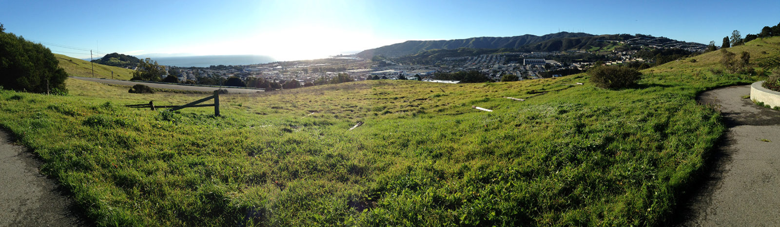
San Mateo County: Windy Hill, Russian Ridge, Long Ridge, Skyline Ridge
The Midpeninsula Regional Open Space District’s ridgetop preserves lining Highway 35 offer some of the most breathtaking views in the Bay Area, falling away to the Bay on one side of the highway and to the ocean on the other. With the panoramic backdrop, the parks offer thousands of acres of wildflower meadows and oak forest to explore.
Santa Clara County: Henry W. Coe State Park
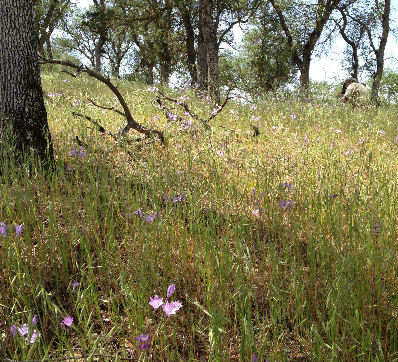
At 87,000 acres, the largest State Park in California is also one of the least-visited — in fact, in the parks crisis in the early 2000s, it was slated for closure. But now its vastness makes it perhaps the most ideal outdoor destination in the region. Plus after the recent rain wildflowers will be blooming in the park’s signature oak savanna.