Nine of the 20 largest wildfires in California in the last 110 years were started by lightning strikes, including the devastating Lightning Complex fires in August 2020 that burned more than 750,000 acres in and around the Bay Area. Between 2017 and 2021, Northern California has witnessed 2,093 lightning-induced wildfires. And research now suggests that climate change could cause an increase in lightning strikes over the continental United States, which will likely lead to more wildfires being ignited by them.
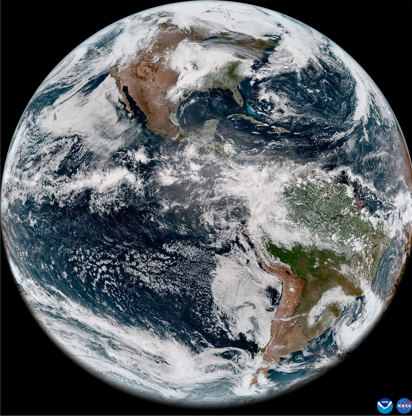
There’s no stopping lightning. But NOAA hopes some of the harmful effects can be reduced with better monitoring. A new environmental satellite, launched this spring, offers that potential, with constant and real-time views of atmospheric conditions over the Western United States and Pacific Ocean.
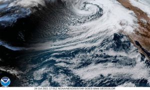
In May, the latest of NOAA’s geostationary operational environmental satellites, or GOES, captured images of lightning as a derecho moved across the Northern Plains through an instrument called the Geostationary Lightning Mapper. The visuals resembled a moving band of fireworks through the clouds as the storm pulsed across the map. In places like Northern California, the Lightning Mapper can keep constant watch over an area that is considered a fire hazard. If it sees a storm system move through, and detects lightning in an area that’s particularly dry, it can help researchers infer when a fire has started. It also aids forecasters in issuing severe storm warnings, because it detects rapid increases in lightning flash rates, which are often a precursor to severe thunderstorms.

NOAA has been sending GOES satellites into orbit since GOES-1 launched in 1975. Every few years, new and improved versions are made. The first satellite in the current GOES-R series launched in 2016 to cover the Eastern United States.
As the name suggests, the satellites orbit above the equator at the same speed the Earth rotates, essentially “seeing” the same region of the United States to track atmospheric conditions and hazards in near real-time. New improvements give GOES satellites the ability to detect and monitor fires, see how smoke from wildfires is moving, track hurricanes and atmospheric rivers as they travel over California, and detect low clouds and fog. “This generation of satellites was conceived in the early 2000s, when we assessed the needs of our users and what would be helpful to them in terms of, say, better cloud observations or better fire detection,” says Dan Lindsey, a research meteorologist at NOAA and program scientist on the GOES-R team. “And now we’re seeing the fruits of that assessment in these latest improvements.”
The GOES-18, launched in March this year, and the GOES-17 (GOES West) before it, look out over the western United States, Mexico, Alaska, Hawaii, and the Pacific Ocean. Together with the GOES-16 (GOES East), which covers the Eastern United States, the satellites track weather patterns across the country. The satellites can frequently detect fires before they are seen on ground – sometimes even before 911 calls.
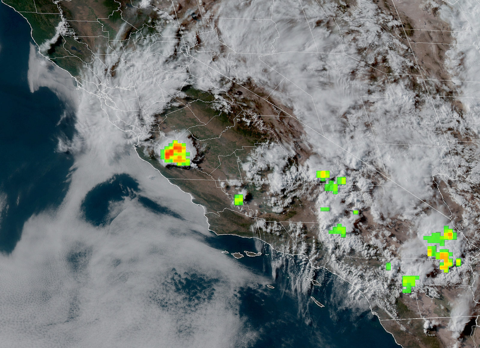
They are able to do this because the Imager, the primary instrument on the GOES-R Series for capturing oceanic and terrestrial weather, can scan Earth every ten minutes, five times faster than previous models, with resolution down to 500 meters and three times more channels than previous GOES models. The speed and precision translate into better forecasting as well as faster, more accurate warnings.
“So, for example in California, if a new fire starts, the satellite is able to detect the thermal anomaly from the fire,” Lindsey says. “And if we’re scanning the same area every one minute, we can detect an anomaly and get that information out within a couple of minutes to say somebody at the local fire department. Sometimes they can go in and put the fire out before it gets out of control — depending on how big it is, and where it is.”
Twenty years ago, the previous generation of satellites didn’t have the granularity needed to “see” some smaller fires, because the pixels that are the fire have to stand out from the surrounding pixels in order for the algorithm to notice it and flag it as a fire.
Fires aren’t the only thing that this granularity can help us detect, and in places like the Bay Area, where the presence of fog is so localized, this improvement is a gift to meteorologists and climate researchers. “Earlier, you may not have been able to pinpoint the edge of the fog, you can think of it as more ‘blurry’ data,” Lindsey says. “So the better resolution gives you the ability to hone in and get really accurate depictions of exactly where the fog is occurring.”
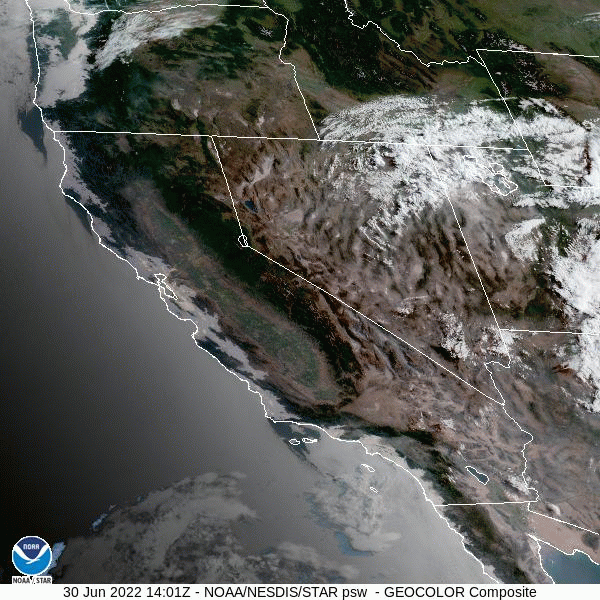
Fog systems in the Bay Area fluctuate every 20-30 years but if climate change causes more severe changes in coming years, changes in the fog bank could adversely impact several ecosystems in the region, including those of the redwoods and coastal chaparral. Studies suggest that the coastal fog so essential along the California coastline is already less frequent now, and mapping it as exactly as possible into the future will become more and more important.
The satellites are also improving our ability to track and understand the cloud formations over California and how they are changing, which is key for scientists to understand climate feedback. And, they fill the rather large data void over the Pacific Ocean. The more precise a weather model’s grasp of current conditions, the better it can predict the future – and without the satellite only a limited number of ships and buoys transmit conditions from the ocean. “The geostationary satellites take an image every 10 minutes over the full area, which means that we can follow clouds as they move,” Lindsey says. “So the satellites are providing the models with an initial condition. And they say, ‘Here’s what the winds are over the Pacific Ocean, here’s what the clouds are, and this is how they are moving.’ And if you do a better job getting that correct at time equals zero, then your forecast is going to be better after that.”
Now, with ever-better satellites, the next challenge has arisen: transforming all those observations into something that climate and weather models can use, a process called data assimilation. “A key to improving weather forecasts is having really good observations,” Lindsey says. “But there’s a lot of data we are collecting that’s not getting into the models, and we are trying to do a better job with that.”