Tracking technologies have reached a level of ubiquity and sophistication that is hard to deny. And clearly, that’s not always a good thing. However, if you’re a wildlife biologist trying to understand the movements of a species of concern to better protect it, well then, maybe those technologies can be a force for good.
Up until recently, wildlife tracking technology was such that you could put a radio transmitter on an animal, but then you had to send staff or volunteers into the field with portable receivers, searching for a signal that would indicate the animal’s presence. The cost in time and resources are considerable, seriously limiting the number of animals and species that can be tracked. For larger animals (think mountain lions or condors), satellite tags that beam signals continuously to a satellite can allow their movements to be observed remotely for as long as the tags (and their batteries) stay on. But because of the size, weight, and $3,000 expense of each tag, their use is limited.
Enter the Motus Wildlife Tracking system, which combines the continuing miniaturization of radio transmitters and batteries with a network of stationary receiving stations, and a whole new world of tracking the movement of species of concern becomes possible. The Motus system (derived from the Latin word for “motion”) was launched in 2012-13 by a group of researchers in eastern Canada interested in tracking the migration behaviors and destinations of birds that spent summers in Canada before heading south.
Bird researchers have frequently used colored leg bands to track these smaller migratory birds, but success with this method depends on re-trapping the same bird (or getting a close look with binoculars). With Motus, all the tagged bird has to do is pass within range of a Motus-enabled antenna to be recorded and added to the Motus open-source database. The Motus database and network are managed by Birds Canada, a large Ontario-based NGO dedicated to bird monitoring and conservation. According to its website, Motus is now “the world’s largest collaborative automated telemetry array,” with over 750 receiving stations, and is growing constantly.
Dunlins and Western Sandpipers
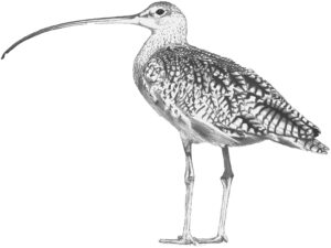
For Nils Warnock, director of conservation science for Audubon Canyon Ranch, a nonprofit based in West Marin, the Motus tracking system was a great solution for advancing his long term studies of two shorebirds — dunlins and western sandpipers — whose populations appear to be declining in California. Nils and his wife Sarah Warnock began researching and banding dunlin and westerns in the late 1980s while working on their graduate degrees. To follow these small shorebirds on their migration from wintering grounds in and around San Francisco Bay up to breeding grounds in Alaska, the Warnocks had to rely, in part, on other researchers up and down the West Coast, asking them to get out in the field with hand-held antennae to watch and listen for the tagged birds at times when they might be passing through. And then, to find the birds on their vast breeding grounds in Western Alaska, they had to arrange for searches by airplane, an immensely expensive and time-consuming proposition.
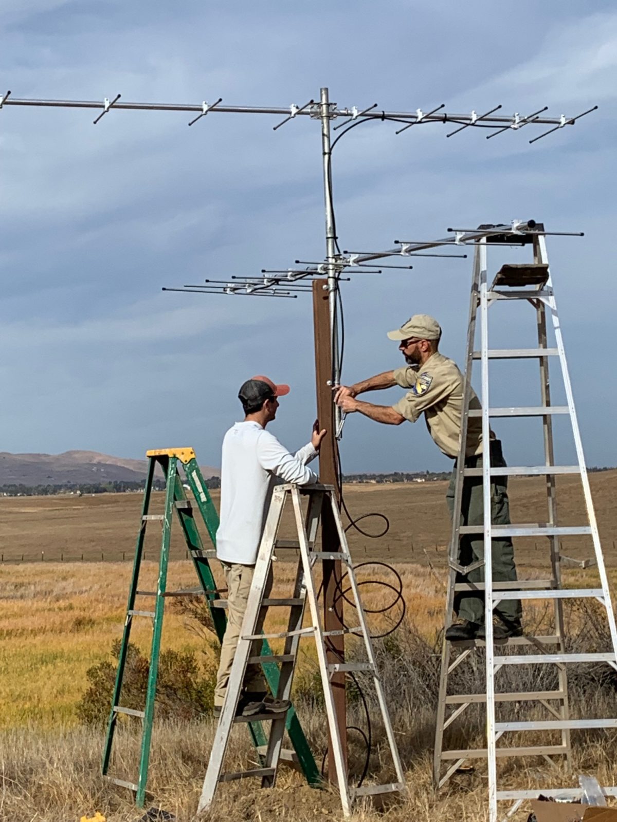
Now, with groups installing Motus towers all along the Pacific Flyway — from southern California to Oregon, Washington, and into British Columbia and Alaska — and the $200 tags weighing less than a gram, Warnock can follow the progress of dunlins he has tagged on Tomales Bay and western sandpipers in San Francisco Bay from his desk at Cypress Grove. On a rare sunny and windless July day on the shores of Tomales Bay, Nils walked me out to the site where the preserve’s Motus tower had been set up the year before, in March 2021, one of the first in the Bay Area. (That same month, Audubon Canyon Ranch installed another tower at its Tom’s Point Preserve, some five miles to the north on Tomales Bay. The organization also has a third tower at its Bolinas Lagoon headquarters to the south.)
The sturdy steel and aluminum tower rises some 25 feet, stationed on a low hill that overlooks a small restored wetland; Tomales Bay stretches to the west and north. It’s a commanding position for the dual antennas mounted high on the tower, which are connected to a transmitter that beams the signals back to computers at the preserve headquarters on the other side of the wetland. All of which is powered by a solar panel array on the tower. According to Warnock, the antennas can capture radio signals emitted by any Motus-aligned transmitter tags passing within three to six miles.
The nature of these radio signals is a major technological advance. This gets slightly technical, but it’s important. In the past, each radio tag emitted a signal at a unique frequency generated by a small crystal in the tag. If I wanted you to look for a western sandpiper I had tagged, I had to advise you to set your receiver to that specific frequency. However, all Motus radio tags emit their signals on the same frequency (166.380 Mhz) in the Americas, so now you can just set your receiving antenna to that frequency and sit back and receive. But then how do you know which bird is transmitting the signal? Each digital radio tag is encoded to emit a unique combination of pulses and bursts that is registered with the network when the tag is mounted on the animal. When that unique combo is detected, the system recognizes that particular animal and transmits its location to a centralized Motus database.
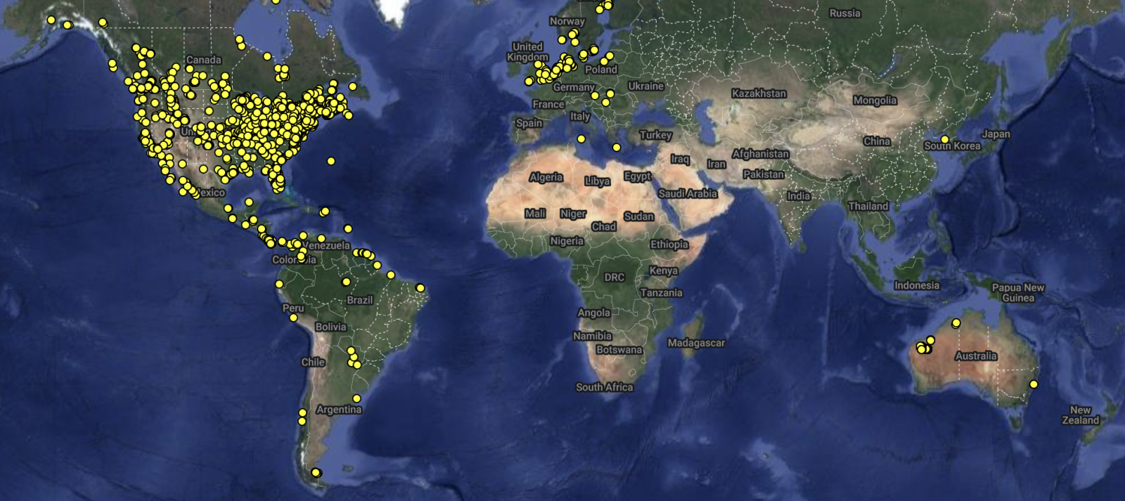
Back at his office Warnock opens up the Motus website on his desktop computer and shows me how he can generate a map tracing the migration route of a dunlin he had trapped and tagged that spring in the Walker Creek delta on Tomales Bay. The line on the screen shows the dunlin’s passage registering with Motus towers in California, Oregon, Washington, and Canada on its way to breeding grounds in Alaska. The information helps him understand where the bird stopped along the way and for how long. This is important and relevant, he explains, because there is a proposal to greatly expand port facilities near Vancouver in British Columbia that would likely destroy a large mudflat area biologists believe may be a critical stopover for migrating shorebirds. Data gathered through the Motus network could provide strong empirical evidence for such claims.
Of course, for the tracking network to be most effective, researchers want as many towers as possible. “The more towers that go up, the better it will get,” says Warnock. The model is the network along the East Coast, where the initiative got its start and has resulted in an almost continuous “fence line” of monitoring towers from New Brunswick down to the Florida Keys. The West Coast is way behind; for example, there are currently no towers along the Pacific Coast between Tomales Bay and Bandon in southern Oregon. Such huge gaps will have to be filled in to fully realize the potential of the Motus network here along the Pacific Flyway.
Screen capture from Birds Canada’s motus.org.
Collaboration in California
One of the organizations leading the charge to grow the Motus network in California is the San Francisco Bay National Estuarine Research Reserve (SF Bay NERR). The NERR system is a partnership between the National Oceanic and Atmospheric Administration and coastal states with a network of 30 reserves along the Atlantic, Gulf, Pacific, and Great Lakes coasts dedicated to protecting estuaries through research, monitoring, and education. The SF Bay NERR has two field sites (at China Camp State Park and Rush Ranch Reserve), with headquarters at the Estuary and Ocean Science Center in Tiburon.
In early 2019, then-SF Bay NERR director Mike Vasey attended a meeting of all the NERRs and learned about the well-established Motus network along the East Coast. Given SF Bay NERR’s position on the Pacific Flyway and its mandate to conduct monitoring, Vasey was eager to get Motus towers up and running in California. Following a COVID-imposed time delay, SF Bay NERR installed a Motus tower at its Rush Ranch location on Suisun Marsh in Solano County, a hotbed for shorebird migration, in the fall of 2021. And more importantly, SF Bay NERR got a small grant to bring the Motus team from a NERR in South Carolina to give a “how-to” Motus workshop for other interested institutions in Northern California. That workshop, held last October, was attended in person by representatives from 12 institutions, with another 75 people joining virtually. Attendees also included insect and bat researchers, says SF Bay NERR’s project lead Aimee Good, because there are now radio transmitters small enough to attach to bats, butterflies, and dragonflies. The workshop, says Good, has resulted in a rapid growth of interest in the network, with “towers going up right and left.”
The main barriers to setting up a new tower are, not surprisingly, money and know-how, and the now all-too-familiar “supply chain” issues. So it has helped immensely for some large institutional players to get involved, including the California Department of Fish and Wildlife (which has been able to tap into state Cannabis Fund monies to support its towers, such as the one at Eden Landing and another at Grizzly Island on Suisun Bay), The Nature Conservancy (which has erected several towers in the Central Valley), and national Audubon. The latter plans to install 20 towers at Audubon preserves around the nation, and selected the Richardson Bay Audubon Sanctuary in Tiburon as the site of its first installation, erecting a tower in early August. In an example of the collaborative ethos that characterizes the Motus network, staff members from the SF Bay NERR, CDFW, and Audubon Canyon Ranch assisted Richardson Bay Audubon staff in putting all the pieces together and getting them operational.
This point can’t be overstated: The beauty of the Motus network is its collaborative nature. The more towers the better. And the more tagged animals, the better. If “my” dunlin flies by “your” tower, I get another data point for my study. And if your phalarope flies by my tower, then you get a point for your study.
The Motus project lead for the San Francisco Bay Bird Observatory, director of landbird programs Katie LaBarbera, emphasized this point when I spoke with her. “The main attraction for me is the collaboration. One of the beauties of Motus is that once you have a tower up, it’s a resource for everyone in the network. And every tower that goes up is exponentially helpful,” she said. Of course, she pointed out, one of the drawbacks is if a tagged bird goes where there aren’t any towers, then you don’t get any data. Fortunately, as the network expands, that drawback disappears.
Expansion in the South Bay
And fortunately for Bay Area organizations, the network is expanding rapidly, and SFBBO is part of that charge in the South Bay, where the organization is based. Its mission is to monitor land bird and shorebird populations in the South Bay. The organization operates a major bird banding station along Coyote Creek in Milpitas, so it is already very much in the business of trapping and tagging birds.
SFBBO’s first Motus tower was erected this spring, but the organization still awaits the large antennae ordered last October (“supply chain issues!” says LaBarbera) before they erect their other two planned towers — at Cooley Landing in East Palo Alto and at the headquarters of the Don Edwards National Wildlife Refuge in Fremont — on opposite sides of the Bay shoreline. LaBarbera explains that the six-mile range of the antennae on SFBBO’s three towers, coupled with the CDFW tower at Eden Landing, will provide overlapping coverage of all the South Bay salt ponds and tidal marshland. This is crucial, because for the immediate future, SFBBO is focusing on the short-range movement of several species of concern within the baylands and surrounding areas.
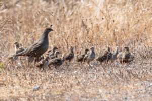
In particular, SFBBO will focus its tagging on two land bird subspecies of state concern that are salt marsh residents: the Alameda song sparrow and the San Francisco common yellowthroat warbler. Neither subspecies migrates out of the Bay Area, but both are threatened by the historic reduction of Bay salt marsh habitat, and it will be important to understand how they move about within the Bay’s marshes. In particular, researchers would love to understand if the birds are using recently restored marshes and if so, which ones and in which seasons. By coordinating data points between the four South Bay towers, researchers will be able to get much more precise answers to these important questions.
Of course, SFBBO’s Motus towers will also help other researchers based far and wide. For instance, very little is known about where the flocks of phalaropes that hang out on Mono Lake in summer go thereafter. Are the phalaropes that appear in the South Bay the same ones that summer at Mono Lake? Once SFBBO’s towers are up and running, the Mono Lake researchers can find out.
With this technology still in its infancy, it’s hard to predict what all the benefits will be. One can only hope that the birds of the West Coast are okay with trading some of their privacy for the long-term health of their populations. Then we have to turn our newly acquired knowledge into measurable actions.