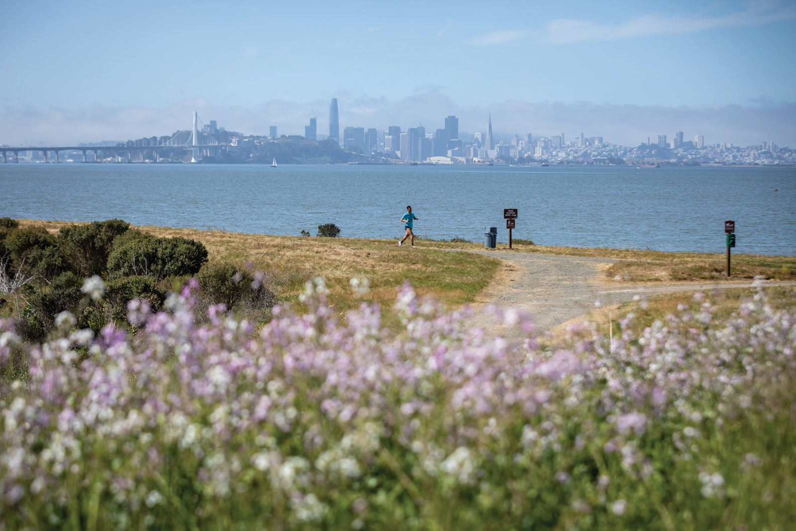
You might think the story of Brickyard Cove, the gleaming new public park at the Berkeley waterfront, is a simple one.
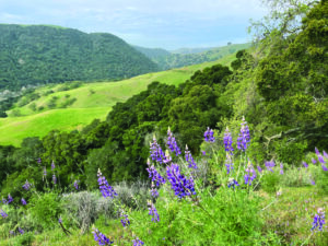
From the small park’s rolling hilltop or the trail that traces the water’s edge, you might take inventory of all you see: San Francisco Bay, the Golden Gate and Bay Bridges, Mount Tamalpais, sailboats, soaring and nesting waterfowl, glittering waterfront cities, beckoning hills.
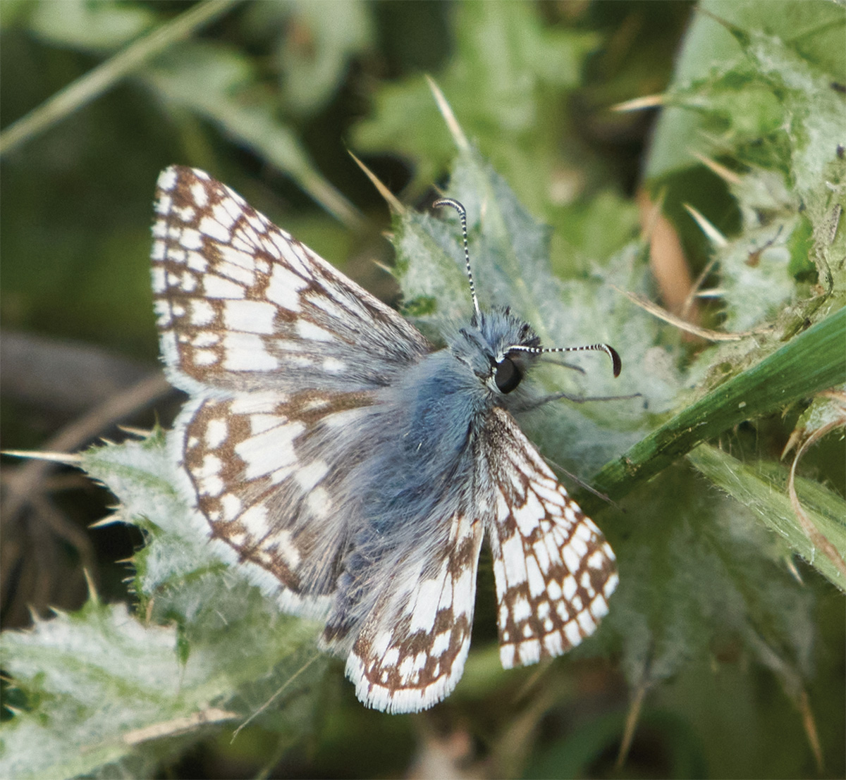
You might look next at the new park’s charming mix of wildlife habitat, native plants, and spaces to walk or run, with areas to learn about Bay history or to celebrate a child’s birthday with a picnic. A simple and accessible public space with a world-class view.
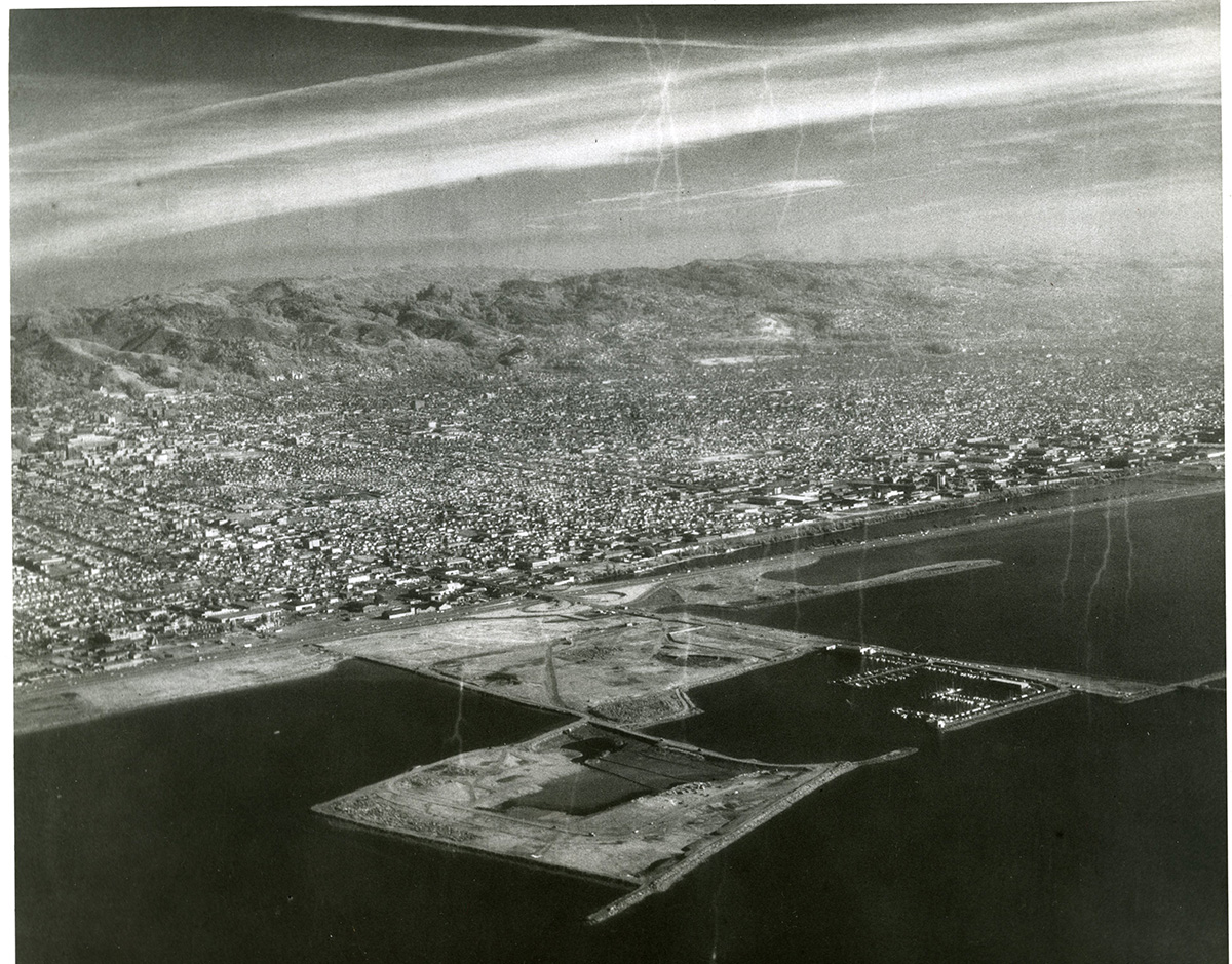
But the old adage rings true: looks can be deceiving. The human history of most urban shorelines begins with Indigenous communities, followed by settlers, and then decades of industrial use under private ownership. Brickyard Cove is no exception, but it is also filled land, built on top of debris dumped into the water, like so many other tracts that now protrude into the Bay.
Newly opened by the East Bay Regional Park District in late March, following years of restoration work, the 31-acre Brickyard park sits at the center of McLaughlin Eastshore State Park, the eight-and-a-half-mile shoreline that parallels the San Francisco Bay Trail from the touchdown of the Bay Bridge all the way north to Richmond.
“Brickyard Cove is now a bright gem that’s welcoming for the entire community,” says Elizabeth Echols, the East Bay Regional Park District board member whose ward includes the new park. “This is something to be cherished and appreciated, because it could have been otherwise.”
While Brickyard Cove is filled land, the original coastline remains visible at the eastern edge of Berkeley’s Aquatic Park. When Spanish settlers arrived in the 1700s, bringing horses and cattle that would forever change the Huchiun region’s ecology, Chochenyo-speaking Ohlone had for thousands of years lived in villages of domed huts along what is today called Strawberry Creek. The creek threads through the city of Berkeley and empties into the Bay at Brickyard Cove’s northeast corner, creating a vital mudflat.
The Ohlone directed songs and prayers to the creek’s waters in gratitude for an abundant diet of shellfish, salmon, and steelhead trout, also harvesting berries, acorns, and seeds from its banks. Shellmounds near the mouth of the creek are physical evidence of an ample food supply from the water and are cherished today as sacred sites for the burial of ancestors.
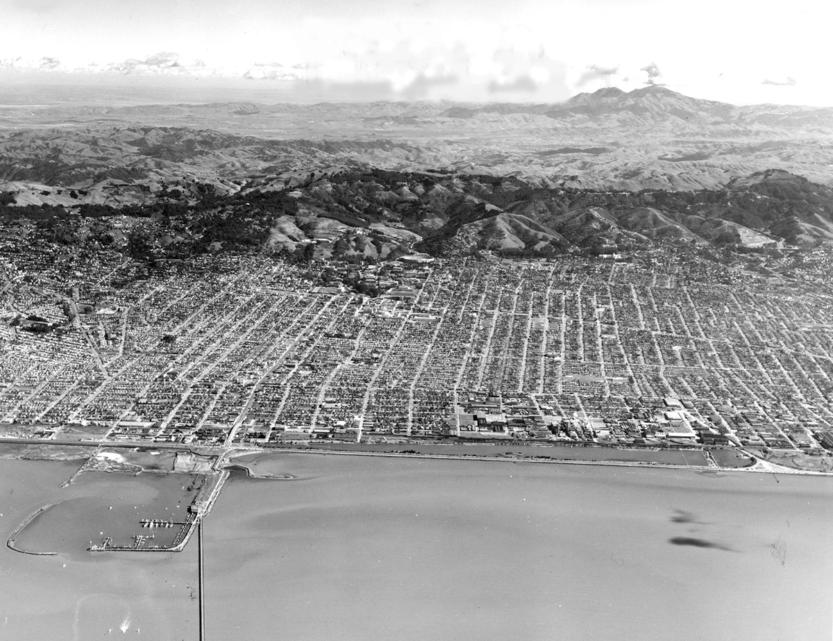
Once begun in the 1700s, the tragic destruction of Indigenous communities by settlers only accelerated. By the mid-20th century the East Bay coastline was also utterly transformed, in part by the Santa Fe Railroad. This western powerhouse had begun acquiring much of the Berkeley and Emeryville shoreline in the 1920s under the name Berkeley Waterfront Company (having already acquired Albany’s waterfront in the 1890s).
The filling of this section of Bay began in earnest with construction of the Berkeley Pier, which hosted ferry service to San Francisco but also provided a route for dumping the city’s garbage at what’s now the Berkeley Marina.
Santa Fe proposed as early as 1948 to develop the Berkeley segment of the waterfront. As Norman La Force lays out in his comprehensive account, Creating the Eastshore State Park: An Activist History, the city rezoned Santa Fe landholdings from industrial to unclassified, which opened the door to broader use but required permits for development.
Then, in 1955, Berkeley produced a master plan proposing to extend the city an astonishing three miles into the Bay from Interstate 80 by filling 2,000 acres of wetland. A later version of the plan included not only industrial and residential development, but also an airport.
“It is this proposal,” La Force writes, “that brought forward Esther Gulick, Kay Kerr, and Sylvia McLaughlin to oppose this plan and to form Save the Bay.”
An alternate narrative to the proposed waterfront developments up and down the Bay’s eastern shore materialized: fierce opposition. By 1970, California’s new Bay Conservation and Development Commission assumed jurisdiction over tidal areas of San Francisco Bay, and further filling was banned.
In a David-and-Goliath matchup that dragged on for years, a mix of ordinary citizens, elected officials, and nonprofits—Save the Bay, Citizens for East Shore Parks, and the Sierra Club, to name just a few—aiming to protect the East Bay shoreline as a public park, confronted the powerful private developers.
Championing the environment is familiar and even expected today, but at the time these citizens were breaking new ground, shaking up a postwar culture that demanded little oversight of corporate activities. With the Bay itself at risk, these advocates wanted answers.
Santa Fe sued the City of Berkeley—by then governed by different sensibilities—and lost. On appeal the California Supreme Court ruled in 1980 that tidelands were subject to public trust doctrine—the public right to such natural resources as air, waterways, and seashores—and could not be developed outside the bounds of that public trust.
Through countless rounds of citizen advocacy and lobbying, Berkeley, Emeryville, and Albany voted between 1986 and 1990 to require citizen approval for future shoreline development. Finally the railway’s development arm, under threat of condemnation, was forced to sell its bayfront land, including the Brickyard and Berkeley Meadow, to the state at a newly appraised parkland price of $27.5 million, far below the amount it would have fetched on the private market.
When the California Department of Parks and Recreation balked at constructing and operating the properties as a new park, Assemblymember Tom Bates sponsored a bill making the East Bay Regional Park District an agent of the state, with sole authority to develop and manage what would become the new McLaughlin Eastshore for a period of 30 years. That now sounds simple enough, but it was achieved through an extraordinary bipartisan process that created a solution not seen before or since. Governor Pete Wilson signed the bill in 1992.

Today, Bates defers to other players. “I was just lucky enough to be a part of that team,” he says. But the state park might never have been created without his persistence and the millions of dollars in financing he delivered.
In that regard, McLaughlin Eastshore had the benefit of continuity. Just three East Bay members of the state legislature jointly spanned enough years in office, some of it before term limits, to see the new state park to fruition: Bates, Loni Hancock, and Nancy Skinner. All three worked for years—decades!—on shoreline preservation, and over time all three were “in the room” in Sacramento applying pressure for that cause.
Hancock led the senate campaign for the Brickyard, which was always in Eastshore’s 2002 general plan but had languished without funding. Finding money was yet another hurdle at a bad time. California State Parks had come under scrutiny in 2011 for hiding a fat budget surplus while threatening to close 70 parks, and the agency was in the throes of a financial and management overhaul while trying to restore its shredded public credibility.
The advent of a new state parks director, General Anthony Jackson, offered a glimmer of hope. Hancock, backed by Skinner, worked behind the scenes to gain Jackson’s full support and—over the objections of his staff—secured a cool $5 million in 2012 to construct Brickyard Cove.
Hancock too shuns personal glory, preferring to quote President Obama’s famous line: “We’re part of a long-running story. We just try to get our paragraph right.”
But her delight with Brickyard Cove is palpable as she recalls the cries for help from McLaughlin Eastshore’s namesake.
“Sylvia McLaughlin, for years, would say, ‘Loni, please do something about the Brickyard.’”
The Brickyard parcel was unusual from the start. Santa Fe had created it—with fill occurring in the 1950s and 1960s—to serve eventually as a waterfront green space to enhance the appeal of the developments to be constructed on the Berkeley Meadow. Meanwhile, the site could hold construction debris, including slabs of concrete and asphalt.
Unlike places with similar names, including one in Richmond, Berkeley’s Brickyard Cove was never associated with brick manufacturing. Somehow that name stuck, but actually everything at today’s new park, not just the name, is invented. There was no brick factory, but also no natural shoreline or cove, no meadow, no protected wildlife habitat or native shrubs. In sharp contrast to nearby landfills, the Brickyard was never a repository for the household garbage that waterfront cities once routinely dumped in the Bay. That, at least, was a plus. The site held mainly dirt but also chunks of hardscape, rebar, and yes, old bricks. Rabbits, gophers, and birds had colonized the rubble. Trespassing humans had littered the shoreline.
Under a series of leases granted after landfilling ceased, private contractors had operated a depot for selling dirt. What remained by 2016 was a 53-foot mound of soil from construction projects, most of it pronounced clean after exhaustive testing. The few contaminated patches could be isolated and removed.
The park district’s former general manager, Robert Doyle, who also ran the land department for 25 years, laughs about the decision to keep that pile of dirt nobody seemed to want.
“We probably saved $1 million of public money by reusing it,” he says. “We didn’t have to bring in dirt to sculpt the hill and meadow you see now.”
Ren Bates (no relation to the legislator) was on hand for the park district’s entire remediation of Brickyard Cove, first as landscape architect and then as capital program manager.
“People talk about restoration, but it was not natural land,” he says, adding that a plant and animal ecosystem was already developing there. “Our goal was to maintain it as a conservation area but balance that with public access.” Add to that the urgent need to mitigate sea-level rise, and you’ve got a tall order.
Beginning in 2016, the district’s project managers worked to create the Brickyard you see today: regrading the entire site, lowering the dirt hill 15 feet, and shaping the meadow to retain Bay views while partly protecting a new picnic area from wind—always taking care not to disturb the burrowing owls known to nest in the area. With running commentary from ducks and geese, the project managers also raised and stabilized the shoreline so it could withstand the effects of changing climate. By 2017, the park district began seeding native grasses—California brome, blue wild rye, and a couple varieties of fescue—and planting California poppies, lupine, and yarrow.
The Brickyard hugs the terminus of University Avenue and the outflow of the iconic Strawberry Creek, both of which sweep down from the UC Berkeley campus. The waterway passes via culvert through the center of town, reaching daylight for a few blocks at Strawberry Creek Park in West Berkeley before again being forced underground.
The creek once had a seasonal salmon run and hosted a rich mix of aquatic life, but the steady march of urban development took its toll. Not until the late 1980s did scientists begin to study and address the damage. Knowing that some historically native fish could not thrive amid the presence of silt, exotic species, and urban runoff, they introduced sticklebacks, suckers, and prickly sculpins tailored to this freshwater ecosystem as it exists today.
Although the freeway and other north-south routes have long obscured the natural mouth of the creek, the water still reaches the Bay via an underground extension that draws the water farther west, ending at the concrete rectangle you see from the Brickyard’s northern edge. There the estuarine mix of waters fortifies a tidal mudflat and salt marsh, providing habitat for myriad species, including the endangered salt marsh harvest mouse, and a place to feed or nest for the hardiest gull or the most delicate sandpiper.
Back in 2002, volunteers organized by Friends of Five Creeks had begun working along the Bay Trail spur near the creek outlet to impede the growth of perennial pepperweed, ice plant, and other invasives, whose growing season only lengthens as the climate warms. On the beach south of the outflow, they planted a few native creeping wild rye, and were gratified to see it spread.
Once Brickyard began to take shape as a park, the Friends welcomed to the cove willing volunteers of all ages, including college students and Scout troops, who pulled more ice plant, pepperweed, French broom, and pampas grass. Pretty much everyone, especially the kids, delighted in being invited to work at the Brickyard’s “secret beach.”
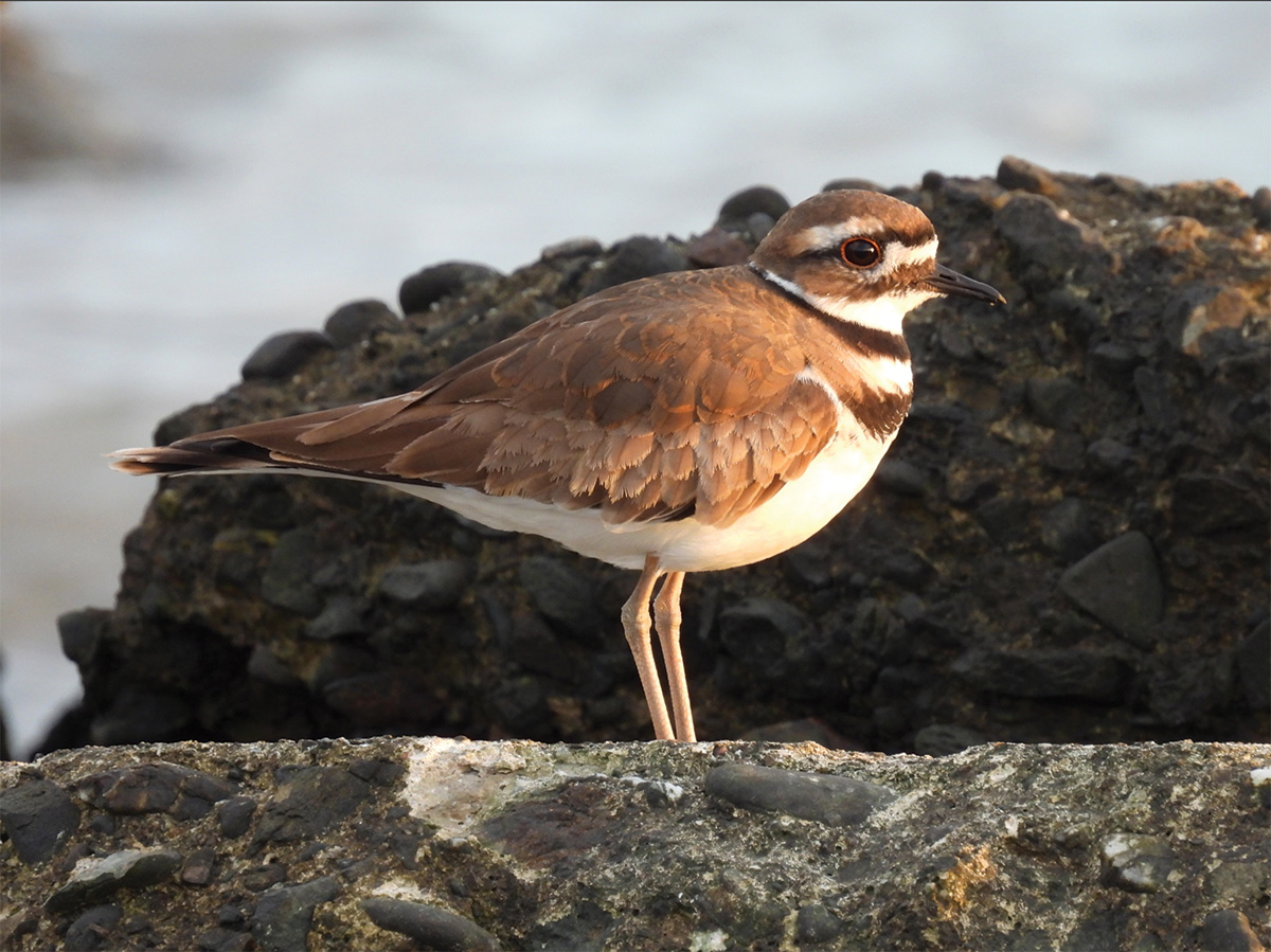
“We called it the secret beach because relatively few people knew about it,” says Susan Schwartz, president of Friends of Five Creeks. “It was sufficiently little used that killdeer could nest.”
Now that the park is open and filled with families, vegetation management will continue, including a final seeding of native grasses. The park district staff will attempt to control fast-growing native species such as the ubiquitous coyote brush, coordinating with volunteers on the endless task of clearing detritus and invasive weeds. Meanwhile, the beach and tidal areas are continually shifting, so stewardship will require monitoring changes and responding as the climate warms.
The challenge of balancing conservation with public access takes on new meaning when you pore over the map. Most of McLaughlin Eastshore State Park is a narrow strip of tidelands, with a few land masses such as Berkeley Meadow—protected as wildlife habitat—and the Albany Bulb. These physical limitations have made it hard to offer amenities for gentle use by a diverse mix of people.
But the park plan included a pledge to provide thoughtful access at Eastshore, with an eye to the needs of underserved communities. This element was critical to stakeholders, some of whom devoted years of their lives to the vision of a protected Bay front owned and managed for the public good, that is, the entire public: all ages, interests, backgrounds, and abilities.
Brickyard Cove fulfills the promise to serve the many and not just the few. As the central jewel of the Eastshore “necklace,” as many have termed it, and with a land mass wider than a few hundred feet, it is accessible from every direction. No other part of Eastshore can offer a space so inviting to people while promoting careful stewardship of an ecosystem.
“Urban parks are so deeply challenging,” says Doyle, the park district’s former general manager. “Had it not been for decades of citizen effort, the district would never have been able to step up and get this done.”
How to Explore: The Cove
» Brickyard Cove is accessible from the Bay Trail, Berkeley Marina, University Avenue, and Fourth Street. Its parking lot sits directly south of Seabreeze, a deli at 598 University Avenue in Berkeley.
» The waterfront loop and spur trail total just over a mile of flat, dirt path with interpretive signage. For a longer route, combine it with trails circling the adjacent Berkeley Marina, César Chávez Park, and Berkeley Meadow to the north.
» Accessible unisex restrooms, water fountains, accessible picnic area with some tables surrounded by meadow.
» Parking lot, electric vehicle charging station, bicycle parking. Dogs allowed on leash.
» For park notices, check ebparks.org/parks/mclaughlin-eastshore