There’s a line in the mud in the Bay Area. It’s a blue line for hydrologists, a green line for biologists, and a red line for environmentalists. Moving the line, which was painstakingly drawn in the 1990s by those who care about wetland ecology and endangered species protection, is considered beyond the pale. It’s the line where the land ends and the Bay begins, and it’s pretty thick. Once a large area of marshes, it’s now a frontier many people feel strongly about guarding.
“In other parts of the nation, you can still build a shopping center on a salt marsh, but that’s not going to happen in the Bay Area. It’s different here,” says Marc Holmes of The Bay Institute.
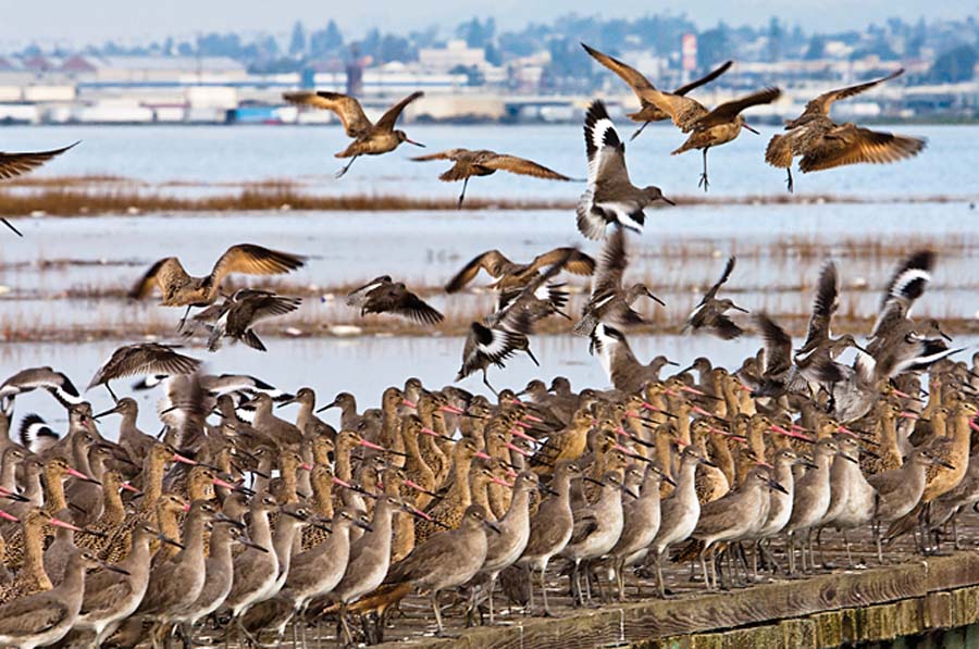
California clapper rail. Photo (c) David Sanger
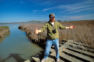
Holmes projects the weary hopefulness one gets from decades spent trying to save the planet. He looks kindly, but underneath he’s steel. He’s fought through lawsuits and permits and policies, worked legislatures and local governments, testified on behalf of defenseless birds and thirsty rivers and the last scraps of nature around the Bay. To a large degree, he and countless other individuals and organizations on the front lines of regional wetland protection have won this particular battle to “save the soft shores from hardscape” because they all have their eyes on the same prize: 100,000 acres.
Once upon a time we had 196,000 acres of tidal wetlands ringing San Francisco Bay. The Bay formed when ice caps melted and the seas rose 10,000 years ago, flooding river valleys as far inland as present-day Napa. Those were the days when the baylands were much more than a patch of pickleweed or a meadow of cordgrass: Creeks and rain emptied the soils and runoff of whole watersheds onto the marsh plain. Each marsh had high and low spots, varied vegetation, and branching channels so labyrinthine it wasn’t clear where one ended and another began. Forty percent of the land area of California drained into this vast estuary and through its marshes.
Then, in short order, settlers dug ditches and heaped up walls of dirt, and later concrete, around all these wetlands. They drained them and sent in the horse and plow, the cow and oats. Soon thereafter cities and towns grew up on the shore and we piled up more dirt in the water–filling the Bay to get more real estate. Along the way, we lost 90 percent of our tidal wetlands.
In the 1960s, three women from Berkeley mobilized a citizen army to stop the filling of the Bay and spawned the Save San Francisco Bay Association (now Save The Bay). Their efforts led to new forms of regional governance restricting shoreline development, while the federal Endangered Species and Clean Water acts gave local activists new tools for protecting wildlife from extinction and stopping sewage and garbage from fouling the Bay.
In the late 1990s, as the paradigm shifted from defense to offense, scientists and resource managers drew a blue-green line in the mud along the shoreline and produced the first maps of what needed to be saved or restored to achieve some kind of ecological equilibrium. “We essentially declared that the baylands are for restoring, and not for developing, at all, ever,” says Holmes.
Since then more than 19,000 acres of wetlands have been restored or enhanced, and 42,450 more acquired and put into the pipeline. Populations of the endangered California clapper rail–once reduced to a few hundred individuals–are slowly rebounding. All thanks to the activism and stewardship of myriad nonprofits, public agencies, park districts, legislators, businesses, and concerned residents.
Prime Waterfront Real Estate
at sunset. Photo: Jennifer Fraser
It wasn’t easy. The realization that wetlands were more than useless swamps was slow to dawn on the Bay Area. In the 1970s, citizens here and there began banding together to save their local waterfronts. In Palo Alto, Florence and Phil LaRiviere, who enjoyed heading down to the marshes with a picnic basket, joined with others to advocate for the creation of the nation’s first urban wildlife refuge, made up almost entirely of wetlands. Groups like the Citizens Committee to Complete the Refuge, Save The Bay, and the Audubon Society battled to keep assorted pieces of shoreline real estate from being developed.
At the time, concerned citizens had to take what they could get. In exchange for paving over this corner of the Bay, developers had to promise to restore another one. An eye for an eye, you might say. “In the 1980s, decision making was governed by last week’s real estate opportunity, or our short-term idealized vision of what we wanted a particular bayland to look like,” says ecologist Peter Baye, then a U.S. Fish and Wildlife Service expert on tidal marshes. “There wasn’t any ecosystem-based approach.”
When regulators hired biologist Francesca Demgen in 1986 to evaluate 18 mitigation sites to see if their approach was working, she quickly concluded there was no way of knowing because there were no established objectives to measure against, nor any historical record of what had existed before.
Then in the early 1990s a wiry graduate student with formidable intelligence was tasked with unearthing what habitats the Bay once had, and where. “At first I thought it sounded really boring. I wanted to get on to the more exciting contemporary stuff,” says the San Francisco Estuary Institute’s Robin Grossinger, who has since produced historical ecologies of the Napa River, Alameda Creek, and the Delta. “But pretty quickly I realized how intertwined this work was with what I’d always wanted to do, which was restart natural systems on a large scale across whole landscapes.” And his very first project, an “EcoAtlas” for the Bay, provided the scientific basis for the two decades of restoration work that followed.
In the meantime, Holmes and other wetland activists got a big break. Cargill Salt, the largest owner of restorable baylands, decided it could make salt more efficiently on a smaller acreage and reversed its previous refusal to sell some of its ponds to the public for restoration.
Overnight, it seemed, a whole new playing field opened up. In 1994, $6.5 million in fines from a Shell Oil spill in Martinez plus $3.5 million from state agencies funded the purchase of 10,000 acres of Cargill salt ponds along the lower Napa River. And regional wetland planning evolved from “an era of litigation to an era of acquisition with the anticipation of restoration,” says Holmes.
A Surge in Restoration
With restoration moving into the big time, the Environmental Protection Agency and the Regional Water Quality Control Board invited more than 100 scientists, resource managers, and consultants to collaborate on a regional wetland vision that became known as the Baylands Ecosystem Habitat Goals. They set to work trying to come to a scientific consensus on what kinds of wetlands, in which amounts, were needed where to restore a sustainable tidal marsh ecosystem in San Francisco Bay.
The project’s overriding conclusion was that the region needed to increase its tidal marsh acreage from 45,000 to 100,000. It also recognized that restoration science was in its infancy, and that there was a big difference between land that was wet and a functional wetland.
The 350-page Goals report, full of maps and photographs, provided a “big beautiful document that you could put down in front of a Congressperson and say, ‘We have this plan, now fund it.’ It brought a lot of money to the table,” says Peggy Olofson, who coordinated the Goals project for the water board. “All of a sudden we had a legitimate program, endorsed by the state and the feds, which became a road map for the future for everyone,” says Holmes.
Today, nearly all the same organizations are still involved in championing implementation of the Goals, including the San Francisco Estuary Partnership, Save The Bay, Audubon, the Coastal Conservancy, and the public wildlife agencies, among others. Bringing them all together to set priorities, get projects done, and monitor and evaluate the results is the San Francisco Bay Joint Venture, a consortium of 26 agencies, businesses, and organizations that share a commitment to the preservation and restoration of local wetlands.
“We knew that no one organization or agency could do landscape-scale protection and restoration on its own,” explains coordinator Beth Huning. “We’ve evolved into such an effective forum for airing the successes and challenges of restoration that project managers and landowners now come to us, knowing that we can collectively help them protect and restore their wetlands.”
The results have been transformative, not just for wildlife, but also for people. “To have been involved in such a catalyzing movement for large-scale restoration has been remarkable,” says Robin Grossinger. “This is one of the places in the world people look to as having really turned the corner, from having the centerpiece ecosystem of our region largely destroyed to having a significant amount of healthy habitat, in just a couple of decades.”
Size Matters . . .
The publication of the Goals report in 1999, coupled with the large size of the Napa salt ponds acquisition, changed the scale of restoration work dramatically. Whereas Palo Alto’s Faber Tract–all of 32 acres–was a big project in the 1960s, and Sonoma Baylands in the early 1990s was a giant for its time at 300 acres, the size, scale, and complexity of wetland projects grew exponentially. The plan for the Army’s Hamilton Airfield and adjacent properties near Novato, starting in the mid-1990s, envisioned a mosaic of tidal marsh, seasonal wetlands, and upland refugia across several thousand acres. Biologists began to envision habitats big enough for wildlife to actually breed on, rather than just stopping by for shelter or a bite to eat. “We got to the point where the scale was meaningful for biological populations,” says wetlands biologist Letitia Grenier.
In 2000, funding scaled up too, with several state propositions providing real taxpayer support for Bay restoration via two state agencies, the Coastal Conservancy and the Wildlife Conservation Board.
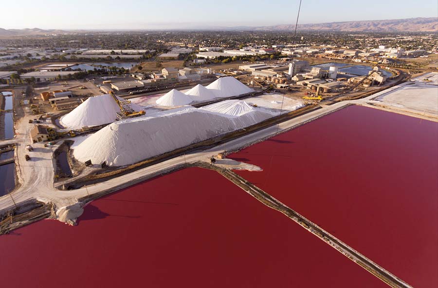
When another 16,500 acres of Cargill’s salt ponds were transferred into the public domain in 2003, everyone’s baseline for projects worth doing changed significantly. “Instead of tens or hundreds of acres we started talking about thousands or tens of thousands. And instead of projects and sites, we started talking about a program and a landscape,” says Jeremy Lowe of the environmental consulting firm ESA-PWA.
Along with the opportunity to restore larger landscapes came increasing know-how, from how to plant native cordgrass so it survives to being prepared for invasions of destructive nonnative plants on newly restored sites. Designers experimented with how deep to carve channels and how wide to make levee cuts. And they even learned how and where to add sediment–from smears over the top of the marsh to several feet of material imported from local harbor bottoms. After being diked for more than a century, many restoration sites were too subsided for plants to grow after levees were breached, so bringing in dirt could cut a 50-year timeline for vegetation to flourish down to 10.
Taxpayers, meanwhile, chose to embrace what had been learned by firing up the backhoes and restoration crews with federal stim-ulus funds. “Restoration creates jobs and infrastructure,” says Huning. “Bay Area residents need to know their federal money came right back here to put people to work on these restoration projects.”
. . . And So Do Rising Seas
The region steamed full speed ahead with its grand vision for a revived wetland ecosystem until warnings about melting ice sheets and rising seas became more dire. For San Francisco Bay, scientists projected a 16- to 55-inch rise in sea level by 2100. But what really got the attention of the environmental ninjas and public land managers working to restore the bay shore was the marked acceleration in the rate of rise projected for around 2060; at that point, marshes will no longer be able to keep up with rising waters through natural processes.
The impact of climate change on the Bay’s natural systems will be profound. Storms will be more intense and more frequent; droughts could be longer and hotter; the timing of snowmelt and runoff into the estuary will change too. “There’s big uncertainty about our end points,” says Grenier, who in the spring of 2013 was coordinating the ambitious effort to update the 1999 Goals, largely to adjust for the rising sea levels.
The climate change curveball means the Goals’ focus needs to shift to a dynamic, rather than static, end product. In pressing the “reset” button on the Goals, Grenier and the rest of her update team are concentrating on building adaptability. For example, Goals teams are talking about getting freshwater back into the marsh, to better re-create the natural gradient from land to sea and from fresh to brackish to salty marshes. This more complex marsh not only builds up elevation faster, but also sequesters more carbon. And they’re promoting using wetlands and transitional zones, rather than conventional levees, to buffer developed areas from waves and storm surges.
Selling the idea to local planning groups, experts are quick to invoke the memory of New Orleans, and to suggest that wetlands do a much better job of protecting shorelines and regional infrastructure than big levees can. “We switched gears on wetland restoration at a critical time,” says Jeremy Lowe. “The threat of more frequent flooding brought the value of these public lands more to the fore. Instead of throwing up our hands or building big structures to keep the Bay out, we’re in a good place to allow the estuary to evolve naturally and provide protection for our developed areas.”
Show Me the Money

After Sandy, even Manhattan seemed to be reconsidering the sharp edge between skyscrapers and the rivers around the island. A New York Times illustration showed a wetland buffer for the Big Apple that might have prevented flooded subways, streets, and homes. But it’s probably too late for Manhattan to go there.
Congress appropriated $60 billion for damage from Sandy. “Sixty billion, for one storm?” says Marc Holmes, shaking his head. He and others at work in San Francisco Bay have better ideas about how to spend money, and they think they have a pretty good investment portfolio. “You spend one billion now, and you save tens of billions in future damages,” Holmes says. “This is not alarmist, sky-is-falling kind of stuff. We’re seeing the impacts of climate change all over the place. We need to accelerate our tidal marsh restoration strategy because it’s a proven sea level rise adaptation strategy.”
Holmes points out how expensive it would be to throw up seawalls around shoreline highways, airports, and downtowns. A 2013 report from The Bay Institute finds that soft-shored wetlands, combined with habitat-friendly earthen levees, cost about half as much ($6 million versus $12 million per mile) as a conventional flood control levee hardened with riprap and they provide equal or greater buffers.
What’s really needed on the federal level is for the San Francisco Estuary to get funding on par with the East Coast’s biggest estuary, Chesapeake Bay. The latter receives $50 million or more a year from the Environmental Protection Agency to do exactly the kinds of things already under way here, while the Bay Area gets only $5 million a year.
Holmes has been trying to light a fire under local public officials to lean on Congress to provide more money. Meanwhile, advocates led by Save The Bay succeeded in getting a San Francisco Bay Restoration Authority approved by the state legislature. The authority currently has no bank account, but that could change as plans take shape for a regional ballot measure to secure a reliable source of funding for its mission–restoring wetland habitat in San Francisco Bay.
Now that the Bay region has fought so effectively for softer shores and advanced so far along the restoration learning curve, it would be an epic miscalculation to retreat from the front lines, and our red line, because we couldn’t find the money, especially when we consider how much is at stake for our infrastructure, ecological well-being, and beloved Bay Area lifestyle.
“It’s a difficult political lift in the current economic climate,” says Holmes. “But it’s inexpensive money at this point, and it’s only going to get more expensive, and pretty soon it’s going to be too expensive. We all need to wake up and smell the salt water.”
This is part of Baylands Reborn, a special section in the July 2103 issue of Bay Nature magazine, funded by the following sponsors:
- Cargill is an international producer and marketer of food, agricultural, financial, and industrial products and services. Founded in 1865, the privately held company employs 142,000 people in 65 countries and produces solar sea salt in the San Francisco Bay Area.
- The Coastal Conservancy is a California state agency that protects and restores the natural environment, invests in communities, and helps people get to and enjoy the coast of California and natural lands around San Francisco Bay.
- The Friends of the San Pablo Bay National Wildlife Refuge are dedicated to protecting and preserving our amazing San Pablo Baylands, which provide habitat for the endangered California
- Clapper Rail and Salt Marsh Harvest Mouse and serve as a wetland sponge, soaking up sea level rise.
- The San Francisco Bay Wildlife Society is a not-for-profit cooperating association that supports the education and research activities of the U.S. Fish and Wildlife Service and promotes public awareness and appreciation of the San Francisco Bay and its natural history, helping to conserve and preserve Baylands as essential wildlife habitat.
- The San Francisco Estuary Partnership brings together resource agencies, nonprofits, citizens, and scientists committed to the long-term health and preservation of the San Francisco Bay estuary. The Partnership manages or oversees more than 50 projects that protect, restore, and enhance water quality and habitat in the estuary.
- The Wildlife Conservation Board was created by the state legislature to authorize and allocate funds for the purchase of lands and waters suitable for public recreation; for the preservation, protection, and restoration of wildlife and aquatic habitats; and for the construction of nature-based recreational facilities.