.jpg)
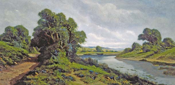
In our January-March 2007 feature, “Valley of Water and Wine,” we highlight the innovative work of landowners along the Napa River who are initiating restoration projects on the upper reaches of the river. The Rutherford Dust Society, a group of mid-valley growers, is poised to start moving dirt this year to enhance salmon and steelhead habitat on 4.5 miles of the river.
Just downstream, the California Land Stewardship Institute (CLSI) is starting an ambitious project to improve habitat along another 10 miles of the river’s channel. That project highlights two notable aspects of river restoration work in the North Bay: a budding movement for sustainable agriculture, which includes restoration of watersheds for fish and other wildlife as a key component; and the use of computer modeling by restoration planners to guide the work.
Fish-Friendly Farming
About half of the landowners in the area slated for restoration by CLSI are also part of an innovative program called Fish-Friendly Farming (FFF). Growers enroll in the program and participate in training workshops about habitat restoration and water quality issues, but the key to the program is that it moves quickly from training and study to actual restoration work.
A farmer works with technical advisors to develop a farm conservation plan that covers the entire property, not just planted areas. “[The program] really errs on the side of the environment,” says Laurel Marcus, executive director of the California Land Stewardship Institute, who developed the Fish-Friendly Farming initiative in 1999. “It looks at everything that can affect water quality. It looks at all the creeks, all the different features that can affect habitat. Most of this is coming from pretty well established ideas on how to reduce erosion and increase water quality.”
Many similar programs rely on self-assessment to monitor progress, but Marcus’s program includes detailed photo-monitoring to make sure the farm conservation plan is having the desired effect.
“The program generates restoration. Instead of studying things a lot, it cuts right to the restoration,” says Marcus. And farmers often drive the process. “In the nearly 10 years that I have directed the program, I’ve been impressed with the sincere interest farmers have in improving the environment and their willingness to go well beyond any regulatory requirement.”
The program’s web site includes testimonials from participating growers, including this one from Tom Piper of Fetzer Vineyards: “The Fish Friendly Farming program rounded out our operation by bringing erosion control practices on roads and environmental enhancement and restoration projects to our streams. We’ve learned to go beyond accepting what we have to enhancing it for fish and wildlife.”
The program was designed specifically for grape growers in the Russian River drainage. In 2002, Marcus joined with Napa farm groups to expand into the Napa Valley. Today, the program covers Mendocino, Sonoma, Napa, and Solano counties and includes over 100 vineyards, some with multiple sites. Currently, there are 50,000 acres enrolled, and Marcus’s organization recently received a grant to enroll 25,000 more acres by 2009. Current participants include high-profile wine labels like Fetzer, Beringer Blass, and Mondavi.
However, it’s not yet possible to pick up a bottle of wine in your local store and know if it came from a certified Fish Friendly vineyard. A marketing plan to make that happen is now being developed and should be launched in early 2008, says Marcus. Visit www.fishfriendlyfarming.org for more information.
Watershed Modeling
Most growers probably know a lot more about their own land than the farm up the road, but rivers, of course, don’t respect property boundaries. Actions upstream can make a world of difference—allowing different restoration projects to have cumulative good effects, if done well, or making downstream vineyards and towns more prone to flooding, if not.
The California Land Stewardship Institute is working with other scientists at UC Davis and at Philip Williams & Associates (PWA), a private consulting firm, to develop complex computer models of the river channel and its flood plain.
In fact, building those models is the first step in the restoration work. Andy Collison of PWA, explains that the larger project will be guided by two different digital simulations of the river.
The first is a hydraulic or flood model that can “predict the depth and velocity of water in response to a rainfall event.” The model will extend beyond the river channel into the surrounding flood plain, and it will allow planners to try out different scenarios to see how changes in certain parts of the watershed will either improve or worsen flooding downstream. It will also allow agencies to zero in on flood-prone lands that are marginal for agriculture but could make prime restored habitat.
The second model, to be developed by Eric Larsen of UC Davis, is called a morphological or meander model. “He has developed a method of predicting how rivers will migrate over time,” says Collison. Here again, potential changes to the channel can be tried out in the model, and then researchers can predict erosion rates in specific areas on the river, which means that a grower with land on an eroding bend in the river would have a good idea how long it will take for the river to erode into cultivated acreage.
“That should allow us to identify particular bends to focus on,” explains Collison. “And then if we make changes elsewhere in the system, how does that rate change in that spot? Does widening the channel upstream change erosion rates?”
Though flood modeling is used all over the world, the model on the Napa River is fairly unusual in its inclusion of the full flood plain. Larsen’s meander model has been developed very recently and used mostly here in Northern California, including on the Sacramento River.
-300x199.jpg)