.jpg)
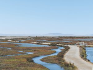
A recurring theme at last month’s biannual State of the Estuary (covering San Francisco Bay and the Delta) conference in Oakland was the environmental challenges presented by global warming–sea level rise, climate change, ecosystem disruption, and water supply shortages. Central to these concerns is the need to generate accurate information about how the Bay Area climate and ecology could change over the next decades as further warming takes place. To produce projections of local and regional climate change scientists refine global climate models, or GCMs, by inputting detailed local environmental data; this process is known as downscaling.
And it’s not just an academic or scientific exercise.
By definition GCMs operate at a global scale by focusing on the probable changes to global climate processes resulting from increasing amounts of greenhouse gases. But because of the vast amount of data that must be processed by a GCM, the scale of output is necessarily broad: It can tell us how much average global temperature will increase by 2100 and how ocean currents might be affected. But it doesn’t tell us anything about changing temperatures and other surface level changes in the San Francisco Bay Area, which is what we need to know to plan for our future.
This is particularly true in a region such as ours, with its many and varied microclimates. These are missed entirely by GCMS that use only three data cells for the large area from Mendocino County south to Santa Maria. Thus, to produce information that is of any use to local officials, downscaling is necessary. In the last several years downscaled models have produced climate change scenarios for the Bay Area at increasingly finer resolutions, initially with data cells 12 kilometers in size, then, more recently, at a scale of 4 kilometers.
At the State of the Estuary conference two scientists at the U.S Geological Survey, Alan and Lorraine Flint, presented a paper on probable changes to North Bay watersheds and landscapes based upon their new downscale computer model with data cells of just 270 meters, a remarkably fine and useful scale that translates into an area of roughly 18 acres.
This downsized model yields way too much information to detail in this report, but let two important points suffice to whet readers’ appetites.
Number one: The validity of climate models is tested by running them backwards to see if they can accurately hind- or backcast (the opposite of forecast) past weather and climate. The Flints ran their model back to 1970 and found that the model accurately recreated the North Bay climate of that 40-year period. More specifically the 270 meter model picked up where rainfall had increased or decreased within the region during that period, as well as areas where both average maximum and minimum temperatures have changed. By operating at such a fine scale, the model is able to provide usable information about the future status of individual North Bay watersheds, as well as for the region as a whole.
Number two: According to the model, although the overall annual amount of precipitation in the region will remain essentially the same, the winter wet season will become compressed as the dry season becomes longer. That fact, coupled with higher rates of evaporation from warmer summer temperatures, will reduce runoff 30 to 40 percent in North Bay rivers and streams.
While this may not be the news that North Bay water officials and resource managers had been hoping to hear, at least it provides them with tangible, credible information they can use to start planning how to deal with the consequences of climate change at a regional level and continue meeting the needs of the local population in the face of rapidly changing conditions. This is indeed “news you can use” in the most urgent way.
And it’s not only North Bay agencies that will profit from the Flint’s 270 meter downscale model; they are currently expanding the model to all of California, which is welcome news for all the agencies tasked with managing public resources in the face of a changed climate and environment.