.jpg)
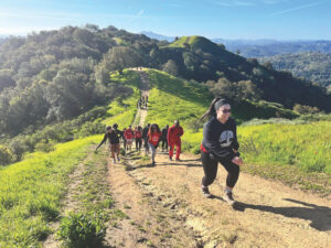
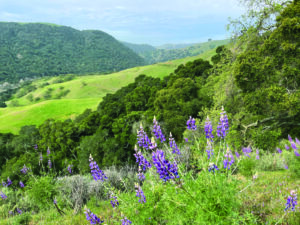
To live in the Bay Area is to be enchanted, sometimes on a daily basis, by the beauty and variety of its open spaces. I’ve spent most of my lifetime here, but much of the area remains a mystery to me, ripe with uncharted wonders. These are often in places we’d least think to look. Discovering recently a tidal marsh alive with wildlife along the Bay in Hayward was just such a revelation: Avocets, egrets, and stilts congregated in a mass foraging spree where a shipping industry once thrived and where, at an earlier time, the Ohlone gathered edible seeds and shellfish along the shore. Glancing up from the shore and looking across the vast sheet of the Bay, one is struck by the immensity of the sky, accentuated here by the absence of trees, man-made structures, or any other obstructions to vision or fancy.

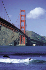
- Surfing below the bridge at Fort Point. Photo by Brad Perks.
San Francisco Bay, the 470-square-mile inland sea that is the dynamic geographic center of this region, is our largest open space by far. But it is also one of the most overlooked. For many local residents, the Bay is often seen as an obstacle to be crossed to get to work or to the airport, rather than as a source of connection to our region’s landscape. It is true that for many years the public has had little direct access to the Bay from land, because so much of the shoreline was in private hands (either diked farmlands or industrial facilities) or simply impossible to get to. But all of that is changing, with the maturing of a grand vision that has been more than a decade in the making: the San Francisco Bay Trail.
The Bay Trail is a planned recreational route that will encircle the entirety of San Francisco and San Pablo Bays, connecting the shoreline of all nine Bay Area counties and crossing seven major toll bridges by means of a 400-mile network of bicycling and walking paths. More than half the trail system is now complete, either as dedicated hiking or multiuse paths, or as on-street bike lanes and sidewalks.
The idea behind the Bay Trail is to provide easy access to as many facets of the Bay as possible, for as wide a range of users as possible—walkers, bicyclists, skaters, commuters, bird-watchers, artists, and schoolchildren. The trail takes people of all ages and abilities to points as diverse as the busy Embarcadero waterfront in San Francisco, solitary Tubbs Island on San Pablo Bay, the braided marsh channels of Alviso in the South Bay, and the sweeping views across the North Bay from Point Pinole. Accessible to residents from all over the Bay Area, the Bay Trail can bring us together to experience our gem of watery open space and the magnificent diversity of wildlife that inhabits it
The Bay Trail was born out of California Senate Bill 100, written by former State Senator (now Attorney General) Bill Lockyer, and passed into law in 1987. The Bay Trail Plan was developed over two years by a coalition of local government representatives, regional agencies, community groups, and environmental organizations and was adopted in 1989 by the regional planning agency, the Association of Bay Area Governments (ABAG). The enabling legislation mandated that the trail provide connections to existing parks and recreation areas as well as encourage use of public transportation to get to and from the trail. Finally, the legislation mandated that, while facilitating and encouraging public access, planners should align the trail to avoid harming sensitive environments and wildlife habitat.
When complete, the trail system will consist of the main spine trail, a continuous 400-mile ring around the Bay; spur trails to the waterfront where shore access along the spine is not feasible; and connector trails linking the spine to inland recreation sites, residential neighborhoods, and commercial districts. Eventually, the trail will pass through or connect to more than 100 parks and open spaces.
The implementation of such an ambitious undertaking depends on the cooperation of many potentially competing interests. Shoreline property owners; local, state, and federal agencies; recreational-use advocates; and environmental organizations — all are stakeholders along the shores of the Bay. The Bay Trail Project, a nonprofit entity, was created within ABAG to oversee and coordinate work on the trail and to promote its use to the public.
The number of partnerships formed by the Bay Trail Project marks it as a thoroughly collaborative effort, one that has demonstrated an impressive ability to leverage limited funding into an effective and comprehensive regionwide program. The California Coastal Conservancy has been a strong supporter and longtime funder of the Bay Trail, having provided approximately $19 million since the project’s inception. Invaluable assistance has also come from the Bay Conservation and Development Commission, which reviews development projects within 100 feet of the Bay shoreline and can require Bay Trail construction as part of the permitting process. Just as crucial is the continuing involvement of countless environmental and recreational groups, whose members (like you and me) care about preserving natural areas and volunteer their time to advocate for completing the trail.
In recent years, money from state park bonds has been available to the Bay Trail for a competitive grant program under which local agencies receive funding for trail development in their areas. These funds are leveraged several times over by public and private matching funds and in-kind contributions, including construction work performed by youth members of the California Conservation Corps.
Recently opened trail segments include Oyster Point Marina in South San Francisco, with trails and access for windsurfers; San Rafael’s Shoreline Park, featuring exceptional bird-watching; Heron’s Head Park in San Francisco, where the trail follows the edge of a wetland restoration in progress; and Napa’s River to Ridge Trail linking the Bay Trail in Kennedy Park to the Ridge Trail in Skyline Park. What’s next? New segments being planned include a new alignment along proposed wetlands in Novato, the Wetlands Edge Trail in American Canyon (Napa County), Point Molate in Richmond, Union Point Park in Oakland’s Fruitvale District, and Coyote Creek Trail in Mil-pitas. In the future, the proposed public purchase of Cargill’s salt-pond properties holds great promise for new Bay Trail segments in the South Bay.
In the policy arena, the Bay Trail Project advocates for safe bicycle and pedestrian access to and across the area’s seven toll bridges, to increase possibilities for longer-distance excursions and to promote car-free commuting. (Such access is currently available only on the Golden Gate and Dumbarton Bridges.) Another priority is the ongoing independent wildlife and public access study, which is examining whether trail users have an effect on the abundance and diversity of shorebirds in adjacent wetlands. The results will help decision-makers and resource agencies plan future trail segments so as to minimize the impact of increased human visitation on wildlife.
More detailed information about the trail is now readily available, with the recent publication of new Bay Trail maps. The set of six maps covers the entire Bay and provides comprehensive and up-to-date information about trail alignment, points of access, and trail characteristics. The back of each map lists recommended hiking and bicycling routes.