Photos by David Liittschwager, liittschwager.com
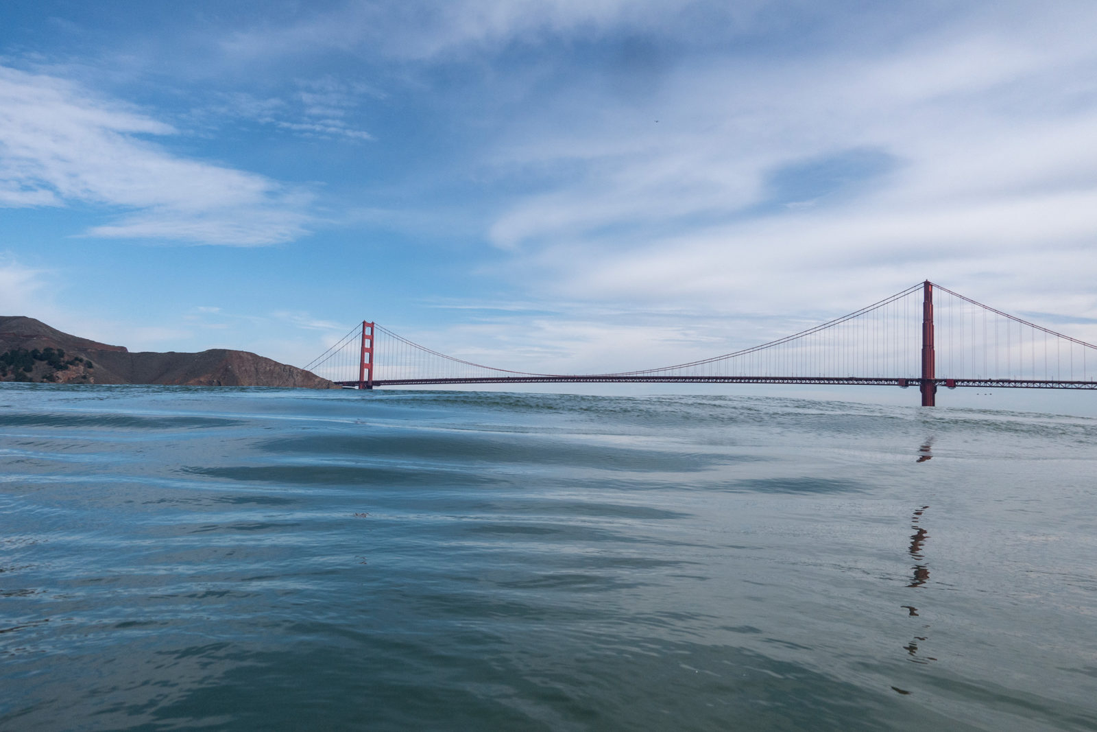
At 8:25 a.m., 40 minutes to high tide on a late September Sunday, a dozen recreational swimmers jump from the back deck of a boat into the water a few hundred yards west of the south tower of the Golden Gate Bridge. Their target is a crown of rock called The Needles, 1.5 miles away on the opposite side of the channel. Kayakers, paddling against a light chop, herd the swimmers into small groups. Wet-suited limbs begin to flash and lime-green caps bob as the flood carries everyone under the bridge and into San Francisco Bay.
On board the support boat, a converted water taxi called Heron, spectators cheer on family members and then crowd the railings to admire the scenery. Terns, gulls, and pelicans soar overhead. Porpoises break the surface, trailing the wake as the boat drifts bayward. Everyone has a camera out as the sun rises behind the arching span of the bridge. It is a perfect Bay moment.
In a National Geographic feature on the Bay in 1981 the writer Cliff Tarpy announced from the bridge that “here, I had found, this great bay offers its finest vantage point.” While it’s probably not so much a secret today that the Golden Gate offers a splendid view, it’s still the finest place to think about the entirety of the 21st century San Francisco Bay. Draw whatever line you can through the incredible diversity of this region: Everything springs from here where the water comes in.
From this same spot, European explorers described the vastness of what seemed to them an inland sea. “A wonder of nature, and may be called the port of ports, on account of its great capacity,” the Spanish priest Pedro Font wrote from near Fort Point in 1776. “A broad sheet of water, sufficiently extensive to contain all the British Navy,” the English captain Frederick Beechey wrote from his anchorage just inside the Golden Gate in 1826.
The modern Bay is still the defining feature of the Bay Area, but it often feels considerably less a wonder of nature. Bridges, freeways, and tunnels have shrunk most sense of grandeur. Almost the entirety of its shoreline is human-made. Even in documents celebrating the Bay, the primary way to engage with it seems to be riding a bike along a fennel-lined, dusty levee trail overlooking a tumble of tide-stained rocks. There is, in many places, the heady aroma of bacteria digesting in the mud.
“San Francisco Bay enters most of our lives as an obstacle to pass over as quickly as traffic-choked bridges allow,” begins a short pamphlet called “An Introduction to the San Francisco Estuary” written by marine scientist Andrew Cohen and published by three prominent Bay conservation groups in 2000. “Although this beats earlier attitudes—when we saw the Bay mainly as a dumping ground, a dam site, or a pit to fill in and pave over—we remain largely oblivious to one of the most remarkable wild resources in urban North America.”
A remarkable wild resource, still. The reason I had given for joining the boat with the swimmers was that I wanted to understand the ecological nature of the modern Bay, and I wanted to watch people tune into the essential wildness of a place most of us take for granted or disregard. Regular Bay swimmers told me that submerging in the water grants a different perspective on the place, stripping away the human-constructed artifice and revealing the powerful, elemental force of nature that beats beneath the surface. Swim often enough, one Aquatic Park regular said, and you begin to feel the pulse of tides and currents. You feel the phases of the moon. Your skin, heart, and lungs grow hardened to immersion in cold water. I thought about that as I shed layers on the 80-degree morning, then watched swimmers climb into the boat shivering uncontrollably, their shaking hands spraying coffee, after 45 minutes in the water.
But it was a different image that ended up staying with me. While we drifted beneath the majestic bridge and the spectators took pictures, I watched the organizer, a swim coach from San Francisco named Leslie Thomas, run in circles around the boat, one eye on the swimmers, one eye on the boat traffic, ear glued to a walkie-talkie, radio tuned to the Coast Guard. It was a typically busy Sunday. Another group of swimmers, in white swim caps, was crossing the Golden Gate from Baker Beach. A catamaran trailed behind them, and a group of stand-up paddleboarders out of Aquatic Park trailed the catamaran. A line of sailboats raced out from behind Alcatraz. A Zodiac with four hunched fishermen drift-trolled under the bridge’s north tower. The Coast Guard expected a 22,000-ton oil tanker to depart Richmond for the Golden Gate around 8:30.
Thomas ran back inside the boat and I followed the curve of the bridge toward the skyline of San Francisco. It is obvious that people have transformed the land around the Bay. But we have transformed the Bay itself nearly as much, and that seems considerably less obvious. This carefully managed exercise in open water swimming, planned in five-minute increments, monitored constantly by a dozen other people, and approved by the federal government, was a glimpse at the modern nature of the San Francisco Bay. There is still wild nature to immerse yourself in, but you have to plan for it, and you have to share.
In the massive humming warehouse in Sausalito holding the Army Corps of Engineers’ Bay Model, I’m perched over a replica of the Emeryville shoreline watching the Bay breathe. The three-dimensional scale model represents one-thousandth the area of the real Bay. A computer-controlled pump pushes water in and out of the system to create roughly accurate but sped-up tides, one real-life hour every 36 seconds. The molded crescent shoreline before me lies exposed for the moment like dry aquamarine clay. The water, sparkling under the Bay Model’s bright overhead lights, has retreated a few feet to the Bay Bridge run-up. Even with this pace the tide changes direction imperceptibly. First the clay glistens; then it slips under the glass sheet of the incoming tide. In the last few seconds the water slithers to the edge of the Bay Bridge toll plaza. Then, with a sigh of the pump, it rolls back. Every 14.9 minutes here is a full tidal cycle: inflate, deflate, inflate, deflate. Ecologists sometimes compare the Bay to kidneys, because its wetlands filter water, or to a heart, because it’s so connected to the rest of the region. But if you watch it move in this way, it becomes irresistibly a set of lungs.
In real life each breath takes place over six hours and 450 square miles. Picture the Bay at slack low tide in the late morning. Dogs and kids play on the exposed sand at Crissy Field. Commuters watch birds pick over the vast exposed mudflat running along the approach to the Bay Bridge. The mud crackles and oozes in wetlands in Alviso, Sears Point, and Hayward. Slowly the water rises. Over the next six hours 640 billion gallons of water, slightly more than the volume of Mount Everest, pour in through the Golden Gate. The Bay expands, adding 50 square miles to the surface area of its water. The mud disappears. Pannes and marsh depressions fill, turning the dusty pickleweed into a kaleidoscope of red and green studded with jewels. The birds float or seek cover in the high marsh. Salt marsh harvest mice climb and cling to the upper stalks of marsh grasses. And then the tide slackens and reverses. The Bay exhales. All that water runs out the Golden Gate. The mudflats, marshes, birds, and mice emerge again.
In thinking about the Bay and its future, the first question that comes up is just what you mean by “the Bay.” What does a place with such incredible diversity have in common no matter where in it you are? It has the tides. The best natural definition is that the Bay is this process. The Bay is not water but a breath, a force, a change.
American and European settlers fought almost from the day they arrived to deny the impermanent essence of the Bay. Much of the public’s tepid interest in the wild Bay today comes from the inaccessibility of its shoreline, from generations of beavering humans whose priority was a stable, fixed border for the water. The Bay’s breathing today is constrained by a dirt-and-concrete jacket people fitted for it. Now the shared vision of the hundreds of scientists, engineers, and planners who work on the Bay is to break up the jacket. The shared hope is that this will also awaken in Bay Area residents an appreciation for the natural rhythm that’s been hidden from them, and so make the Bay something more than a negative space to drive over.
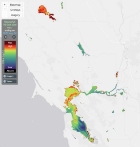
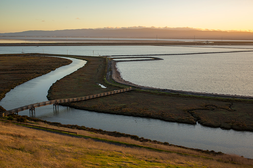
At a onetime commercial salt pond labeled SF2 at the west edge of the Dumbarton Bridge, you can glimpse a small manifestation of the scientific vision. For nearly a century, a bayshore levee running off to the south of the bridge protected a 252-acre basin for salt making and blocked any connection to the tides. In 2003, the federal government bought the pond, a tiny part of the 15,000 acres of salt ponds it purchased as a part of the ambitious South Bay Salt Pond Restoration Project. In 2009, engineers upgraded the levee, adding tidal gates to control the flow of water into the pond behind it. They redesigned the basin with permanent water areas, bird refuge islands, and snowy plover habitat. A mudflat and pickleweed marsh formed on the Bay side of the levee. They built a trail on the levee, adding elevated platforms for birdwatching.
John Bourgeois, the director of the salt pond restoration project, walked me down the levee recently, and what arrested his attention was the birds. It was an ebb tide, and we watched the water draining out of a pond. There were thousands of birds floating there, and every so often a flock of dozens would hop over the levee from the draining pond onto the tidal mudflat. Eventually, Bourgeois told me, the deep water area would be nearly empty and all the birds would be out hunting on the mudflat. Then the tide would reverse and the birds would all flock back the other direction, until the mudflat was submerged. The birds do this all day, Bourgeois says, back and forth over the levee as the tides swing, like nature’s yo-yo. The birds follow the rhythm of the breathing Bay.
Yet people often think the Bay is lifeless. It is muddy, so you can’t see into it. Even if you could, many of the bigger animals that live in it are an unappealing brown. “The Bay, when you live around it, you look at it, it’s not like you’re in a location with a glass-bottom boat where you can go out and be excited,” says Marilou Sieff, the executive director of the Marine Science Institute in Redwood City. The MSI offers summer camps for kids based on the Bay and on the ocean, and Sieff told me she usually has to call parents to ask them to enroll their kids in the Bay classes. “Most people don’t know what’s down there,” she says, “so they see it as a mystery, or devoid of life.”
Which, if you think about the human relationship to the Bay, is perhaps the core challenge. “The salt pond restoration project aims to bring back some of the bay’s lost wetlands, but it cannot restore the lost connections between the bay and its people,” the historian Matthew Booker concludes his 2013 book Down By the Bay.
SF2, a part of the Don Edwards San Francisco Bay National Wildlife Refuge, lies directly across the street from the Facebook campus. Two other ponds nearby are now mid-restoration, and in another 10 years One Hacker Way will be gripped on three sides by pulsing, thriving bay lands. There will be birds everywhere, trails and viewing stations everywhere. But will anyone visit them? Right now, Bourgeois told me, hardly anyone ever does. Lines of gleaming white tech shuttle buses pour over the Dumbarton Bridge every morning or line up on Marsh Road to oviposit their workers into the headquarters. Tourists take selfies in front of the Facebook sign. On a nearly perfect Friday afternoon Bourgeois and I parked in an empty parking lot and hiked undisturbed on a deserted trail, just the two of us and a solitary birdwatcher peering through binoculars from one of the viewing platforms.
The flood tide creates an entirely different Bay. The sheet of water grows bigger by the size of Manhattan. Fish and invertebrates emerge to stretch out into their increased domain. But from the human point of view the water is so muddy it’s almost like the rising tide is rolling a cover over the surface. The flood tide obscures, rather than exposes, the life of the Bay. So try this thought experiment: Say you drop a big white china dinner plate into the middle of the central Bay and leave it there for a year. You pull it out, and what’s it look like?
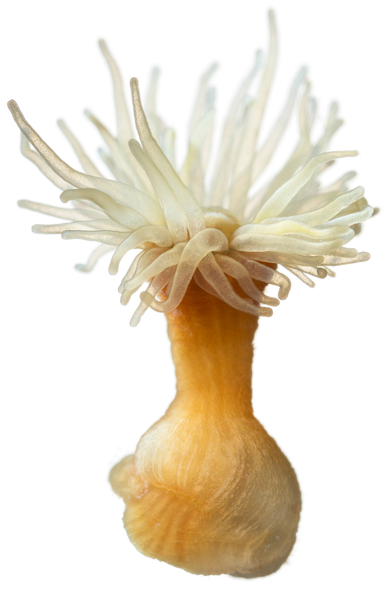
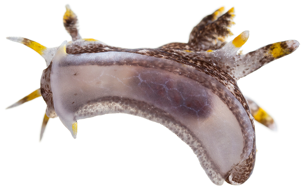
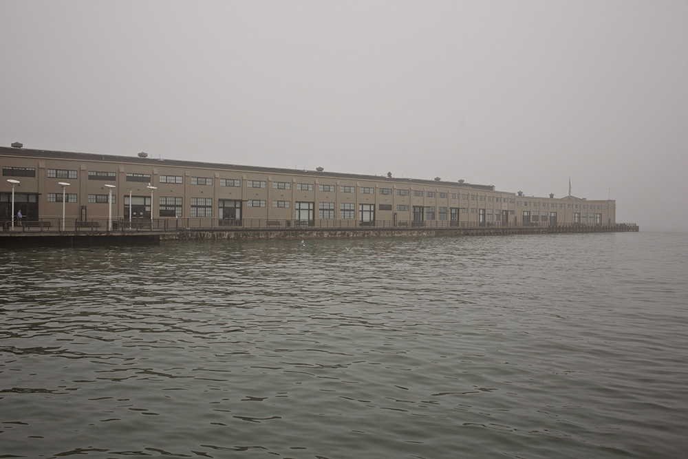
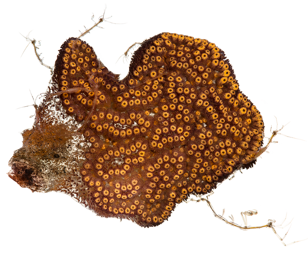
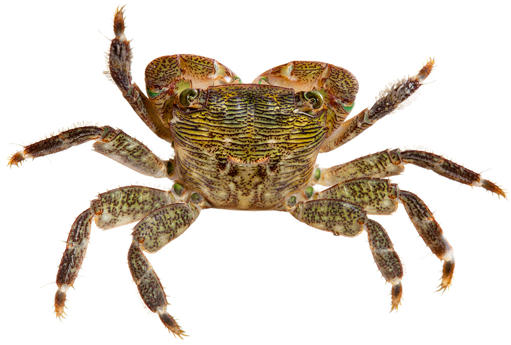
The answer is: It is absolutely infested with life and looks like Rasputin’s beard after a peanut butter and jelly sandwich. I know this because the Exploratorium has a carbon dioxide buoy floating just off Pier 15, a big cylindrical white thing with a bottom like a dinner plate, and once a year they haul it up to clean it off, and last year when they did this they invited along a bunch of naturalists to catch and tag all the critters.
Out of the twisted profusion of life on the buoy they identified several dozen species. Crabs, worms, anemones, nudibranchs, mussels, squirts, and algae. California Center for Natural History naturalist Constance Taylor exclaimed over the human-like qualities of stalked tunicates as her hands turned red from peeling algae off the buoy. Stalked tunicates are “snot blobs,” Taylor said, but they are really surprisingly human-like snot-blobs. “It has a ganglion,” she told a group of gawking schoolkids. “It has intestines. It has a stomach. Of all the things on this buoy, this is the closest related to us. So you can say ‘hello cousin’ every time you see one.”
Nearby, Exploratorium staff had posted a whiteboard so passersby could write down questions. “At which point did we evolve from snot blobs into capitalist pigs?” someone soon scrawled in green marker. “Follow-up,” the next question read, “have we evolved from snot blobs … ?”
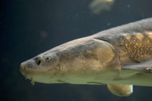
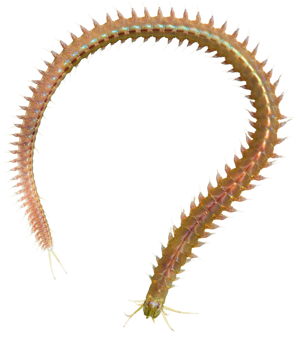
There are theories of art appreciation that suggest that humans gravitate naturally to bold colors and big shapes. Perhaps that explains the quiet SF2 trail, or why Muir Woods and Yosemite have created hundred-page crowd control plans for their millions of visitors while the 30,000-acre San Francisco Bay National Wildlife Refuge, 60 times the size of Muir Woods, hosts half that number. A necessary part of loving the Bay is appreciating the diverse, weird, resilient creatures that make a life in it; there are no big colorful trees here to appeal to the beginner. Instead we have snot blobs with ganglia, plainfin midshipman fish that sing, monkeyface eels and excessively slimy tonguefish, “northwest ugly clams” (Entodesma navicula), and a bewildering variety of marine worms.
Once, California Academy of Sciences invertebrate curator Christina Piotrowski told me, researchers studying a kind of polychaete worm—a class of annelids common in the Bay—realized that the one worm they were viewing in a single square meter was in fact six sibling species, previously undescribed by science. If you can look past the name, worms really connect you to the mysteries of the deep. “Who cares about polychaete worms?” Piotrowski says. “Well, they eat a lot of things that need to be eaten, and a lot of things that we eat eat them, and that’s why they’re important. But they are small and brown.”
The collections at the Academy hold more than 700 species from the water and mud of San Francisco Bay alone, and “that is likely to be only a fraction of what is there,” reports the Academy’s book Animals of the San Francisco Bay. If you look at the Bay right now and wonder what’s going on under the surface, the answer is that even to many scientists, it’s a mystery. It is bursting with life, and yet our grasp on the nature of that life is as tentative as it can possibly be. How did people who for generations have so carefully managed the shape of the Bay lose track of what actually lives in or around it?
At a spring low tide a careful observer would just see the ripple caused by Blossom Rock. The size of three soccer fields at a depth of 24 feet, Blossom Rock once rose to within five feet of the surface, directly in the path of boats. “As soon as a ship passes the fort, she enters a large sheet of water, in which are several islands, two rocks above water, and one under, exceedingly dangerous to shipping,” noted the American surveyor Cadwalader Ringgold in 1849. Trailing a weight overboard to mark bottom depth wouldn’t help a navigator avoid it, Ringgold wrote, since the rock rose so steeply.
In 1866, Congress ordered San Francisco’s Chief of Engineers, an Army lieutenant colonel named R.S. Williamson, to destroy Blossom Rock. It gave Williamson $50,000 and generous leeway in the selection of dynamite. In October 1869, a contractor went out and blew the top 20 feet off of Blossom Rock. If you look at a bathymetric map of the central Bay now, you can see the stump, a belly button a half-mile northeast of Pier 39. As the draft on subsequent generations of ships has become deeper, so subsequent generations of engineers have continued to blast away at the top of the outcropping.
John Muir, the champion of American wilderness, had arrived in San Francisco one year before the destruction of Blossom Rock. Muir would later make a home on the shores of the Delta and devote his life to saving mountain rocks 200 miles away. “Idealizing a distant wilderness too often means not idealizing the environment in which we actually live, the landscape that for better or worse we call home,” writes William Cronon in his famous Muir critique “The Trouble With Wilderness.”
The Bay started to form only about 10,000 years ago, as glaciers melted and rising seas flooded through the Golden Gate to drown a landscape of river valleys and gentle rolling hills. It’s “very likely,” writes historian Matthew Booker, that people arrived before the Bay did. The Ohlone, living around the Bay in one of the densest populations of people in North America, considered the estuary a commons, hunting, fishing, harvesting, trading, building dams, and gathering salt. Early white settlers saw the Bay shore and waterways as a source of vast private wealth; 19th- and 20th-century Americans as an unstable danger to be tamed in the name of commerce; late 20th-century Americans as a damaged environment to be saved.
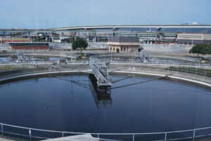
The Bay remains essential in the 21st century. But its utility is found in infrastructure that’s invisible unless it breaks: sewage treatment, shipping, transportation, pipes. Our food comes from the Central Valley, our fish comes from the ocean (the last real Bay fishery, herring, sends most of its catch to Japan because there’s little demand in California), and the canneries and shipyards are closed. There is little left to connect people to the Bay except aesthetics—and the modern American aesthetic appreciation of nature is still deeply inspired by Muir’s Romantic wilderness ideals. So what will people think two generations from now, when sea level rise makes the Bay a threat again?
Among the many things nearly lost in the genocide of the Ohlone peoples was a cultural view of nature in which the Bay was both useful and sacred, wild and human. “It’s natural beauty and commerce, and those being allowed to coexist,” says Vincent Medina, a Chochenyo Ohlone and outreach coordinator at the magazine News from Native California who has led a modern revitalization of the Chochenyo language. Medina describes the welcoming smell of the salt at the site of the East Bay village of his ancestors. In posts on his blog, “Being Ohlone in the 21st Century,” he describes gathering food from Bay marshes and San Lorenzo Creek. But he also describes sitting in traffic on the Bay Bridge and thinking about the way his ancestors in their tule boats crossed to visit San Francisco. His ancestors would throw clamshell beads into the Bay to appease spirits; Medina stops and pays five bucks at the Bay Bridge toll plaza. The Bay has its own story, he says, and past or present it is always a celebration of people and nature together. “The Bay is living,” he says, “like people. It changes, like we do. It’s been hurt, and damaged. And the Bay—like us—has persevered.”
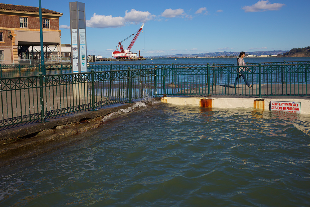
Along the northeast edge of San Francisco, the rising tide slaps at the edge of the Embarcadero. Each boat wake sends the water surging over the top, spray crashing on the breakwater and little rivulets of water draining back into the Bay. It’s just a normal high tide today, but in a king tide you might see this entire walkway flooded.
Outside, the surge rolls against the wall. Inside the Exploratorium’s steel-and-glass Fisher Bay Observatory on Pier 15, landscape architect and UC Berkeley instructor Nate Kauffman begins his future-of-the-Bay stump speech with a black-and-white photo of a wood table and a quote from the table-maker, woodworker George Nakashima: “The live edge is not only a creative force but a moral idea.”
Kauffman then pivots to an illustration of San Francisco Bay, its shoreline blazing with gold. “We have a hell of an edge to work with,” he says.
Every Bay Area resident has a mental image of that familiar contour, the outline of the Bay. But that shape is human-created by generations of people who wanted a static, predictable shore. A 2016 San Francisco Estuary Institute report suggests that 82 percent of the Bay’s edge is human-made, in the form of levee, berm, embankment, or transportation structure. Thinking about the shoreline as a “line” denies the essential shifting nature of the Bay and has done us no favors, Kauffman says. This is not a static place, and now most everything we’ve built on the assumption of stasis is at risk.
For the last century the average sea level measured at the Golden Gate tidal gauge has risen by about two millimeters per year. By midcentury, that rate is expected to accelerate sharply. Conservative projections now call for around one meter of sea level rise by 2100. The less optimistic projections seem to be nudged higher every few years, but if the world emits the same amount of greenhouse gases over the next century as it does now, we could see as much as nine meters of sea level rise.
Over the last 20 years around 10,000 acres of marsh have been restored to the Bay, with another roughly 20,000 planned for restoration. It is now apparent that this effort is doomed. Absent additional protection, 96 percent of the Bay’s restored tidal marsh habitat will drown by 2100. “This is not science based off of some sophisticated theorem,” Kauffman writes in a booklet of future Bay illustrations that represent the Live Edge Adaptation Project. “It is a math problem a seventh-grader can do.”
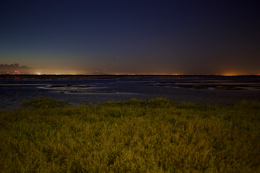
Kauffman joins scientists and planners in proposing a number of nature- and people-friendly solutions. Barrier beaches and tidal marshes provide natural protection against sea level rise, so Kauffman draws landscapes where people gather around campfires on sandy Bay beaches, separated by lagoons from bird-sheltering tidal marshes that keep pace with the rising sea on a constantly replenishing bed of reclaimed sewage. Eelgrass beds and oyster reefs provide valuable habitat and slow storm surge, scientists believe, so Kauffman says we should “redeploy oysters.” These aren’t just functional dreams, he says, they’re a designed, constructed, managed improvement with human use front and center. “What if the Bay was somewhere you wanted to go at night?” he often says.
The idea of the Bay as a project to imagine, a natural system hauled onto a workbench to be modified to suit human aesthetic and functional preference, sounds hubristic. But it is more or less the only choice. Because marshes and barrier beaches also need time to establish themselves, we have a window now to build up natural protection against sea level rise, or by the end of the century we will have to build hard walls and lead what the engineers call a “managed retreat” from the shoreline. “It’s binary,” Kauffman says. “Do something or hand a diminished Bay to the next generation.”
The bad news: It will require a lot of money to build the Bay up in a responsible way. Measure AA, a first-of-its-kind parcel tax approved by 70 percent of Bay Area voters in June 2016, will bring in $500 million over the next 20 years. But AA was not a panacea. John Bourgeois likes to say he could spend the entire amount in a day, and he’s not the only project manager hoping to build a better Bay shore. Even more, AA will only mark a turning point in the human relationship to the Bay if people appreciate the nature its funding helps restore. While Bay proponents have celebrated the passage of AA as proof that the relationship is on the mend, Bay Area residents loved nearly every bond or tax measure on the ballot in June 2016—30 of 32 parcel tax or bond measures on the ballot in the Bay Area passed. Pre-election polls often show that almost everyone says, when asked, they love the Bay and want it to be clean and healthy. But the specifics are less convincing: The same polls generally show that voters found sea level rise protection and access to the Bay the least compelling reasons to vote for the measure.
The other bad news: Almost any scenario for solving the sea level rise conundrum in a nature-friendly way involves filling in the Bay. And almost all regulations governing the shape of the Bay exist to prevent fill. Meanwhile, the natural sediment flow into the Bay is drying up, too, as water diversions in the Delta cut the supply of freshwater that reaches the lower estuary. Bay Institute chief scientist Marc Holmes says that for the South Bay especially the solution to sea level rise is obvious: use sediment to fill around the Bay edge of all the restored marshes and create what scientists tend to call “horizontal levees.” But as Kaufmann likes to say in his presentation, the pilot horizontal levee project near the mouth of San Lorenzo Creek took six months to build and four years to permit. “Everyone’s trying their best within the phone booth of what they’re allowed to do,” Kauffman says.
Nonetheless, most everyone agrees this is doable. Consider Measure AA a starting point instead of an ending point. Bay Area voters have funded wetland restoration and sea level rise protection, and out of that perhaps established a first-of-its-kind regional common purpose. “I think it’s fair to say engaging in something as big as a regional ballot measure changed the game for us,” says Save the Bay Communications Director Cyril Manning. “We have the ability, as an organization and as a region, to tackle these monumental problems with monument-scale solutions.”
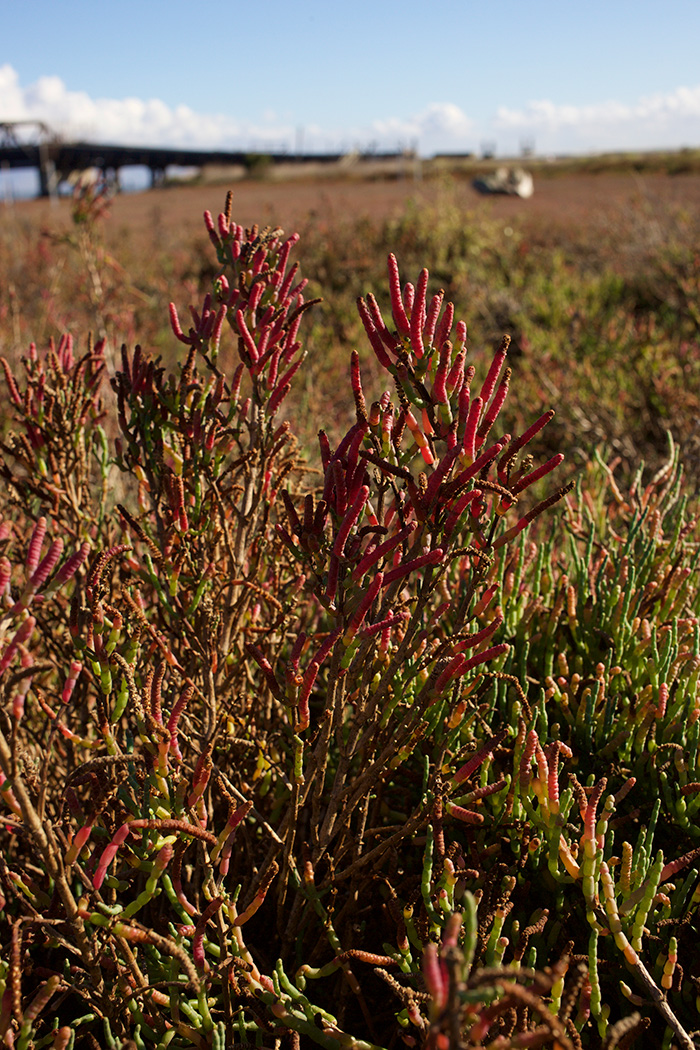
For the last few years I’ve been taking my young daughters on monthly walks at the small sliver of marsh at Heron’s Head on the southeastern shore of San Francisco. The trail, created by the Port of San Francisco out of Bay fill that was originally intended to become a shipping terminal, runs two-thirds of a mile out into the Bay. Lash Lighter Basin, a narrow tidal inlet and a dilapidated wharf, separates the trail from a recycling warehouse where gulls scream from rooftop solar panels. India Basin curves off to the south into the ruins of the Hunters Point Naval Shipyard and what was once the world’s largest crane. American avocets wade in the marsh lagoon, oystercatchers pick along the rocky banks, and one of only three living populations of federally endangered sea-blite in the Bay sprouts just off the trail. My daughters and I measure seasons and the pulse of the Bay by the breathing of the water, the movement of the birds, and the color of the pickleweed.
At last year’s statewide September Coastal Cleanup, San Francisco Recreation and Parks Department Director Phil Ginsburg gave a pre-cleanup speech to thank us Heron’s Head volunteers. He called us smart for choosing the Bayshore over the crowded cleanup at the more charismatic outer coast. Because what we understood, he said, was the vision. This stretch of military-industrial-complex-victimized shoreline between Pier 94 and Candlestick Point could in the next few decades become San Francisco’s second Crissy Field. In all, nearly two miles of Bayshore will be revitalized. It will host a mix of uses, from housing developments to parks and wildlife refuges, in keeping with the best traditions of the Bay’s human and natural mosaic.
I found that idea stuck with me, like the image of the swimmers under the Golden Gate. A fundamental part of my narrative of the natural world is its decline since my youth. The pastures and open fields where I played as a kid have been almost entirely developed. I’ve seen forests cleared, creeks filled, and landmarks erased by strip malls and sprawling tract homes. But on a bad-news globe there’s a blessing in thinking local. My urban daughters, growing up in the heart of San Francisco, are going to have a counter-narrative to tell. When they’re my age they’ll be able to say that the beach they started visiting before they could walk has improved in their lifetime. The southeastern San Francisco Bayshore will be less polluted, more open, more natural, more popular, and more appealing. While the story in so much of the world is one of inevitable decline, the Bay offers us a salve. We can look at it today and imagine how it could, and will, be better. And on this local scale we have the power to ensure that future happens. “We can do it,” Kauffman says. “The San Francisco Bay Area is poised to be an international leader.”
Late last fall I went for a walk at Heron’s Head with my youngest daughter in the backpack. It was the tail end of a breathless fall heat wave and the water sat still in the lagoon. A few birds were out, willets and sandpipers picking along the water’s edge, and I realized suddenly that the water was as clear as I’d ever seen it. I could see the seaweed splaying out below the surface, and the muddy bottom two or three feet deep, and I knew that it would be no real challenge to swim here. In the same moment of realization I also put a name to, on a more visceral level, all of my unspoken fears of the dirty, muddy, unknown Bay. I’ve read the reports about improved water quality; I know the “Pulse of the Bay” report in 2015 calls the status of the water for swimming “excellent at most Bay beaches”; I know that Heal the Bay scores an A+ for the mouth of nearby Islais Creek. But I was still afraid to fully commit to that brown water.
So I came up with a half-measure. A few weeks later I left work early and headed over to the marsh. In the parking lot I changed out of my jeans and into a swimsuit and neoprene boots. I padded out the trail to the rocky breakwater at the end of the path, and climbed over the concrete steps where my girls and I usually stop and turn around. It was empty and quiet out here but for a lone fisherman casting from the shore in the glare of the sinking sun. Off in the distance, the just-greening crown of Mount Diablo rose over the East Bay Hills. I picked across the rocks, down to the water’s edge.
At 4:15 p.m., 40 minutes to high tide, I stepped into the Bay. The water felt cool on my legs. Rockweed and sea lettuce brushed my knees. I pushed out past the last rock, to where the bottom dropped away into deep mud, and stood still. I listened to the waves, and the birds. The recycling facility turned on with a roar, a crunch, and an echoing metallic crash, causing the gulls on its roof to scatter angrily into the sky. Then it turned off again. Waves rippled on the shore behind me, while the water swirled around my waist in a cautious embrace.