On Saturday, February 23, 2013, the gates at the new Taylor Mountain Regional Park and Open Space Preserve will be thrown open and the thousand-acre parcel just outside Santa Rosa will complete a multi-year evolution from off-limits private land to accessible public park.
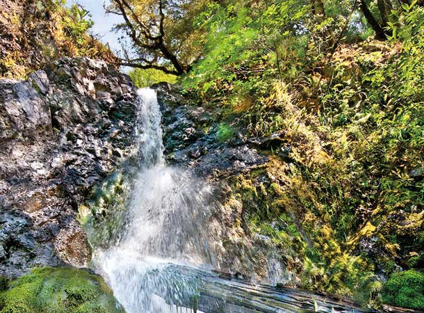
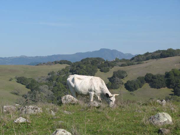
Rising 1,400 feet just east of Highway 101, Taylor Mountain is home to a mix of grasslands, oak woodlands, wet meadows and seeps, and creek corridors. Thanks to that variety, plant and animal life is surprisingly diverse for a long-grazed parcel in plain view of so much suburban development.
“It’s the largest regional park close to Santa Rosa,” says Mark Cleveland, senior park planner with Sonoma County Regional Parks. “There are a few big meadow areas that are spectacular for wildflowers and some native grass areas as well.”
On a sunny day in February, abundant soap plant hinted at great blooms to come, some Fremont star lilies were already making a good show, and western meadowlarks and bluebirds filled both grasslands and nearby oaks.
For now, hiking opportunities on the 1,100-acre park are limited to just a few trails covering four miles, all starting from one trailhead off Kawana Springs Road. Check out that loop on our Trailfinder.
[slideshow]
Eventually, says Cleveland, the park will feature about 20 miles of trails and five access points, including a transit-accessible trailhead just off Petaluma Hill Road. That trailhead, paid for with state grant money from Proposition 84, will be the first to be built, slated completion by summer 2014.
The park’s proximity to Santa Rosa inspired an usual planning process. Just across Petaluma Hill Road is a census tract that includes Roseland, a mostly Latino neighborhood where many residents speak Spanish, incomes are lower than elsewhere in the county, and, traditionally, involvement in open space planning has not been the rule.
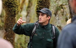
That last rule changed with Taylor Mountain. “To my knowledge it was the first fully bilingual planning process at the regional park level,” says Jonathan Glass, fields programs director for the Santa Rosa-based nonprofit LandPaths, which led the outreach effort.
LandPaths’ work in Roseland started at Bayer Farm, as we reported in 2011, a city-owned lot where gardening and the sharing of food led directly into park planning. “The City of Santa Rosa with Bayer Farm asked us to assist them with engaging that diverse community around Bayer Farm,” Glass explains. “That was a fully bilingual process that resulted in a lot of community input into the future of Bayer Farm. On the tail of that, the Taylor Mountain master planning process started up, and we were asked to assist in the same way.” At that point, Taylor Mountain was owned and managed by the Sonoma County Agricultural and Open Space Preservation District (which originally purchased the land and recently transferred it to the county).
LandPaths also ran a special trail permit program, where about 3,000 people received training and an access code so they could hike Taylor Mountain before this week’s long-awaited public opening. “We were able to fill the permit orientations both in English and Spanish and really feel like there was a way for people to give their input,” says Glass. “Our own assumptions of how relevant a [trail] permit program would be to Spanish speakers were challenged—there was a lot more interest than we expected.”
Jonathan Bravo, LandPaths’s Bayer Farm coordinator, helped lead the Spanish-language outreach effort at Taylor Mountain. “At some bilingual events, I had more than 50 percent of people speaking Spanish,” says Bravo. “One time, when we needed people to go to Taylor, and I went to ESL [English as a second language] classes, and that time we had more than 120 people show up for a hike. On Fourth of July last year, we had hundreds of people, maybe more than 300 people up there.”
Cleveland, the regional parks planner, anticipates an initial burst of attendance just after opening, but then much smaller crowds until more trails and trailheads come on line: “We are going to have a huge surge of people who want to look at the property. But until we provide more services, it’s probably not going to be heavily used.”
At the existing Kawana Terrace trailhead, parking will be free for regional park members and $7 for nonmembers. Trails are currently open only to foot traffic during the winter, and one or both routes may be temporarily closed because of wet conditions.