.jpg)
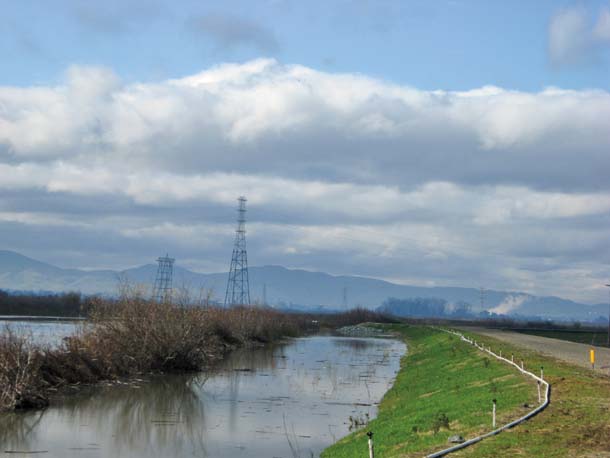
I am standing at the westernmost point of Sherman Island, the westernmost tract of the Delta, on top of a new dike that can stand for many efforts to keep this region above the waves. Here and now the waves are lapping unusually high. My guide, Bryan Brock of the Department of Water Resources, casts a critical eye on the “freeboard,” the vertical space that separates the water from the soles of our shoes. He thinks it is about two feet. Behind us, inside the island, the ground drops off like a moat. I have the feeling of standing on a castle wall, facing a permanent siege.
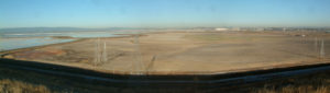
Sherman Island is the tongue of land where the Sacramento and San Joaquin rivers converge and finally join. It was first settled in 1855 and diked in 1869, the first island to be carved out of the heart of the peat zone. Its western location, close to Bay Area earthquake faults, means it can expect a hefty shaking when the Big One, or even the Middle-Sized One, arrives. Its levees are no better than average. Putting these factors together, Sherman appears to be the most vulnerable to flooding of all the Delta islands. With much of the island now lying 15 feet or more below sea level, it would be a real feat to repair.

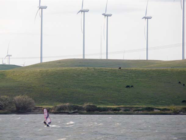
- A windsurfer off Sherman Island takes advantage of the same winds that power the Montezuma Hills wind turbines. Photo by Joseph DiDonato.
Sherman Island is also, in the present configuration of things, hard to dispense with. The major highway and three big power lines that cross it could be rerouted in a pinch. More important is the role of this and some other western Delta islands in defining channels and keeping salt water at bay. If they were breached in summertime, pumping by the state and federal water projects would soon have to stop. The smaller intake of the Contra Costa Water District is nearer and would be instantly affected by the increased salinity.
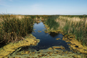
Recognizing the special role of Sherman Island, the state has bought it up in recent years, creating a clean slate for experimentation. This new western dike is one of the first doodles on that slate. Nearly a mile of substandard levee was first widened on the landward side and then excavated on the river side, creating a 30-foot shelf of shallow water. Tules were planted in the shallows, and willows, wild rose, and native grasses set out along the waterline. It is a young but promising garden, different from the many miles of Delta channels where rock-armored walls drop abruptly into the deep. While shielding the levee from wave damage, the buffer will provide some habitat as well.
Our tour continues: along the shore of Sherman Lake, actually a piece of the island abandoned in the 1920s and now managed as a State Waterfowl Area; past a small marina; and up onto the dike along the Sacramento River, where steady summer winds bring thousands of windsurfers and kite surfers to the shore. Beyond, the mighty wind turbines on the Montezuma Hills spin in the same stiff breeze.
- DWR’s Sherman Island project included planting natives on reconstructed levees. Photo by Bryan Brock, CA Dept of Water Resources.
A little farther on, a big pipe leads down to the water. At a glance you could take it for one of the 2,000 conduits by which water is taken into the islands for irrigation or pumped out again as waste. This is actually the spot at which Delta smelt, trapped at the intakes of the State Water Project and brought here in tanker trucks, are dumped back into the river for another chance at life. The deep waters near this island seem to suit the fish. There is debate as to whether the possible flooding of Sherman Island would help the endangered species or harm it further.
Our last stop is a soggy field in the middle of the island, beside a strip of water that is actually a remnant of an old tidal slough, now “captured” inside the dikes and used as part of the island’s irrigation system. This year, if funds hold out, this former hunting club will become a 300-acre tule farm, the largest effort yet to rebuild peat and raise an island’s surface. Efforts like this are impressive, or maybe the word is touching. You wonder if there is time.
With enough will and wallet, the rebuilding process might be speeded up. Under one accelerated plan, drafted by the Natural Heritage Institute, the island would be crisscrossed with new dikes. Some of the compartments thus defined would grow tules. In others, more deeply subsided, the void would be filled with the baled straw from rice farming (which farmers are no longer allowed to burn). As these segments approached sea level, they would be reconnected to the tide, allowing marsh to form. At the end of 50 years, Sherman would be a marshland island again, a piece of the ancient Delta reborn. Thereafter the living surface would maintain itself as the whole Delta once did, adding an inch of peat for an inch of sea level rise. The institute has estimated the cost at $274 million in the first three decades. Considering that the bill for the Jones Tract breach was put at $90 million, that doesn’t seem out of line.