.jpg)
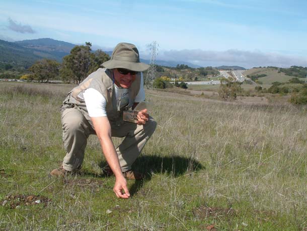
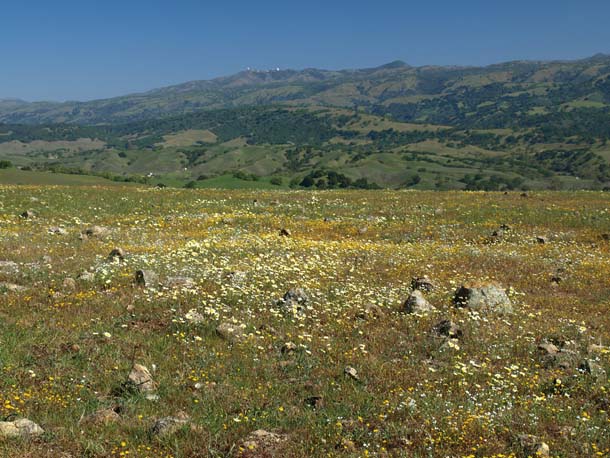
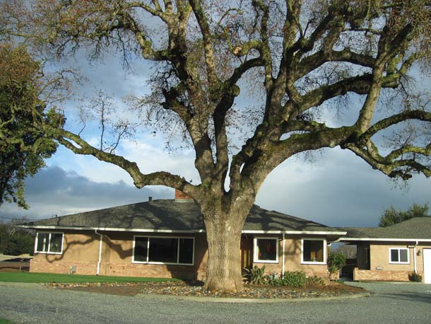
It is a hot Indian summer afternoon on Jasper Ridge, site of a 1,400-acre biological preserve on the San Francisco Peninsula managed by Stanford University. Not even the slightest breeze stirs the foliage of the live oaks and madrones, and the pungent aroma of tarweed–a late summer forb of California savannas–is heavy in the air. Stuart Weiss, chief scientist for Menlo Park’s Creekside Center for Earth Observation, walks slowly along a trail, taking ground temperature readings with his thermo-gun–a pistol-like device that precisely measures surface temperature.
Weiss is using the thermo-gun to make a point: The temperature differential between the soil surface and the atmosphere two meters above the ground can be extreme. Certainly, that’s the case today. Weiss runs a 30-meter transect at the crest of a small hill. At head level, the air temperature hovers around 90 degrees Fahrenheit; the average of several readings on sun-exposed ground, on the other hand, is 116, with a maximum temperature of 131.8 degrees. On the south slope of the hill, the ground-level climate is even fiercer: The average is 130.9 degrees, with a maximum of 150. This has tremendous biological implications. Many plants and animals live close to the ground. For them, a global warming-induced increase of a few degrees could lead to their demise. Here on Jasper Ridge, the disappearance of the Bay checkerspot, an exquisite little butterfly with vivid tessellations of red, yellow, white, and black across its two-inch wingspan, is a clear and ominous signal that this process already is under way.
Climate Change Comes to the Bay Area

- Bay checkerspot butterfly. Illustration by David Fierstein.

The disappearance of a small, if pretty, butterfly is not as dramatic as the breakup of the Antarctic ice shelf or the plight of polar bears in the Arctic. But climate change is affecting ecosystems all over the world, including those in the Bay Area. Because the changes here tend to be more subtle and–so far, at least–difficult to measure, they have not monopolized our attention. But the increasing sophistication of global warming models and the ability of researchers to apply them at the regional level are providing a clearer picture of the impacts of climate change on the Bay Area and Northern California.
Some of this new work is presented here, and it may not make for soothing reading. The emerging consensus is that this region, renowned for its biodiversity, faces a dramatic loss of native plant and animal species. Also in the cards: more floods, wildfires, drought, and air pollution. Moreover, scientists agree that past and present greenhouse gas emissions ensure that a significant quantum of warming already is stored up in the system; it cannot be averted, no matter what we do. Still, it would be both tragic and wrong to assume it’s too late to change course.
Most global models show worldwide average temperatures increasing between 3 and 10.5 degrees Fahrenheit (1.7*-5.6* C) by the end of the century, depending on whether we continue or dramatically alter our current practices. This spread demonstrates that there is scope for action, both regionally and globally. That action must include both prevention–specifically, reducing greenhouse gas emissions–and adaptation, mitigating the impacts of the warming we cannot avoid. Devising and implementing effective measures in both these arenas requires a concrete understanding of the effects warming will have on four aspects of our regional environment: the general landscape, watersheds, the ocean, and the atmosphere.
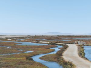
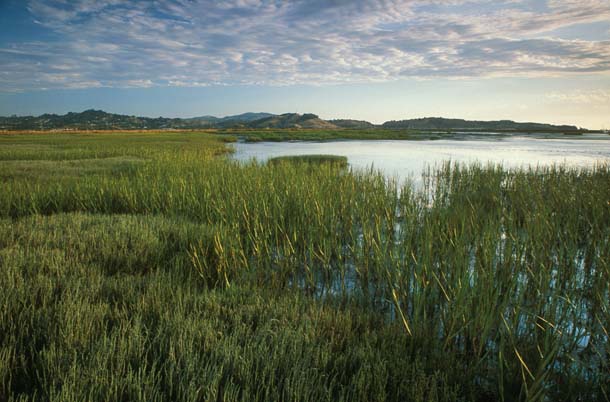
Data sets on temperature and other climate variables have been collected at Jasper Ridge Biological Preserve for decades and are proving invaluable to researchers who are tracking the changes now underway in serpentine grasslands–the habitat of the Bay checkerspot–and other local ecosystems.
Last Flight of the Butterfly?
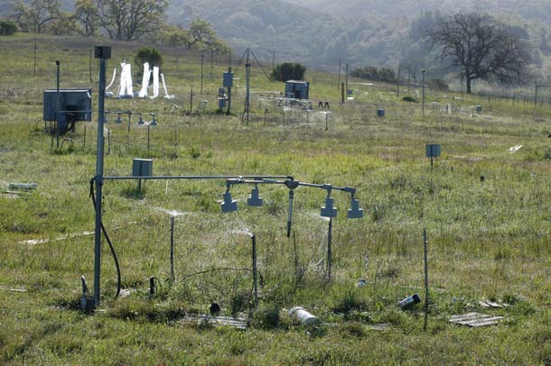
- Experimental plots at Jasper Ridge Biological Preserve are part of a decade-long study directed by Christopher Field examining the response of grassland to 16 scenarios with different combinations of atmospheric warming, elevated carbon dioxide, increased nitrogen input, and altered precipitation. (Subplots above are receiving supplemental watering.) The scientists study ecosystem responses such as carbon storage in the soil, shifts in flowering time, and changes in the plant community. Photo by Nona Chiariello.
The Bay checkerspot has been on the federal endangered species list since 1987. Highly specialized, it is adapted to a mix of native plants that now grows primarily on serpentine soils in the Bay Area. And this specialization is the problem. Over the years, the checkerspot’s habitat–never expansive–has been sliced, diced, hashed, and generally fragmented by development. And as the butterfly’s habitat has disappeared, its numbers have declined precipitously. Today, it hangs on by its wing tips in a few last redoubts near San Jose. It was once abundant on Jasper Ridge, says Weiss: In the 1960s and 1970s, up to 15,000 checkerspots foraged among the vernal wildflower fields here. But a drought in the mid-1970s reduced their number to no more than several hundred. By 1998, they were gone from the ridge.
On the one hand, the Bay checkerspot’s disappearance from Jasper Ridge confirms a certain randomness implicit in natural processes. But it also points to a pattern. It is a signal of the future.
Over the past century, temperatures have been rising on the ridge. From the mid-1890s to the mid-1900s, the mean annual temperature varied from about 56 to 56.4 degrees F. From 2000 to 2008, the range was from 58.9 to 60 degrees. “While year-to-year temperature variations generally are too noisy to provide any real value to researchers, we do know there is a negative correlation between a warmer temperature regime and Bay checkerspot populations,” says Weiss. “So what’s happening on the checkerspot lands is troubling.”
- Field researcher Stuart Weiss places a Bay checkerspot larvae onplantain at Edgewood Natural Preserve near Redwood City. Photo by Kathy Korbholz.
Weiss pauses and gazes out over the preserve. Sunburned, loose-limbed, and sturdily built, he looks like what he is: a field researcher who spends most of his time outdoors. A tendency to couch ideas in terms of river-running metaphors points to his great avocational passion, whitewater rafting.
Right now, though, Weiss isn’t thinking about past river trips. He is contemplating the specific needs of a little caterpillar that has a robust appetite and likes to sunbathe. “So much of this is about timing,” Weiss continues. “Bay checkerspot larvae eat dwarf plantain. After they fill their gut, they typically curl up and bask in the sun.”
Warming temperatures, explains Weiss, can throw off the plaintain’s phenology–its seasonal timing relationship with the environment and climate. In other words, it can mature, flower, and decline sooner–not terribly significant for the plaintain itself, but a very big deal for the checkerspot larvae, which require tender, succulent plantain leaves when they emerge from their eggs. If the plantain has begun to desiccate by the time the checkerspot’s eggs hatch, the larvae starve to death.
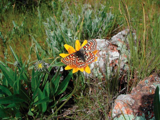
- An adult Bay checkerspot on Coyote Ridge near San Jose nectars on a flowering California helianthella. Photo by Stuart B. Weiss.
“Over long periods, the Bay checkerspot’s phenology has adjusted to accommodate the availability of its essential food plants,” he says, “so any change can have really dire consequences for the butterflies.”
Now but a memory at Jasper Ridge, the Bay checkerspot is also facing problems in its remnant refuges near San Jose. These areas, and the indigenous plants they support, are changing. “What we’re seeing are outcrops of Mojave Desert vegetation in the checkerspot lands,” Weiss says. “It’s not that they’ve made the leap from the Mojave. Rather, they’re relicts of a sort, remnants in south-facing, sheltered areas, probably left over from the 1200s, when the area was warmer and drier. What we could expect with another warming and drying trend is their expansion into more of the Bay checkerspot reserve lands.”
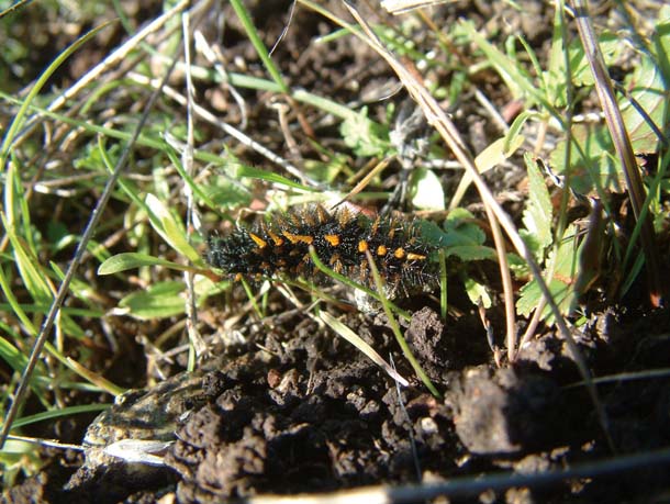
- Bay checkerspot caterpillar at Edgewood Natural Preserve. Photo by Kathy Korbholz.
The situation is exacerbated by the deposition of excess reactive nitrogen from the exhaust of the hundreds of thousands of vehicles driving by on nearby freeways; this nitrogen fertilizes the naturally nutrient-poor serpentine soil, favoring the spread of nonnative plants. “We’re already seeing a general contraction of local native plants (in the San Jose preserves) now,” says Weiss. “Invasives– non-indigenous plants of no value to the butterfly and its larvae–make the whole situation really ugly. The problem is that when vegetation types shift, it isn’t always a nice slow turnover. Things can happen rapidly, and specialized species like the Bay checkerspot have difficulty with rapid change.”
Becoming Los Angeles
To greater or lesser degree, all Bay Area native plants and animals face the same dilemma as this little butterfly. Driven by the loading of greenhouse gases into the atmosphere, the warming climate will affect both the terrestrial and marine environments, as well as our signature nexus of water and land: San Francisco Bay and the associated delta of the Sacramento and San Joaquin rivers. While the detailed consequences of this shift are not yet predictable, the broad outlines of the future can be limned: a Bay Area that is utterly transformed. The change will be too slow, perhaps, to be easily perceived by humans, but it will be much too fast to allow for genetic adaptation by plants and animals. “It’s going to be a wild ride,” says Weiss. “But at least it will be an interesting one.”
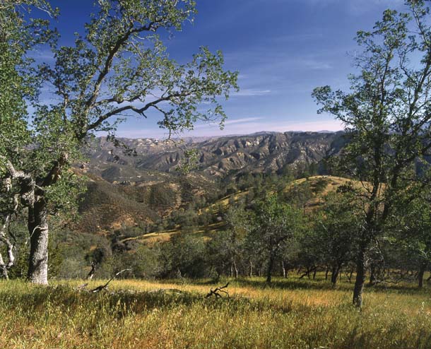
Predicting the regional and local effects of planetary warming is extremely challenging. That’s especially so in the Bay Area, which is rich in the “microclimates” caused by various geographic gradients. “We have the altitude gradient in the Coast Range,” Weiss says. “Aspect–north or south exposure–is another gradient. You have the climatic gradient of fog along the coast. Each gradient implies a great deal of information, and of course the gradients interact with each other, which further complicates things.”
To get a predictive handle on the effects of climate change in such a diverse region, researchers need sophisticated computer models that can break things down at a fine scale. “The entire country already is mapped down to an 800-meter grid by a program developed at Oregon State University called PRISM,” says Weiss. “Now we are working on methods that will allow us to map portions of the Bay Area–specifically, Bay checkerspot habitat–down to a 10-meter grid.”
- The Bay Area’s many microclimates make it a challenging place to predict climate change impacts. Coastal fog (above, over Mount Tamalpais, seen from China Camp) is a major factor in the region’s climatic diversity. Photo by Kathleen Goodwin.
So the good news is that researchers are developing systems that show great promise for predicting the regional effects of global warming. The not-so-great news is that the data increasingly points to cataclysmic changes that will stretch the entire concept of adaptability.
“To say the least, the predictions of three- to ten-degree warming over the next century imply some profound challenges,” says Kim Nicholas Cahill, a researcher at Stanford University’s Department of Global Ecology. “Ten degrees is the difference between Portland and San Diego. Five degrees is the difference between Fresno and the Napa Valley.”
Like most scientists, Weiss is disinclined to jump to conclusions. But the available data is sufficient, he says, to divine the general direction we’re heading for the next few hundred years. “In the simplest terms, I think it’s reasonable to assume the Los Angeles Basin will move up here–not literally, but in terms of climate,” he says. “We’re already seeing vegetation changes in Bay checkerspot habitat. That will continue.”
Plants on the Move
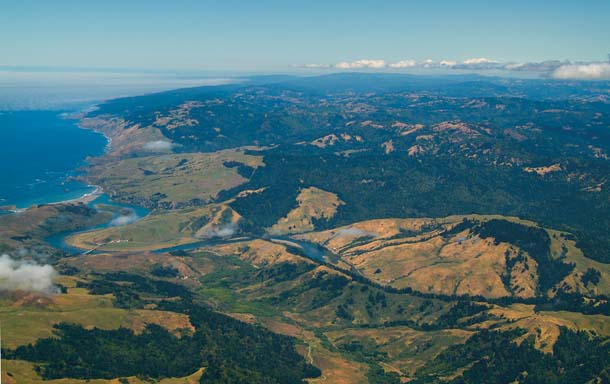
- The Bay Area’s many microclimates make it a challenging place to predict climate change impacts. The numerous ridges and valleys of the inner and outer Coast Ranges (as at Coyote Ridge southeast of San Jose) are a major factor in the region’s climatic diversity. Photo by Ronald Horii.
These changes ultimately will reshape the distribution of vegetation across the Bay Area, the state, and beyond. David Ackerly, a UC Berkeley professor of integrative biology, is coauthor of a recent study on climate-induced plant migration scenarios. He says plant communities that require cooler temperatures and more moisture may move higher, move north, or seek northern exposures. Or they may not be able to make the shift at all, in which case they will eventually disappear.
“Broadleaf forests, for example, need cooler, moister areas,” Ackerly says. “Right now, they exist on both southern and northern slopes in some areas. But in the future, it’s possible you could find them almost exclusively on north-facing slopes.”
Ackerly says such shifts probably will be characterized by the movement of individual species rather than the migration of integrated suites of plants. “There is no reason to believe that an entire assemblage will move together,” he says. “It’s possible that species will move independently, and current species associations and habitats could break up. We are, of course, a long way from being able to make specific predictions.”
A large part of the uncertainty is the lack of consensus in climate change models about the effect of warming on precipitation. Generally speaking, there is agreement that average precipitation levels in the Sierra Nevada–the source of about 60 percent of California’s water supply–will remain more or less stable, and that we’ll see more of that precipitation as rain and less as snow. And there will likely be greater variability, with more severe storms and more periods of drought. However, Ackerly cautions that the interactions between temperature, precipitation, and plants are still not fully understood. Moreover, precipitation scenarios for the coastal region are much less clear than those for the Sierra.
“A couple of years ago, an analysis of the available precipitation models yielded net zero, because half the models were wetter and half drier,” says Ackerly. “A very big challenge will be making the connections between possible changes in precipitation patterns and shifts in habitats and specific species.”
But even in the most optimistic scenarios, the Bay Area and state will lose a wide array of native plants. Ackerly and co-researcher Scott Loarie, now a postdoctoral fellow at the Carnegie Institution, conclude that up to 1,300 species, or about two-thirds of California’s endemic flora, will either be eliminated or greatly reduced from their current ranges. Their conclusions are based on the high carbon dioxide emissions scenario from the Intergovernmental Panel on Climate Change (IPCC) in its 2001 and 2007 reports.
“These are not unreasonable assumptions,” says Ackerly, “especially considering that the IPCC’s original scenario may not have been high enough. Observed rates of CO2 increase and climate change right now exceed the IPCC projections. And for many plants–especially woody plants–the chances of rapid migration are extremely small.”
Generalists Ascendant

- Many California endemic species face extinction as a result of the rapid warming of the habitat they have adapted to. On the other hand, species that can adapt to a wide range of conditions, like the American crow, are likely to thrive. Photo by Kevin Nibur.
The Bay Area’s flora is thus likely to change significantly over coming decades. San Francisco wallflower, a fleshy annual with brilliant zinc yellow blooms, is now found–rarely–along the coast from Marin to Santa Barbara. In the IPCC’s high emissions scenario, it almost disappears. Facing a similar plight with continued high emissions is Clark’s ragwort, another pretty yellow wildflower found on the eastern slope of California’s Coast Range and the western foothills of the Sierra. The Oakland star tulip, a small lily that produces delicate white blossoms with magenta streaks near the sepal, fares somewhat better. Now ranging from inland Mendocino County to Southern California, it retreats to a narrow band near the coast.
Even blue oaks, a signature species that is distributed as a “bath-tub ring” forest from 1,000 to 5,000 feet on the hills surrounding the Central Valley, could diminish significantly, retreating to a stronghold in the northern Coast Range south of the Trinity Alps, with scattered populations along the west slope of the Sierra and in the Los Padres National Forest along the Central Coast.
Native plants that do drop out of the mix likely will be replaced by “weedier” generalists. “Climate change will favor plants that can evolve and adapt quickly,” says Ackerly. “Basically, those are species with shorter life spans. It’s no coincidence that many invasive plants are annuals. They are able move into areas that provide them an opportunistic niche and propagate rapidly.”
The new, warmer world will be hard on specialists across the board, says Terry Root, a conservation biologist at Stanford who is evaluating the impacts of climate change on California wildlife. The plant or animal geared to a particular thermal range, moisture gradient, or food plant will suffer. On the other hand, “the generalists that can tolerate a wide range of temperatures, adapt to different ecosystems, and exploit a variety of food sources probably will thrive,” Root observes. “Crows will do well. So will mammalian mesopredators–skunks, raccoons, and the like.” She estimates that 20 to 40 percent of the state’s native species could become extinct because of climate change.
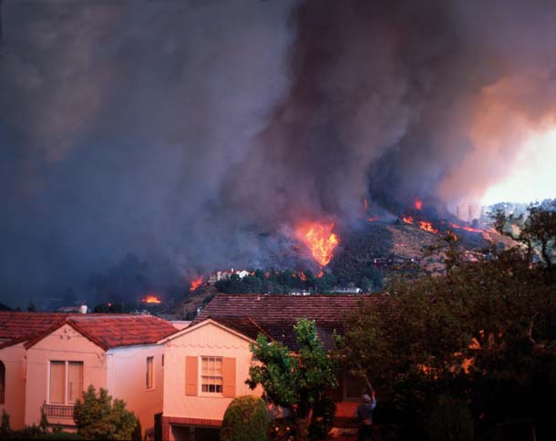
Out of the Frying Pan, Into the Wildfire

- Scientists predict that climate change will lead to a longer fire season in California and more intense wildfires, threatening both native landscapes, such as the chaparral at Henry Coe State Park after the September 2007 fire there. Photo by Jim Dascoulais, California State Parks.
Many of those declines could well be hastened by fire. As forests dry out, they will become increasingly vulnerable to catastrophic wildfires. Such fires essentially are “slate cleaners” that can permanently alter plant and animal communities.
Max Moritz, adjunct professor at UC Berkeley’s Department of Environmental Science, Policy, and Management and codirector of the university’s Fire Center, says recent research links increased wildfire activity in the West with warmer springs and earlier melting of the snowpack. Evidence is accumulating that we already are seeing longer, more intense fire seasons throughout the West as a result of these factors, says Moritz, whose own studies focus on California chaparral.
- Oakland hills during the October 1991 fire. Photo by Richard Blair.
Moritz cites a recent study published in Science demonstrating that a warming climate is resulting in a longer fire season with more and larger wildfires. This will have a profound effect on our wildlands, particularly shrubbier habitats. Most of the native plants that stock our shrublands are varieties adapted to intermittent drought and seasonal burning, says Moritz. By the end of a typical summer, live fuel moisture in indigenous shrubs often falls below 80 percent, making them extremely susceptible to wildfire. “If you have 79 to 80 percent moisture in the living shrubs, it is difficult for wildfires to really get going,” Moritz says. “Below that level, though, fires can be very intense.”
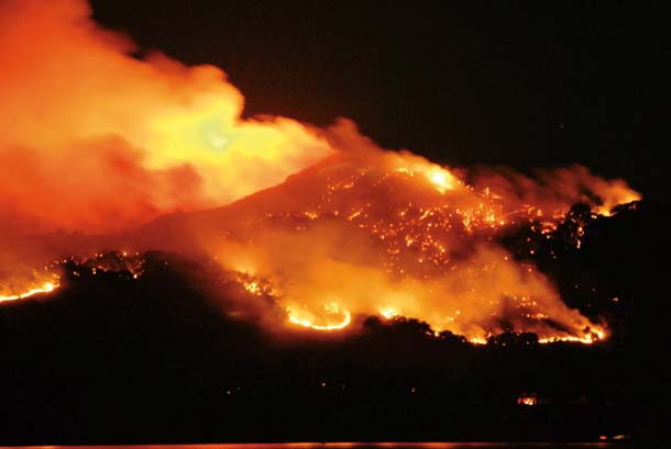
- The October 2008 fire on Angel Island, as seen here from the East Bay, burned over half the island’s 740 acres. Photo by Dale F. Mead.
Chaparral and coastal shrub are adapted to late summer/early fall fire, says Moritz. “Many of these species are fire dependent. Seeds can lie dormant in the soil for years; wildfire allows them to germinate, cued either by flame or smoke.” But if climate change leads to reduced spring rains, as expected, it could cause earlier desiccation of the plants, extending the fire season. This, in turn, could accelerate the burning cycle, causing the shrublands to burn more often. “If an area burns too soon after a previous fire, the parent plants might not be able to set enough seed in the soil for regeneration,” says Moritz. “That could be devastating for these fire-dependent shrublands.”
So what moves in then? “Crappy invasive weeds,” Moritz says, repeating a familiar refrain, “With increased fire, we may be facili-tating the loss of native shrub species and creating annual exotic grasslands that can burn every year.”
Take a Walk on the Dry Side
Robin Grossinger, an environmental scientist with the San Francisco Estuary Institute (SFEI), notes a paradox: Climate change may present conservationists with opportunities for the restoration of some indigenous systems.
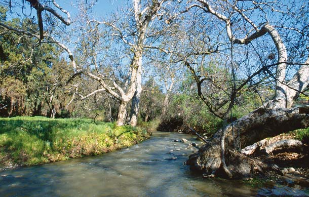
- Stands of sycamore trees, such as this one along Penintencia Creek near San Jose, are no longer widespread in California, but they might be a good candidate for restoration in the drier conditions caused by global warming. Photo by Frank S. Balthis.
“Actually, ‘opportunities’ may not be the right word,” says Grossinger. “Perhaps it’s better to talk about reasonable responses that could yield some benefits for native species.” Grossinger advises looking at the “drier side of the California ecological palette” for clues on how best to proceed. “Perhaps due to a cultural bias, we’ve tended to overemphasize the wetter, lusher types of habitats in restoration work,” says Grossinger. “But in the coming era, we may want to focus as much on some of the largely forgotten native habitat types that should have a better chance of persisting in our future climate.”
These include western sycamore riparian woodlands, alkali meadows, seasonal wetlands, and valley oak savannas, Grossinger says. These habitats were historically abundant in the Bay Area and farther south, but are relatively rare today. Indeed, there are only 17 significant stands (of 10 or more acres) of sycamore alluvial woodland left in the state. In the Bay Area, such stands are only found along Alameda Creek, Coyote Creek, and Pacheco Creek. Other “forgotten” habitats have suffered similar declines.
But looking to these native systems that were associated with highly variable, low rainfall conditions can help us design landscape-level responses to climate shifts, and perhaps restore native habitats in the process. “For example, we could give streams more room on their natural floodplains as a flood control measure,” Grossinger says. “As the climate becomes warmer and drier, sycamore woodlands might be more appropriate than the hydrophilic (water-loving) species we tend to focus on now in restoration work.” Grossinger points out that “many of these drier habitats have not been seen for 50 or 100 years,” but ironically, their time may be coming around once again.
Will Rising Tides Sink All Ships?
- Rising seas also threaten to submerge restored wetlands, such as Marta’s Marsh near Corte Madera. On the other hand, with enough new sediment to build up the level of the marsh above that of the rising tide, healthy wetlands like this can shield inland areas from storm surges and very high tides.. Photo by Charles Kennard.
On the whole, global warming bodes ill for the Bay Area’s native terrestrial species. And the coming changes are liable to be even more dramatic for its coastal waters and estuaries. Higher sea levels are not merely pending; they are here now. The tide gauge at the Golden Gate shows that sea level rose at the rate of 0.47 feet a century from 1855 to 1997, but this rate accelerated to 0.75 feet a century from 1925 to 1997. The most recent report from the IPCC–one now viewed by many in the scientific community as overly conservative–pegs the expected rise in sea level globally at up to one meter (3.28 feet) by 2100. Locally, the Bay Conservation and Development Commission’s expectation for sea level rise is 1.4 meters (about 4.6 feet) by the end of the century. That may not sound like much–unless you’re one of the myriad species that require tidal marshes to survive.
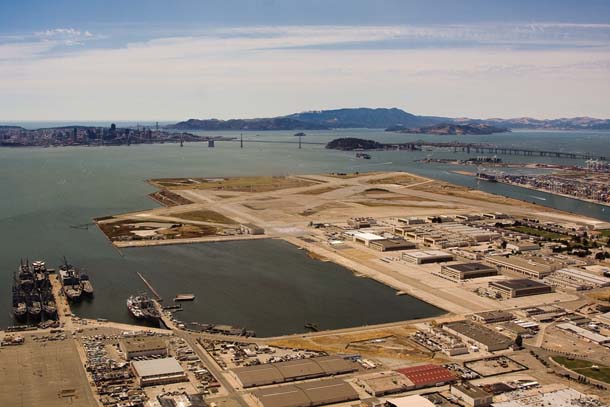
- A lot of high-value infrastructure has been built right on the shoreline of the Bay, such as the former Alameda Air Station and the Port of Oakland. Deciding what and what not to protect in the face of rising sea levels won’t be easy. Photo by Kira Stoll.
It’s certainly enough to inundate most of the estuary’s restored wetlands, particularly if there isn’t enough sediment to keep pace with the sea level rise, says Abe Doherty, climate change coordinator for the state Coastal Conservancy. “That’s extremely disturbing, given the time, effort, and money we’ve put into these projects. It also means that many of the threatened and endangered species we’ve worked so hard to protect could find themselves in very dire straits.”
Fortunately, local agencies such as the Conservancy and the Bay Conservation and Development Commission (BCDC) are paying a lot of attention to the issue of climate change. BCDC was formed in 1965 to control the filling and development of the Bay’s tidelands; by the mid-20th century, almost one third of the Bay–about 240 square miles–had been filled. So BCDC’s prime mission for its first 40 years was to prevent the Bay from getting smaller. But in an era of warming temperatures, the agency has to focus on keeping the Bay from getting too big, and thereby inundating critical infrastructure and restored wetlands.
“This is the fifth-largest metropolitan area in the country, and it surrounds the nation’s most urbanized estuary,” observes Will Travis, executive director of BCDC. “We have essential high-value infrastructure that must be protected–the airports, Silicon Valley, Mission Bay. At the same time, we also have areas where we’ve made incredible habitat conservation investments, specifically the North and South Bay salt ponds. So we need to identify areas where marshlands can migrate or expand.”
The limited opportunities for marsh migration around the Bay make it all the more important to restrict development in those areas where future wetland expansion may be possible. And that will take great–perhaps unprecedented–public and political will.
“There are 52 local governments around the Bay, and we won’t get this done if everyone goes it alone,” Travis says. In an effort to get all these public entities on the same page, BCDC, the Metropolitan Transportation Commission, the Bay Area Air Quality Management District, and the Association of Bay Area Governments have formed the Joint Policy Committee. The JPC’s charge is to ensure that all major planning decisions in the region are informed by the need to reduce greenhouse gas emissions and prepare for the climatic changes that cannot be avoided.
Steve Ritchie, executive director of the South Bay Salt Pond Restoration Project for the Coastal Conservancy, says the great uncertainty in Bay wetland efforts is the availability of sediment–the clean sand and silt used to elevate a wetland to the level where marsh plants can take root and grow. These restoration projects depend largely on sediment migration, and on the way that migration is managed.
Some of the efforts to date hold out hope that restoration work in the South Bay can proceed even with rising sea levels. “Our first project was at the Island Ponds–479 acres near the Dumbarton’s drawbridge,” Ritchie says. “We restored it to tidal action in 2006. Since then, we’ve accumulated sediment there at a rate far higher than we anticipated–from one to three feet. We’re already seeing colonization by marsh plants in some locations. So we know that tidal marshes are very efficient trappers of available sediment; if there’s enough sediment around, they can keep up with sea level rise.”
Steve Crooks, a senior associate with Philip Williams and Associates, an environmental hydrology firm specializing in wetland restoration and analysis of sea level rise impacts, is another believer in the importance of sediment in the face of rising seas. “We have to change our view of dredge sediment,” he says. “Right now, it’s often seen as a public problem. In actuality, it’s an incredibly valuable natural resource.” A dark-haired man with a boyish mien, Crooks lives right on the margin of Richardson Bay in Marin. He’s not too worried, he says, about estuarine waters flooding his condominium. “At a certain point some kind of small berm might be required,” he says, looking out his back deck at the tidal flats where he often observes bat rays foraging for shellfish. “But I think we’ll be able to stay above the worst of it.”
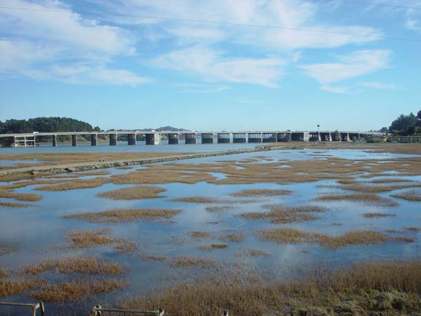
- At high tide, the Bay Trail along Bothin Marsh at the north end of Richardson Bay is nearly submerged; joggers and bikers might have a hard time with the expected 1.4 meter rise in the tide level. Photo by Steve Crooks.
But nearby Bothin Marsh–a lovely little wetland at the head of the bay visible from the Highway 101 bridge–is another matter entirely. Less than 10 percent of Richardson Bay’s marshes remain, says Crooks, and for that reason Bothin is highly esteemed by locals; some ambitious restoration work has taken place here, and it shows. Joggers and cyclists exercise along its trails, and birders scan the wetland vegetation and tidal flats for endangered California clapper rails. “There are probably four or five pairs here,” says Crooks on a recent tour of Bothin. “I saw one just the other day, a very bold bird. Just walked out on a mudflat and looked around.”
As Crooks strolls around the marsh, he points out groups of avocets dozing on the flats, their heads tucked into their plumage. He also points out heavy erosion on the marsh edges facing the bay and main channels. Bothin Marsh is slowly disappearing, its elevated sections crumbling away with every extreme high tide and flood event. This process will accelerate, Crooks observes, as the sea level rises. “One of the things I love about Richardson Bay is that it’s an excellent analogue, in microcosm, of San Francisco Bay,” he says. “We have people living in flood-prone areas, and heavily armored shorelines with some marshes and tidal flats that are good candidates for restoration. What we see happening here reflects what will happen to the estuary at large.”
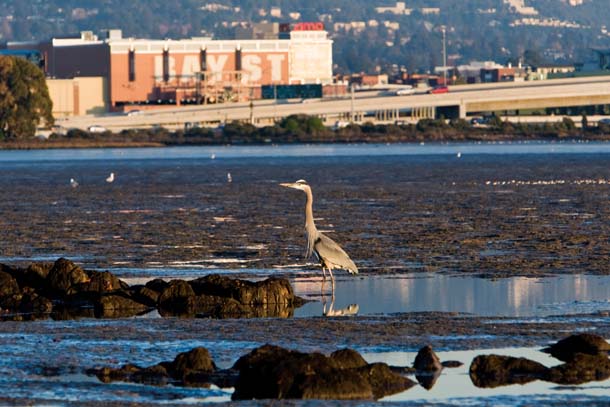
- A great blue heron patrols the Emeryville Crescent marsh at low tide. With a rising tide, it can move elsewhere, but I-80 and Bay Street won’t have that option. Photo by Kira Stoll.
Anticipating such changes, BCDC is launching a field study on Corte Madera Creek where it meets the Bay. The goal: to better understand how and if wetlands can serve as buffer zones to protect shoreline development from wind-driven waves and storm surge– inevitable concomitants of higher sea levels and more intense storms, and the prime sources of flooding in low-lying areas.
Crooks agrees with Travis that rising sea levels will force hard public policy decisions around the estuary. “We’ll have to decide not only what we can save, but what we can afford to save,” Crooks says. “SFO and Oakland Airport will probably be high priorities for preservation–it’s very difficult to find sites large enough for major airports near existing metropolitan areas. Other developed areas may not be worth similar investment.”
Similarly, some marshes will have to be abandoned; there simply won’t be sufficient available sediment to maintain them. “But other sites will become restoration candidates,” he says, particularly those in areas where they can serve as buffers. “We have to identify those sites in advance and make adequate provisions for acquiring and restoring them.”
Remaking the Delta
- With climate change, more precipitation will fall as rain than snow in the mountains, causing more frequent flooding in the Central Valley and Delta. Photo by Barrie Rokeach.
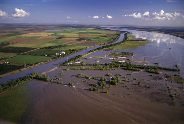
Rising sea levels also will exert dramatic effects in the Sacramento/San Joaquin Delta, the region that provides the Bay Area with much of its water and connects it to interior California. Here a system of fragile levees protects subsided “islands” of land from both salt and freshwater intrusion. Once a vast patchwork of tidal and freshwater marsh, seasonal wetlands, grasslands, and oak savanna, the Delta has been converted into a highly–if haphazardly–engineered tract of intensively cultivated agricultural holdings separated by canals and sloughs. Over the decades, the peat soils have oxidized and been compacted by farming activity; some of the islands are now 20 feet below sea level. Water is pressing on poorly engineered and ill-constructed levees, making breaches and flooding of the islands increasingly likely.
“Since agricultural exploitation of the Delta first began about 150 years ago, approximately 3.2 billion cubic yards of peat soils have been exported into the atmosphere,” observes Jeffrey Mount, a professor of geology at UC Davis and the director of the university’s Center for Watershed Science. “That’s material you’re not going to get back.”
- The Delta smelt, already on the brink of extinction, may face increased competition from nonnative species. Yet, on the other hand, it may benefit from additional freshwater flows and reduced water exports. Photo by Moose Peterson/WRP.
The Delta would be an unstable system even with an utterly predictable climate. But add a meter or so of sea level rise, and the situation goes from dicey to completely untenable. Levees that are now barely holding their own against the tides will fail.
And a rising sea level is only part of the problem. Changes in Sierra precipitation also will be a factor, says Mount. As more of it falls as rain rather than snow, winter runoff will increase, and managers will be forced to release vast amounts of water down the Sacramento and San Joaquin rivers, whether they want to or not. That water will end up in the Delta. “Combine those events with, say, some high tides and a sea level that is a foot or two higher than we have today,” says Mount, “and there will be major levee failures. Or you could also see wholesale liquefaction of the levees due to a significant earthquake on the Hayward Fault. In any event, they’re gone, and water will fill the central and western Delta.”
That will transform the heart of the Delta into an inland bay similar to Suisun Bay, disrupting California’s water delivery systems and irrevocably changing the Delta ecosystem.
Peter Moyle, a professor of fish biology at UC Davis and the doyen of California native fish research, says invasive species already in the Delta–overbite clams, freshwater Asiatic clams, and Brazilian waterweed, for example–may find additional opportunities for expansion, wreaking havoc on already beleaguered native fish, mollusks, and crustaceans.
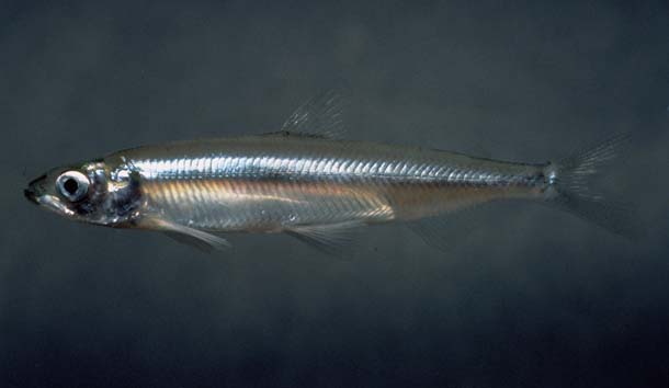
But some of the Delta’s threatened fish could actually benefit from the flooding of the Central Delta, says Moyle. Many of the Delta’s indigenous fish species–the Delta smelt and longfin smelt among them–are swimming on the razor’s edge of extinction due to reduced habitat and the destructive effects of the giant pumps that send water to cities and farms farther south. A flooded Delta could force the pumps to shut down, stopping the water exports and fish kills. The cessation of water exports would also mean much more fresh water for the Delta, expanding habitat for native brackish and freshwater species, including the smelts. Salmon and steelhead smolts might find their annual seaward egress through the Delta much less hazardous.
“It will not be the Delta of pre-European contact,” Moyle explains, “but it won’t be the Delta of today, either. We’ll have a big, salty-to-brackish bay in the middle of the Delta that will have significant opportunities for wetland restoration.”
And Moyle gets positively exuberant as he talks about the changes that are pending for Suisun Marsh. “Right now, Suisun Marsh is maintained mainly as a freshwater marsh and pond system by duck clubs,” Moyle says. “That’s going to change with sea level rise. Inevitably, the levees will be overtopped and Suisun will revert to a tidal system. With appropriate restoration programs, it could be a haven for (the Delta’s) native fish, which generally require brackish conditions.”
But this halcyon vision comes with a caveat: Invasive species could also find this tidal Suisun Marsh congenial, says Moyle. “There’s no guarantee that it could be managed strictly as a haven for natives. One exotic species or another–or several–could expand there very rapidly. The issue of invasive species in the Bay/Delta is not going away–climate change could very well exacerbate it.”
Signals from the Salmon
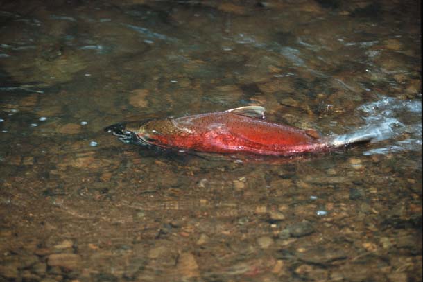
- Coho and chinook salmon divide their time between rivers and the ocean. As a result, they face a dual threat from climate change: warmer water in their spawning streams and diminished or delayed upwelling offshore. Photo by Wyn Hoag.
California is at the southern end of the range for many salmonids, cold water fish that include salmon and trout. The Sacramento River chinook–comprising the fall, late fall, winter, and spring runs– is one of the last great salmon populations in the West. And coho salmon, a sensitive anadromous species that requires even colder, cleaner streams for spawning and smolt development, is still found in the immediate Bay Area: Marin County’s Lagunitas Creek supports the largest coho run in the state. Steelhead trout–an anadromous phase of rainbow trout–inhabit many of the streams running into the estuary. Because salmonids require clean, cold streams and cold, productive oceans, they are excellent indicators for both general ecological health and a temperate climate.
Recent trends have not been encouraging. Chinook numbers on the Klamath and Sacramento river systems have plummeted, forcing the first complete commercial fishing season closure in 2008. Coho populations–once numbering in the hundreds of thousands in California–have also fallen. Steelhead, which are more tolerant of a wider range of environmental conditions than the two salmon species, are faring better, but only marginally. Biologists attribute the declines to degradation of spawning streams from dams, pollution, and warmer water, as well as increasing variability in ocean productivity.
“Salmonids in general are going to shift northward and upward,” says Moyle. “In particular, it’s very hard to be optimistic about coho, given their cold water requirements.”
Troubled Seas
Down with Upwelling

- There will be winners and losers from climate-induced changes in the ocean. Pacific krill are “the dietary cornerstone” for many species, but they are threatened by changes in upwelling. Photo by Joseph Dougherty.
Marine systems are exceedingly complex–a good thing, considering that this complexity can result in both great productivity and extravagant biodiversity. Off the Central and Northern California coast, this biological productivity is driven by upwelling, the movement of deeper, offshore water up to the surface along the coast. This is caused by strong, seasonal winds driving nearshore surface water seaward; deeper, colder, more nutrient-rich water then rises, initiating phytoplankton blooms and ultimately stimulating robust populations of copepods and krill. For pelagic birds, forage fish, salmon, and marine mammals, krill are the dietary cornerstone; all either eat the small, pelagic crustaceans directly or feed on the animals that eat them. It is no accident that most of the marine bird species that inhabit the great rookeries of the Farallon Islands brood their young when the krill typically are most abundant, in May and June.
When upwelling is weak, delayed, interrupted, or absent, krill can be scarce, and many species suffer drastically. In 2005, upwelling off the Farallones began in February, but abruptly shut off in May, just when the birds and fall-run salmon needed it most. Fishermen reported that the salmon caught offshore that year were skinnier than usual. Fall-run chinook typically follow a three-year cycle. In 2008, the numbers of returning fall-run fish on the Klamath and Sacramento Rivers–and on all West Coast rivers north to Canada–were so low that commercial and sport salmon fishing was banned.
Things were also grim for the Farallon seabird colonies in 2005. Cassin’s auklets, which breed on the Farallones and subsist almost entirely on krill, were suddenly faced with minimal food sources.
“They were able to initiate nesting, but the number of breeding birds was down, and those that did nest abandoned the colony in mid-May,” says William Sydeman, president and senior scientist at the Farallon Institute. “And it’s by no means clear if they could sustain similar (upwelling) changes year after year. If we see growing variability in upwelling events, as predicted, the coevolved traits that have developed between krill and their predators could be severely disrupted. Obviously, that wouldn’t be good for the birds or for salmon.”
Recent models and observations show that warmer surface temperatures will increase the stratification between marine water layers; that is, the temperature and salinity gradients in the ocean will become more pronounced and harder to break down. “You could end up with a situation that is intuitively paradoxical,” says Jeff Dorman, a UC Berkeley researcher who is studying the possible impacts of climate change on the California coast. “Under many models, climate change brings stronger seasonal coastal winds, and wind is the driving force in upwelling. So at times, you would have stronger upwelling; but the nutrient input to surface water could be limited by the stronger stratification caused by warmer surface temperatures.”
Though those stronger coastal winds might not improve marine biological productivity, they might moderate climate change impacts along the shore. A study presented at the 2008 California Climate Change Conference by San Jose State climatology professor Robert Bornstein supported earlier postulations that the fierce heating of the Central Valley predicted in most climate warming models will actually intensify coastal cooling due to stronger onshore winds. This coastal zone cooling could provide a limited refuge for some of the species threatened by global warming: redwoods, coho salmon, and marbled murrelets, for example.
The Marine Food Web Unravels

- Jellyfish, such as these brown jellies (Chrysaora sp.) near the Farallones, appear to be increasing in numbers both here and in the Sea of Japan. Photo by Enrique Aguirre.
Ellie Cohen, the executive director of PRBO Conservation Science, an organization that maintains a research station on the Farallon Islands under a contract with the U.S. Fish and Wildlife Service, says observed changes in wind patterns over the ocean point to greater variability in the marine environment. And Sydeman’s research indicates that changes in the appearance and intensity of upwelling could be generating phenologic mismatches–timing disruptions between the breeding cycles of marine birds and their food sources.
Krill aren’t the only component of the marine food web affected by these fluxes: Rockfish also have suffered significant declines off the California coast, and changes in upwelling seem to be a contributory cause. That in turn has forced a change in foraging habits for some bird species. Murres breeding on the Farallones, for example, typically feed their young on juvenile rockfish from the sea near the islands. But a decline in rockfish populations has compelled the murres to switch to anchovies, which are rich in lipids and oilier than young rockfish, but are found farther from the colonies. “Very young rockfish, when they are about two inches long, are the ideal food for murre chicks under seven days old,” says Jaime Jahncke, director of marine ecology for PRBO. “Anchovies have high food value, but they can be too large for young murres.” For now, the murre population is doing well, but it’s not clear what effect shifting marine conditions will have on them and their forage species in the future.
And those conditions are definitely shifting. Cohen observes that plankton surveys taken around the Farallones have recently shown a great increase in gelatinous zooplankton, including jellyfish and salps. Though gelatinous zooplankton declined in 2008 with the return of strong upwelling, Cohen worries that their recent abundance could be a harbinger of a phenomenon manifesting in other parts of the world, notably the Sea of Japan: a population boom of jellyfish at the expense of fishes.
“What concerns me is that this could be an early warning of a shift to a very different ecological com-munity off our coast, an indication we’re sliding into a simpler, jellyfish-dominated system,” she says. “It’s clear that there will be winners and losers in climate change, with salmon among the losers, and jellyfish among the winners.” And Humboldt squid, a big, voracious subtropic cephalopod that invaded Central California waters in force a couple of years ago, may become permanently ensconced, says Sydeman. Yet some of the changes may not be so negative: Tuna and bonito could expand their range up our coast, providing some consolation to fishermen hurt by declining salmon populations.
Ocean Acidification
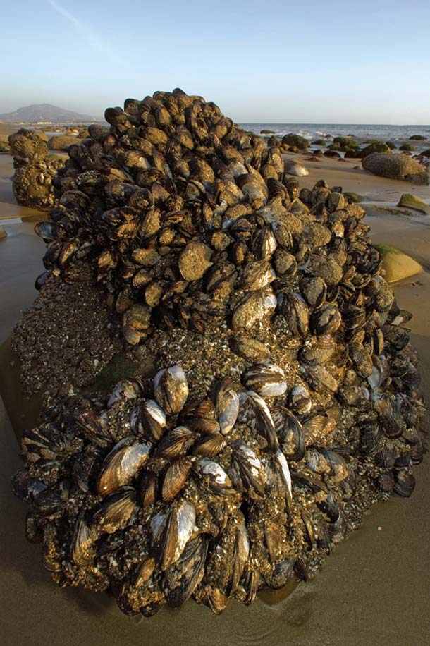
- California mussels are another important marine food source, but with ocean acidification, they could have difficulty forming their shells. Photo by Kip Evans.
Climate change is doing more than stimulating shifts in species distribution. The very chemistry of the oceans is changing. As greenhouse gases are released, the seas act as sponges, absorbing vast quantities of carbon from the atmosphere. This lowers the marine pH through the production of carbonic acid, a result of the mixing of CO2 and water. According to a paper published in 2008 in Science by Richard A. Feely et al., the oceans have absorbed roughly 130 billion metric tons of carbon since the advent of the Industrial Revolution, lowering seawater pH by 0.1. Given the expected rate of greenhouse emissions, the pH of surface water could decrease by a total of 0.4 by the end of the century. Sydeman notes that “changes in pH are logarithmic–exponential, in fact. A change from 0.1 to 0.4 would be one of many orders of magnitude.”
As the seas become more acidic, availability of carbonate ions is reduced. This, in turn, prevents marine animals from producing calcium carbonate, the stuff from which shells are made. Increasing ocean acidity could thus devastate marine “calcifiers.” All the hard corals would be affected, as would oysters, barnacles, snails, and mussels. Additionally, “pteropods–free-swimming pelagic snails–would be at great risk, “says Sydeman. “That’s a real concern, because they are important forage for other species, including salmon.” Pointing to a recent study of acidification and mussel colony declines on Tatoosh Island off the coast of Washington, Cohen adds, “It’s a significant concern. Some scientists predict that even if we stopped CO2 emissions today, lower pH levels could impact marine food webs for centuries.”
Sequestering Carbon in Native Plants
So make no mistake: Bay Area researchers are alarmed about the likely impacts of climate change on the region. But we can still have a major impact on the degree of warming that occurs through effective policies and aggressive action. Measures adopted now to reduce production of greenhouse gases could still slow the global warming train and keep it from running off the tracks.
- Drought-tolerant valley oaks can sequester carbon and provide shade even in suburban neighborhoods, as here in San Jose. Photo by Robin Grossinger.
Along with curbing our output of greenhouse gases, we can explore ways of capturing and sequestering carbon already emitted. Planting trees–which extract carbon from the atmosphere and store it in their woody tissues–can be part of this strategy. According to a 2008 publication from the California Oak Foundation, over 600 million metric tons of carbon currently are sequestered in the state’s oak woodlands, with the greatest benefit coming from trees that are 20 years or older.
Environmental scientist Grossinger at SFEI is working on a model for restoring the resilient and drought-tolerant valley oak in suburban areas of the South Bay, based on research of the historic distribution and spacing of these large and long-lived shade trees in the region’s former savannas.
And we won’t necessarily have to limit ourselves to trees to lock up carbon, Steve Crooks observes. “Recent research on tules (a native freshwater marsh plant) as a means of carbon sequestration is very exciting,” he says. “They can store a lot of carbon–about one kilo per square meter a year.” That’s far superior to conifer plantations, which typically store about one-tenth of that amount, Crooks says. Additionally, tules can do something most trees can’t: build wetlands. He cites pilot projects by the California Department of Water Resources and the U.S. Geologic Survey indicating two to four inches of peat soil a year can be created from tule plantings. There is a drawback: Tule marshes emit methane, a gas that has an even greater heat-trapping capability than CO2. “Still, you have to balance that with the fact that CO2 stays in the atmosphere for 50 to 200 years while methane is in the atmosphere for only 10 to 15,” Crooks says.
Planning for Ecosystem Resiliency
But carbon sequestration is a long-term strategy and will take decades to yield palpable results. So if we are to preserve any semblance of the natural world through the next century, we must work for ecosystem resiliency; we have to do everything possible, in other words, to acquire and enhance strategic native wildlife habitats, with an emphasis on those that will give us the biggest preservation bang for the buck.
“We need to purchase and manage reserves and corridors for analogues of climate diversity,” says Stuart Weiss, “and the best way to do that is through the protection of areas with a lot of topographical relief.” Rugged, mountainous areas provide the greatest possibility for ecological resilience, says Weiss, because there are so many gradients inherent in the landscape. “Along the coastal range north and south of the Bay Area, you have different altitudes, different exposures, and the impact of seasonal coastal cooling. There are a lot of habitat niches compressed in a relatively small area.”
Climate change has already begun affecting the way conservation organizations in California plan land acquisitions. In the not too distant past, says Rebecca Shaw, associate director of conservation for the Nature Conservancy of California, conservation groups approached land protection as though the habitat were static, frozen in time. “Acquisitions were based on the assumption that the land was in equilibrium,” she says. “Now we’re analyzing the ways the habitat will change as the climate changes. That’s having a tremendous impact on where and how we acquire land.”
- Conservation organizations and land managers are now tailoring their acquisition and stewardship strategies with an eye to providing habitat and corridors for vulnerable species adapting to climate change. The Gabilan Range south of Hollister holds great potential as refuges for threatened wildlife. Photo by Charles Kennard.
The goal is to build resiliency into habitat acquisitions, says Shaw. That means identifying areas not only where biodiversity is richest, but where climate change will be minimal and the habitat will remain relatively stable–and where such core reserves can be connected through corridors of open land.
“One area we’ve identified as a conservation priority under these criteria is the spine of the Gabilan Range,” Shaw says. This cordillera, which runs south of San Jose between the Diablo Range to the east and the Salinas Valley to the west, contains some of the best wildlife habitat in Central California. “When we stack up all of the IPCC climate change models, the summit of the Gabilan Range remains fairly stable,” she adds. “It presents one of the best opportunities we have for the preservation of threatened species and ecosystems.”
- The Jenner Headlands on the Sonoma coast also hold great potential as a refuge for threatened wildlife. Photo by Stephen Joseph.
Finally, says Shaw, the carbon sequestration protocols established by the state’s Global Warming Solutions Act of 2006 present great opportunities for both mitigating greenhouse gas emissions and protecting habitat. “We’ve already begun establishing forest carbon projects, including one on the Garcia River in Mendocino County,” she says. “These provide a double benefit: We can sequester very large quantities of carbon in these forests while we simultaneously manage them as habitat for sensitive species.”
These dual objectives of carbon sequestration and habitat connectivity are also manifest in the recently announced acquisition of the 5,630-acre Jenner Headlands by the Sonoma Land Trust and Sonoma County Agricultural Preservation and Open Space District. Located just north of the mouth of the Russian River, the property includes 1,500 acres of coastal prairie, eight watersheds (including one supporting coho salmon), and 3,100 acres of redwood and Douglas fir forest. Following the model of the Garcia River project, the conservation goals at Jenner Headlands include a management plan for the forest that will increase carbon storage capacity while preserving biodiversity, habitat connectivity, and water quality.
Local Solutions to Global Dilemmas
The epochal changes predicted by the scientific community can induce a sense of hopelessness. But it says a great deal about the Bay Area that its residents are responding to climate change with a sense of determination–even subdued optimism–rather than fear. Local solutions are being developed here that can be applied to the global problem. (See the other articles in this section.)
On a berm in northwestern Santa Rosa, two men look down at a pea-green reservoir that may ultimately prove to be part of the solution. Thirty or so ducks–mallards, ring necks, green-winged teal, buffleheads–paddle about the water or lounge on the banks, grooming their plumage. Fifty yards away is a similar pond of treated wastewater, also supporting some opportunistic wildlife.
These ponds are the cornerstone of a pilot project the Sonoma County Water Agency (SCWA) hopes to replicate across the county–and nation. In the simplest terms, the ponds, located at a wastewater treatment plant near a large business park, will supply the water to be used as a heat exchange medium, says Cordel Stillman, a senior engineer for the agency. “It’s kind of a riff on heat exchange systems that use the differential in ground temperature to heat or cool buildings,” says Stillman.
When completed, the project will serve several of the building complexes clustered around the business park. “We expect savings of 50 percent for electricity and 90 percent for natural gas,” Stillman says.
The temperatures in these reservoirs are between 55 and 60 degrees year round. Water drawn from the reservoirs will be transported to buildings in the business park; there, heat exchangers either derive heat from or transfer heat to the water. After heating or cooling the buildings, the water will then irrigate nearby vineyards.
Similar systems are being considered at two other sites in the county, says Grant Davis, assistant general manager of the agency. These projects are part of a countywide climate change initiative that aims to sequester carbon equal to half of Sonoma’s transportation-related greenhouse gas emissions, reduce carbon emissions from vineyard and farm equipment 50 percent by 2030, and develop a decentralized energy supply network providing half the county’s electrical power needs–about 250 megawatts–by 2030.
Davis notes the agency–which is the county’s largest energy user–is doing its part by planning for a “zero net carbon” water supply by 2015: that is, the delivery of water to the agency’s customers, and disposal of wastewater, with no net export of greenhouse gases. “About 20 percent of the energy used in this state goes to moving water around,” Davis observes. “We’ve taken a liability–wastewater–turned it into a valuable resource, and reduced our carbon footprint in the process.”
It’s this kind of thinking, says Will Travis, that can get us through the global warming bottleneck. “The one thing we know for sure,” says Travis, “is that nature will bat last. If we want economic prosperity, we have to plan for ecological stewardship. With a changing climate, there’s no other way. What makes the Bay Area unique is that people here are already aware of that. Our long tradition of environmental protection is going to serve us well.”