Around 12 million years ago, when massive hippo-like marine mammals called desmostylians still paddled along California coasts eating kelp and seagrasses, the Pacific Ocean reached as far east as Bakersfield. The area we know as the East Bay Hills wasn’t hilly yet, but was covered by a shallow sea where currents transported small pieces of rock and chunks of mollusk shells, eventually dropping them on what’s called the shoreface: the marine zone that starts below the low-tide line and ends where the everyday force of ocean waves stops.
The region was in the midst of truly seismic changes: the San Andreas Fault system, a relatively recent arrival, had propagated up from Southern California as the Pacific Plate ground northward against the North American Plate. The Hayward Fault, one strand of that system, was just starting to form. Lava would soon flow from newly formed volcanoes. And the land nearby would heave upward to create highlands, hemming in parts of the ocean and making a shallow bay.
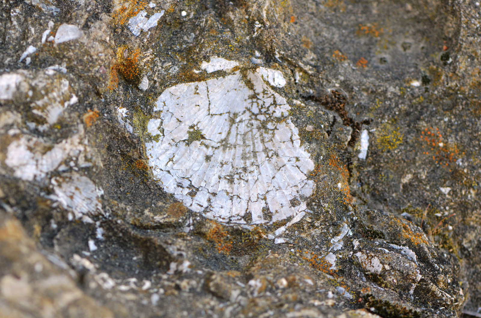
All the while, the shells kept piling up: clams, scallops, sand dollars, and snails mixed together, breaking apart, and settling on the shoreface.
Those shells, pebbles, and sand grains would, over time, cement together to become the middle section of a body of rock called the Briones Formation. More than 700 feet thick in places, the rock is notable because it contains a high concentration of smashed mollusks called shell breccia or shell hash. And on a hot and windy October afternoon, Ashley Adams, an interpreter with the East Bay Regional Park District, lovingly hoists a big chunk of it into the air for all to see.
“We like to say every rock has a story to tell and geologists know the language,” she says.
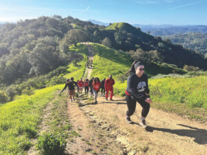
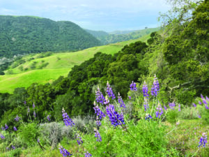
We are in the Las Trampas Wilderness Regional Preserve, a swath of land in the East Bay Hills across the San Ramon Valley from Mount Diablo. Adams’ enthusiasm for all aspects of the place abounds. It’s October, which is raptor season and tarantula season, she says. Strokes of blue, red, and orange punctuate the dry brown grass, evidence of the last lupine, California fuchsia, and poppy wildflowers of the year. She reels off other park highlights throughout the seasons: animal tracking, salamandering, fossil hunting.
“It’s my favorite park,” says Adams of Las Trampas. “It’s the hidden jewel of the District because it has everything.”
Today, we’ll tour the preserve’s distinctive geology, including the shell-rich rocks of the Briones Formation, which coalesced millions of years ago. Adams and I head out from the staging area on the Rocky Ridge View Trail. The Army built the road, a reminder that the area was a Nike missile site during the Cold War. As I huff and puff up the slope, Adams points out a fence lizard that just missed chomping on a butterfly. She’s not a linguistic interpreter, she notes, but a geologic one. She translates Las Trampas’ history, biology, and yes, rocks, to help visitors gain a deeper understanding of the park.
Adams recently designed and led a nature tour called “Radical Raptors of Las Trampas,” and she spots a couple of harriers that seem frozen in place, riding the updrafts above Rocky Ridge. It’s the only hunting we see today, but the name “Las Trampas” means “the traps” in Spanish, and some believe it refers to a strategy, used by Ohlone, of driving elk and antelope into the canyons for easier pickings.
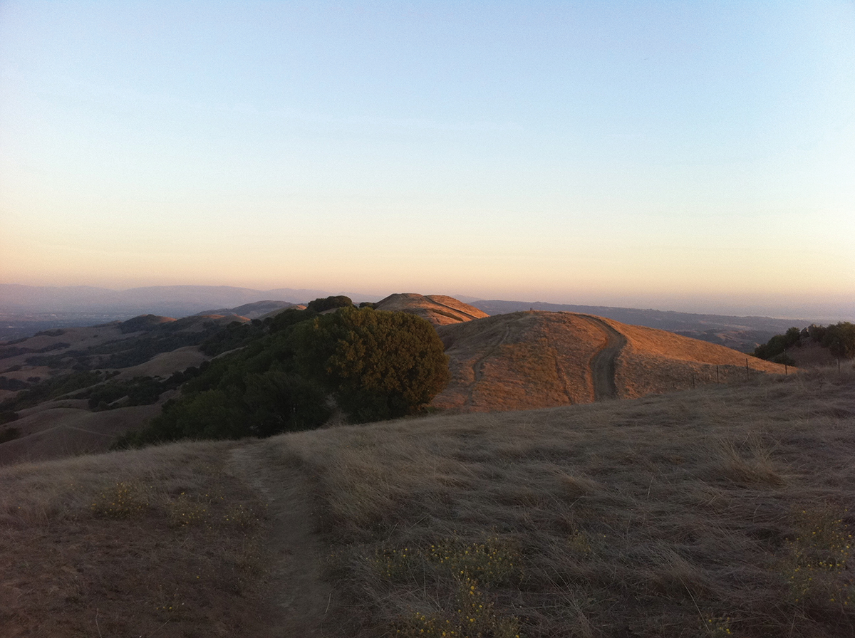
Half a mile up the road, we turn left onto a dirt path, the Cuesta Trail. Last year, Adams and her colleagues released an interactive, 360-degree virtual reality view of Las Trampas from a vantage point near this intersection. The spot is ideal, giving a splendid view of the park’s two most distinct features: the Rocky and Las Trampas ridges. Looking northwest up the canyon, you see Rocky Ridge on the left, covered with gently rolling slopes and lots of grass; on the right sits Las Trampas Ridge, more rugged and covered with shrubby chaparral.
“To me, it’s really fascinating,” says Adams. “You’re in the same valley but on either canyon wall it’s totally different: different rocks, different plants. And different plants give way to different birds and critters.”
These abrupt shifts in plant and animal types occur because distinct geologic layers of rock sit at the surface, and those different substrates determine what grows and lives there. Sedimentary rocks of the Contra Costa Group, deposited in a meandering river or floodplain environment, make up much of Rocky Ridge’s grass-covered northeastern face. By contrast, the older rocks of the Neroly Sandstone constitute the steep southwestern slopes of Las Trampas Ridge, which features a thick chaparral of native chamise, black sage, and buck brush. (Both rock types are younger than the Briones shell hash.)
A viewer can easily detect the transition between rock layers without seeing the underlying rocks, because the vegetation changes from grasses to chaparral so abruptly. No one knows exactly why the Neroly rocks encourage chaparral growth and the Contra Costa rocks grasses, but it may come down to moisture retention. The sedimentary Contra Costa rocks may hold water better than the Neroly.
How did the older Neroly rocks end up above the younger Contra Costa rocks, which, if geology were always neat and predictable, should have been deposited on top? It comes down to a phenomenon called “transpression.” Immense lateral pressure causes the ground to fold like an accordion, upward and downward—or to break outright, creating the cracks in the earth’s crust that we call faults. The region that contains Las Trampas, referred to as the East Bay Hills Block, has been squeezed this way between the Hayward and Calaveras faults for millions of years, buckling and breaking the rock layers, and occasionally pushing rock types from different geological periods right next to each other. Meanwhile, the middle Briones formation, with its layers of shell hash, forms the crests of both ridges, sticking out from the softer surrounding rock like the tilted, broken crust of a crème brûlée.

As we continue along the Cuesta Trail, we see evidence of that ancient ocean everywhere. You can occasionally find marine fossils elsewhere in the Bay Area, but here they’re ubiquitous. Nearly all rocks sticking out of the trail, it seems, contain fossilized shells or the impressions they’ve left.
We stop at a small clearing, probably scooped out of the hillside by a landslide. Behind it is a scarp—the steep bank left behind when part of the ground became liquid-like and flowed downhill. A few cows lying on the ground eye us lazily. The District allows them to graze on the land, helping to reduce the overall fire danger. Their grazing fills an ecological niche left vacant by the now-absent elk and antelope, Adams points out. They also eat invasive species that can grow taller than native ones and shade them out. And the paths they walk form parallel lines on the preserve’s tawny, grass-covered slopes that trace contours like Mother Nature’s own topographic map.
The playwright Eugene O’Neill moved to a property on the other side of Las Trampas Ridge after winning the Nobel Prize, and these patterns may have prompted him to describe the landscape as having a corduroy texture, inspiring the “Corduroy Hills” name associated with the area. (O’Neill wrote his last plays here, including The Iceman Cometh and Long Day’s Journey Into Night.)
Adams spots more fossiliferous rocks strewn throughout the clearing. “That is so many bivalves!” she exclaims. These are chunks of the Briones Formation—the shell hash—from higher up on the ridge. Typically, younger sediments are layered above older, but in this case a reverse fault—when one side of a crack in the earth rises above the other—thrust the older rocks on top of the younger ones. As a result, older Briones rocks now lie above younger Contra Costa rocks, and bits and pieces have crumbled off and migrated downslope.
We continue through a gulley where coast live oak and slender-leafed California bay trees grow in abundance thanks to the water that flows through (reduced to just a seep when we visit). As we navigate through more cows resting in the shade, we surprise a group of feral pigs rooting through the undergrowth, the adults and piglets crunching leaves underfoot as they quickly trot away.
We exit the grove and round a bend, walking off trail onto an overlook with a clear view down the canyon. This is our last stop before turning back, and it’s an opportunity to see most of the length of Las Trampas Ridge. It’s a stunning view: the canyon, the ridge, Mount Diablo looming in the distance. The park’s creation stems from the efforts of a local student group in the 1960s called SANE (Save America’s Natural Environment). The legacy of their work is as clear as the shift from grass to chaparral: not far down the canyon, past the preserve’s borders, houses begin to dot the landscape. A little farther you’ll find even more development cutting into the slope.
The Las Trampas preserve gives us a glimpse of an ever-changing East Bay, from its time in a prehistoric sea to a landscape constantly reworked by faults. It’s an ongoing story written by geology and biology—and now people. As we are occasionally reminded by the Bay Area’s earthquakes, the geology here also has the potential to rewrite human stories. The titanic forces constantly reshaping this landscape can be awe-inspiring—frightening, even. But as so many who have picked their way through the countless fossils scattered along the high ridge know, they are also a source of beauty and wonder.
Explore: Hiking Las Trampas
»Bollinger Staging Area—Las Trampas Wilderness Regional Preserve sprawls across more than 5,300 acres, making it one of the largest parks in the East Bay Regional Park District. Hikers, mountain bikers, and horseback riders all use its more than 40 miles of trails. The main entry into the preserve is via Bollinger Creek Road, which ends at the Bollinger Staging Area. A number of major hiking trails radiate from there.
At the staging area, look for the boulders placed throughout; they include great examples of shell hash and other fossil-rich rocks.
»Bollinger Creek Loop—For a relatively easy 1.5-mile hike with minimal elevation change, take the Bollinger Creek Loop from the north end of the staging area. One segment winds along the creek through trees and vegetation; on a recent walk, I was pelted with falling acorns. The other half of the loop is essentially an unpaved extension of Bollinger Canyon Road.
»Fossil Viewing on Rocky Ridge—The paved road heading up Rocky Ridge from the staging area is the most popular hiking route in the park. The grade varies but it ultimately ascends 800 feet in three-quarters of a mile—which most people will find steep enough to be a challenge going up (and a relief going down). The Rocky Ridge View Trail is ideal for viewing fossils. Once at the ridge crest, head south. The walking is easy, but be prepared for long stretches in direct sun. On a clear day, you can get stunning views in all directions, from Mount Diablo to San Francisco.
»Briones Shell Hash—Restricted EBMUD land parallels the trail but is accessible if you purchase a permit for a nominal fee; otherwise, you can admire its beautiful rock formations from afar. Walking south, you’ll find nice outcrops of Briones shell hash, both directly in the path and alongside it in large exposed beds, especially as you near the Elderberry Trail. When you turn onto that trail, you’ll pass sheer slopes created by the Bollinger Fault. Elderberry eventually leads back to the staging area, making a 4.75-mile loop.
»Las Trampas and Calaveras ridges—For a taste of the rugged Las Trampas Ridge topography, take the steep switchbacks of the Chamise Trail to the intersection of the Las Trampas Ridge and Calaveras Ridge trails. A short walk along Calaveras Ridge leads to a huge stone outcrop with a commanding view down Bollinger Canyon. Or take Las Trampas Ridge Trail to see the comparatively lush vegetation on the ridge’s northeast face. You can connect to the Bollinger Creek Loop Trail for a hike that comes in under three miles.
While it pays to be aware of rattlesnakes, scorpions, tarantulas, wasps, protective mother cows, and poison oak, Adams says, “the most dangerous thing out here is the sun.” Be sure to bring sun protection and plenty of water.
For a full map of the preserve visit: ebparks.org/parks/las_trampas