Climate change may sometimes seem like a far off event. But the state of California has pulled together evidence throughout the state that climate change is truly in the here and now.
In a recently released report — Indicators of Climate Change in California — the California Environmental Protection Agency (Cal/EPA) highlighted 36 indicators of climate change throughout California. By compiling the results of ongoing scientific research, the agency is showing that climate change is having a significant and measurable impact on the environment.
“[The report] makes it clear that climate change is not some abstract idea but that it is already having very real impacts on all parts of the state,” said Cal/EPA spokesperson Alex Barnum.
The climate change indicators — from massive wildfires in the Sierra Nevada to an earlier arrival of warblers at Point Reyes National Seashore — paint a picture of a very different California than the one in which most of us are accustomed.
“One of the things that was most striking to me was the decline in spring runoff to the Sacramento River,” said Barnum. “Spring run off has declined by 9 percent over the last 50 years and you know that that has potentially a big impact on California, on agriculture and on the water that cities get for their populations.”
The recent report updates a previous climate change indicators report from 2009, and adds seven more indicators that document impacts on wildlife and vegetation.
“The report is part of a broad effort that we’ve taken to both learn about the impacts of climate change and address them,” said Barnum.
“It is important to have scientifically rigorous research and information that we can use to make decisions on how we respond to climate change.”
California is one of the first states in the country to compile a set of indicators measuring the domestic impact of climate change. Underlying the report is a sense of urgency. As we now know, climate change waits for no one.
Here are the Top 10 signs from the report that climate change is really here in Northern California.
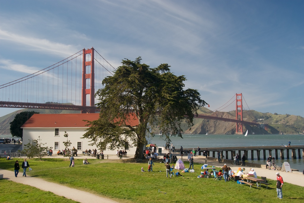
1. Crissy Field, San Francisco: Rising sea levels
Measured at the Golden Gate tide gauge in San Francisco’s Crissy Field, this indicator shows that over the last century, sea level along California’s coast has increased by an average of 7 inches. With higher temperatures, the thermal expansion of ocean water and the melting of glaciers and ice sheets has caused global sea levels to rise at nearly one- tenth of an inch each year. Sea level rise combined with storm surges could lead to potentially devastating impacts such as increased flooding, loss of coastal wetlands, erosion of cliffs and beaches and damage to fragile estuaries.
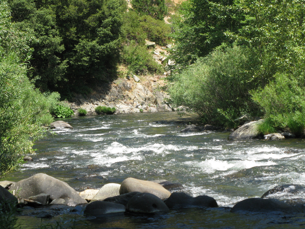
2. Sacramento River: Decline in spring run off from the Sierra Nevada
Over the past century spring, runoff into the Sacramento River and its tributaries has declined by 9 percent. The snowmelt comes from the Sierra Nevada and Southern Cascade mountains, which historically contribute approximately 35 percent of the state’s usable annual water supply for agriculture and urban use. Warmer winters mean less accumulation of snow, and the reduction in summer water flow.
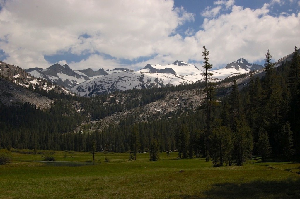
3. Sierra Nevada: Glacial melt
The surface area in seven Sierra Nevada glaciers including, Conness, Lyell, Darwin and Goddard has decreased over the past century and is indicative of a broader global trend in receding alpine glaciers. The Sierra Nevada glacier retreat has occurred mostly during extended periods of above average spring and summer temperatures. These changes are likely to have large scale ecological impacts as glaciers play an important role in alpine hydrology and provide flora and fauna with access to water late in the summer after seasonal snow has melted. Global glacier shrinkage is also a contributor to the sea level rise.
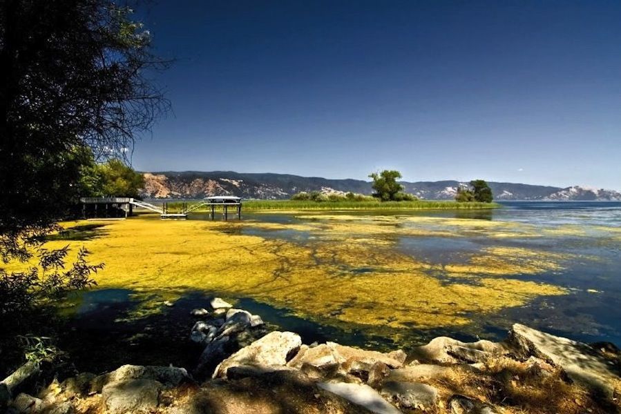
4. Clear Lake: Rise in lake water temperature
Clear Lake and four other lakes in California — Lake Tahoe, Mono Lake and Lake Almanor near Lassen Volcanic National Park — have experienced a significant warming trend in summer nighttime temperatures since 1992, with Clear Lake at the bottom of the list with an increase of 0.09˚F. That may not seem like much, but lakes are pretty sensitive and even slight changes in temperature could be responsible for upsetting the fragile ecology by creating algal blooms and conditions that favor introduced species such as largemouth bass.
5. Monterey Bay: Ocean acidification
The ocean absorbs nearly one-quarter of the carbon dioxide released into the atmosphere by human activity each year and as a result, the chemistry of seawater has become more acidic and the availability of calcium carbonate has decreased. That impacts the ability of shell-bearing sea life, corals and other marine organisms to construct skeletons or protective structures such as shells. This in turn impacts larger fish species who depend on creatures such as marine snails for food.
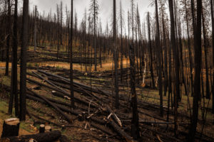
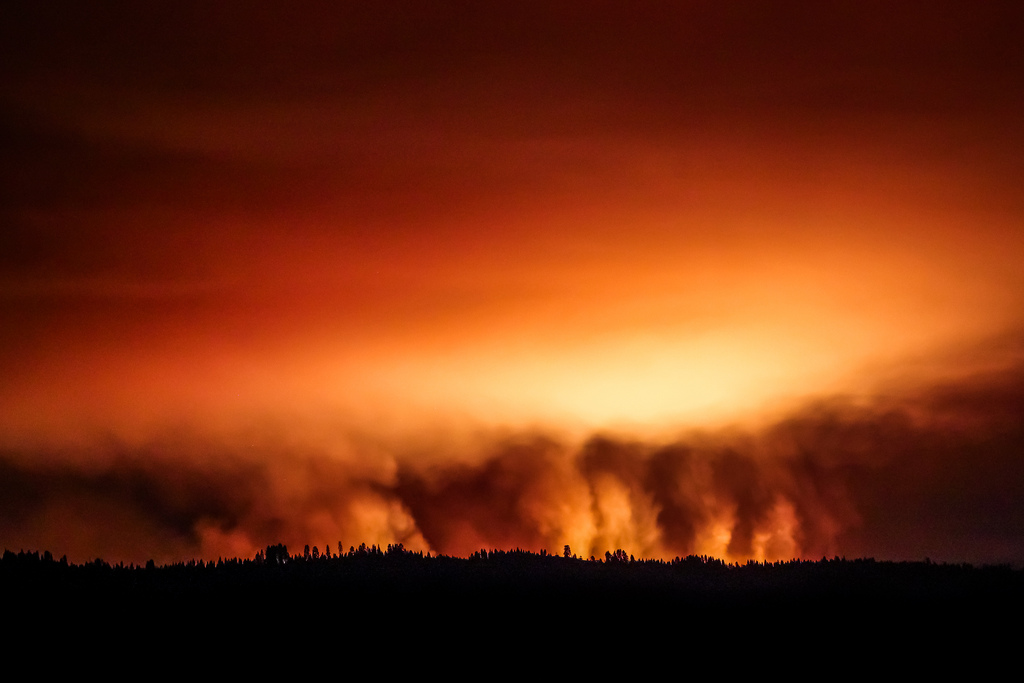
6. Yosemite National Park: Massive wildfires
As this year’s Rim Fire in Yosemite and Stanislaus National Forest demonstrate, California is extremely vulnerable to massive wildfires. The frequency of large wildfires (1000 acres and greater) and the length of the fire season are increasing in California. In 2003 there were four times as many large wildfires than in 1987, and the total area burned during that time period was six times greater than an earlier timespan (1970-1986). As a result of more frequent wildfires, forest composition changes have turned many of California’s natural carbon sinks — namely forests — into carbon dioxide emitters.
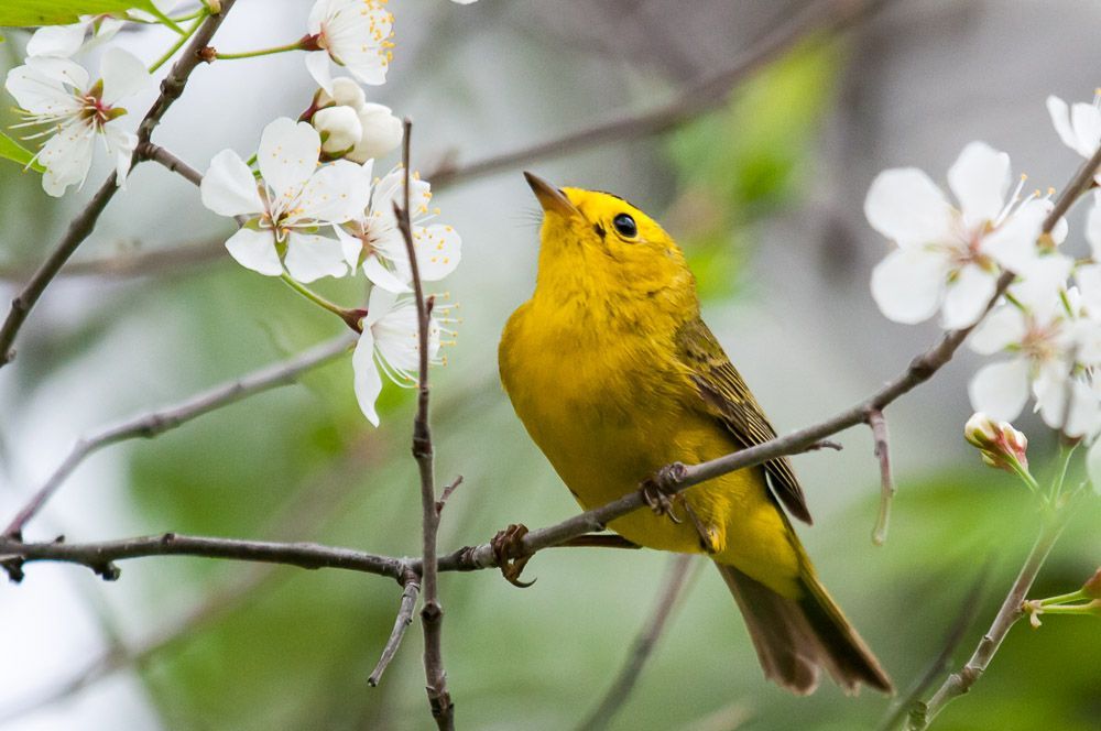
7. Point Reyes National Seashore: Change in Migratory Bird Patterns
Scientists at the Palomarin Field Station in Point Reyes have been observing Wilson’s warblers for more than 36 years. Long term research is showing that the warblers are arriving much earlier in the spring, a pattern also seen in several other songbird species. The likely culprit: higher temperatures.
8. Solano County: Earlier spring flights for butterflies
In Solano and two other study sites — Sacramento and Yolo counties — the average date of the first flight of 23 butterfly species has become earlier in the spring over the past four decades. The date of the first flight (DFF) is defined as the date in which the first adult of the species is observed in the field in a given calendar year. The shifting start-dates of these species is directly related with the hotter and drier conditions in recent decades.

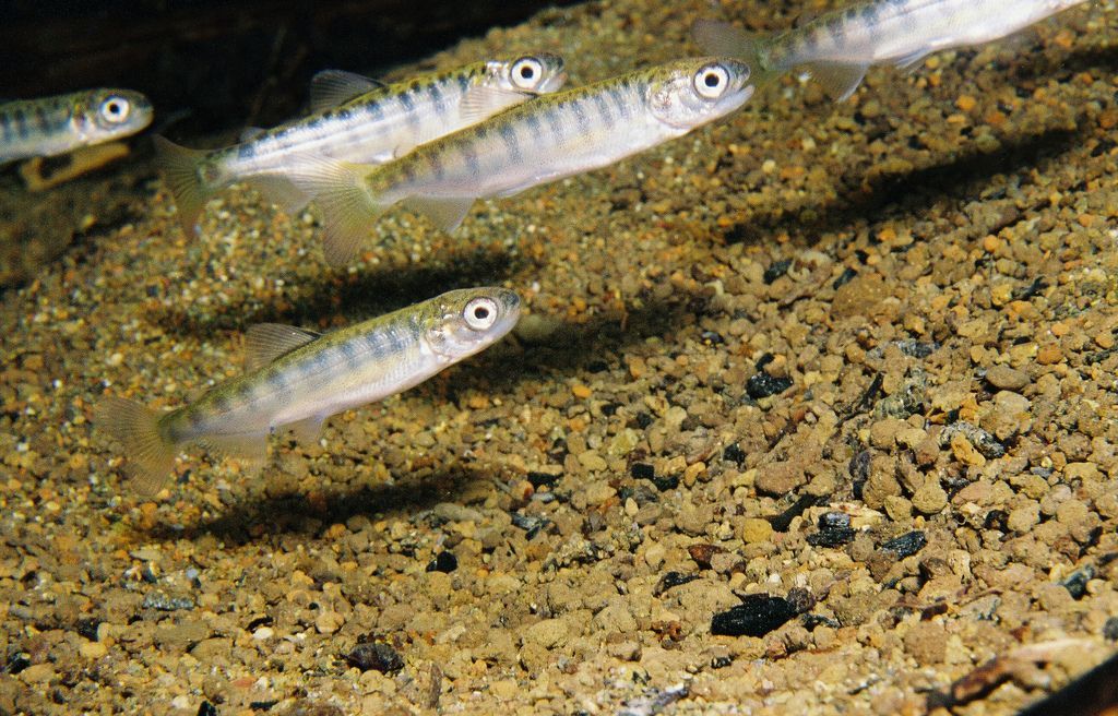
9. Sacramento River: Decline in chinook salmon
Although fall run chinook salmon abundance fluctuates year to year, it has declined dramatically since 2004 in the Sacramento River. The distribution of krill and other prey in the Gulf of the Farallones — a vast marine area off the Northern California coast — is related to the abundance of adult salmon two years later. In recent years there has been less krill in the Gulf meaning less food for juvenile salmon to feed on and subsequently, a decline in Chinook Salmon populations.
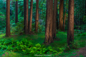
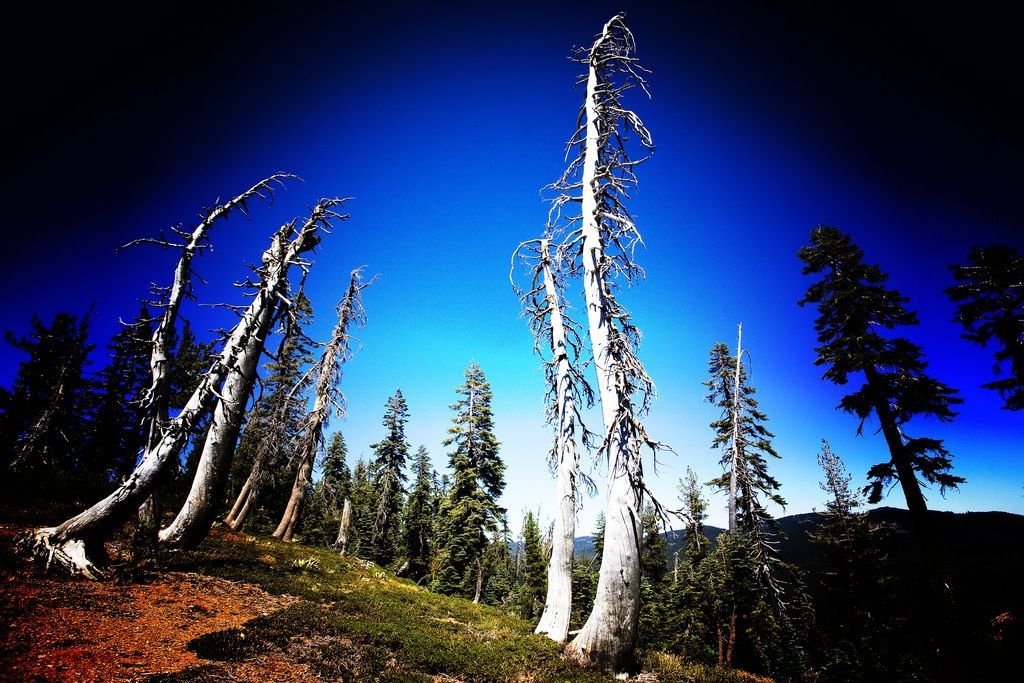
10. Sierra Nevada: Changing vegetation patterns in forests
As conditions at lower elevations warm, conifer- dominated forests of the Sierra Nevada have been retreating upslope over the past 60 years, leaving in their wake a transition to oak and chaparral vegetation. This not only has resounding consequences for other species in the forest ecosystem, but with the domination of oak, areas dry out more quickly and are therefore more susceptible to wildfires.
Alessandra Bergamin is a Bay Nature editorial intern.