The 2014-15 rainfall season was a head-spinning array of meteorological extremes that set records, raised and then dashed hopes for an end to the state’s three-year drought, and possibly—just possibly—gave us a hint of California’s climate-change future.
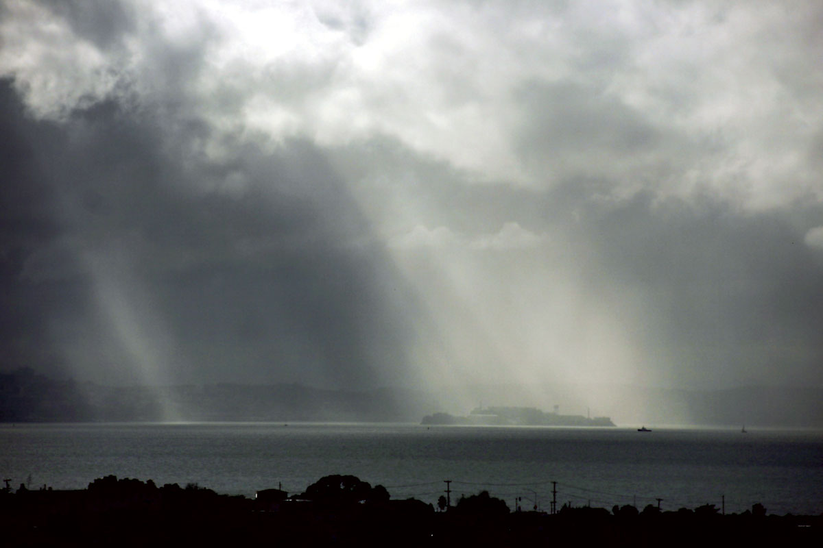
First, 12 inches of rain fell in the Bay Area between Thanksgiving and Christmas, a record-setting 469 percent of normal that stoked speculation about a wet winter. But in January, usually our wettest month, the atmosphere went dry, completely dry, with nary a raindrop falling—another record set, but a very unwelcome one. In early February two drenching Pineapple Express storms revived hopes for at least an average year. However, after three days the skies ran dry once again. In a “normal” winter we get over 70 days of rain spread out over five months. This year, in stark contrast, 90 percent of our rain fell in just five days.
So what’s going on? Over the past two years, we’ve been hearing a lot about the ridge of high pressure that has blocked our winter storms and helped cause our current drought. But now scientists are gaining a better understanding of a second, related question: When it is wet, why is it really, really wet? Current climate change research suggests California’s weather could become even more variable than in the past, a “new normal” of drier dry periods punctuated by wetter winter storms.
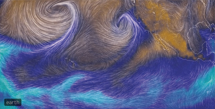
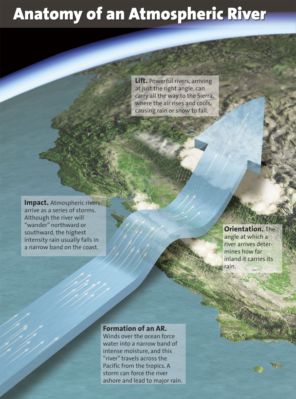
One reason for the extreme wetness is that an increasing percentage of our rain in the last few years has come from “atmospheric rivers” — long, narrow, river-like filaments of moist air, stretching thousands of miles across the Pacific from the deep tropics, that can bring extraordinarily heavy rainfall to the West Coast, according to the National Oceanic and Atmospheric Administration (NOAA). You can compare these “rivers in the sky” to, say, the Mississippi River, flowing a thousand miles through the heart of North America before dumping huge amounts of water into the Gulf of Mexico, except scientists say an atmospheric river may carry 10 or 15 times more water than Old Man River. (If you want to do the math, the average flow of the Mississippi at New Orleans is 600,000 cubic feet per second.)
Atmospheric rivers, commonly abbreviated as ARs, aren’t actually rainstorms themselves. Rather, they’re a product of the earth’s heat-balancing act, the natural process of moving heat and moisture from the tropics to higher latitudes. It’s only when an atmospheric river combines with a Pacific storm that ARs become energized into super-storms like those that drenched the Bay Area in December 2014 and February 2015. Because most of our winter storms are created over the Pacific from the dynamic mixing of cold arctic air from Alaska and warmer air from the mid-latitudes (north of the Hawaiian Islands), they consist of two distinct parts, one warm and one cold; commonly, most precipitation falls from the warm front since warm air holds more moisture than cold air does. The difference between a normal Pacific storm and an AR event is that the latter has an extensive river-like warm sector that delivers vast amounts of moisture directly from the warm and wet tropics.
West Coast meteorologists had long been baffled as to why some winter storms produced so much more rain than others. But over the last decade and a half, scientists have started to understand the complicated conditions that create an atmospheric river storm. In 1998—a huge year for rain in California—scientists began a series of airplane flights through winter storms over the California Coast Ranges and the Sierra Nevada. These “Hurricane Hunter” flights discovered extraordinarily large amounts of water vapor embedded in strong air currents, rolling off the Pacific at around 6,000 feet in altitude, uncommonly low compared with the usual Pacific storms.
Around the same time, researchers from the Massachusetts Institute of Technology, using brand-new satellite remote sensing imagery, found scores of long, narrow, river-like air masses moving vast amounts of heat and moisture from the tropics into the mid-latitudes—“atmospheric rivers.” West Coast scientists wondered if this new atmospheric river concept might be the answer to their long-standing question about why some winter storms are much, much wetter than others. Being able to answer this question would not simply satisfy scientific curiosity, but would allow them to more accurately warn water management and emergency response agencies of incoming dangerously wet weather.
While discovering the role atmospheric rivers play in transporting tons of water vapor across the sky was significant, another critical question remained, and that is how the water vapor in an AR is transformed into a liquid state, resulting in rain and snow. For an atmospheric river to really pour, something has to happen to get the water out of the clouds, into raindrops, and down to the ground. And that something, it turns out, is a gathering of water molecules around tiny particles known as aerosols, which are the very seeds of rain and snowfall. But aerosols come in many varieties—both natural, like oceanic salt spray, desert dust, and volcanic ash, and human-generated, like soot from autos and factories. Determining which of these aerosols are more likely to attract water molecules and which are not is a major scientific quest.
To answer questions about the character of atmospheric rivers and what kind of aerosols they carry with their tropical water vapor, NOAA, NASA, the Scripps Institution of Oceanography, and UC San Diego began a two-year expedition in 2009 known as CalWater1. The groups collected aerosol and precipitation data both in the air, by flying planes through the storms, and on the ground, through a new network of ground stations. The results were startling.
Although by definition all ARs transport huge amounts of water vapor, there can be massive differences between the amount of rainfall actually precipitated from different AR events. While some storms drop only 2 percent of their water vapor, others can precipitate seven times that amount. Two of the storms that were studied had identical water vapor content, but one storm dropped 40 percent more than the other, a difference on the ground that amounted to 1.5 million acre-feet of water, more than the city of San Francisco uses in a year. So what was the difference between these two AR storms?
Aerosols, yes, but not just any aerosols. The wetter storm was laden with dust from the Taklamakan Desert in northwestern China, while the drier storm had none of these microscopic water-friendly particles. Professor of chemistry Kim Prather and her lab at UC San Diego have determined that the Taklamakan Desert aerosols actually contained unique organic compounds that were extraordinarily water vapor friendly, much more so than the more common array of marine salt aerosols.
The implications from Prather’s finding are huge. If dust aerosols from the desert in China seeded that one storm, they’re probably seeding others. If Taklamakan dust has been seeding California AR storms for centuries, which we infer to be the case based on the accumulation of Asian desert dust in the Sierra Nevada mountains, what if the desert’s supply of that water-friendly dust is finite or—worse yet—paved over or eliminated by industrial activity?
Rivers and aerosols may produce the right conditions for a drenching winter storm, but it’s also important to try to predict how those storms will hit us and how much water they’ll drop here. To start answering those questions, researchers needed to understand just how atmospheric rivers land in Northern California.
Climatologists say that during a normal rainfall season around 20 atmospheric rivers combine with Pacific storms to strike the West Coast, with most ARs making landfall in Oregon and Washington while just four or five affect California north of Monterey Bay. (Few atmospheric rivers visit Southern California.) But because of the persistent high-pressure ridge for the last three winters, that number has been reduced. During the 2014-15 rainfall season the Bay Area and Northern California had only three atmospheric river events: one in late November; the strongest of the season, on December 11; and then the third, a double-barreled AR on February 7-9. At least five other atmospheric river storms were shunted northward to Washington state by the ridge.
Analysis of California’s daily precipitation records suggests that normally ARs contribute 30 to 50 percent of our seasonal rainfall, with the remainder coming from the weaker, cyclonic storms that brew over the North Pacific. But in the last several drought-plagued years ARs have accounted for around 80 percent of our meager seasonal rainfall. So while ARs bring with them the threat of severe flooding, water managers increasingly see them as an essential contribution to the state’s water supply.
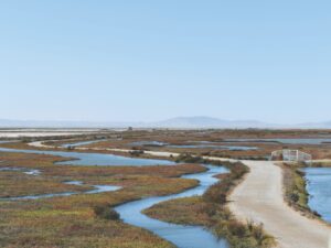
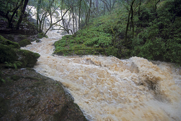
Nonetheless, atmospheric rivers have indeed wreaked havoc in the Bay Area, particularly in the Russian River basin, where they’ve been responsible for 37 of the past 39 floods during the 20th century. Heavy rains created the New Year’s flood of January 3, 2006, when the Russian River crested 10 feet above its 32-foot flood stage at Guerneville, while nearby Santa Rosa measured 17 inches of rain in less than a week. During the December 2014 and February 2015 AR events, more than 10 inches of rain fell within 24 hours, but flooding was minimal because the region’s parched soils sucked up the copious rainfall before it ran off into streams and rivers.
Not surprisingly, the Bay Area’s diverse topography exerts a strong influence on the amount of rain deposited by an AR — as it does with regular storms, too—with more rain falling in higher places as a result of what meteorologists call the orographic effect: Rainfall increases with elevation because air masses are cooled as they rise over hills and mountains, a process that lessens the moisture-holding capacity of an air mass. For example, during the December 11, 2014, AR event the venerable San Francisco rain gauge at the Old Mint measured 3.4 inches of rain in 24 hours. Across the Bay in the Oakland-Berkeley hills, at around 1,000 feet, that amount was closer to 5 inches. Higher still in the mountains west of Healdsburg, the Venado gauge measured 7.5 inches. These rainfall intensity rates—the amount of rain that falls during a given period of time—put our AR West Coast storms right up there with the intense downpours associated with tropical typhoons and hurricanes.
Topography also matters when you consider a storm’s directional approach, which hydrologist Marty Ralph of the Center for Western Weather and Water Extremes at Scripps calls the “angle of attack.” Do the AR winds meet the Coast Range mountains head-on, at a true 90-degree perpendicular? If they do, heavier rainfall results, due to the orographic effect. A good example would be when southwesterly AR storm winds flow over the southeast-northwest trending Santa Cruz Mountains, dumping more rain onto the slopes, rain that then drains into the San Lorenzo River, which then floods downtown Santa Cruz.
The angle of attack also determines how far inland AR moisture travels and whether or not it will add to California’s or other states’ water supply. Those storms that arrive just north of the Golden Gate usually go through a gap in the mountains near Petaluma known as the Petaluma Gap and proceed into the Sacramento Valley, then northward along the Sierra front, dropping rain and snow that will collect in Oroville and Shasta Lakes.
Global climate change computer models have long been unclear on whether Northern California will receive more or less rainfall in our climate-changed future. Those same models, however, have been remarkably consistent in projecting increased variability, with more extremes in our already highly variable rainfall. Has that future actually arrived, given the erratic dry and wet pattern of the last several years, winters of alternating “ridges” and “rivers”? There’s not yet a consensus from the scientific community, but at least some experts think so. “Under current climate scenarios, atmospheric rivers will hit Northern California twice as often by 2100 as they do now,” said USGS hydrologist Mike Dettinger at the December 2014 meeting of the American Geophysical Union. “When the atmosphere is warmer it holds more water, so there will be a huge increase in these atmospheric rivers.”
With more pressing questions to answer about atmospheric rivers and aerosols, a 22-member science team, backed by an array of agencies and universities, launched CalWater2 in December 2014. Once again Hurricane Hunter aircraft arrived from Florida while research vessels headed out to sea. Unfortunately, there were no storms at all in January 2015. But then the atmospheric river arrived in early February, sending researchers out into the torrential rain to collect data in the air, on the ground, and at sea, making it perhaps the most studied storm in California’s history.
CalWater2 will run for several more years, until 2018, and scientists hope that conditions will shift enough during that time to give them a few more atmospheric river storms to study. Of course, they’re not the only ones. Almost everyone in the state, from farmers and fisherman to water agency officials and golf course managers, is hoping and praying that we’ll get a few wet winters to replenish our dwindling water supplies and bathe our parched landscapes.