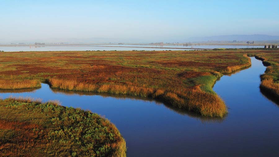
While the primary goal of the restoration of wetlands around San Francisco Bay has been to restore a degree of biological diversity to the Bay, a significant additional benefit has been the increase in access for nature-based recreation at many of these restoration sites. Following is a listing of many of the sites where you can get out and see different stages of the restoration process while you’re stretching your legs and observing wildlife.
Jump right to the site descriptions:
All of these wetland restoration sites are:
- Accessible to hikers and bicyclists
- Great for bird watching
- Protective of wildlife: Rules prohibit off-trail travel and restrict access for dogs (dogs must be on leash and are not allowed in some places and/or at some times of year; check with the managing agency for rules about dogs).
- Exposed: sunny, foggy, windy, etc.
- Flat
Many are:
- Near noisy infrastructure: freeways, highways, airports
- Changing: Trails may occasionally be closed due to ongoing restoration work, trail/facility construction or maintenance, wildlife concerns, seasonal flooding, etc. Check with the managing agency for current conditions.
- Muddy in the rainy season
- Part of the 500-mile Bay Trail system
Some are:
- Wheelchair accessible
- Accessible via public transit: Consult local transit agencies or TransitandTrails.org
General educational resources:
- Audio/video tours of Bay wetland restoration sites
- Bay Trail website with online maps for computers and mobile devices
- San Francisco Bay Shoreline Guide, Second Edition, State Coastal Conservancy, University of California Press, 2012
- “Highway to the Flyway,” Bay Nature special supplement, July-September 2007
- “South Bay Challenge: Reclaiming the Salt Ponds for People and Nature,” Bay Nature special supplement, October-December 2004
- Video: “From Salt Ponds to Wetlands,” KQED QUEST: http://science.kqed.org/quest/video/from-salt-ponds-to-wetlands/
NORTH BAY
Green Island Unit, Napa–Sonoma Marshes Wildlife Area
(formerly the Napa Plant Site)
Located near American Canyon, Napa County
Managed by the California Department of Fish and Wildlife (CDFW)
This once-extensive marshland along the Napa River in American Canyon was first diked for agricultural use and then converted to commercial salt production ponds. Now the ponds are being restored to tidal marsh habitat for endangered wildlife species, with picnic sites and access for wildlife viewing and hiking on a few miles of the Bay Trail along the edge of the restored wetlands.
To get there: From Hwy 37, exit at Sonoma Blvd. (Hwy 29), and head north. Go 2.5 miles and turn left on Rio del Mar, then immediately turn right on Eucalyptus Drive. Go about a mile on Eucalyptus Drive to the small parking lot on the left.
More information:
- Napa-Sonoma Marshes Wildlife Area (CDFW)
- Napa Sonoma Marshes Wildlife Area Green Island Unit Restoration Project (San Francisco Bay Joint Venture)
- Video–Napa Sonoma Marshes Wildlife Area restoration (Your Wetlands)
Tubbs Island/Tolay Creek Marsh
Located near Sears Point, southern Sonoma County
Managed by the US Fish and Wildlife Service (USFWS)
The 8-mile (out and back) segment of the Bay Trail at Tubbs Island takes you worlds away from busy Hwy 37 and along levees between wetlands to the west and agricultural lands to the east. A tidal marsh enhancement project completed in 2010 opened channels and improved the health of the wetlands. Birds and other wildlife are abundant in this remote-feeling part of the San Pablo Bay National Wildlife Refuge.
To get there: Note: Access is from eastbound Hwy 37 only. From the intersection of Hwys 121 and 37, go 1/2 mile east on Hwy 37. Turn right into the unmarked turnout that leads to a small parking lot.
More information:
- San Pablo Bay National Wildlife Refuge (US Fish and Wildlife Service)
- Tubbs Island trail description (Bay Area Hiker)
- Tidal marsh enhancement at Tubbs Island (Audubon California)
Cullinan Ranch/Pond 1
Located west of Mare Island, western Solano County
Managed by CDFW (Pond 1) and USFWS (Cullinan)
Walking along the 1.3-mile levee-top trail between Pond 1 to the west and Cullinan Ranch to the east provides an ongoing ecology lesson. Once tidal marshes with deep water channels, these areas were diked for hay and grain farming in the mid-1800s and subsided almost six feet below sea level. The Pond 1 area was converted to salt production in the 1950s, while Cullinan Ranch was an active ranch until the early 1980s, when the site was proposed for a 1,500-home and marina development. Both are now returning to their marshy ecological roots. After levees are breached, sediment carried in by the Napa and Sacramento-San Joaquin Rivers will slowly build the land back up, and native marsh vegetation will recolonize it. Pond 1 was flooded first; Cullinan Ranch, currently dry, will initially become a 1,500-acre shallow lake when its levees are breached in early 2014. In addition to the trail, the site offers a canoe/kayak launching dock and a universally accessible pier for fishing and wildlife viewing.
To get there: Note: Access is from westbound Hwy 37 only. On westbound Hwy 37, go 3.5 miles west of the Mare Island Bridge to a turnout leading to a small parking lot on the right.
More information:
- Cullinan Ranch Restoration Project website
- Tour Guide–Napa-Sonoma Marshes Wildlife Area, Napa River Unit (California Department of Fish and Wildlfe)
- San Pablo Bay National Wildlife Refuge (USFWS)
Hamilton Wetland Restoration Area
Located in Novato, Marin County
Managed by the California Coastal Conservancy & US Army Corps of Engineers
A two-mile segment of the Bay Trail bordering this dramatic restoration site offers a sweeping overview from its high point on Reservoir Hill and wetland-level intimacy along most of its length on the western edge of the former Hamilton Airfield. That airfield, completed in 1935, was once part of a vast tidal marsh that was diked for farming a century ago. When the base closed in 1988, much of it was redeveloped for housing, businesses, and parks. But the eastern portion surrounding the old runway is being restored to wetland with the importation of dredge sediment from the Port of Oakland. Though part of the site is currently dry, it will be flooded when the levee is breached in 2014-2015. The current view, which includes the grading work to shape the floor of the wetland, is fascinating and instructive.
To get there:
Bay Trail from high point on Reservoir Hill: From US-101 northbound, take the Nave Drive exit. Follow Nave Drive to Main Gate Road. Turn right on Main Gate Road. Or from US-101 southbound, take the Bel Marin Keys Blvd. exit. Cross over 101 and turn right on Nave Drive. Head south on Nave Drive to Main Gate Road. Turn left on Main Gate Road.
Follow Main Gate Road, which turns into Palm Drive, to the intersection of Palm Drive and Palm Drive South (at the Novato Art Center). Take the left fork (Palm Drive), then turn left on N. Hamilton Parkway and look for a small parking lot at the trailhead on the right. There is additional parking across the street from the Novato Arts Center.
The trail heads uphill half a mile to an overlook, then downhill to connect with the 1.3-mile Hamilton Levee Trail.
Bay Trail at wetland level (Hamilton Levee Trail): From US-101 northbound, take the Nave Drive exit. Follow Nave Drive to Main Gate Road. Turn right on Main Gate Road. Or from US-101 southbound, take the Bel Marin Keys Blvd. exit. Cross over 101 and turn right on Nave Drive. Head south on Nave Drive to Main Gate Road. Turn left on Main Gate Road.
Follow Main Gate Road as it turns into Palm Drive and stay left at the intersection with Palm Drive South (at the Novato Art Center). Continue on Palm Drive to Hangar Avenue and turn right. Follow Hangar Avenue to the end, and park in the lot for South Hamilton Park. Walk south to the end of the block and onto the wide paved trail, which turns left along the levee.
More information:
- Hamilton/Bel Marin Keys Wetlands Restoration (California Coastal Conservancy)
- Video on dredge materials used at the Hamilton Wetlands Restoration Project (KQED)
EAST BAY
Richmond Shoreline (Point Isabel to Meeker Slough)
Located in Richmond, Contra Costa County
Managed by East Bay Regional Park District (EBRPD)
This one-mile segment of the Bay Trail showcases important remnant and restored wetlands in an area once dominated by heavy industry. The paved trail is built on an old railroad levee that follows the Bay and distances itself from the sounds of I-580 as it heads north from Point Isabel. Along the way, there are intimate views of Hoffman Marsh, Western Stege Marsh, and Meeker Slough on either side of the trail, as well as panoramic views of the Bay. Good birdwatching opportunities, particularly on the Bay side.
To get there: From I-580 or I-80 in Richmond, take the Central Avenue exit and head west, then go north on Rydin Road and park at Point Isabel Regional Shoreline. Follow the Bay Trail to the north (another branch of the trail loops through the off-leash dog park at Point Isabel).
More information:
Martin Luther King Jr. Regional Shoreline
Located in Oakland, Alameda County
Managed by EBRPD
In San Leandro Bay, an area that lost nearly 97 percent of its wetlands, Martin Luther King Regional Shoreline’s Arrowhead Marsh and New Marsh provide important habitat on the Pacific Flyway. While it is in between the Oakland Airport and an area of warehouses and office buildings, the birds don’t seem to mind at all. After tidal flow was restored to 71 acres of filled wetlands in 1998, native plants recolonized the marshes along with both migratory and resident shorebirds and waterfowl. A paved trail from the parking lot leads to a short boardwalk extending over Arrowhead Marsh. In the opposite direction, another segment of paved trail skirts New Marsh.
To get there: From I-880 in Oakland, exit at Hegenberger Road and head west. Turn right onto Doolittle Drive (Hwy. 61) and right again onto Swan Way. Turn left into the park for access to the trails, a large grassy play area, picnic areas, and the boardwalk out to Arrowhead Marsh.
More information:
Hayward Regional Shoreline
Located in Hayward (north of Hwy 92), Alameda County
Managed by EBRPD (Hayward Shoreline Interpretive Center managed by Hayward Area Recreation & Park District)
Hayward Regional Shoreline’s 1,811 acres of marsh—freshwater, brackish, and saltwater—offer opportunities to see the results of wetland restoration 15 to 30 years out. Five miles of gravel trails, mostly along levee tops, skirt former salt ponds now returned to marshland and recolonized by native plants and wildlife. Oro Loma Marsh, near the northern end of the shoreline park, is a tidal marsh with seasonal wetlands as well as uplands; Cogswell Marsh, in the southern central part of the park, is saltwater; and Hayward Marsh, near the Hayward Shoreline Interpretive Center in the south, has both fresh and brackish water habitat and is fed by treated wastewater.
The Hayward Shoreline Interpretive Center showcases the marsh environment in its indoor exhibits and via an observation platform and deck outside the center. The Bay Trail runs from the center’s parking lot to the northern end of Hayward Regional Shoreline past Oro Loma Marsh.
To get there:
To access the northernmost staging area (near Oro Loma Marsh): Take I-880 and exit at Washington Avenue. Go south on Washington Avenue and right on Grant Avenue to the parking lot on the right at the west end of the street.
To access the central area of the shoreline (near Cogswell Marsh): Take I-880 and exit at West Winton Avenue. Follow West Winton until it ends at the parking lot.
To access the southern end of the shoreline (near Hayward Marsh) and the Hayward Shoreline Interpretive Center: From eastbound Hwy 92, exit at Clawiter Road/Eden Landing Road (just east of the toll plaza), turn left on Clawiter and left on Breakwater Ave. Follow Breakwater to the Interpretive Center at 4901 Breakwater.
From westbound Hwy 92, exit at Clawiter Road/Eden Landing Road (just east of the toll plaza), and cross Clawiter. Turn left on Breakwater Ave and follow it to the Interpretive Center.
The trail starts outside the center; the center itself is currently open Saturday and Sunday, 10 am – 5 pm (510-670-7270).
More information:
- Hayward Regional Shoreline (East Bay Regional Park District)
- Hayward Shoreline Interpretive Center (Hayward Area Recreation and Parks District)
- Virtual tour–Hayward Shoreline
- Audio tour–Hayward Shoreline (Your Wetlands)
- Podcast–Hayward Regional Shoreline (East Bay Regional Park District)
Eden Landing Ecological Reserve
Located in Hayward (south of Hwy 92), Alameda County
Managed by CDFW
At Eden Landing Ecological Preserve, which is part of the South Bay Salt Pond Restoration Project, more than 600 acres of former salt ponds are being restored to salt marshes, tidal wetlands, and managed ponds through the efforts of the California Department of Fish and Wildlife and Save the Bay. Along three miles of gravel trail, visitors can look out over the ongoing restoration, which is creating habitat for threatened and endangered species as well as thousands of other birds and wildlife. Future plans include construction of a kayak launch and a trail extension to the edge of the Bay as well as connections to Bay Trail segments to the north and south.
To get there:
From westbound highway 92, take the Clawiter Rd/Eden Landing Road exit. Turn left at the light, go over the overpass, and continue straight at the stop sign onto Eden Landing Road. Follow Eden Landing Road to the trailhead at its end, near the intersection of Arden Road.
From eastbound highway 92, take the Clawiter Rd/Eden Landing Road exit and turn right on Eden Landing Road at the stop sign at the end of the off ramp. Follow Eden Landing Road south to the trailhead at its end near Arden Road.
The trail can also be accessed near the northwest corner of Gordon E. Oliver Eden Shores Park at 2841 Seahaven Court in Hayward.
More information:
- Eden Landing (South Bay Salt Pond Restoration Project)
- Audio tour–Eden Landing Ecological Reserve
- Virtual tour–Eden Landing trail
SAN FRANCISCO
Heron’s Head Park
Located in San Francisco, Hunter’s Point
Managed by the Port of San Francisco
Heron’s Head Park is on a narrow peninsula that didn’t exist 100 years ago; it was created with fill brought in to build a shipping terminal. When the terminal project was abandoned, nature took over and the “new” land became salt marsh, attracting large numbers of birds. The Port of San Francisco and the nonprofit Literacy for Environmental Justice enhanced the site in the late 1990s by removing debris, adding native plantings, and constructing a tidal channel, a picnic area, a fishing pier, and a 3/4-mile-long trail offering salt marsh views on the south side of the peninsula. The park also boasts an educational eco-center.
To get there: From 101, take the Cesar Chavez/Army Street exit. Go east on Cesar Chavez, turn right on Third Street and left on Cargo Way, which dead ends at Jennings Street and the park entrance.
More information:
- Heron’s Head Park (Port of San Francisco)
- “Growing a Greenway in Hunter’s Point: Heron’s Head Park,” Bay Nature, April-June 2006
PENINSULA/SOUTH BAY
Bair Island
Located in Redwood City, San Mateo County
Managed by USFWS (Don Edwards San Francisco Bay National Wildlife Refuge)
Bair Island, actually three islands separated by sloughs, is returning to its roots as a tidal wetland after nearly a century of use for cattle grazing, salt production, and proposed residential/office development. The 1,400-acre restoration project is well underway; it currently includes a new pedestrian/bicycle bridge and a one-mile loop trail on Inner Bair Island for viewing the work in progress and looking across the slough at restored Middle Bair Island. Inner Bair Island is currently dry, but plans are to breach the levee by the end of 2013, and also to construct a longer trail as well as viewing platforms. Now part of Don Edwards San Francisco Bay National Wildlife Refuge, Bair Island is one of the Bay Area’s most popular shoreline areas, both for people (250,000 visitors each year) and for wildlife (home to over 150 species of birds and other wildlife).
To get there: From US-101, exit at Whipple Avenue, head east on Whipple–which turns first into E. Bayshore Road and then beyond a traffic roundabout into Bair Island Road–to the paved lot south of and adjacent to the Bair Island Marina parking lot. Walk a short distance north on Bair Island Road (now Uccelli Blvd.) to the pedestrian bridge for Inner Bair Island.
More information:
- Bair Island Restoration Update (US Fish and Wildlife Service)
- Bair Island Restoration (City of Redwood City)
- Don Edwards San Francisco Bay National Wildlife Refuge brochure
- “Raising Bair Island,” Bay Nature, October 2008
Bedwell Bayfront Park
Located in Menlo Park, San Mateo County
Managed by the City of Menlo Park
Even landfills are not safe from development. Bedwell Bayfront Park, a closed landfill, was proposed as the site of a new golf course in 2005, but local residents defeated the proposal and advocated for creation of an open-space park instead. The park is surrounded on three sides by the Don Edwards San Francisco Bay National Wildlife Refuge, and its highest interior hill offers 360-degree views as well as great perspective, with former salt ponds on two sides and the marshes of Greco Island towards the Bay. A two-mile perimeter trail loops around the park at bay level.
To get there: From US-101, exit at Marsh Road. Follow Marsh Road east until it ends at the park entrance, just past Bayfront Expressway.
More information:
Ravenswood Open Space Preserve/Pond SF2
Located in East Palo Alto, San Mateo County
Managed by Midpeninsula Regional Open Space District (MROSD)
A new trail along the edge of the Bay in the northern portion of Ravenswood showcases the recently reconfigured Pond SF2, part of the South Bay Salt Pond Restoration Project. This former salt pond is now being restored to a natural tidal wetland with nesting islands for shorebirds as well as upland habitat for other wildlife. For human visitors, the 0.7-mile levee-top trail between the pond and the Bay is enhanced by two viewing platforms with interpretive signs explaining the restoration project, benches, and a binocular viewer.
To get there: From University Avenue in East Palo Alto, go east about 3/4 mile on the approach to the Dumbarton Bridge and exit at the Ravenswood turnoff on the right. Park in the paved lot next to the bridge and look for the trailhead across from the midpoint of the parking lot.
More information:
- Ravenswood Open Space Preserve (MROSD)
- Map of Ravenswood Pond SF 2 restoration area
- Virtual tour–Bay Trail along eastern edge of Pond SF2
Ravenswood Open Space Preserve/Cooley Landing
Located in East Palo Alto, San Mateo County
Managed by Midpeninsula Regional Open Space District and City of East Palo Alto
This former 19th century port town/shipping terminal and 20th century county dump/boat repair facility is now part of the Ravenswood Open Space Preserve. Cooley Landing’s narrow peninsula is a great place to see the contrast between historic (never diked) Laumeister Marsh on the south side and a newer marsh created from a salt pond about a dozen years ago on the north. The peninsula is also a good place to observe shorebirds feeding in the mudflats along the bayshore. A levee-top trail along the new marsh offers observation decks and interpretive displays. Future plans include construction of a nature education center at Cooley Landing.
To get there: From the Dumbarton Bridge, go south on University Avenue and east on Bay Road to the very end. From US-101, exit at University Ave (toward East Palo Alto), go north on University and east on Bay Road for about a mile to the very end.
More information:
Baylands Nature Preserve
Located in Palo Alto, Santa Clara County
Managed by City of Palo Alto
Fifteen miles of multi-use trails at the Baylands Nature Preserve provide access to one of the largest tracts of undisturbed marshland remaining along San Francisco Bay. For a quick walk “into” the wetlands, take the 1/4-mile boardwalk that extends across the marsh from the Lucy Evans Baylands Interpretive Center to an observation platform. Birdwatching at the preserve’s tidal and freshwater marshes is reputed to be some of the best on the West Coast. Save The Bay runs a native plant nursery here and organizes work parties to help with the restoration of native marsh habitat here.
To get there: From US-101, exit at Embarcadero Road and go east to the end of the road. To the left is the Lucy Evans Baylands Nature Interpretive Center at 2775 Embarcadero Road, 650-329-2506, currently open Thursday and Sunday afternoons.
More information:
- Baylands Nature Preserve (City of Palo Alto)
- Baylands Nature Preserve brochure and trail map
- Virtual tour–Palo Alto Baylands
Alviso Ponds/Don Edwards SF Bay National Wildlife Refuge
Located in Alviso, Santa Clara County
Managed by USFWS
This vast and beautiful preserve has it all: uplands, marshes, salt ponds, and a freshwater tidal slough. Several of the ponds and marshes are newly reconfigured or restored as part of the South Bay Salt Pond Restoration Project, and you can see them along the six-mile Mallard Slough Trail and the 10.5-mile Alviso Slough Trail. Use a combination of the maps of Mallard Slough/Alviso Slough trails and Initial Restoration Actions (see More Information, below) to locate the newly restored ponds (A16, A17, A6, A20, and A21) and the trails that border them.
The Environmental Education Center (408-262-5513) is closed for renovations in summer 2013.
To get there: From I-880 or US-101, exit on Hwy 237 toward Alviso. Turn north onto Zanker Road for 2.1 miles to Grand Blvd. Turn sharply right on Grand Blvd. and continue to the Environmental Education Center at 1751 Grand Blvd. If the gate is locked, park outside the gate and walk the rest of the way.
More information:
- Don Edwards San Francisco Bay National Wildlife Refuge (US Fish and Wildlife Service)
- Don Edwards San Francisco Bay National Wildlife Refuge brochure
- Alviso Ponds (South Bay Salt Pond Restoration Project)
- Map of Mallard Slough/Alviso Slough trails at Alviso
- Map of Initial Restoration Actions, Alviso Area
- Audio tour–Don Edwards National Wildlife Refuge, Alviso (Your Wetlands)
- Virtual tour–Mallard Slough Trail and the Environmental Education Center, Alviso