Larry Pyle may have the best view in all of Napa County. He is not a world-class vintner, a millionaire landowner, a famous chef, or anything else that comes to mind when you think “Napa Valley.”
Pyle’s domain is Skyline Wilderness Park.
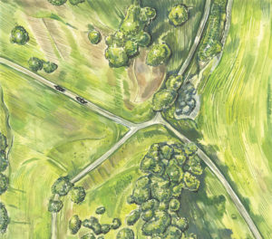
At first glance, the park doesn’t seem to merit its name: The eclectic mix of amenities clustered near the entrance area could hardly be called wilderness. A disc golf course sits beside an archery range, a crowded RV park abuts a well-tended native plant garden, and a few tent-camping spots intermingle with an equestrian training ring.
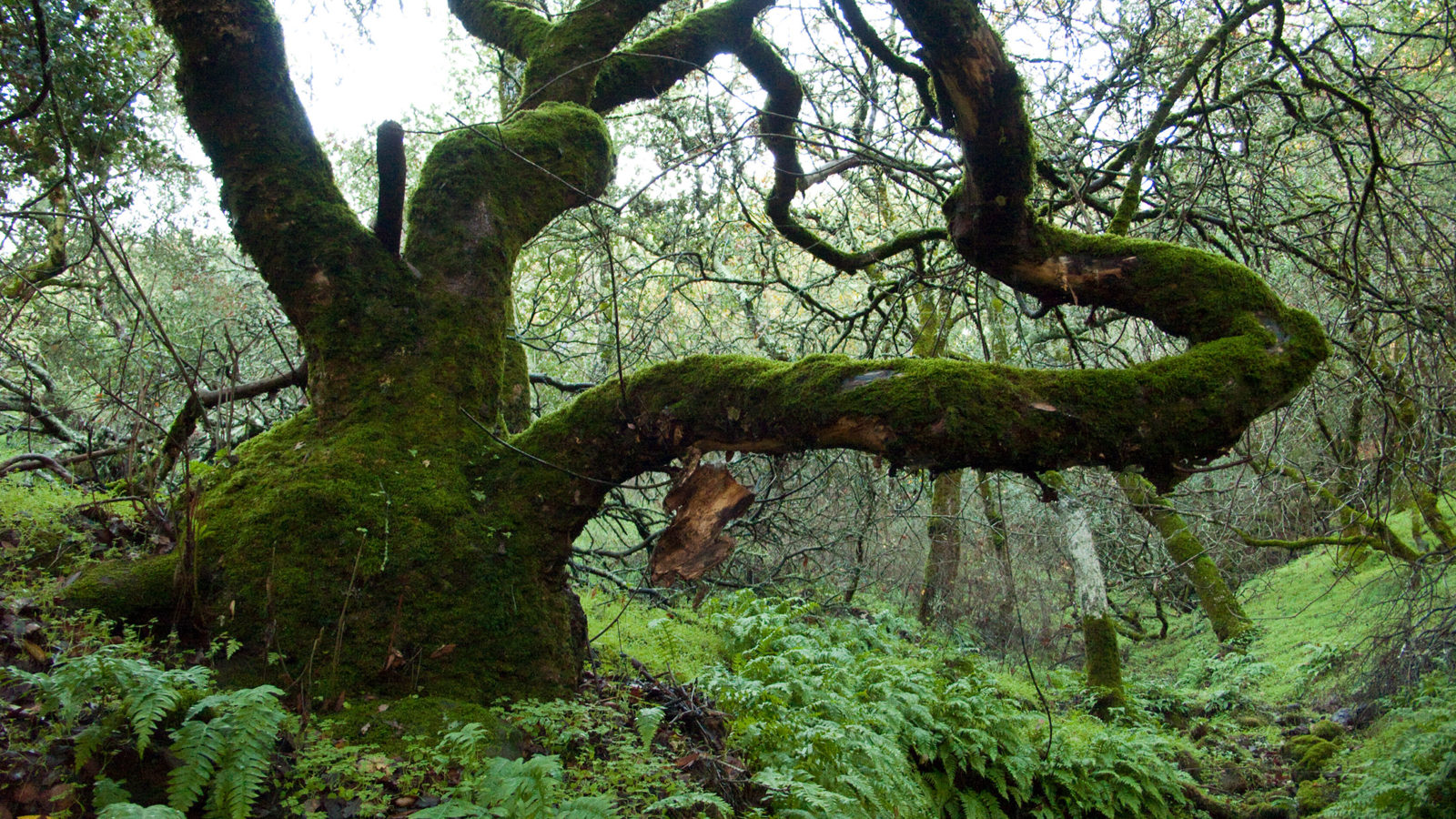
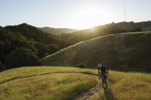
But the park has another face, one of sweeping natural beauty that reveals itself soon enough to the mix of hikers, mountain bikers, and horse riders who head out on the park’s many trails. About 25 miles of trails thread through 850 acres of blue and live oak woodland, chaparral, grasslands, open ridges, and riparian valleys.
The rewards of a trip here include spectacular views of the Napa Valley and the opportunity to explore the dramatic canyon cut into the volcanic country rock that indeed feels like wilderness.
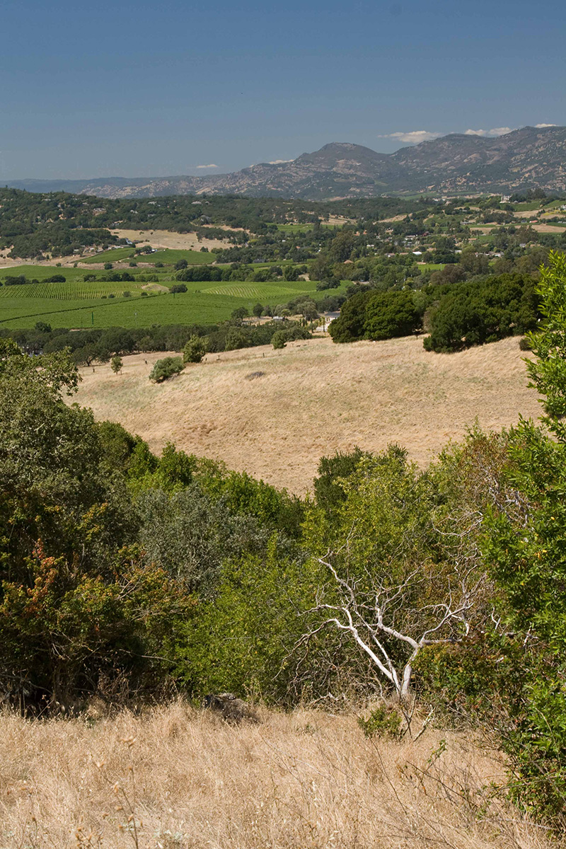
The 1,630-foot-high summit of Sugarloaf, the park’s highest point, is worth the climb, with views that are truly panoramic. In the foreground, Napa and its lush vineyards are close by, but on a clear day, you can see Mount St. Helena to the north, San Francisco Bay in the opposite direction, Mount Tamalpais to the west, and Mount Diablo to the east.
You might expect such an impressive domain to be preserved as a state or county park. But in this case, it’s not an overstatement to say that it’s Larry Pyle’s park. He and a few dozen other Napa County denizens have ruled this scenic, accessible plot of valley parkland for more than three decades in a governance model that is part fiefdom and part democracy–and generally a success.
To paraphrase a famous American sentiment, the park is of the people, by the people, for the people. It turned out this way by a combination of luck and the locals’ determination: Until 1979, the land was part of the grounds of the Napa Asylum for the Insane (now called Napa State Hospital), which once drew its water from several man-made lakes that still dot the park. When the state decided it no longer needed the land and was poised to sell it off, locals stepped in and struck a deal to run the park on their own–one of the state’s only large parks managed entirely by volunteers.
Now, with many California state parks facing closure due to the state budget crisis, could Skyline offer a model for an alternative–citizen-run parks? It sounds like a tailor-made solution–people who care about a park can run it. After all, how tough can it be to manage some oak-covered hills and valleys?
Larry Pyle openly laughs at the notion. The retired mechanic is president of the Skyline Park Citizens Association, and he’s busier than ever.
And so is the park, located on Imola Avenue southeast of downtown Napa. It attracts 30,000 day-use visitors a year as well as a steady flow of campers from as far as away as Quebec and the Netherlands at the RV park near the entrance.
Napa County may be a scenic paradise of rolling hills and diverse oak woodlands, but in some respects, it’s hardly a hiker’s haven. Much of Napa’s open space is in private hands, and the county has only two state parks–Bothe-Napa Valley and Robert Louis Stevenson, both far from the county’s population centers in the south.
Napa County’s regional park system, inaugurated just three years ago, is limited to a few small holdings. Skyline Park isn’t one of them, though a new park master plan and recent state legislation will allow the county more involvement, including ownership of the land, which is still officially state property. The change will have little impact on the park’s day-to-day operation, since the citizen association has nearly 20 years left on its $100-a-year lease.
But all those bureaucratic details seem far away on a recent visit. Pyle, sitting with a cold beer on the porch of the archery range clubhouse, is pleased with how things have worked out here.
“Everyone wants their way–hikers, mountain bikers, and horse people. But we manage to get along just fine,” he says.
On any given day, the single-track trails handle a mix of hikers, mountain bikers, and equestrians. The park’s trails are neither straight nor well-planned. In fact, they weren’t planned at all. When the park became a park nearly three decades ago, the new managers decided that the existing cow, pig, and deer tracks would become the pathways for people as well. So volunteers set out and stamped down the grass to make the trails. Horseback riders followed and soon the trails were set. The result is that the paths range from easy to strenuous and back again, zig-zagging across the land.
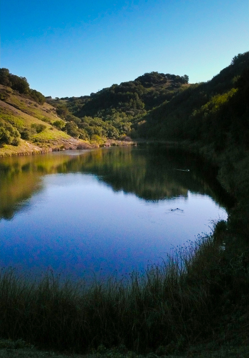
One popular route, the Skyline Trail, rises briskly more than 1,000 feet over three miles, snaking through most of the park’s habitat types and then circling around Lake Marie. Nestled at the bottom of the main canyon, the lake is the largest of several ponds created as water supply for the hospital. Skyline Trail is also part of a 10-mile Bay Area Ridge Trail spur that runs east from the Napa River just south of downtown Napa.
Historic dry-stacked rock walls, quarry pits, and the remains of an old stone cabin along the central fire road are all good clues about the interesting geology at Skyline Park. The hills sit at the southern end of the Sonoma volcanic field, which stretches north up to the Palisades near Calistoga and into Sonoma County, the largest and most visible evidence of an extended period of volcanic eruptions here that began eight million years ago.
Recently, a U.S. Geological Survey team mapped the area and studied the rocks at the park, observing the transition from dark, iron-rich basalt to the lighter gray rhyolite and lightweight pumice (which floats in water). Each rock tells a story of eruption, from the hot, fast-flowing lava that creates basalt (like in Hawai’i) to the viscous, slow-moving rhyolites to violently explosive magma (like at Mount St. Helens) that cools so quickly that countless gas bubbles are trapped inside, forming pumice.
“Most volcanic eruptions were fairly small, but there were some gigantic violent eruptions in Napa Valley–some of the biggest in the western U.S.–that spewed clouds of ash and blew tops off mountains,” says Don Sweetkind, a federal geologist who hiked the trails here and gathered samples as part of the geological survey’s mapping effort.
Out on the trail, you can distinguish the dark basalt from the lighter rhyolite, which has a streaky appearance of colors and lines in the rock faces. Looking west from several spots along the ridge on Skyline Trail you can see into the neighboring Syar Industries basalt quarries, providing a view into the hills’ interior.
The park’s more recent history is almost as intriguing as its distant volcanic past: The “asylum” to which all this land belonged was a vast Gothic edifice complete with spires and turrets. Patients picnicked and swam at Lake Marie and they visited the hills to paint, take walks with their caregivers, and work in farm fields and livestock pens, both as therapy and as a revenue source for the hospital.
By the 1960s, the old building had been razed and replaced and the hospital was no longer using its grounds. After citizens took over the land in 1979 and opened it to the public in 1983, no one was harvesting produce, but revenue remained a concern. At one point in the first year of operation, the park was down to $43 in the bank. In 1984, it had to close for a week due to insurance issues.
Today, that bumpy start seems a distant memory. The park employs a half-dozen people and collects more than $300,000 annually from day-use fees, annual passes, and RV fees.
The place is a melting pot of sorts for several community recreation groups that have made Skyline their home. Each group acts as a constituency, providing upkeep and maintenance on its little slice of the Napa Valley and contributing to the park as a whole.
On weekends, Skyline Park buzzes with activity. The 18-hole disc golf club hosts regular outings and tournaments. On a Sunday morning, there might be a mountain bike race on the trails, featuring world-class cyclists going at breakneck speeds in time-trial laps. Thursday nights, the smell of barbecue tri-tip comes from the archery club, which holds weekly socials. The riding ring features horse shows with riders from across Northern California competing for prizes. And don’t forget the Society for Creative Anachronism and its medieval-themed festivals.
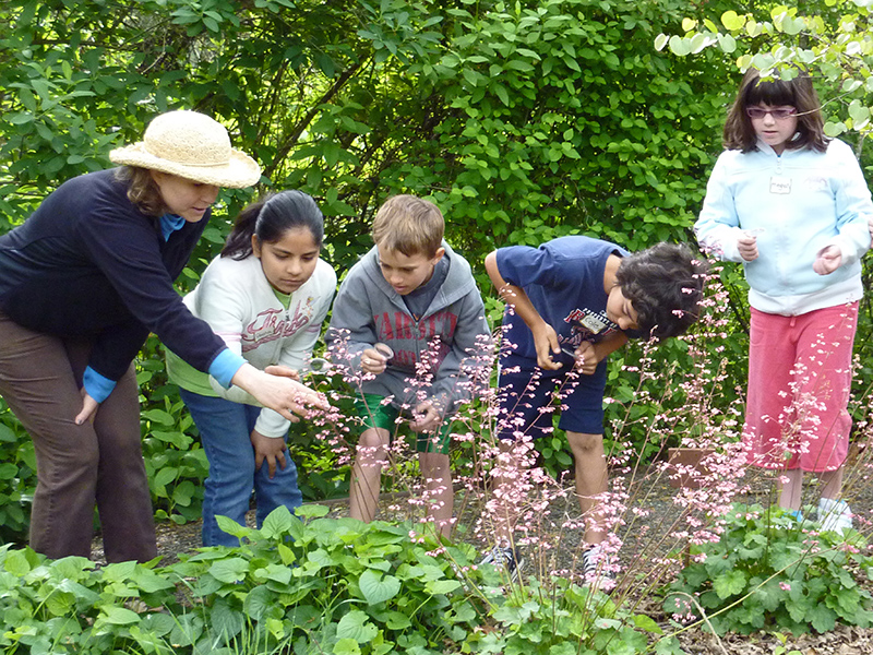
Volunteers from the Napa Valley chapter of the California Native Plant Society maintain the Martha Walker Native Habitat Garden, named for a Napa resident known for her regular column in the Napa Valley Register and her gardening classes at Napa Valley College. Hikers curious about the plants they’ve seen on a trail can visit the garden and find some 400 different species divided into four habitat areas: oak woodlands, redwood forest, chaparral, and open meadow. Staffed by about 25 volunteers and a part-time curator, the garden now encompasses three acres of the park.
At the entrance kiosk near the garden, you might run into Luanne Kollar, the park’s longest-tenured and sole full-time employee. The self-proclaimed “Ranger Mom” collects access fees, hands out maps and advice, and takes campground reservations.
For that, she gets to live in a house on the property, an ideal spot to raise two young daughters with her husband, who helps with groundskeeping. On a recent day, her daughters were dissecting some owl pellets they found nearby.
A ranger’s job at a sprawling, heavily used park can be daunting, but Kollar is quick to praise the patchwork collection of volunteer groups that step in and handle their own needs. “Everyone wants to help. They know that what they do here is for the good and something that will last and be here,” she says.

With California’s state parks in financial crisis and 70 slated to be closed by the summer of 2012, the prospect of community partnerships supporting parks is being considered around the state. But those who have worked at or with Skyline over the last three decades aren’t so sure it’s a good template for other places. For one thing, the simple lease created in 1979 probably could not be replicated in today’s more legally restrictive environment. And Skyline’s RV park has been a key to its survival, providing stable revenue most parks lack.
Finally, there is the diversity of the stakeholders willing to support this particular park. John Woodbury, general manager of the Napa County Regional Parks and Open Space District, credits that broad base with the park’s success.
“Skyline Park has a very effective volunteer base, and it’s done it by partnering with several special-interest groups. Each of those groups has its own set of volunteers, its own funding, its own mission–which adds up to a way of taking care of the park,” he says. “It’s easy to look at the park and only see the ranger, but there has to be an energetic group of people [to keep it going]. The people there have a motivation to make the place work, and it does.”
Getting There
From the south, take Highway 29 toward Napa, to the exit for Downtown Napa/Lake Berryessa. Merge onto ca-221 North. Turn right on Imola Avenue, and the park is 1.2 miles ahead on the right. From the west, take Highway 29 into Napa to Highway 221 (Imola Avenue West, which becomes Imola Avenue East). The park entrance will be three miles ahead on the right. From the north, take Highway 29 south through Napa to Imola Avenue. $5-per-car entry fee. No dogs.
Learn more about the park at skylinepark.org.
-300x221.jpg)
-300x200.jpg)