.jpg)
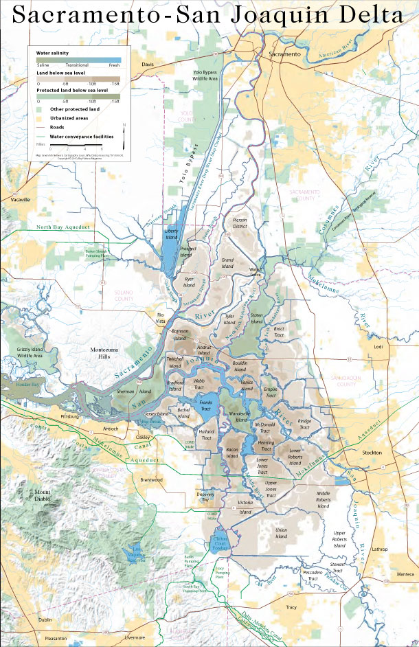
This map covers the entire Sacramento-San Joaquin Delta, showing protected areas, water conveyance systems, subsided areas (below sea level), and water salinity gradient. Click image for a larger version, or download as a 5 MB PDF file (that’s the most legible version).