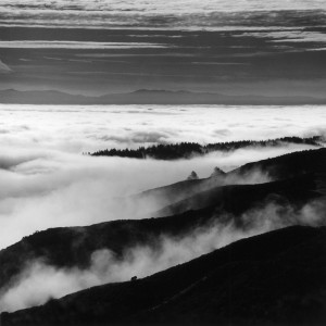
The hiking group was supposed to meet 20 minutes ago, but I’m sitting here on the roadside staring at a locked gate and a handful of discouraging signs. “Hazardous Fire Area,” “Bioregional Habitat Restoration Project,” “No Parking Any Time” (twice). Past the gate, a road winds up through thick green hills half-hidden in fog.
I’ve been waiting for weeks to get behind this gate, but that barely makes me a newcomer to the scene: Pressure on the landowner to open the area to public recreation has been mounting for decades. So far that pressure has been relieved only by docent-led hikes like the one I’m meant to be on today, but now it may have reached a breaking point.
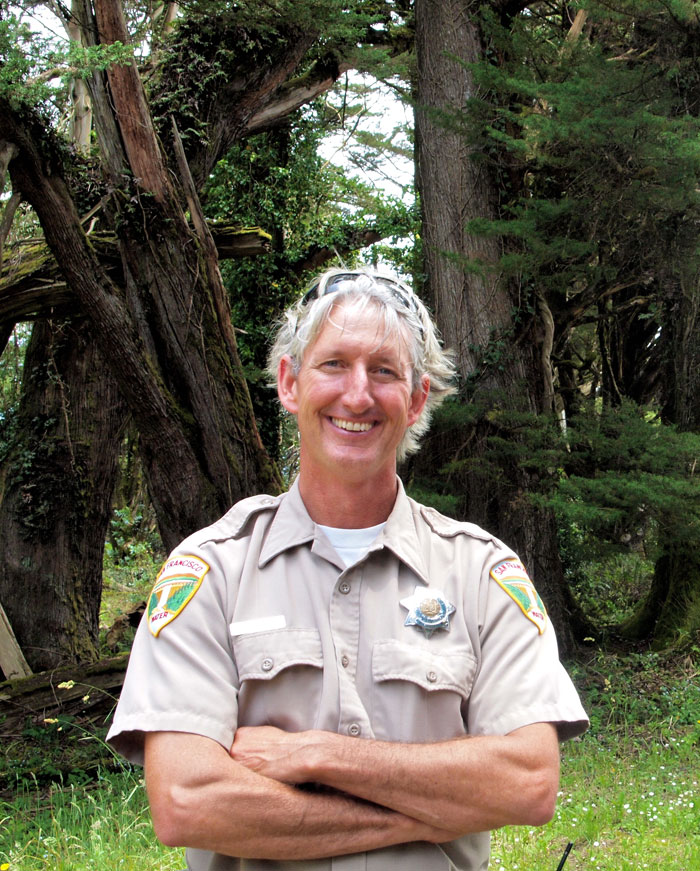
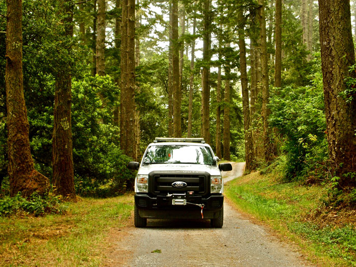
A white service truck pulls off the highway. I think it might be the docent, but the driver, a tall man with a tan uniform and wavy blonde-gray hair spilling from his cap, just hollers at me to move my car before it’s hit by a semi. When I tell him I’m trying to meet with a hiking group around here, he offers to let me park my car inside the gate. In a moment I’m driving slowly behind him through the entrance. After almost a month of research, phone calls, and logistical planning, I’ve finally set foot in the protected Peninsula Watershed.
“In our backyard lies what would be to the SF Peninsula what the Point Reyes National Seashore or Mount Tamalpais is to Marin, an open space so vast and wonderful that it is almost unimaginable.”
The driver’s name is Jim Avant, and he tells me he’s one of 12 full-time “watershed keepers” – something like a park ranger, security guard, maintenance person, and conservationist rolled into one – for the area. Avant’s father and grandfather were both state park rangers, and he’s worked on the Peninsula Watershed for almost 20 years. He’s also one of the lucky few who live full-time on the land.
Why spend all your time making money to buy a big backyard, he asks, when you could just start with the yard instead?
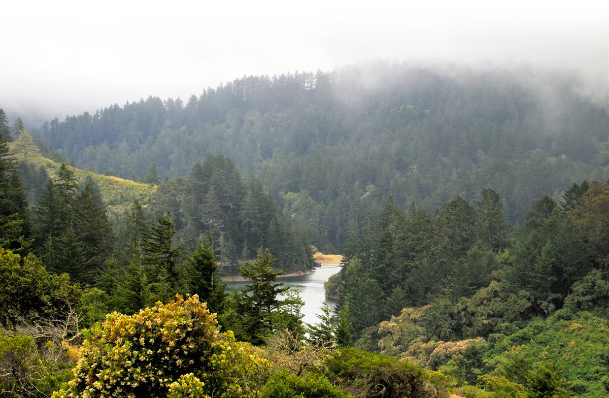
This “yard” is huge. Bordered by Pacifica and San Bruno in the north, and Woodside and Redwood City in the south, the San Francisco Public Utility Commission’s 23,000-acre Peninsula Watershed is one of the largest expanses of open space on the Peninsula. Sometimes called the Crystal Springs Watershed after its largest reservoir, the land has been an important part of the Bay Area’s water supply for the past 150 years. Local runoff to the watershed’s three main reservoirs, along with runoff in the Alameda Watershed across the Bay, provides 15 percent of the SFPUC’s water for its 2.6 million Bay Area customers. Two of the reservoirs also store water piped in from Hetch Hetchy Reservoir, the source of the other 85 percent.
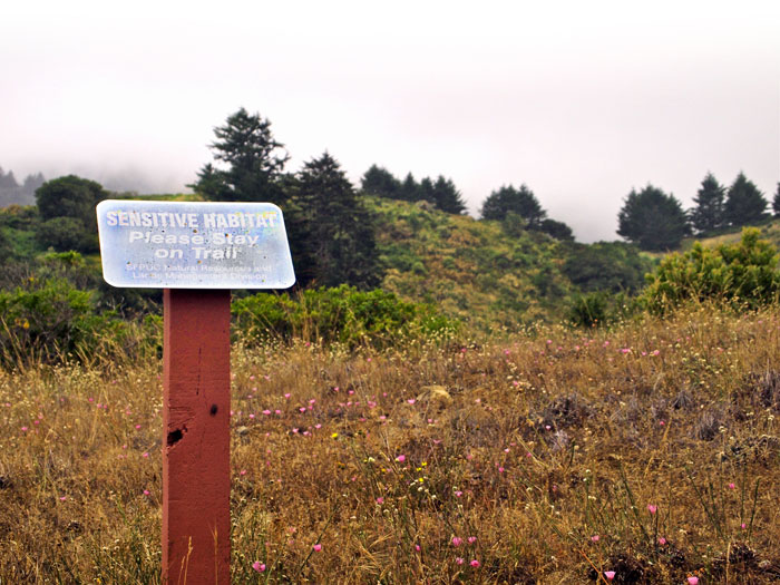
Citing the importance of protecting the area’s water supply and its open space character, the SFPUC has banned public access to the bulk of the watershed for most of the 85 years it has owned the land.
Perhaps as a result, the watershed is home to the highest concentration of rare, threatened, and endangered species in the entire San Francisco Bay Area. At least 16 special status plant species have been recorded in the watershed, including the federally endangered San Mateo thornmint, San Mateo Woolly sunflower, fountain thistle, and white-rayed pentachaeta, as well as the federally threatened Marin dwarf flax. (San Mateo thornmint no longer grows on SFPUC land, says Ellen Natesan, the ecosystem stewardship coordinator for the SFPUC, but the agency is considering re-introducing it to serpentine areas to the east of the reservoirs.) Thirteen more special status species have been reported to have a moderate or high potential to occur in the watershed, though they’ve never been found there.
At least six federally threatened or endangered wildlife species also live in the watershed: the federally endangered Mission blue butterfly, San Bruno elfin butterfly, and San Francisco garter snake, and the federally threatened California red-legged frog, steelhead trout, and marbled murrelet. The bald eagle, which just came off the list, nested in the watershed for the first time in a century in 2012.
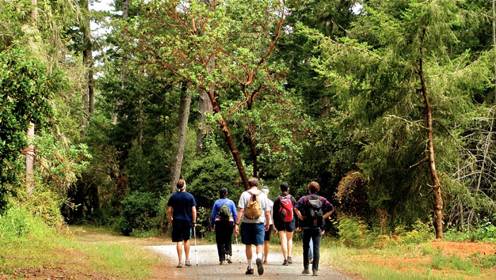
A portion of the marbled murrelet’s critical habitat is 947 acres of old-growth conifer forest around Pilarcitos Reservoir. The reservoir is just west of the Fifield-Cahill Ridge Trail, the route taken by the regular docent-led hikes. With Avant’s help, that’s where I’m heading today.
It turns out our hike had a last-minute trailhead change. But following Avant, who had come to meet the hiking group and also missed the last-minute note, I drive up a tangled network of dirt roads to the start of the Fifield-Cahill Ridge Trail. I leave my car at the trailhead, a clearing lined at one end with a grove of moss-draped Monterey cypresses. Across from it the trail, a wide gravel road, runs into a forest dotted with Douglas firs. I hop into Avant’s truck, and he drives me down the road to catch up with the rest of the group.
Avant points out pieces of trash on the road as he drives, three in the first quarter-mile or so. He seems surprised but mostly undisturbed by it. Sure there’s some trash up here, he says, but it’s nothing compared to what it’s like down at Sawyer Camp Trail – a six-mile section of the open-access Crystal Springs Regional Trail that follows most of the watershed’s eastern border. Sawyer Camp Trail is currently one of a small number of unrestricted-access trails that skirt the area’s boundaries, and sees more than 300,000 visitors each year.
Such an obviously huge demand for hiking trails in the area is an important point for recreation advocates like Andy Howse, a fifth-generation Peninsula resident who wants to see more of the Peninsula Watershed opened to public recreation. “In our backyard lies what would be to the SF Peninsula what the Point Reyes National Seashore or Mount Tamalpais is to Marin,” Howse wrote in a 2014 article on the watershed, “an open space so vast and wonderful that [it] is almost unimaginable.”
In 2001, after years of public discussion, the SFPUC decided for the first time to open a restricted public-access trail in the heart of the watershed. For the past 12 years, the agency has offered docent-led trips to small groups of hikers, bikers, and equestrians on the Fifield-Cahill Ridge Trail. Last year these docent outings served about 9,000 visitors to the trail. But changes, and expanded access, now appear to be on the way.
Two years ago, Howse founded Open the SF Watershed, an organization whose mission is to “open the SF Watershed to Hikers and Cyclists, the nature loving public that this property belongs to.” The group wants to create a more extensive network of public recreation trails on already-existing service roads in the area.
“We want people to know and care about the world around them. For people on the Peninsula, that is the watershed.”
The Peninsula Watershed isn’t really an untouched wild space, Howse says. Miles of service roads thread through the watershed, providing access to cell towers, radio sites, and SFPUC, PG&E and Caltrans facilities. Howse says his group is not advocating for any new trails on the land, but only to open service roads already built to public recreational use.
“We want people to know and care about the world around them,” Howse says. “For people on the Peninsula, that is the watershed.”
Increased public access would also have a more direct environmental benefit, Howse says, by keeping people closer to home and using their cars less to get to an open space. Getting rid of the docent system on trails would let people enter the park on their own time – minimizing logistical mix-ups – and walk, bike, or take public transportation to the watershed.
Plus, Howse says, the watershed is an integral part of the Peninsula’s history. The Pilarcitos dam brought an important new source of water to San Francisco in 1867 that allowed the then-80,000-person city to continue growing. Remnants of old homes, fountains, roads, and other marks from earlier generations of Peninsula residents still dot the watershed. “The public should feel emotionally empowered and responsible for this stuff,” Howse says.
Howse has met with the SFPUC, local and state officials, and a variety of environmental organizations about his ideas, recruiting political allies such as San Francisco Supervisor Scott Weiner. “People want to be able to use the beautiful open space in the region,” Weiner says. “As the region continues to grow, it becomes even more important to have recreational access.”
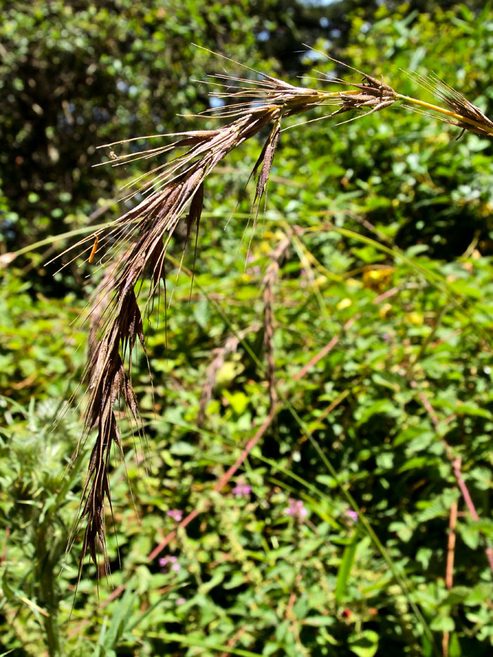
Only two hikers, a man and woman with Nordic walking sticks, are visible when we pull up in the truck. The hike’s docent, George Prince, trails behind them. Stately Douglas firs tower over us, accompanied by smaller trees such as bay laurel, tanoak, and madrone. Ferns and grasses line the road, including California bottlebrush grass, a native perennial grass listed on the CNPS Inventory of Rare and Endangered Plants. It’s the greenest place I’ve been to in months, and I breathe deeply in the foggy morning air.
Some of these Douglas firs are more than 200 years old and listed as old-growth. Others, Prince tells me, were planted in the watershed because of their incredible ability to collect moisture from the heavy fog that often blankets the ridge.
Avant, who walks with us for a few minutes, points out a group of Douglas firs along the road where violet-green swallows have been nesting. A mile or so farther, scattered patches of coastal scrub give us views of Pilarcitos Reservoir to the west, and the marbled murrelet’s critical habitat.
We all stop at the next open-pit-toilet, one of several spaced at regular intervals on the trail, where we find the rest of the group of 14 hikers. A few of the hikers wander far off-path in search of banana slugs while we wait, and Prince gently shepherds them back onto the trail. Prince tells me he’s had plenty of packed trips like this in his years as a docent, but also groups of two, three, and everything in between.
We reach our turnaround point, Five Points Junction, before noon, and all of the hikers are eager to keep going. Prince lets us walk a few hundred yards to a picnic bench up the hill, then calls his supervisor to check in. The supervisor orders us to turn around. It’s not just the docent watching the hikers, Prince says, apologizing, but the supervisor watching the docent, and his boss watching him, all the way up the line.
It is, of course, not so simple as just opening the watershed. Hikers, even well-behaved ones, leave a trace. Without a Prince to watch them or call for advice from the bureaucracy on high, their cumulative trace could be much bigger.
In an open letter to the San Francisco Board of Supervisors earlier this year, Emily Roberson and Jake Sigg of the California Native Plant Society’s Yerba Buena Chapter wrote of the importance of a “relatively healthy native plant community” for keeping the water that flows into the reservoirs clean. Increasing recreational use of the area, they wrote, would mean more people bringing in more nonnative invasive weeds that compete with and displace sensitive native species. At least six species from the rot-causing phytophthora pathogen genus have also been found in the watershed in recent years; increased recreation could cause more transmission and spread of such dangerous diseases into the watershed, they wrote.
“This is not the time to increase demands and pressures on an already drought-stressed plant community in a watershed that supplies our water and protects imperiled wildlife.”
Getting rid of docent oversight, Roberson and Sigg wrote, would also lead to more off-trail travel that degrades soil and damages plants. Unsupervised use could also increase the likelihood of wildfires. An uncontrolled fire in the watershed could be a disaster to the water supply, they wrote.
“This is also not the time to increase demands and pressures on an already drought-stressed plant community in a watershed that supplies our water and protects imperiled wildlife,” the letter read. “Crystal Springs is a water treatment facility – not a recreational facility. It should be managed and protected as what it is: an essential source of inexpensive clean water for millions of people.”
“Those who want to open it for recreation will tell you that you can have both,” Sigg added in a recent conversation, “but they aren’t asking hard questions.”
The Committee for Green Foothills has supported an expansion of the docent system, but not unrestricted access to the watershed. In an April brief on the history of the land, CGF Legislative Advocate Lennie Roberts wrote: “CGF has not supported unlimited access in this sensitive interior area of the watershed due to compelling public health concerns regarding protection and enhancement of water quality, avoidance of increased fire hazards, and protection of the area’s unique assemblage of sensitive habitats.” In a recent phone conversation, she added: “We’re not anti-trails – we’ve almost always been in favor of trails.” But dangers to the sensitive water supply and wildlife like the marbled murrelet “can increase with public use that is uncontrolled,” she said.
Both of the watershed’s endangered butterfly species, the San Bruno elfin and Mission blue, live farther along on the trail, but now Prince is adamant we won’t make it there today. Instead, we stop and eat our lunches around a picnic bench beside one of the bathrooms. The ridge has opened up to grassland and coastal scrub with plenty of coyote brush. A few of the hikers continue up the hill for views of the mountain ranges north. Behind us, a turkey vulture hovers high over Pilarcitos Reservoir before drifting off farther south. We pack our lunches and follow it back.
The number of day hikers in the United States more than tripled between 1982 and 2009, according to a 2010 report by U.S. Forest Service researcher Ken Cordell. Biking and many other outdoor nature activities have followed a similar trajectory.
A steady stream of research papers have analyzed the trend’s effect on people and their surrounding environments. Many of these studies have described the countless benefits of being in natural areas – on child development, physical and mental well-being, psychological restoration, general satisfaction, and even self-esteem. Studies have also shown the importance of environmental recreation for areas’ economic vitality and people’s interest in supporting environmental conservation.
“It’s a noticeable difference compared to areas that are open to recreation. You can tell there is a lack of human presence.”
More researchers are also studying the impact of quiet, non-motorized recreation (like hiking, biking, and horse riding) on the environment itself. The topic has become a formal discipline, “recreation ecology,” complete with conference sessions, research networks, and a Wikipedia page.
In 2008, then-UC Berkeley graduate student Sarah Reed and Berkeley conservation biology adjunct professor Adina Merenlender looked at the impact of non-motorized recreation on mammalian carnivore species in the North Bay Area. They studied 14 pairs of similar nearby sites, one of which allowed public recreation and one of which did not, and used scat findings to determine the presence of native and nonnative carnivores (including domestic cats and dogs) in each. In sites that allowed public recreation, Reed and Merenlender reported a “five-fold decline in the density of native carnivores and a substantial shift in community composition from native to nonnative species.”
More recently Paul Beier, a professor at Northern Arizona University’s School of Forestry, received a grant from the Gordon and Betty Moore Foundation to expand on Reed and Merenlender’s research.
Michelle Reilly, a graduate student in Beier’s lab who led the study, covered all 10 counties in the Bay Area (including Santa Cruz) and a suite of mammal species with her research team. Over the last three years, the team has studied 286 Bay Area sites with a wide range of public access – including the Peninsula Watershed. The team used camera traps in each site to monitor trail use by different mammal species.
While they’re still analyzing their data, the team’s preliminary results split from the findings of Reed and Merenlender. The results suggest that all 10 species in the study preferentially used human-made trails, while only three species were negatively impacted by human presence (mountain lions and pigs were affected by hiking, and pigs and opossums by bikes). “A lot of species in the Bay Area are used to high levels of recreation,” Reilly said in a phone conversation, listing examples such as the gray fox, bobcat, and mule deer. “We’re not saying that human recreation doesn’t have any impact, but these species are still adaptable and still present.”
Still, Reilly described the Peninsula Watershed as a “unique place” in the team’s research sites. “It’s a noticeable difference compared to areas that are open to recreation,” she said. “You can tell there is a lack of human presence.”
One example of this was the high number of mountain lion detections on the watershed, some of the highest of any site. And the team’s preliminary results, Reilly said, suggest that mountain lions are a species significantly negatively affected by human recreation.
The mountain lions haven’t decided to pick up and move just yet. Avant told me in the morning that a number of mountain lions use the Fifield-Cahill Ridge Trail and the surrounding area. He said he’d also heard that a worker had been surrounded by a mother mountain lion and her two cubs while doing maintenance at one of the Fifield-Cahill Ridge Trail entrances.
Remember, they are an exotic species in the Western United States, and are rapidly increasing their geographic range and range of habitats. Are they outcompeting or excluding native species in the process? How would we know? We have done almost nothing to monitor changes in the assemblage of mushroom species in areas before and and after the incursion of death caps.
Further Reading
Pringle et al, “The ectomycorrhizal fungus Amanita phalloides was introduced and is expanding its range on the west coast of North America,” Molecular Biology 2009
Lockhart et al, “Simultaneous emergence of multidrug-resistant Candida auris on 3 continents confirmed by whole-genome sequencing and epidemiological analyses,” Clinical Infectious Diseases 2017
Battalani et al, “Aflatoxin B1 contamination in maize in Europe increases due to climate change,” Scientific Reports 2016
A Q&A With The Unseen Peninsula’s Award-Winning Photographer: ‘I Am A Placed Person and This Is My Home’
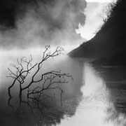
Acclaimed nature photographer Robert Buelteman spent a decade photographing the Peninsula Watershed. His art, collected in the book The Unseen Peninsula, shows a side of the protected area that few have ever seen. He talked to Bay Nature’s Nathaniel Dolton-Thornton about getting access to the watershed, making art in the area where he grew up, and his new projects.
We’re waiting for the rest of the group at a bathroom on the way back when Avant pulls up again. When I ask him about threatened and endangered species in the area, he says the broader effect of increased human presence on species movements and fire hazard would probably be more significant than that of people’s direct interaction with special status species on the trail. He also emphasizes the intensity of the monitoring of the watershed’s natural environment by the SFPUC and other organizations. In general, Avant says, “We’ve got more biologists out here than we can shake a stick at.”
Tim Ramirez, who manages the Division of Natural Resources at the SFPUC, says he’s confident in the state of the watershed’s natural environment. The SFPUC regularly monitors butterfly species along the Fifield-Cahill Ridge Trail and throughout the Peninsula Watershed. The continued health of the watershed’s butterfly populations is one reason, he says, the SFPUC announced earlier this year that it would expand its public trail system.
The plan, which the agency announced at a public hearing with the San Francisco Board of Supervisors in April, is to open the Fifield-Cahill Ridge Trail to access by annual permit from dawn to dusk, seven days a week. The SFPUC will also build a new six-mile Southern Skyline Boulevard Ridge Trail Extension that would connect the Fifield-Cahill Ridge Trail to Phleger Estate (part of the Golden Gate National Recreation Area), and possibly to Purisima Creek Redwoods Open Space Preserve, south of the watershed. These two changes would allow hikers on the Bay Area Ridge Trail to cross the Peninsula Watershed from north to south for the first time.
The plan also includes a new 1.25 mile trail along the north edge of the watershed, trail improvements to the Crystal Springs Regional Trail, and a proposal for a new Whiting Ridge Trail – the first east-west trail in the heart of the watershed – that would open an already-existing service road in the area to public access.
Ramirez emphasizes that it’s a slow process. The Ridge Trail Extension is the SFPUC’s first focus, he says, and construction on the trail isn’t slated to start until April 2016. The trail is set to open at the end of next year, and the Fifield-Cahill Ridge Trail will start its annual permit system at the same time. Meanwhile, even though the agency has determined its 2001 Environmental Impact Report for the area is still valid, it has agreed to have an outside consultant write an addendum to the report.
“Some folks would like us to do a lot more than we’re doing, some would like us to do a lot less,” Ramirez says. “I’m sure we’ll end up someplace in the middle.”
The fog has mostly burned off by the time I leave the watershed. I drive the winding dirt trails down and soon pass the gate where I first met Avant this morning: It is closed again. The sky is clear, and the tall green hills roll away to the horizon.
I merge onto the highway, and in a few minutes I’m passing thick clusters of shopping malls and houses. To my right, the long cement plains of the San Francisco Airport run along the Bay. Freighters sit out in the waters behind them. My navigation system urges me to keep left.
Whatever the SFPUC decides about recreational access, I realize, that fence will still be keeping most of this out: the skyscrapers, the cell phone billboards, the acres of toxic solvents – and the mental states a constant flood of stimuli creates. I hope they have enough signs.