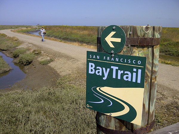
This year marks the 25th anniversary of the Bay Trail, a 500-mile-long trail corridor which traces nearly the entire shoreline of San Francisco Bay. We spoke with Bay Trail project manager Laura Thompson about her efforts to connect remaining segments, and the often herculean task of bringing together all of the necessary funds, resources, and stakeholders.
BN: Are you originally from the Bay Area? If not, where are you from and what brought you here? And, how did you get involved with the Bay Trail – and when?
I grew up in Illinois and lived near the Illinois Prairie Path, one of the first rail-trails established in the country. In 1997, I moved to the Bay Area after completing graduate school in Chicago. I worked as a volunteer planner for the Marin County Open Space District and then joined the San Mateo County Planning Division. In 1999 I saw a job opening at the Association of Bay Area Governments for a Bay Trail Planner and jumped at the chance to work on a long-distance trail like the one I loved to ride my bike on as a kid.
BN: You’re celebrating the 25th anniversary of the Bay Trail this year, and the Hamilton Field segment of trail was recently opened. It sounds like it’s been a big year! What’s next?
It is a big year! With the completion of the Hamilton Field segment in June, the Bay Trail has reached 338 out of 500 miles! Later this year we’ll celebrate 340 miles with the completion of the Carquinez Scenic Drive segment between Crockett and Martinez in Contra Costa County. This is a former country road that runs along the bluffs over the Carquinez Strait. The East Bay Regional Park District is converting this damaged, unusable road into a 2-mile multi-use trail that will be part of the Carquinez Strait Scenic Loop Trail, an interconnected series of trail segments along and across the Strait. It’s a joint project of the Bay Trail and the Bay Area Ridge Trail.
Another thing we’ve been working on are the two recently-launched smartphone audio tours, developed by Canogle and Doug McConnell of Convergence Media Productions. These audio tours of the Hamilton Wetlands in Novato and the Rosie the Riveter World War II Home Front National Park in Richmond were sponsored by a Coastal Conservancy “Explore the Coast” grant. They highlight historic points of interest and offer curated short stories about the environment and landscapes along the trail. It’s kind of like hearing a customized museum tour as you walk along the Bay Trail. You can download the Point by Canogle app for either iPhone or Android devices. Tours for the Bay Trail in Napa/American Canyon and Alviso are coming soon.
BN: From what I understand, the Bay Trail is about 70% completed. What are the greatest challenges remaining?
All the “easy” segments have been completed so now we’re working on the most difficult sections. The primary challenges to completing the remaining gaps include: finding funding for planning and construction, building trail within restricted rights-of-way and balancing shoreline public access with wetland habitats. Bay Area citizens can help by letting local and state legislators and decision-makers know that funding to complete the Bay Trail is an important goal for the region. Our estimates show that over $170 million will be needed to complete the remaining gaps, not including the toll bridge pathways.
BN: Tell us about a successful Bay Trail collaboration in the South Bay.
My favorite Bay Trail success story is the completion of 2.4 miles of Bay Trail between Mountain View and Sunnyvale. The trail, which runs adjacent to the Moffett Federal Airfield, opened in September 2010 after a multi-year collaboration between a jaw-dropping number of partners: the South Bay Salt Pond Restoration Project, the San Francisco Bay Trail Project, the U.S. Fish and Wildlife Service, NASA Ames Research Center, the 129th Rescue Wing of the California Air National Guard, State Coastal Conservancy, Cargill, the City of Mountain View, and the City of Sunnyvale. Herculean efforts were made to transfer land, relocate munitions, and meet security clearances along the edge of the airfield. Everyone involved was committed to opening the trail and did everything in their power to make it happen. This popular section of trail is now part of the Don Edwards San Francisco Bay National Wildlife Refuge and completes a 20+ mile stretch of continuous Bay Trail between East Palo Alto and San Jose.
BN: Do you have a personal favorite segment of the trail to walk or bike?
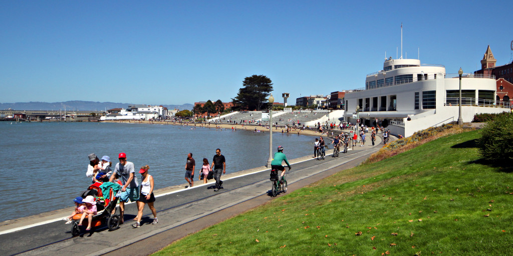
If you haven’t been to the Richmond shoreline, I encourage you to visit. If you have, you know what I’m talking about. This is one of my favorite places to enjoy the Bay Trail. The 6+ miles of Bay Trail between Point Isabel Regional Shoreline and the Craneway Pavilion are spectacular. This is what the Bay Trail is all about! Expansive views of the Bay, including the Golden Gate Bridge, the Bay Bridge, Angel Island, the San Francisco skyline, and Mount Tamalpais; connections to shoreline parks for picnicking and bird-watching; historic markers highlighting stories from the past; and a smooth, flat trail fit for running, strolling, bicycling, rollerblading, wheelchair-riding, dog-walking and first-time bike riding. And now there’s the story of the Rosie the Riveter World War II Home Front National Park on the BayTrail/Canogle mobile app.
>> Learn more about the Bay Trail, and upcoming 25th Anniversary events at www.baytrail.org