The Bay Area’s No. 1 mercury polluter, the Lehigh cement plant in Cupertino, is cleaning its business after the region’s air district passed the strongest air rules in the nation.
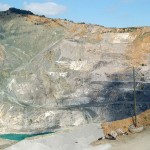
Cupertino cement plant cutting mercury pollution
December 5, 2012 •
-150x150.jpg)

-150x150.jpg)
-150x150.jpg)
-150x150.jpg)
-150x150.jpg)
