September 21, 2003, 4:30 a.m., Dan is moving about in the kitchen. There is a plan afoot, so to speak. Last night it sounded like fun, but as I lever myself into my wheelchair in the dark bedroom I’m trying to remember whose bright idea this was. Still, I’m up, I’m up, and Dan puts a cup of coffee in my hands. Jumpstarted with caffeine, I hang the canvas bag with thermos, binoculars, bird book, and camera on my chair and follow him outside.
Above the yellow streetlamp, Cassiopeia watches me roll aboard our van. I ride shotgun past dark storefronts and lonely flashing traffic lights.
In Tilden Park, two deer bound away in the headlights. A jackrabbit crouches briefly before bolting from the deserted parking lot at Inspiration Point.
It is still inky dark. Dan’s bike light and my mini-flashlight are uselessly feeble, but the trail is paved and wide, a pale ribbon bordered here by tall foliage. It’s 5:15, the sun will rise at seven, and we have five miles to go. We slip past the gate, and get underway.
Something big plunges away in the brush to our left. Another deer? It’s cold; I wish I’d brought my gloves. In open stretches we can roll at my full speed, seven miles per hour, but where the trail drops into a black tunnel under eucalyptus, fallen branches litter the pavement and roots have buckled the asphalt, forcing us to pick our way.
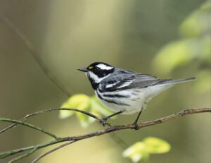
In the open again, Dan the amateur astronomer calls a halt where a notch in the ridge gives us a view to the east. The sky is getting pale above a thin layer of clouds at the horizon, but two “stars” are still clearly visible. This morning Mercury has cozied up to Jupiter. Like an indigo bunting, Mercury is elusive, hiding so close to the sun that I’ve never seen it before. But unlike the bunting, it keeps on schedule.
So does the sun, and so must we if we are to catch it rising. Our goal is the old Nike missile site, where we remember a glorious 360-degree view, and the lowest possible eastern horizon.
We don’t get there. In the dark, after two miles we evidently take a wrong turn, on a gravel track that climbs over what I later determine is a saddle north of Wildcat Peak, and wanders west from there. Never mind, it’s 6:30, the sky is brightening, we’ve got more or less the east view we came for and our thermos of coffee. Thirty minutes to wait. To the west the lights of Richmond are fading, and we scan for landmarks, warming our hands on our cups.
We’re not alone. Three cows trudge past, headed for a knob just south of us. They’re cold too, and they know where to wait for the sun’s first rays.
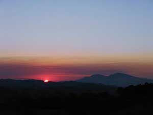
The eastern clouds have Dan worried—will they obscure our sunrise? It seems a long wait under the wide pale sky, watching the red-gray band behind Mount Diablo’s twin peaks. But when at last the edge of the sun appears, it’s a yellow disk in the haze, safe to look at even when it clears the low hills north of the mountain, and possible to photograph without a filter. It moves fast, and Dan has a few busy minutes with the camera. The cows watch impassively. Light catches the curve of the hills below us, and turns San Pablo Reservoir silver.
Daylight. Suddenly sunshine is on the grass, and on the cows (one is very pregnant), and on the kitten-sized bunnies hopping off the pavement as we skim back—to discover what we had missed in the dark, a sign at the gate that explains why we’ve met no joggers: TRAIL CLOSED: EXTREME FIRE DANGER.
Dan’s equinox photos are solid evidence that we were there, and when. And the cows have the goods on us too. But we appear to have gotten away scot-free, and it’s eight o’clock, time for breakfast.
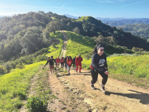
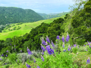
Running north from Inspiration Point on Wildcat Canyon Road, Nimitz Way—a wide, paved, four-mile trail along San Pablo Ridge—offers great views of the Golden Gate, Mount Tamalpais, San Pablo Bay, Mount Saint Helena to the north in Sonoma, and Mount Diablo to the east. The first mile is almost level; thereafter some stretches are steep, but most power chairs and strong manual chair users won’t require assistance. There are several benches along the trail and an accessible toilet at the trailhead. There are also two van-accessible disabled spaces in the parking lot, but both the and the trail can be crowded on weekends.
Ann Sieck is a semi-retired classroom teacher who has lived in Berkeley most of her life and is obsessed with making the Bay Area more liveable for humans and other native species. Her web site, www.wheelchairtrails.net, provides reviews of Bay Area trails focused on their level of accessibility.

.jpg)
