At first, it seemed like a rather straightforward task to put together a map for our section on the San Pablo Baylands. While no map worth its salt is ever simple, on a scale of one to ten, I was guessing maybe a three. After all, when you drive Highway 37 from Vallejo to Novato, there’s not a lot of —there— there. The complications of urban life seem miles away as you roll across a wide open landscape of wetlands and farmlands.
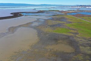
But take a look from the air, and seeming simplicity evaporates into a jigsaw puzzle of irregular polygons in shades of blue, green, gray, yellow, and brown. Then look at the GIS data showing intersecting ownership boundaries and 30 categories of wetlands, and you—ve got a real puzzle.
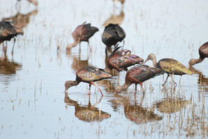
The story we aim to tell in “Highway to the Flyway” is of the extraordinary work being done—mostly under the public radar—to restore one of the Bay Area’s largest swaths of tidal wetlands. This is a vital corridor for human commuters, but it is even more critical for the thousands of canvasbacks, dowitchers, and curlews who have been traveling the Pacific Flyway since long before humans arrived.
We’ve heard a fair amount about the effort to restore the South Bay salt ponds. Of the 16,500 acres of salt ponds purchased from Cargill in 2003, 15,100 are in the South Bay. But those other 1,400? You’ll find them at the opposite end of the Bay, along the Napa River, where they represent the largest single piece of the approximately 30,000 acres already restored or slated for restoration along the Highway 37 corridor.
As our work on the map revealed, the North Bay story is even more complicated than its South Bay counterpart, which, though ambitious, is more or less a single undertaking. In the north, wetlands are being painstakingly assembled and restored, piece by piece, over time, by a multitude of players. The trick in telling this story is to communicate enough of the particulars to make palpable the ingenuity and complexity involved, without losing sight of the grand vision that informs it all.
Of course, words on a page—however evocative—and maps—however accurate—and photos—however compelling—can only approximate the experience of being there. Our primary aim at Bay Nature is to entice you out to the places we cover and to enrich your experiences there. So I’ll leave you with the following suggestion: As summer turns to fall, take a walk out along the levees at Tubbs Island or Sonoma Baylands (during an incoming tide if possible) or the creatively named Pond 1. Take in the wide-open sky stretching out in all directions and the hundreds of shorebirds and waterfowl before you. With such tangible evidence of abundance and diversity, it’s hard not to feel rather a small part of an immense universe. Small, but not insignificant, because it is our efforts that can make this region, once again, a refuge both for wild species and for those of us who hope to continue sharing the world with them.

.jpg)


