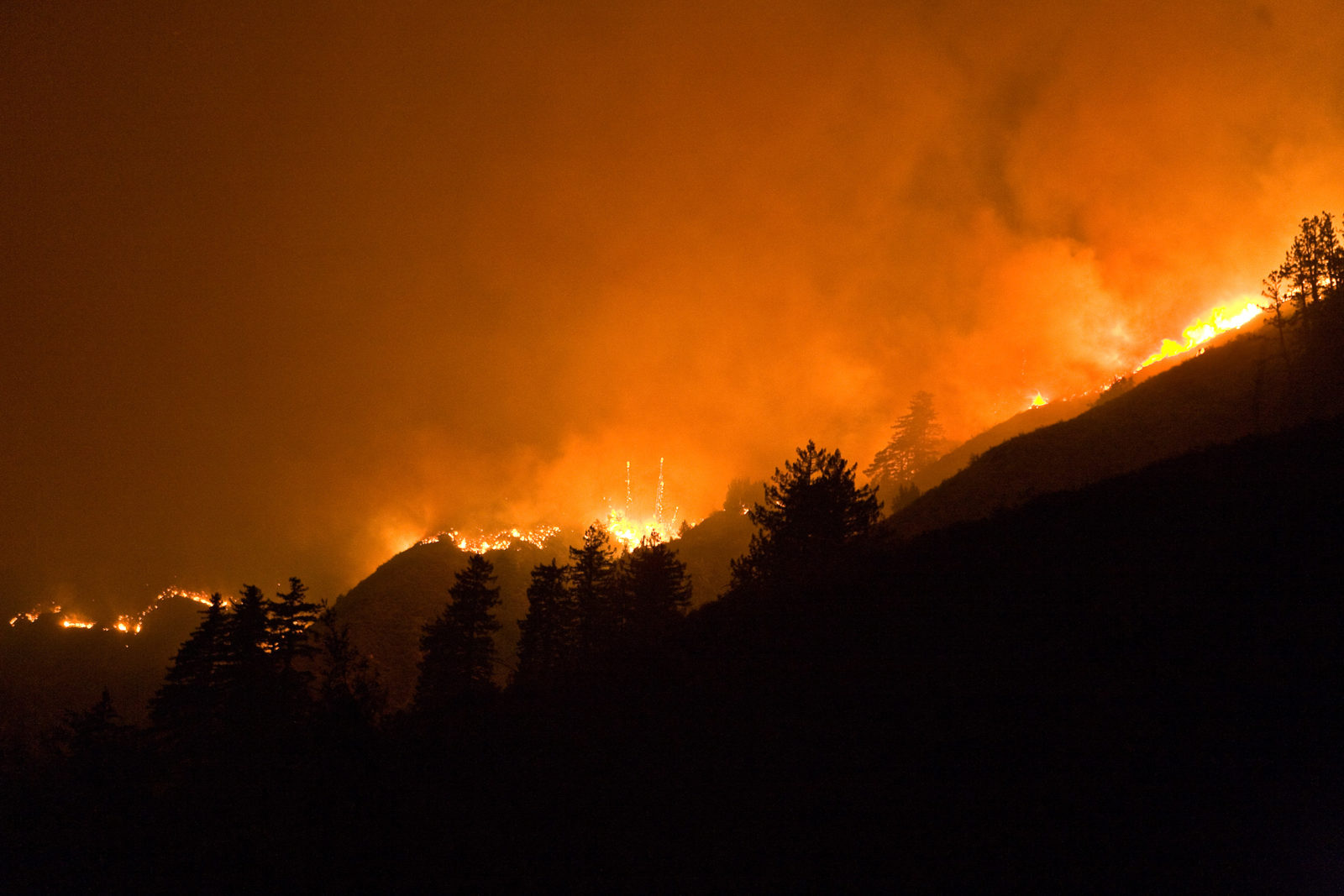
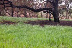
On the afternoon of Saturday, June 21, 2008, a thunderstorm moved onshore at Big Sur. The sky blackened and dry lightning flashed, starting three wildfires within several miles of each other. As the storm moved through drought-stricken Northern California, it started 600 more fires that afternoon. Within three days over 25,000 lightning strikes had been recorded and 2,750 wildfires were burning in what state fire officials called the Northern California Lightning Siege.
By July 12 these fires had burned over 800,000 acres, a new state record for land burned in a single year. Yet this was only the midpoint of a fire season that lasted until December. Once again California confronted the conundrum of wildfires: The forces responsible for the state’s unique and treasured biodiversity also contain inexorable powers of destruction.
Meanwhile, in Big Sur the three fires had merged into one, becoming the Basin Complex Fire. It continued to burn for another month, scorching 162,818 acres. After firefighters directed the fire into the still-burning area of an earlier blaze (started by an out-of-control campfire), the combined Basin-Indians Fire burned 240,000 acres, making it a contender for the state’s second-largest wildfire on record. Over 90 percent of the burn was within Los Padres National Forest’s unsettled and wild Ventana Wilderness.
A year after the fire, the casual visitor to this iconic coastline might not realize just how much of what we see here is a product of a complex fire ecology. From the fog-shrouded coastal cliffs, up the moist canyons drenched by winter rains, over the ridges into dry inland valleys, this is a rare place where major fires, virtually all started by lightning, have burned repeatedly over large areas during the last several decades.
Much of the Basin-Indians Fire burned the same area as the state’s fifth largest fire, Marble Cone, ignited by lightning in July 1977. That fire marked the end of blanket efforts at fire suppression that began in 1907 with the founding of Los Padres National Forest. In the coming years, two other lightning-started fires scorched large parts of the Ventana Wilderness: the 1985 Rat Creek-Gorda Fire and the 1999 Kirk Complex Fire.
This 31-year fire history has created a fascinating laboratory for fire ecologists and naturalists to study the processes that nurture California’s fire-born biodiversity, and I have been fortunate enough to see these changes firsthand: As a child, I traipsed these mountains with my botanist grandmother, and since the 1970s, as a professor and landscape ecologist, with my students I have tracked changes in the complex life of this wilderness. Since the Basin Fire, I’ve returned a dozen times and have talked with firefighters, resource managers, and researchers working in this area.
Contrary to the slate-clearing image we have of large wildfires, the more natural, lightning-induced wildfire regime that’s taken hold here shows how fire creates a diverse mosaic of plant communities, which in turn means more diverse wildlife habitat. By looking at some of the ways the Big Sur landscape has responded to these recent wildfires, we can get a better understanding of how fire shapes the unique biodiversity of coastal California.
Layers of Fire
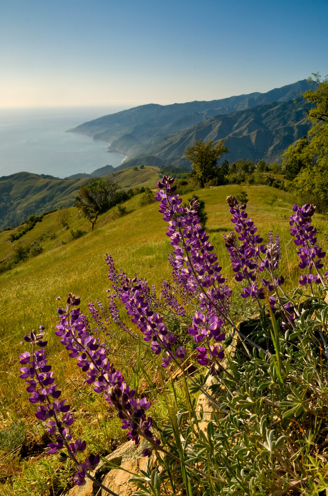
The dominant characteristic of Big Sur’s burned areas is the heterogeneity or patchiness of the landscape, a mosaic of burned and less burned areas, punctuated by islands of vegetation completely untouched by fire. While we often hear of extremely hot wildfires as “slate-cleaning” and “stand-replacing” events that destroy all vegetation and leave little except a moonscape of ashes and charred stems and trunks, such landscapes today are relatively rare in Big Sur.
This patchy post-fire mosaic results from a combination of factors, primarily from the differing intensities of the fire itself as it makes its way across the land, but also from the different abilities of the plants and trees to resist and protect themselves from damage. These factors not only produce the patchy landscape but also set the scene for an equally patchy recovery, a renewal that will not necessarily return this habitat to an earlier state but instead set the scene for new directions.
Bottcher’s Gap campground, a 40-minute drive up Palo Colorado canyon from Highway 1, provides a splendid platform for observing this process. Here, on the Ventana Wilderness’s western edge, you overlook the upper watershed of the Little Sur River. To the north are Skinner’s Ridge and Devil’s Peak, while in the east, some eight miles away, lies Ventana Ridge, connected to Double Cone peak in the southeast. The rugged ridges separating the Big and Little Sur watersheds lie directly south, about 10 miles away.
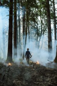
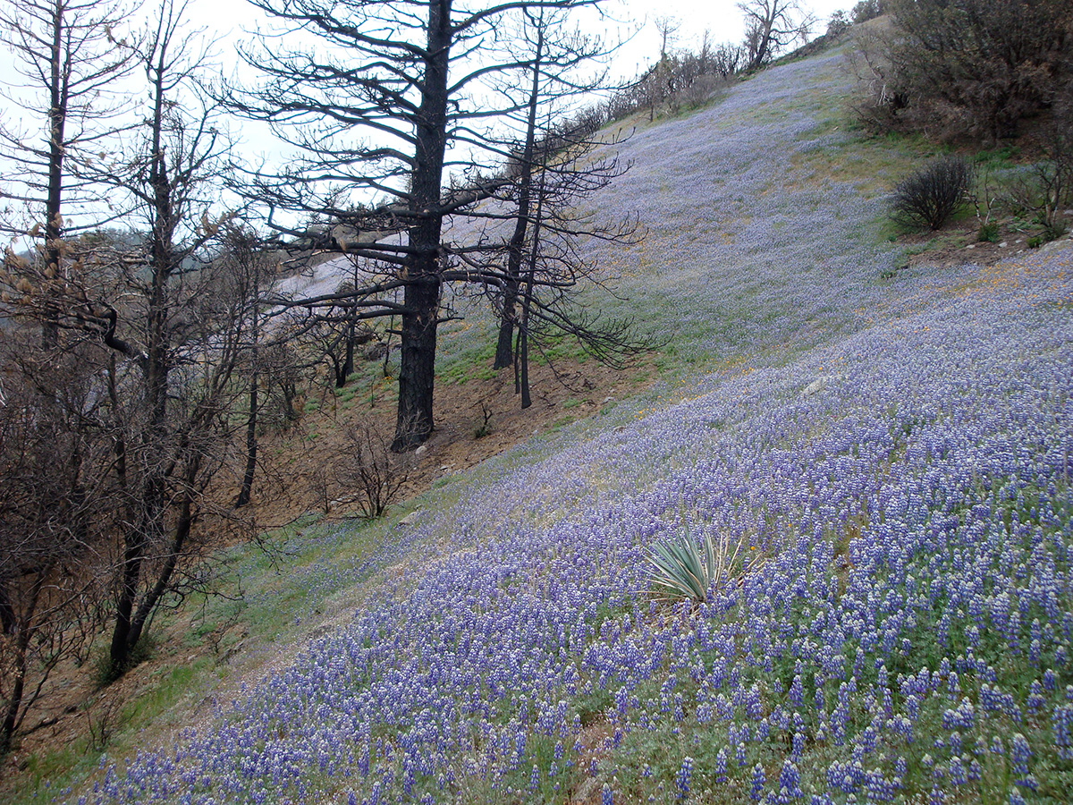
In September 2008, with the area still smoldering from the Basin Fire, the landscape conveyed an array of messages not just about fire ecology but also about how we manage fires. In 1977, bulldozers carved a fire line up Skinner’s Ridge to contain the Marble Cone Fire, keeping it from burning privately owned cabins in Palo Colorado canyon. In July 2008 those fire lines were etched anew as the Basin Fire traveled north and once again threatened Palo Colorado. In several places along the fire line, backfires were started to deprive the main fire of fuel as it burned through the watershed. These low-intensity backfires, designed to burn downhill, did little damage to the chaparral that dominates south-facing slopes here. In contrast, closer to Devil’s Peak, the Basin wildfire roared upslope with hotter temperatures and longer flame lengths, destroying oak, madrone, chamise, manzanita, and all other shrubs and trees in its path. Even the ponderosa pines on the Ventana ridgeline were severely damaged by this upslope inferno, and they’ve now been reduced to charred silhouettes on the skyline.
Shaping the Landscape Mosaic
In many ways, fire marches to the beat of its own drummer, influenced by regional factors such as wind and terrain, but it also creates its own unique micro-environment that is highly variable in terms of heat, flame length, speed, and duration. As a result, and unsurprisingly, the ensuing damage to plants and trees differs greatly throughout the burn area. In some places the fire burns rapidly with hot, high flames that consume brush and trees alike, while in other areas it smolders as it slowly works its way through grasslands and chaparral.
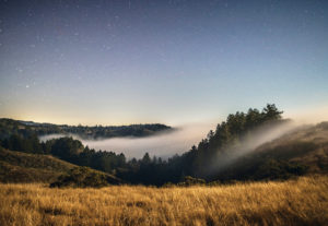
In Big Sur the presence or absence of the cool, moist marine layer results in significant differences in fire behavior. This fog was absent when the lightning storm hit Big Sur on June 21, with high temperatures and low humidity, ideal conditions for a fire’s rapid expansion . . . which is exactly what happened. Several days later when the fog returned, the fire slowed dramatically along the coast, yet continued to burn hot elsewhere.
Inland and at higher elevations, other factors were more important than the marine layer: terrain, slope aspect, and fuel load. Fires burn hotter when moving upslope, since rising heat preheats fuel above the fire. Fires also burn hotter on drier south- and west-facing slopes than on those slopes angled to the north and east, even though vegetation is usually denser there.
Even seemingly unrelated snow and ice storms can significantly affect the course of subsequent fires. In 1977, the Marble Cone Fire may have been unusually destructive because of heavy snowfall in 1974; oak and madrone branches broke from the snow’s weight, later acting as ladder fuels that spread the fire into the trees, where it then crowned, causing much more damage to ponderosa and sugar pines than would a normal ground fire. Similarly, a snow and ice storm in February 2008 added to ground fuel available for burning in the Basin Fire.
A major variable in shaping the post-fire landscape mosaic is the chemistry of the soil. In much of the world, plant litter decomposes and returns nutrients to the soil, but this is generally not the case in coastal California because our warm season is too dry for this kind of nutrient recycling. Instead, most nutrients are returned to the soil with periodic fire. However, fire redistributes the nutrients in a patchy manner, and as a result, the regrowth is also patchy.
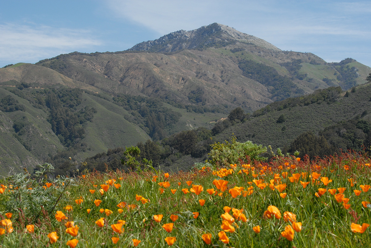
During a wildfire, nitrogen, one of the most important plant nutrients, evaporates at relatively low temperatures, and is lost to the atmosphere. Fortunately, though, heat from the fire activates many nitrogen-fixing microorganisms in the soil that are able to convert atmospheric nitrogen back into plant-friendly form. They attach themselves to the roots of plants such as lupine, vetch, ferns, and poppies, which are usually the first plants to appear after a fire. Because the Basin Fire occurred relatively early in the summer, these plants created vibrant carpets of purple, green, and orange by early September, particularly near the coast where they were watered by fog drip.
Other nutrients such as calcium, phosphorus, potash, and magnesium volatilize at higher temperatures than nitrogen, so they generally remain in the soil. However, since these nutrients are in the uppermost ash layer, runoff from winter rains often carries them downhill. This redistribution of nutrients is among the most important of the hundreds of variables that interact to produce the striking clusters of wildflowers in the post-fire landscape. In April 2009, along the Old Coast Road between Bixby Creek and Molera State Park on Highway 1, the burned-over lower south-facing slopes above the Little Sur River were resplendent with fields of orange poppies, yellow blazing stars, and purple lupine that provided colorful hints about where nutrients had accumulated after winter rains.
Another consideration is the presence or absence of hydrophobic or water-repellent soils. These soils are found in chaparral areas because the leaf litter from plants like chamise and mountain mahogany contains organic compounds that fire distills into a waxy substance that then forms a water-repellent layer several inches beneath the soil. While rainwater percolates through the upper soil, it stops at this water-repellent layer and forms a slip surface that aggravates soil erosion. As the soil moves, so do seed pools and nutrient patches. With heavy winter rains, this water-repellent layer created the slippery foundation for the mud-flows that caused havoc on Highway 1, especially near the headquarters of Julia Pfeiffer Burns State Park.
Resisting and Persisting
It’s common knowledge that coastal California’s unique flora is a product of thousands of years of recurring fire; not surprisingly, many native plants and trees need periodic fire to reproduce and thrive. As a result, ecological fire-friendliness takes many forms. Three different strategies serve as examples. Some perennial plants–such as the toyon, madrone, mule’s ears, and iris–resprout from energy stored in their roots, in underground bulbs, or from thick burls on their lower stems. Others, such as most species of ceanothus, rely on seedlings that germinate in response to clues from the fire–they germinate only after some exposure to heat, smoke, scarification (abrasion of the seed’s coating), or charcoal ash chemical signals. A third strategy is a combination of the first two, one that involves both root sprouting and seedlings. Chamise, a widespread chaparral plant, is a good example of this dual strategy.
Annuals, by definition, rely only on seeds to reproduce. However, one of the great mysteries of these fire-followers is just when they choose to bloom. While some appear in the first year after the fire, other plants produce seeds that lie dormant for years, even decades, before appearing. Unquestionably, one of the great intrigues of fire ecology is finding plants that have not been seen for years. On Dolan Ridge, on the southern flanks of the Basin Fire and the northern boundary of the Landells-Big Creek Natural Reserve on the coast south of Big Sur, four plant species previously unseen on the reserve were found by botanists in April 2009.
Fire-friendly plants also differ in how often they need fire, with some thriving on frequent fires while others need a longer interval. Although older ponderosa pines withstand fire well, their seedlings do not. Field observations in several areas have shown that the Basin Fire has taken a high toll on young ponderosa seedlings.
The knobcone pine, often a poster child for closed-cone pines that need fire to reproduce, doesn’t produce viable seeds until it is at least a decade old. Consequently a stand of young seedlings spawned by one fire may become victims of the next should it come before the seeds have matured. This appears to be the case with a flush of knobcones on Chews Ridge, off Tassajara Road, that were begat by the Kirk Complex fire in 1999, then seriously damaged in 2008 by the Basin Fire. In the summer of 2009 no new knobcone seedlings were apparent. In the absence of those seedlings, one suspects a nearby stand of Coulter pine will expand and become dominant.
Because of this wide range of adaptations to fire, there is a privileging of certain species, or plant communities, over others. Conventional wisdom says that with frequent fires grasslands expand and shrublands decrease. That theory, however, assumes a certain consistency in the frequency and intensity of fires over a long period of time. That is not the case at Big Sur. Instead, there has been a dramatic change in the fire regime affecting the Ventana Wilderness area in the last three decades. Because of fire suppression policies and strategies put into place in 1907, fires became relatively infrequent. But when fires happened, and Marble Cone is a prime example, the immense accumulated fuel led to hotter, more intense fires compared to those associated with a more natural fire regime.
After Marble Cone and Rat Creek, it seemed that major fires would reduce the range of conifers in favor of shrublands. However, since then, Big Sur has had two more major fires, the Kirk and Basin Complex fires in 1999 and 2008, which overlapped with the footprint of the two earlier fires. The new fire pattern suggests that Big Sur’s fire regime could be moving in a new direction, with more frequent yet lower intensity fires. In the recent Basin Fire, most of the fire area had burned at least once since 1977 and therefore did not get very hot, while the area categorized as high burn severity was in the southern quadrant of the Indians fire, an area that had not burned in recent memory.
If it’s true that the fire regime has changed, then the Big Sur landscape will also change. Not that the flora of Big Sur will necessarily return to an earlier, “more natural” state. Instead, it will probably move in new and different directions, steered not only by a changed fire regime, but also by factors such as climate change through global warming coupled with the effects of sudden oak death on the oak-madrone woodlands of the coastal canyons. Because of these changes and the ecological story they will tell, Big Sur and the Ventana Wilderness will add much to the understanding of California’s unique biodiversity and its interaction with fire.

