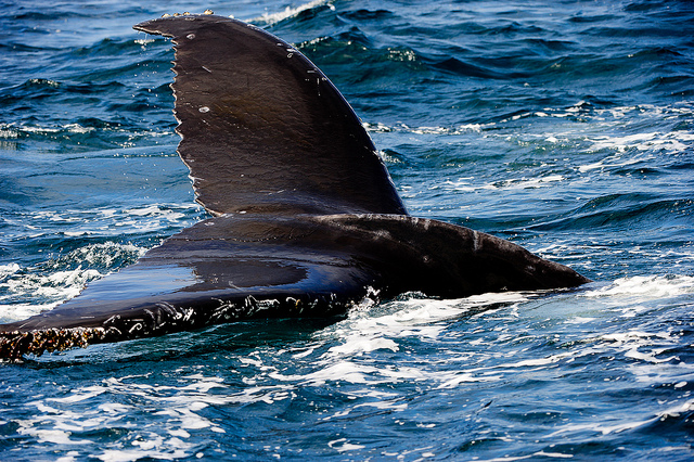
It’s been a promising season for whales migrating around the waters of the San Francisco Bay.
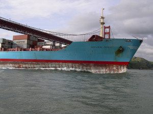
For one, food is plentiful because of a massive krill bloom, which is bringing them close to shore. There’s normally danger involved when they enter coastal shipping lanes, but the whales are more protected than ever this summer due to new regulations on ship navigation through whale territory around the Golden Gate.
And last week saw the release of a mobile “spotter” app, which allows users (mainly intended for boat captains) to pinpoint real-time whale locations on a map, a feature that will create a registry of whale sightings that can be used to further adjust shipping lanes in response to whale densities.
Conservationists hope that the new app — available in the App Store as Spotter Pro — will help protect whales in cases where the regulations may not. The new lanes have been narrowed in some places and extended in others to avoid areas known to be frequented by whales. However, the lanes are now immovable until their reassessment by the U.S. Coast Guard. The whales, of course, will continue to venture where they please, heedless of the human thoroughfares.
With the spotter app, a user can record the location of their whale sightings and any relevant behaviors and photographs. The app uses a device’s GPS to capture the exact location of the sighting and can also catalog weather, sending all information to a cloud database.
“It’s really our eyes and ears on the water,” said Michael Carver, Deputy Superintendent for the Cordell Bank National Marine Sanctuary (CBNMS).
Conservation groups like CBNMS intend to use the data to create dynamic management areas. If the spotter app shows whales in a particular traffic lane, conservationists will go out to verify the sighting, and ships will be asked to slow down or reroute to a different lane. Ship cooperation will be voluntary at first, but if vessels do not change their behavior in accordance with the recommendations, their response will be made mandatory.
“We’re looking at creative strategies to change the distribution of vessels based on real-time information about where the whales might be at any given time,” said Leslie Abramson, a resource protection specialist with the Gulf of the Farallones National Marine Sanctuary (GFNMS).
Fortunately, shippers have been on board with the new regulations and have cooperated with regulators and conservation groups. The Pacific Merchant Shipping Association (PMSA) has contributed funds to the development of the app and has helped create educational posters for ships to familiarize crews with whale species and reporting methods.
“They have been really cooperative,” said Abramson. “They absolutely love those animals as much or more than any of us landlubbers.”
PMSA’s vice president John Berge said shippers have an important role to play, given their maritime vantage point.
“Ships have the potential to serve as platforms for spotting and reporting whales on the coast, since they are traveling those routes as a matter of course,” said Berge.
Landlubbers, too, can contribute to the effort by donating old iPhones through the mail to those who can be of most help, like ship captains. And everyday citizens at sea, say, on sightseeing trips, can record whale sightings by downloading the app as a “demo” user.
“It’s sort of akin to a Twitter feed,” said Carver. “It might not be the most precise information, but it’s a nice pulse on what’s going on out there.”
At this early stage, it’s hard to say how many ship strikes might be avoided with the spotter app, but those involved in this crowdsourcing project believe it will ultimately lead to a decline, especially as more people participate.
Carol Keiper, a marine ecologist with the conservation nonprofit Oikonos Ecosystem Knowledge, has been field-testing the app since March.
“I love using this spotter app,” she said. “Instead of spending so much time writing the data and then entering it on my computer in a database, all I need to do is tap, tap, tap.”
Claire Mathieson is a Bay Nature editorial intern.