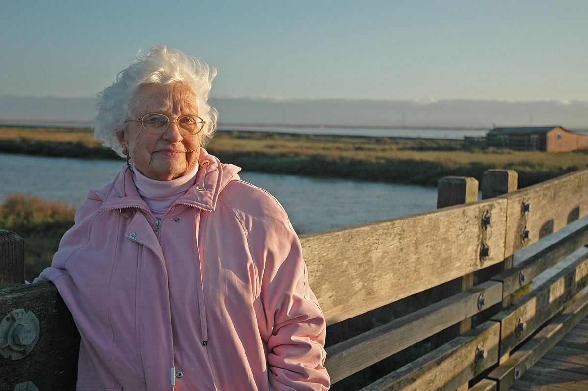
Florence LaRiviere has fought to protect marshes in the Bay Area for decades. In the 1960s she joined a small group of residents to push for the creation of what would become the Don Edwards San Francisco Bay Area National Wildlife Refuge, a now-30,000-acre haven along the shores of the South Bay that provides habitat for migratory birds and several special status species.
In 1985 LaRiviere began the Citizens’ Committee to Complete the Refuge, an all-volunteer organization committed to protecting more of the Bay shoreline. Now in her late nineties, with a voice barely above a whisper, with 60 years of activism experience and a marsh named in her honor in the wildlife refuge, LaRiviere and the Citizens’ Committee are still at work. One of their primary goals is expanding the boundaries of the refuge so that it can include neighboring areas, some of which were diked off from the Bay in the past and used to create salt ponds or duck hunting preserves. One of these parcels is Newark’s “Area 4.”
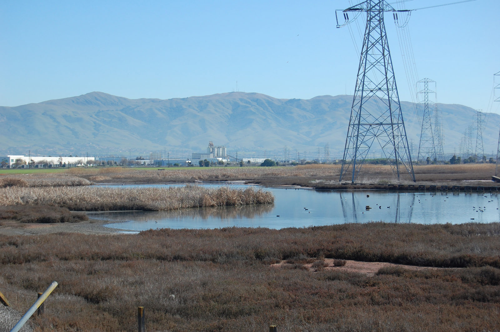
In November 2019, the city of Newark approved the “Sanctuary West” project for Area 4, a plan to construct 469 single family homes and 2,739 parking spaces. The land borders the Don Edwards National Wildlife Refuge, and conservation groups and state and federal agencies have targeted it for restoration since the 1990s. “Even then we realized the value of that land, but it has become more and more evident how valuable the adjoining uplands are because of how very rare they are now,” LaRiviere said.
Area 4 is a rare San Francisco Bay upland habitat. Tidal wetlands move inland over time as sea level rises, but for the most part, in the Bay Area, cities are built right up to the edge of the marsh and the wetlands have nowhere to go. If Area 4 remained undeveloped, it would provide migration routes for endangered species and other wildlife to move upland to survive in the future. However, since it is not protected it remains within the authority of the city to zone, and the city has been steadfast in its plan for low-density housing on the site. City planners would not comment for this story, citing pending litigation, but in 2019, Newark Community Development Director Steven Turner told Bay Nature, “the city has consistently felt this is the type of land use they want over the years.”
The city approved the development in November 2019. But local and regional activists, planners and scientists have continued to question it. It’s not just the habitat loss: most of Area 4 is in the Federal Emergency Management Agency’s “AE” flood hazard zone, which means it would be inundated in what hydrologists call a “1-percent storm.”
“Restoring wetlands is one of the solutions for climate adaptation,” said Mark Lubell, director of the Center for Environmental Policy and Behavior at UC Davis. “Building green infrastructure or living shorelines helps mitigate sea level rise. So you have two things that are working against it being a good idea to develop here — risk of flooding, which already exists since it lies in a FEMA flood zone, and the loss of an opportunity to restore wetlands.”
Environmental organizations, including the Citizens’ Committee to Complete the Refuge and the Center for Biological Diversity, had a lawsuit to stop the project rejected by the Alameda County Superior Court in December. On February 8, 2021, in response to the rejection, the groups filed an appeal to the 1st District Court of Appeal in San Francisco, stating that the city of Newark’s environmental review for the project under the California Environmental Quality Act (CEQA) was flawed and inadequate. But the lawsuit reveals what some planners say is an oversight in environmental law: it’s focused on the present.
“In terms of the legal aspect here, it’s a future ecological benefit that’s being lost, so how is that even adjudicated?” said Mark Stacey, a professor of environmental engineering at UC Berkeley who studies coastal science and policy. “If we imagine what 2100 might look like, with and without this development, it may be that it is one of the few places around the South Bay where tidal marshes are able to survive, because there’s space for them to progress.”

Newark isn’t alone, planners say: cooperating for future regional benefit at the expense of short-term development considerations – both building and not building — has challenged cities around the Bay Area. In a region in which many other cities had approved more housing projects, perhaps there wouldn’t be as much pressure on Newark to develop this one – though Zoe Siegel, the climate resilience director at the Greenbelt Alliance, said she thinks Newark has plenty of room to develop climate-smart housing even without using Area 4.
Stacey’s work looks at the cascading impacts of not just the kind of housing development that Newark has approved, but also protective infrastructure that cities might want to build to keep higher waters out in the future. As communities, counties, and regional and state agencies prepare for sea level rise and flooding, one group’s actions might affect all the others. So while an individual project like Area 4 does not create a physical impact in Bay water levels regionally, if every available part of the shoreline ended up like this, it would. “If we consider each one incrementally and in isolation, it may lead us on a path to where we end up with a regional strategy where shorelines are hardened around most of the Bay perimeter,” Stacey said.
While Stacey tries to understand the physical impacts of coastal infrastructure at the regional scale, Lubell studies governance gaps and how to implement adaptation strategies that work for the whole Bay. In a 2017 report funded by the National Science Foundation, Lubell wrote, “these governance challenges are barriers to stakeholder cooperation at multiple geographic levels—local, regional, state, and federal. There are many different governmental and non-governmental actors facing the same sea-level rise problem (in ‘the same boat’), and coordination is required to have them ‘row in the same direction.’”
State agencies like the San Francisco Bay Regional Water Quality Control Board and the San Francisco Bay Conservation and Development Commission (BCDC) have also reconsidered their strategies as regional governance groups in an often fractious mix of cities, counties and local agencies. BCDC’s role is to regulate filling and dredging in the San Francisco Bay, while the Water Board works on water quality and preservation of wetland acreage. The Newark project has provoked criticism from both. In May 2020, both agencies submitted letters that stated that the city of Newark and the developers had incorrectly concluded that the Water Board and BCDC had no jurisdiction in the area, and that no work could begin on the property without additional permits.
In its letter to the city BCDC reiterated its jurisdiction over areas of the planned development that existed as duck hunting preserves in the 1960s. These managed wetlands would require a permit from the BCDC “for any fill, excavation of materials, or substantial change in use of land or water within the area of the Commission’s jurisdiction,” the agency wrote.
The Water Board contended in its letter that the construction would result in the discharge of approximately 1.6 million cubic yards of fill at the site to raise the building pads from the 100-year floodplain. The Board added that “even if the proposed discharge avoided wetlands by being placed outside them, it has the potential to impact the wetlands and their associated beneficial uses by altering existing wetland hydrology and the habitat mosaic in which the wetlands currently exist.”
With the law mostly unable to consider future harms, environmental groups are pinning their hopes on regulatory bodies like BCDC and the Water Board stepping in.
“We think that we have sufficient authority to review projects both in context of the current tidal situation and for reasonably foreseeable impacts in the future,” said Keith Lichten, chief of the Watershed Management Division at the San Francisco Bay Regional Water Board.
In December, the 1st District Court of Appeal (which will also hear the Newark case) ruled that the California Environmental Quality Act does not constrain an agency like the Water Board from imposing further mitigation requirements on a project, even if an environmental impact report has been approved, as it was in Newark. The court ruled on a case brought by the Santa Clara Valley Water District, which challenged the Water Board’s waste discharge requirements for a project to control flooding on Upper Berryessa Creek near San Jose.
“One of the outcomes of that decision was to both affirm but also direct the Water Board to evaluate a project’s environmental impact with respect to our mandate of water quality impacts, even if the CEQA lead agencies analyses might have been more limited,” Lichten said. “One of the concerns for environmental groups when it comes to Newark is that the city didn’t go as far as they should have in terms of thinking through environmental impacts. This court case says that the Water Board has not only the authority but the responsibility to do so.”

In the last decade both the Water Board and BCDC have taken steps to increase their involvement in regional planning decisions. This has included advisory guidelines, scientific reports and interactions with multiple stakeholders. The question is, will they also make cities listen? There are widely divergent views on which approach to take, carrots or sticks — whether cities need more regulation or more incentives.
As a contribution to regional shoreline management, the Water Board funded a San Francisco Bay Shoreline Adaptation Atlas in 2019. Prepared by the San Francisco Estuary Institute and SPUR, the Atlas divides the Bay shoreline into “operational landscape units” (OLUs), connected geographic areas with common physical traits.
The report provides geographically specific and science-based sea level rise adaptation strategies for each unit and suggests constructing or maintaining beaches, marshes, and subtidal reefs to create a resilient shoreline. “Nature-based approaches, and hybrid measures that integrate nature with engineered structural approaches, may perform better than traditional engineered infrastructure alone,” the report concludes. “They can also cost less over time and provide important co-benefits like new recreational opportunities and habitat for native species.”
Lichten said he believes the best way to build along the shoreline is for the Water Board to work with project proponents and local governments to develop frameworks, like the OLUs from the Atlas, so that cities and counties can learn more about how the parcel they’re considering fits into the region. “It’s a lot harder when someone shows up with their fully baked project, and it doesn’t look like it makes sense,” Lichten said.
The Water Board and BCDC have also looked for guidance on sea level rise to the Ocean Protection Council, a state policy advisory group, which last year released a 2020-25 Strategic Plan to protect California’s coast and ocean. A key component of the plan is investment in multi-benefit projects that provide nature-based climate resilience.
Similarly, in 2011 BCDC adopted climate change policies into its regulatory document, the Bay Plan. The agency now requires projects around the Bay shoreline to demonstrate that they are resilient to mid-century and adaptive to end-of-century conditions before they are issued permits. BCDC also runs an Adapting to Rising Tides program, which offers cities and counties support for adaptation plans.
“We are going to be dealing with these issues for a long time, so it’s not just a question of how we adapt the shoreline but how we approach our governance for it in the long run that matters,” said Jessica Fain, director of planning at BCDC.
In 2020, BCDC created a program called Bay Adapt, an attempt to bring together all the actors that are part of the adaptation process to form some agreements around how to coordinate. The first draft of the “Bay Adapt Joint Platform of Actions” proposes 15 actions, including establishing a regional vision and consistency framework so that each city isn’t left on its own to figure out what to do. Fain said she hopes that BCDC will adopt these action items and implement them before the end of 2021.
The requirement for a platform like Bay Adapt stems from the idea that a “local only” approach will lead to uneven, unequal, under-funded, and uncoordinated outcomes that will hamper adaptation goals and cost far more in the long run. These actions, if implemented together and everywhere, will not only fill the governance gaps from Lubell’s work but also take into account Stacey’s cascading regional infrastructural impacts. Whether advisory actions from authorities will be enough for cities to go along with a bigger plan or whether the local-regional tensions will require a more regulatory approach remains to be seen.
One of the most successful multi-agency initiatives (which includes the Water Board and BCDC) is the San Francisco Bay Restoration Regulatory Integration Team (BRRIT), a team of staff from the six state and federal regulatory agencies with jurisdiction over permitting habitat restoration projects in and around the San Francisco Bay. Under the aegis of the San Francisco Bay Restoration Authority, habitat restoration project leaders can apply to coordinate with BRRIT during the planning phase of a project on “early review, project input and guidance, identifying agency requirements that need to be met, and resolving regulatory issues early in the planning process.” The geographical scope of BRRIT includes uplands adjacent to potential or actual tidal wetlands that can provide transitional habitat and/or marsh migration space.
“One of the things that we are excited about with the change in presidential administration is the ability to recognize climate change and rising tides as a threat, and to potentially to free up some federal resources to take these kinds of actions that make sense from an environmental perspective and are more cost effective over the long term,” Lichten said.
Still, as Newark’s Area 4 development project shows, regulatory agencies can’t force cities to consider the interests of the region or the future. The project developer hasn’t approached BCDC or the Water Board with permitting requests, but most environmental organizations want more than just a handful of additional mitigation measures. They’ve advocated from the beginning for the parcel to be bought out in its entirety and protected for its future ecological benefits.
“Is it humane to build in an area like this?” Florence LaRiviere said. “Such an expansive open space shouldn’t be used for expensive, gated houses. Its value is in keeping it undeveloped for everyone — the people and the critters that live here, and to ensure their future.”


