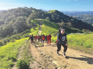
Armed with a San Francisco Bay Trail map, his set of Bay Trail map cards, and his Clipper Card, San Francisco resident Kurt Schwabe spent every day last month circumnavigating the Bay, completing over 300 miles of accessible trail – and mainly using public transit to get there and back. At home between segments, he blogged about his adventures. We caught up with Kurt just before he reached his goal on Saturday, June 29th.
BN: What originally inspired you to trek around the Bay in a month’s time?
KS: I saw a Bay Trail sign in southern Marin and decided to look into how extensive it was; I learned it was a major project over 25 years in the making! I’d been looking around for a new challenge, and since I’m a longtime runner and hiker I knew it was something I could handle. And I wanted to do it in such a way that I could share my experience with others and inspire them as well. So part of the challenge was to be able to come home each night and also to use public transportation to “commute” to and from my start and ending points.
BN: Where did you start? Did you go clockwise, or counterclockwise – or in no particular order?
KS: Clockwise, starting at the San Francisco Ferry Building.
BN: Did you grow up in the Bay Area, and if not, what inspired you to come here?
KS: I grew up in both Portland, Oregon and Sacramento. Like a lot of young people, I needed a break from the hometown scene after I’d graduated from college. And I‘d always been attracted to San Francisco since coming here as a kid to see Alcatraz.
Also, when I was around nine or ten years old I got a gift subscription to National Geographic World magazine from my grandparents and saw an article about “found art” popping up along the shoreline of San Francisco Bay in the mudflats just north of the Bay Bridge. I got the chance to see these on our Alcatraz trip.
BN: Did you often find yourself going “off plan” during your trek?
KS: Yes. When I started, I set a minimum number of miles I’d need to do in order to complete the hike in 30 days. But the trail has many “spurs” and “out and back” sections due to parts that haven’t yet been connected. I found myself exploring many of these sections even though doing do so meant I’d need to backtrack to my original route to continue on. So, often what started as an 8-mile day ended up being a 10- or 12-mile day.
Like today for instance: I was walking through Coyote Point and decided to visit CuriOdyssey [the former Coyote Point Museum]. I spent a few hours there and missed the San Bruno Caltrain, so I just kept walking for another two miles and caught a SamTrans bus on Airport Boulevard by the next trailhead. The plus side was that I did not have to do those two miles the next morning.
BN: What have been some of your favorite spots along the Bay Trail?
KS: In the North Bay, my favorite is the Shoreline Trail in China Camp State Park. It winds up into these trees and some hills so you get interspersed views of the Bay. I saw wild turkeys and a deer with her fawn.
A close second would be the trail out along Tolay Creek to Tubbs Island, a remote section of the trail [Ed: Kurt actually had to drive to that spot because it lacks a transit connection.]. When the trail begins, you have no idea you’re so close to the water. You’re walking along and see this big vineyard, then you hang a left and follow along the same trail and see fields of hay—you could be in Kansas. Eventually you’re in the marshland and finally you reach the shoreline where you can see the waves crashing on the rocks at the edge of San Pablo Bay.
In the South Bay, the Coyote Hills were striking. In that one small area you can see so much. Walking along the Alameda Creek Flood Control Channel, I saw ducks and flocks of pelicans on these islands. Then I hiked up into the hills and saw a great horned owl and her chick in some trees. And once you get to the top of the hill you have endless views over the Bay.
BN: How do you plan your transportation for each day’s trip?
KS: I use 511.org; it has schedules for all the Bay Area transit systems, including BART, Caltrain, Muni, and AC Transit and SamTrans buses.
BN: And how do you plan out the segment of trail you’ll take?
KS: I have my Bay Trail map and I swear by the map cards. You can also pull those up on your smartphone.
BN: I hear the MUNI holds a special place in your heart.
KS: Yes, I actually met my future wife waiting for the MUNI Stockton 30 line right after I moved to San Francisco. I was working for the March of Dimes at the time, and we’d just moved our offices from Brisbane to Jackson Square. I had no idea how to get home, so I struck up a conversation with her at the bus stop. I got on the right bus, asked her out to lunch, and we ended up getting engaged a year later.
BN: What was the most important takeaway from your trek?
KS: After years of spending a small fortune on vacations to faraway places and dreaming about venturing to exotic locales, I’ve learned that the sense of adventure and the feeling of being somewhere exotic can be found within a bus, train, or ferry ride from my home, right here in San Francisco. Also, venturing off the beaten path – both physically and metaphorically – leads to amazing discoveries for those willing to look for them.
BN: Would you do it again?
KS: In a New York minute!
Inspired by Kurt’s story? Check out his Walking the Bay Trail blog and the Bay Trail Project website to get started on your own Bay trek!


