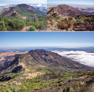
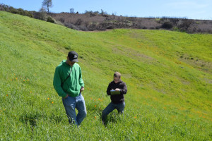
It’s been a busy morning. I arose before the sun, zoomed down the freeway, and hiked along a fire road. Now I’m off trail, following the battered blue backpack of ecologist Lindsey Hendricks Franco on the upper slopes of 3,849-foot Mount Diablo. As we approach our destination, Hendricks says, “I’m nervous. It’s like Christmas.”
We’re here to see what’s sprouting—or not sprouting—in a few of the 216 study plots Hendricks set up six months ago. Our first stop is a circular wire cage about four feet high and three feet across. “Whoa!” Hendricks shouts, pressing her nose to the quarter-inch mesh. “Some lupine in there is going freakin’ nuts!”
A doctoral student at UC Berkeley, Hendricks is studying the sparsely vegetated places where grasslands and dense, shrubby stands of chaparral come together. These borderlands, or “bare zones,” have been controversial since long before 28-year-old Hendricks was born. Nobody knows for sure why they exist. Early explanations involved everything from trampling by cows (which aren’t allowed on Mount Diablo) to the hogging of nutrients, water, light, and space by hardy, deep-rooted chaparral shrubs.
A few decades ago, a 1964 cover story in Science by UC Santa Barbara professor C.H. Muller popularized the theory that coastal sage and chaparral shrubs were adding substances to the air or soil that were keeping grass and other plants out. This idea of plant-on-plant chemical warfare, or “allelopathy,” has been talked about since the time of the ancient Greeks.
Other factors might be at work, too, Muller acknowledged. But his observations in the field and experiments in the lab with extracts of California sages (in the genus Artemisia) and true sages (Salvias) led him to believe that allelopathy was the primary force.
Muller’s work was later challenged by researchers who argued that his work glossed over the role of hungry seed and plant eaters. “In California, the chaparral and coastal sage shrubs form excellent cover for rodents, rabbits, and birds,” Stanford graduate student Bruce Bartholomew wrote in a seminal 1970 paper.
These small animals leave the shelter of chaparral in search of food. But they don’t go far, lest they themselves become a meal for hawks, bobcats, mountain lions, coyotes and other predators. That’s why the bare zone is also called the “scurry zone.”
Where Bartholomew set up cages excluding small animals, the bare zone largely disappeared. That and followup experiments led to the view held by many field biologists today, that wary little animals play a huge role in keeping chaparral-grassland borders free of vegetation. In their view, the bare zone is not so much a strip of dirt poisoned by plant chemicals, it’s a landscape shaped by fear.
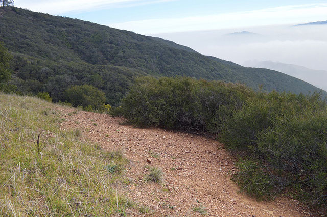
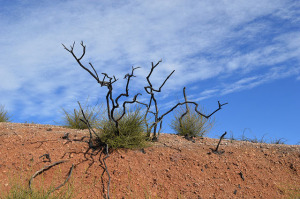
Starting last in July 2014, Hendricks set up an experiment that will test the herbivory hypothesis on Mount Diablo. She’s asking another important scientific question, too. If herbivory is maintaining the bare zone in the unburnt areas, what is happening in areas where chaparral—and the small mammals it sheltered—were displaced by the 2013 Morgan Fire? Will the bare zone disappear in those areas, at least temporarily?
To explore these questions, Hendricks has set up plots in four locations: two inside the burn and two outside. Sometimes alone and sometimes with a team of undergraduate volunteers, she established 54 one-meter-square plots at each location: 18 inside the chaparral (or what was left of it after the fire), 18 in the grassland, and 18 in the bare zone between the two. A third of the plots were exclosures encircled with quarter-inch wire mesh impenetrable to small birds and mammals. Another third were out in the open. And—just in case the wire mesh itself was changing results (for instance, by provide shade or catching fog and adding extra moisture to the site)—a third were half-open cages, enclosed on one side only.
It turned out to be an epic effort. In July, the month she was setting up her experiment, temperatures topped 100 degrees. The burned areas were accessible enough, but she had to crawl on hands and knees to establish plots in unburned chaparral. She tried camping on the mountain, but after raccoons kept making raucous attempts to raid her food supply, she decided to make early-morning commutes from Berkeley instead.
In March, Hendricks will lead a crew of trained volunteers in a full week of documenting what’s growing at each of her 216 plots. “The sampling effort is huge,” she says. If she can get long-term funding, she’ll repeat the process two or three times a year for five years.
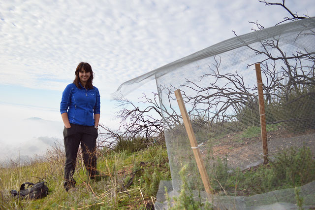
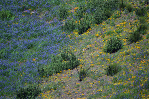
On the January day we visit, our first stop is in the burn. We spot that “freakin’ nuts” stand of lupine and other plants growing inside the exclosure. After looking around for a minute or two, Hendricks spots similar patches of plants growing outside the exclosures, too, inside and outside the zone that used to be chaparral. Those little clumps of green support her hypothesis that the bare zone could disappear where herbivores have been displaced by fire. But it’s still too early in the growing season to draw any conclusions.
Besides, science rarely proceeds with trumpets blaring. Given all the variables involved in plant growth—including competition, drought, herbivory, and allelopathy—it’s a painstaking, perhaps impossible task to prove exactly what keeps California’s bare zones bare. It’s likely a combination of factors.
But our second stop yields an interesting clue as to what’s going on at this particular time and place. It’s a classic “halo” landscape on a steep slope: dense chaparral a few feet above us, thick grass below, and in between, a six-foot strip of bare earth, dotted only with a few sagebrush bushes. It’s an area untouched by the Morgan Fire.
“Here we’ve got a bare zone we can really see,” Hendricks says with satisfaction. “Chaparral is intact with very little understory. The bare zone beside it is maintained.”
At the first exclosure in the bare zone, we spy the seed leaves of dozens of tiny plants. Outside the exclosure, the bare zone looks, well, dusty and bare. If someone told me this was a cow path, I’d believe them.
But then we plop down in the dirt. I assume we’re taking a rest. But Hendricks immediately begins examining the soil in “the bare zone.” Soon she’s showing me one plant after another, probably grasses, clipped off at ground level. I can almost see the teeth marks.
I get excited, but Hendricks resists the temptation to draw conclusions. “We could sit here and confirm my hypothesis all day,” she laughs. But she’s got science to do.


