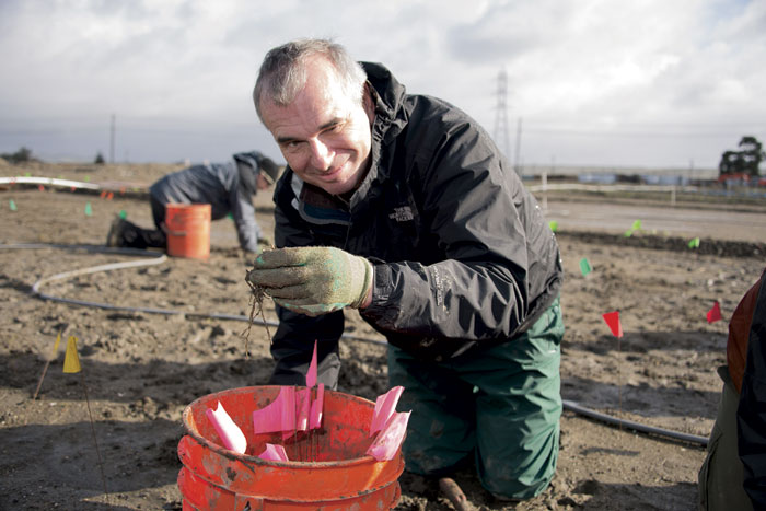
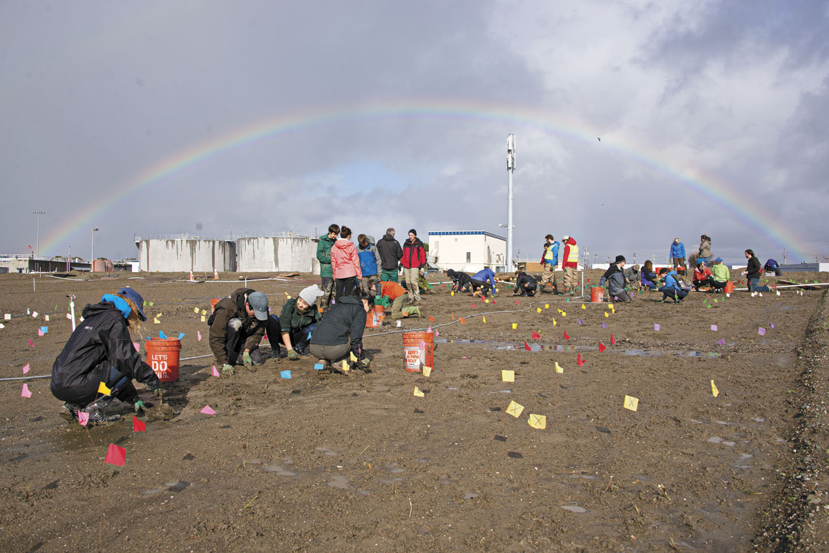
“Everything we’re doing here is illegal, infeasible, and unfundable,” Jeremy Lowe tells me with a rakish grin, as we watch a couple dozen volunteers, including several small children in galoshes, planting grasses in the mud. They’re working on an experimental levee near the Bay’s edge in San Lorenzo, just west of Hayward, innocently enough, and Lowe soon confesses that he and his colleagues aren’t outlaws after all. But this prototype levee, situated a half-mile from the Bay, is so innovative that building it on the shoreline is prohibited, even though it could help mitigate a looming environmental crisis: the rising sea levels brought on by global climate change.
Most levees are basically just walls separating water and land. (Indeed, the word levee comes from the French verb lever, “to raise.”) In contrast, we’re standing on a relatively rare horizontal levee, very wide and almost flat, dropping just five feet in elevation as one walks its 150-foot width. This small prototype stretches 700 feet along the “shoreline” (in this case, a trench), while a grown-up one might span as much as 14 miles. Lowe, a geomorphologist at the San Francisco Estuary Institute and one of the project’s chief architects, compares it to a layer cake: Underneath the loam we’re standing on is a layer of sand and wood chips where microbes break down nitrogen-containing waste, and beneath that a stratum of dense clay and a hardpan that keeps the water used in this experiment from seeping into the Bay. But since this layer cake sits on land owned by the Oro Loma Sanitary District, next door to its wastewater treatment plant and downwind of its aromas, I wish we’d talk about something other than food.
Bay water levels could rise by as much as three feet by 2050 and more than five feet by 2100—putting up to 270,000 Bay Area residents in flood zones, along with 1,800 miles of road, 15 power plants, 10 wastewater treatment plants, and all of the Bay Area’s major airports, predicts the National Research Council. Rather than attempting to hold back all this water behind taller and taller walls, a horizontal levee like Oro Loma’s uses the natural infrastructure of wetlands to absorb that water and the force of waves. For that reason, Peter Baye, an independent coastal vegetation ecologist and another mastermind behind this experiment, told me that he prefers the term “wetland levee.” (The Oro Loma site is also sometimes called a habitat levee.)

Whatever you call it, a horizontal levee is actually two levees in one: a wetland zone sloping gradually into the Bay, and a conventional vertical levee between that wetland and civilization. This interplay between old and new levees reinforces Baye’s frequent warning that wetland levees are not a panacea, but a tool to help the existing levee infrastructure handle the Bay’s water levels. Rather than replacing vertical levees, horizontal levees supplement them.
But before this potentially game-changing barrier can be constructed, its proponents must overcome a significant legal barrier. This is what Lowe means by an “illegal” project: building wetlands on the edge of the Bay can mean filling portions of it with soil if infrastructure already abuts the shoreline. “If someone started doing that right now,” Lowe explains, the San Francisco Bay Conservation and Development Commission (BCDC), a regional watchdog agency, “would be saying, ‘Wait a minute! You can’t do that! That’s what we were set up to stop people from doing.’”
Indeed, BCDC was formed in 1965 as a direct response to the imminent threat of cities filling in vast tracts of the Bay for development. Since then, it has been a centurion standing watch to prevent reckless developers from impinging on the Bay. Ironically, it’s now impeding environmentalists and scientists. It will take some bureaucratic wrangling to square contemporary environmental science and unforeseen climate challenges with some arguably well-intentioned but now outdated regulations; to that end, BCDC policy is currently under revision with horizontal levees in mind. In the meantime, the Oro Loma experiment’s purpose is to test whether a habitat levee is as useful as its supporters hope and to document its value to convince potential allies.
The horizontal levee already has the support of Save the Bay, the organization formed in 1962 to halt the filling of the Bay. And not just on paper—most of the two dozen volunteers kneeling in the mud on a Saturday morning were recruited by the nonprofit, and habitat restoration director Donna Ball is on site as well, singing the project’s praises. “All we need to do is grow 70,000 plants,” she says, sighing theatrically, though she’s clearly eager for the challenge.
One plant at a time, the volunteers approach that target. Amy Ritchie, who works on an unrelated project at the San Francisco Estuary Institute, says she’s volunteered in part to support her colleagues. Also, she’s here to fight climate change with her bare hands. “It’s hard to have worry with no outlet. To know that the sea is rising, but with nothing you can do about it,” she says. “That’s why it’s nice to have things like this, that give you a way to address the problem yourself.”
Ritchie and the other volunteers are planting a variety of native plants—Baltic rush, iris-leaf rush, field sedge, and creeping wild rye. Bryan Derr, a Save the Bay trainer on hand to answer volunteers’ questions, explains that these water-loving rhizomatous species reproduce via their roots. They are excellent nitrogen absorbers, crucial in this man-made wetland because of a feature that makes the Oro Loma levee truly distinctive: the water flowing through it is treated wastewater.
Wastewater, which remains rich in nitrogen even after treatment, routinely causes harmful algae blooms in the Bay and elsewhere. But in the 1970s, the wastewater community adopted a new slogan: “the solution to pollution is dilution,” encapsulating an effort to divide and conquer wastewater’s nutrient load by diluting it deep underwater before it could contribute to algae blooms on the Bay’s surface. This strategy is still largely in place today. Deepwater discharging, Peter Baye tells me, was embraced “before we had any understanding of how estuaries and floodplain wetlands denitrified nutrient loads. We just didn’t know how it worked.”
Oro Loma’s wetland levee is a potential alternative to the deepwater discharge model and would represent, if not a return to the Bay’s “natural” state, then at least a step in that direction. Running nutrient-rich water through a wetland levee and its absorbent sedges and rushes would prevent many of those nutrients from entering the Bay in the first place.
Conveniently, man-made wetlands like the Oro Loma levee are improved by treated wastewater just as much as that wastewater is improved by the wetlands. Ecologists can dump soil and plant the right grasses all they want, but for wetlands to be wet they need water, which no longer flows naturally to where it’s needed in urban spaces like San Lorenzo. One can pump the water in, of course, but thanks to the drought, water is in short supply. But Baye, Lowe, and their colleagues noticed a huge supply of water going completely unused—10 million gallons of treated wastewater, getting dumped uselessly into the Bay every single day.
In other words, Oro Loma’s horizontal levee looks like a win-win. Or rather, a win-win-win-win: improved water quality in the Bay, productive use of wastewater, habitat for a variety of birds and mice, and flood protection in the face of a rising sea. And even better, its funding is folded into the wastewater treatment fees that support the sanitary district. But scaling up such sea level rise mitigation projects will depend on additional sources of funding, such as the Measure AA parcel tax that comes before Bay Area voters on June 7. The measure will fund the San Francisco Bay Restoration Authority to support projects such as Oro Loma for 20 years.
While sea level rise is not the only problem the levee addresses, it’s probably the most urgent—which has helped this project move along faster than it otherwise might have.
“People don’t understand,” Lowe says, “their house might not be in the low-lying area, but the wastewater facility is. And the power station, and the highway, and their airport is. So everybody in the Bay Area, all nine counties, has an interest in what happens on the shoreline. Because if we start having these big floods, you’re not going to go to work. You’re not even going to be turning your lights on.”


