slais Creek Park sits on a small creekside beach just off Highway 280, on the outskirts of San Francisco’s Dogpatch neighborhood. A small patch of sand and marshy shrubbery that slopes gently to the water, the beach is surrounded on all sides by signs of industrial development: an abandoned 5-story copra crane, warehouses, and a heavy metal drawbridge that hardly ever has need to rise. Islais Creek, a once-thriving waterway bottled into a dead-end channel, has served many needs through San Francisco’s history – transport during the Gold Rush, a channel for industrial and wartime trade during World War II. Now, though, the creek has added a new designation: in September it became the first official San Francisco site on the San Francisco Bay Area Water Trail.
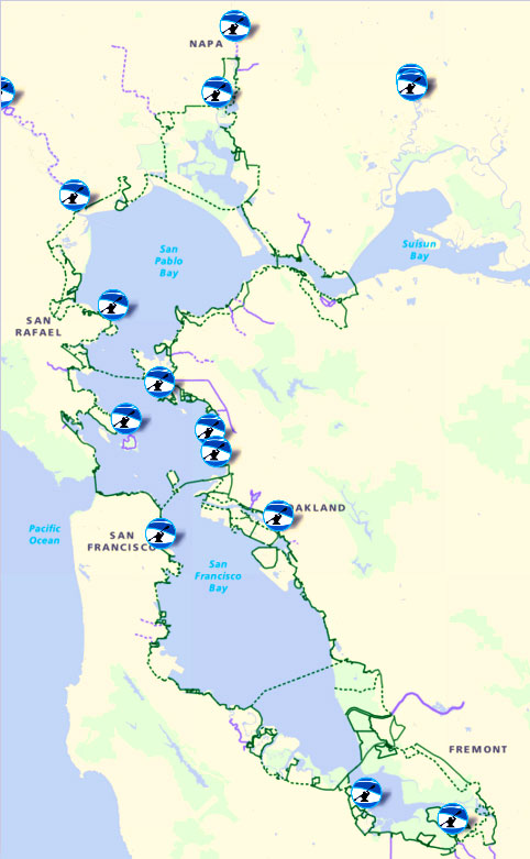
The Water Trail is meant to serve as a kind of marine parallel to the well-established Bay Trail, and when completed would offer paddlers and recreational boaters sites to launch boats or haul out, as well as bathrooms and other facilities, to enable longer trips around the Bay. The trail added two new sites in December and is expanding in 2016 to add more, says Ben Botkin, a planner with the Association of Bay Area Governments (ABAG), which leads the Water Trail project.
Bo Barnes, the president and founder of Kayakers Unlimited, and Fran Sticha, a longtime member of the group, helped us fit our spray skirts and life vests on the beach of Islais Creek. Barnes emphasized the importance of knowing the paddling conditions for the day. Currents, winds, tides – even on the often placid-looking Bay it’s foolish and can be downright dangerous to embark on a paddle without knowing what you will be facing. “When people lived in Nature they understood these things,” Barnes said, opening up an app on his phone. “But we have electronics now so there’s still no excuse.”
our KU members, Botkin, and I pushed off into calm water off Islais Creek Park. The air was still and though it was still early, the sun had burned away residual fog and promised a clear, warm day. Egrets soared close over the surface of the water as the kayaks cut through the protected creek, passing industrial service towers and under a low bridge that forced us to duck our heads. A salty wind backed behind us, just strong enough to provide a boost. As we paddled, the narrow channel broadened and steep concrete walls replaced the marshy sand banks.
Approaching the mouth of the creek, the wind picked up and the water became choppier, slapping insistently against the side of the kayaks. “Get ready for the Bay!” Barnes yelled as his kayak emerged from behind the protection of the concrete jetty and entered open water.
This particular morning, the waters were calm, the winds were mild, and the air was comfortingly warm – an exception of a day, the KU kayakers assured me. The giant towers of PG&E’s decommissioned Potrero power plant rose up over a small cove called Warm Water Cove – another site Botkin has considered for the Water Trail. The park contains abandoned warehouses, graffiti, and has become a gathering ground for D.I.Y. music and touring musicians. Nicknamed “Toxic Creek,” the site has been undergoing restoration and clean up efforts in recent years. It would still require several specific assets – a boat launch and storage facilities, for example – to be considered for official Water Trail designation.
For the kayakers, the experience of being on the Bay in their human-powered crafts is communion with nature, even when surrounded by the urban landscape. “I love it – nobody’s out here except seals and birds,” said KU member Mark More.
San Francisco’s bayfront legacy of industry and commercialism pervades the view. But even amidst the towers of the power plant and the industrial concrete warehouses rising up on either side, the deep blue-green waters of the Bay remain populated with fish, birds, and seals. Unpredictable currents and constantly changing winds remind the smart kayaker that the Bay is a force of nature that for all of the development hasn’t been tamed.
addling north past Pier 70, we approached Crane Cove Park, where a warehouse had been torn down for multi-use development. Currently, the lot is conspicuously empty – a flat concrete slab framed by two multi-story cranes – but Water Trail advocates like KU are helping to incorporate boat launch ramps and storage facilities into the development plan, which could allow it to be added to the Water Trail once the project is finished. In an area as developed as San Francisco, every ramp counts. “You can only get into the water at certain points,” Botkin said.
It’s not just the developed waterfront that’s a challenge to expanding the Water Trail: even in areas where there’s water access, it has traditionally been devoted to commercial and government barges, which don’t mix well with small human-powered canoes and kayaks.
To become an officially designated part of the Water Trail, a site needs waterfront access, a bathroom, facilities to store boats and general accessibility features – such as a launch point and parking. Elsewhere around the Bay, Water Trail sites also have facilities for overnight camping. The long-term goal is a site every 2-3 paddleable miles, and places to stay overnight every 8 paddleable miles. “The idea is if you’re going from place to place, where are you going to stay?” Botkin said. “It’s like backpacking in the Sierra Nevada — but instead, you’re kayaking.”
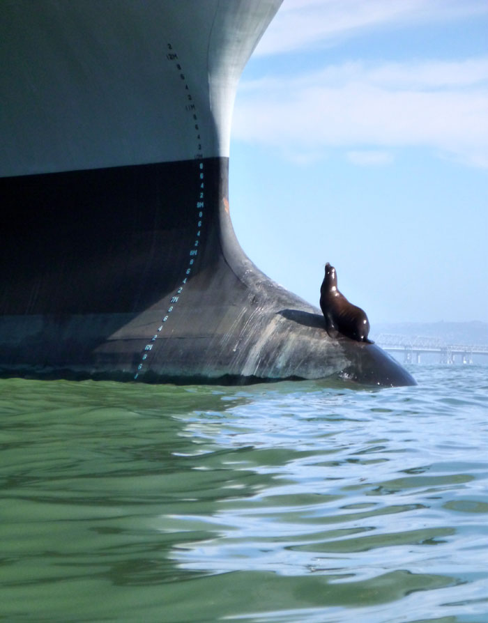
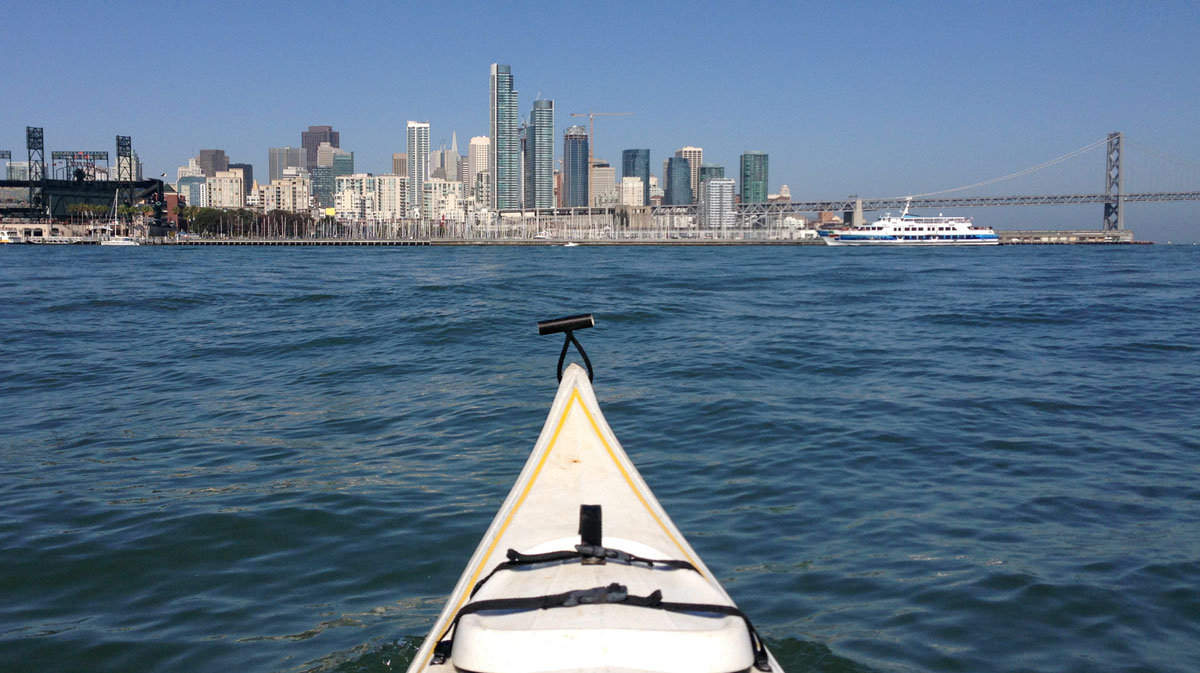
North of Crane Cove Park we enter China Basin and then McCovey Cove behind AT&T stadium, where two huge barges loom over us. As we edge around the nearest one, a sea lion pops up out the water to take a look at us, so close to the kayaks that someone could have reached out to pat its head. The sea lion submerges again and reemerges suddenly with a burst of power, landing on the lower hull of the barge, where it settles down to soak up the sun and watch us paddle by.
For the first time since beginning the paddle we encounter other people on the Bay – in kayaks and smaller motor-powered boats, floating outside the stadium to enjoy the festivities of a late-season baseball game. The smell of butter, popcorn and hotdogs wafts from the vendors and cannons explode spectacularly over our heads.
The slight turbulence of the Bay fades away as we turn up Mission Creek. We pass the row of charmingly dilapidated houseboats that fronts the shiny new glass facilities of UCSF’s Mission Bay campus. The sounds of the stadium and the Bay fade again, replaced by mostly quiet except for the interruption of squawking gulls.

Mission Creek would be yet another good San Francisco Water Trail site, Botkin says. It has a low freeboard dock, an important and rare boon for kayakers. Most docks on the Bay are high freeboard that accommodate motorboats, but make it more difficult for paddlers to climb in and out of their water-level boats. It would be a nice spot, Botkin says, for novice kayakers to easily launch and gain paddling experience without the hazard of the Bay, where traffic and currents can be dicey. “Trying to incorporate a variety of experiences is a great part of the Water Trail,” he said.
Mission Creek could be a “destination” location, Botkin says, meaning its main use would be for people to hop off their boat. Other such sites include Schoonmaker beach in Sausalito, where it’s possible to pull a kayak onto the sand and have a picnic.
Water Trail organizers have also worked with the owners and managers of historic ship bunks around the Bay, such as Cass Gidley Marina in Sausalito, to add boat-building workshops, boat launches and campsites to existing facilities. In other words, not only would travelers be able to attend unique and historical programs on how boats were built, but they might also get the chance to stay on an old one. “It would be a neat experience to bunk up on an old ship,” Botkin said.
But overall, access to gear and the water are the Water Trail’s top priorities. “Having a lot of clubs, storage options and rental facilities are all important for getting more people into the sport,” Botkin said.
So far ABAG has approved 14 sites for the Water Trail. Botkin said that much of the past decade has been spent figuring out how to structure the trail and get bureaucratic approval for new sites, and he hopes now to grow it more rapidly. The Trail has no official trajectory, but, Botkin said, “the goal is as we’re able to get more sites designated there will be a natural trend towards developing certain routes for trips involving one-night stays, or two night stays.”
But that’s in the future. For today, there’s nowhere to camp and nowhere to stop, so we turn our kayaks and fight the currents to head back to Islais Creek.
Melanie Hess is a Bay Nature editorial intern.

-300x190.jpg)