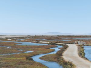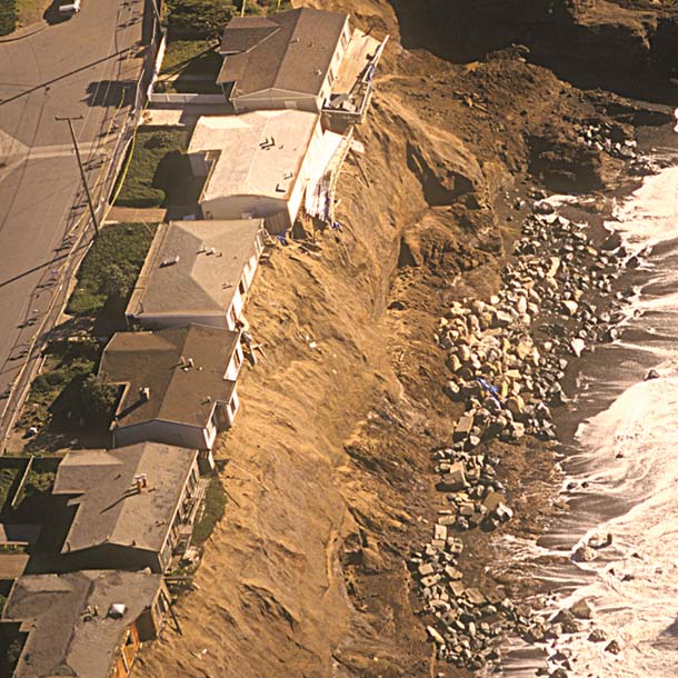
Most of the people in the world–and most of their infrastructure–can be found in jurisdictions bordering the coast or coastal watersheds. The Bay Area is no exception. However, in this era of climate change, the benefits of living close to the shoreline are accompanied by the peril of rising sea levels and more frequent major storm events. Climate scientists project that sea levels will rise between 31 and 55 inches by the end of this century and that flooding now associated with 100-year storm events will become much more frequent.
How can coastal communities prepare for and respond to this threat? That was the challenge that several government agencies and nonprofit organizations decided to tackle when they formed Our Coast–Our Future (OCOF) in 2010. The primary goal was the development of an interactive online service that would combine the latest scientific knowledge of physical factors such as sea level rise, storm intensity, and coastal flooding with fine-scale mapping of the existing Bay Area shoreline, from the Pacific coast into San Francisco Bay. Now the achievement of this goal is in sight: This winter OCOF will release its “Adaptive Planning Toolbox” for the outer coast, to be followed by a San Francisco Bay version in mid-2014.
The underpinning of the toolbox is a high-resolution digital elevation model (DEM) produced by the U.S. Geo-logical Survey (USGS) based on the latest underwater and land-based elevation data at a resolution of two meters. From this foundation, USGS is modeling projected coastal erosion and flooding based on increments of sea level rise and a range of storm surge scenarios. PRBO Conservation Science is pairing that with a suite of physical and biological data layers that users can turn on or off, depending on their objectives and concerns. What existing infrastructure in the community is at risk? What neighborhoods might be subject to flooding? Is there land that could be acquired to buffer existing communities? Does it make sense to restore a particular wetland?
According to OCOF coordinator Kelley Higgason of the Gulf of the Farallones National Marine Sanctuary, this will be the first locally scaled model of its kind, putting state-of-the-science data into a user-friendly format for real-world application by planners and authorities in coastal communities. The other partners in this effort are the San Francisco Bay National Estuarine Research Reserve, NOAA Coastal Services Center, and the Na-tional Park Service. To find out more, go to prbo.org/ocof.