by
This story is part of Sea of Troubles, a series about the changing Pacific Ocean, and first appeared in the January–March 2016 issue of Bay Nature magazine. It was supported by a grant from the Schwemm Family Foundation.
Early one July morning, a boat left Sausalito looking for evidence of a silent killer from the depths of the sea that might be coming into San Francisco Bay.
The research vessel Mussel Point had a crew of three: a technician, a researcher, and a captain—a deeply tanned and weather-beaten man of the sea who spent the early part of this voyage half-watching the Tour de France on his iPad while the scientists drank coffee. The morning light played across the unruffled waters of the Bay in that sparkly Thomas Kinkade sort of way that makes you wonder if nature has any taste at all.
The expedition by a team from UC Davis’ Bodega Bay Marine Laboratory was to be some of the last physical labor of more than two years and more than a quarter of a million dollars’ worth of science—all of it being conducted, nervously, during some of the strangest conditions ever recorded in the Pacific Ocean. This was the part that gets buried in journal articles under the heading of “Methods,” but actually consumes most of the money and effort. The RV Mussel Point was out looking for five buoys.
Each buoy is anchored to the Bay floor by 200 pounds of heavy steel chain links and a nylon rope. Midway along this rope is a subsurface float to keep the line taut. Also along this rope is the whole point of this contraption, sensors that repeatedly measure and store the water’s temperature, salinity, and dissolved oxygen content. The sensor package will sit in the water, tracking the killer’s movements and lethality. The sensors are tightly secured to the rope. At the very end of the rope is a bright orange hard plastic float the size of a beach ball that is topped with a 10-foot-high aluminum mast, which is itself topped with a reflector panel. It should be very easy to see.
The first buoy to be retrieved is located off of Tiburon. At least, that’s where they left it. Plotted it with GPS and everything. It is, alas, not to be seen.
The technician, David Dann, says they tried to place the buoy out of everybody’s way, but the Bay is a busy place and you never know when a boat’s going to run over a buoy and cut it loose. Dann says he hopes they don’t have to come back for the sensor with scuba gear. The Bay is a turbid murk with near-zero visibility, heaped with trash and spider-webbed with pipes. It’s not, he says, the safest place to dive.
The Tiburon buoy abandoned for now, the Mussel Point motored off to the next location, just off Potrero Point in San Francisco, where, any minute now, they should find the next buoy. Any minute now. Right around here.
Nope.
The researcher who built these buoys, Matt Robart, says the current is really ripping along. He put a lot of slack into the mooring line to keep the buoys at the surface of the water, but maybe not enough. He shrugs. With the price of fuel being what it is, every hour running the Mussel Point costs $249.
“Yeah, we just burned about 400 bucks looking for those moorings,” Robart says.
The next spot is at Mile Rock, outside of the Golden Gate and there, at last, is a buoy. They snag it and attach it to the boat’s winch. As they haul it aboard, the mooring line is absolutely filthy with life, so much so that Robart has to slough it off before it reaches the spool, depositing upon the deck big, briny, snot-colored clumps of writhing little worms.
The captain, Steven Neil, looks on and says, “You could make a helluva burger out of that.”
Robart says, “Some would call that a delicacy.”
“That’s a big pile of shit,” Neil says.
The little wrigglers are Caprellids, better known as skeleton shrimp. They latch onto anything in the ocean—grasses, seaweed, rockfish, buoy moorings—and wait with their gnathopods poised to snatch any smaller creature that passes by. Could these be the tasty and sustainable protein of the future?
“Nah,” Robart says. “Mostly shell. I ate one one time—you gotta try it, right? All crunch.”

The killer they hope to find with these buoys is a pulse of water from the ocean’s depths called an upwelling, and it makes for a strange villain, says John Largier, a professor of coastal oceanography at UC Davis’ Bodega Marine Lab, who leads this team and is the principal investigator of what the upwelling means for the San Francisco Bay.
We sit at the eastern boundary of the North Pacific Gyre, a great clockwise swirling of the ocean from the Philippines to Japan to southern British Columbia to the tip of Baja California. Our coastal slice of this southward-flowing water is called, straightforwardly enough, the California Current. Every year, through the spring and summer, a northerly wind blows down the west coast of North America. As it blows, the frictional force of the wind tugs at the surface of the ocean, pushing it south, while the rotation of the earth creates the Coriolis effect, turning the water clockwise and pushing it off to the current’s right as it heads down the coast. Because we are on the west coast, that means the surface water is being pushed offshore. That water has to be replaced, and it is pulled up from the depths below the continental shelf. This is the phenomenon called upwelling, and it occurs from north of Oregon to south of Baja California. The water that it brings up from the depths is colder, saltier, lower in oxygen, and richer in nutrients from decomposed plant and animal life than the water on the surface.
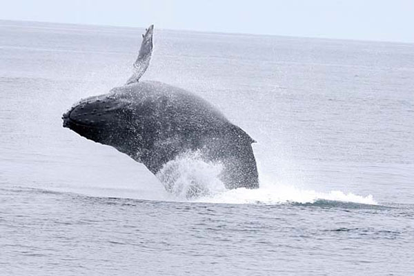
And mostly, the upwelling is pretty great. All those nutrients from below create a great feast of phytoplankton, the base of a food web that feeds zooplankton, bait fish, predatory fish, porpoises, whales, sharks, seabirds—“it’s like the Serengeti Plain out there, a wonderful grassland that’s fertilized by the upwelling, and these grasslands are grazed on by all sorts of animals, except the animals happen to be little half-inch zooplankton,” Largier says. But the zooplankton are eaten by larger fish, birds, and mammals. For humans, the upwelling supports commercial and sport fisheries, whale watching, and the cool waters and fogs that give coastal California such a moderate summer climate. At least, usually it does.
For the last two years the Pacific Ocean has been in a state that no one has ever seen it in before. It is behaving very weirdly, with large numbers of whales feeding right off the Golden Gate and algal blooms spreading, and people like Largier wondering how far that weirdness might go. Might it go all the way into the Bay?

When we think of the Bay, we don’t really think of it as part of the ocean. We kind of realize it’s connected to the ocean when a whale gets lost in it or we notice a huge container ship, but we don’t usually think about the water itself as linked with the ocean. Usually, we think about the water in the Bay in terms of the water that comes downriver out of the Delta. Is there runoff pollution? How much was diverted? Whither the smelt? That sort of thing. After all, there are sensors measuring water quality every few miles throughout what scientists refer to as the “Bay-Delta system.” But there is no one measuring what comes in from the ocean—even though, until you get to the Carquinez Strait, the Bay is mostly seawater with a dab of freshwater thrown in.
When Largier started looking at what he calls the “ocean watershed,” it seemed like the problem would just be in understanding how the ocean works, and then how it interacts with the Bay. And then things outside the Golden Gate started changing, and the problem became much greater—and much more urgent. The threat of the killer became far more serious. Why? Well, first it helps to know a little about how the ocean ought to work.
The vast majority of life in the ocean lives in the warm water near the surface, in the euphotic zone, so called because only here is the water bright with sunlight. Where there’s light, there’s photosynthesis, meaning all those one-celled phytoplankton that feed the zooplankton that feed the little fish that feed the bigger fish that feed the seals that feed the sharks. The phytoplankton and the wind churning the surface of the water are also saturating this top layer with oxygen. Of course, everything that lives also dies and, when you die in the ocean, you sink. As all these carcasses fall out of the euphotic zone, they’re being decomposed by aerobic bacteria that are inhaling oxygen and exhaling carbon dioxide. “It’s a moving compost heap,” Largier says. Below the bright and vibrant layer of life and light, there’s a layer in the ocean that’s darker, colder, full of nutrients and lower in oxygen. (It’s also more acidic, thanks to that carbon dioxide, but that’s an entirely different giant problem.)
Over the last few decades this cold, low-oxygen layer has expanded. It’s growing wider, and it’s reaching closer to the surface, so that marine life that once lived or ventured into those depths has been forced upward into an ever-shallower and warmer surface layer. Now when there’s an upwelling, that cold, suffocating low-oxygen layer can be dragged higher and can spread wider than ever before.
We’re used to thinking of dead zones as the direct result of human pollution in places like the Gulf of Mexico, where every spring, agricultural runoff flows down the Mississippi and induces a runaway choking algal bloom. The algae then dies off and is consumed by bacteria that take in oxygen and excrete carbon dioxide below the river plume, creating an unbreathable oceanic wasteland thousands of miles across, driving away fish and dolphins and birds, creating the watery equivalent of an electronic dance music festival, a place utterly unfit for multicellular life.
But since 2002, these horrible dance parties have been popping up along the West Coast, seemingly without direct human pollution. The most dramatic case was probably in 2006, off of Oregon’s Cape Perpetua, on a seafloor that normally teems with sponges, rockfish, sea slugs, and crabs. But after dead crabs started washing ashore, scientists sent down a remotely operated submersible and the footage it returned showed vast and barren tracts, alternating with what look like the aquatic version of Matthew Brady’s images of Civil War battlefields, the bodies of all the crustaceans and other animals too slow to get away piled atop one another, claws outstretched to the current, waving lifelessly.
The big problem with a dead zone that comes in near the shore isn’t that it chases off the fish. The fish are largely fine, if a little stressed; they’ve just gone somewhere else. The problem is what happens to the slower creatures on the ocean floor who can’t escape from the throbbing bass and low oxygen levels. We’re talking about crabs, clams, and such. When the oxygen saturation drops below 5 milligrams per liter, they suffer stress; when it drops below 2 milligrams per liter, they start to die. The crabs go first, after maybe an hour. The clams last longer because they can clam up and outlast a brief dose of hypoxic water. But eventually, they too will die. If this kind of hypoxic dance party came into some place really full of crabs, like the Bay, the carnage would be obscene.

The intrusion of upwelling into the Bay is very much like the fog that sweeps in above the surface: a cold, dense layer, sinking under a warmer layer above it, backing up behind hills and mountains. So the changing character of the upwelling, though a large and growing problem along the coast, didn’t look like a concern for San Francisco Bay, because the Bay is protected by a shallow sandbar outside the Golden Gate, and by the fact that it is a large and active body of water. The upwelling backs up behind the bar, like fog backing up behind Mount Tamalpais, but the deepest and coldest low-oxygen water rarely or never overtops it. And even upwelled water that does make it over the bar and into the Bay gets churned up just inside the Gate in the central Bay, like fog mixing away into the atmosphere.
Then in April 2011, the attention of Largier and his colleagues was caught by data from a regular monthly survey of the Bay done by the U.S. Geological Survey. It showed a continuous layer of low-oxygen water along the bottom of the central and south Bay. The oxygen levels were less than 5 milligrams per liter—low enough to look like the sign of a water quality problem caused by organic pollution, Largier says. But the water was also cold and salty, and clearly from the ocean. Here, sneaking over the sandbar and slithering across the bottom of the Bay, was the killer upwelling.
Excited and alarmed, Largier wrote a study proposal and sent it off to California Sea Grant. By early 2014, he had $293,000 to support a grad student for a couple of years and to pay for the time of his coastal oceanography group staffers to collect data and run the data analysis. And so, by March 2015, Matt Robart had sensor buoys built and deployed: one near Tiburon, one off Potrero Point in San Francisco, one at Mile Rock outside the Golden Gate, one near Point Bonita, five in a semicircle following along the crest of the sandbar outside the gate, another out in the Gulf of the Farallones, and one right off Stinson Beach. It was just in time for upwelling season.
The plan was to pull the buoys out of the water in July. It took a little longer than expected. The team eventually found the Oakland buoy, but it was being pulled so strongly by the current that they had to suit up and dive down the line to cut the sensor off of it. The top of the Tiburon buoy, they later learned, had been found by a concerned member of the public who thought it was trash and cut it loose; only after he had hauled it in did he realize it belonged to Bodega Marine Lab. After he returned it, lab staffers were able to go out and dredge the rest of the mooring off the bottom and recover the sensor. Two other buoys were never recovered, Robart says, but they were less expensive and not as critically located. Overall, nine out of 11 buoys came home to the lab with their sensors.
The research team peered into the data, looking for signs of the upwelling sneaking into the Bay. Maybe they would see these dance parties starting, while they’re still just low-oxygen intrusions like in 2011, and not the kind of deadly hypoxic carnival that hit Oregon in 2006. Because if they could find it then, we would start to know under what conditions the Bay is vulnerable and where it is most vulnerable before one of the worst symptoms of the changing ocean came into the Bay.
They didn’t find it. Or, rather, Largier says, they found it, sure, but it was muted and then thoroughly mixed up and obliterated by the time it reached Angel Island.
What happened, basically, was more global warming, in the form of California’s massive drought and the nonexistent snowpack of 2014-15. See, for the upwelling to sneak into the Bay, Largier believes, the Bay needs a surface layer of warm, formerly fresh water from the rivers: the runoff from snowmelt. This warm buoyant layer will, somewhat counterintuitively, allow the deep ocean water into the Bay—because it prevents the cold upwelled water from mixing with the rest of the Bay (best time is during neap tides when currents are weak). Under those conditions, the upwelling could slither in like icy death for the Bay’s crabs. And it’s perfectly reasonable to believe this will happen, because the upwelling starts in March and goes through June, just like the snowmelt. The two forces peak at different times, but it’s easy, Largier says, to imagine them overlapping, and that’s likely what happened in 2011 when cold water with less than 5 milligrams per liter snuck in along the bottom of the central Bay and the south Bay. Largier and his team were perfectly situated this year to catch the upwelling sneaking in and describe the process. But: no snowmelt, no sneaky upwelling intrusion.
Now the grant is done and so is the study. What they hauled out of the Bay, besides a lot of writhing, snot-colored skeleton shrimp, was a messy, incomplete, and frustrating glimpse of the ocean’s influence on the Bay as it looks now. The Bay might keep looking like this; it might not. Nature is not cooperating with her interrogators.
Largier says this kind of thing happens all the time when one is trying to observe complex natural systems (and not, say, working on a theory in a lab with a near-limitless supply of lab rats to run experiments on). It’s also very difficult, bordering on impossible, to line up funding and do a study quickly enough to catch anomalies in the climate.
It’s hard to say what comes next, Largier says. The forces changing the upwelling seem likely to continue. Perhaps it will come sliding back into the Bay when we have a snowpack again, perhaps in a La Niña year. With the way the climate is going, Largier says, it’s hard to predict if the upwelling will make it into the Bay. “Maybe,” he says, “in the end it’s not actually going to happen.”
But Largier will keep worrying about the upwelling making it over the bar and in through the Golden Gate, because it could be a huge disruption of life as we know it in the Bay. Maybe he’ll be able to round up some funding to put a sensor or two in the water in the coming years. Maybe a permanent sentinel buoy. Maybe he’ll be able to collaborate with someone who has funding, or with people using the Bay.
“We have to try and keep an eye on it,” he says.
Watch
Between 2013-2016 we witnessed some of the strangest conditions ever seen off the West Coast of the United States. Record-breaking warmth, birds dying, fisheries closed, sea lions suffering seizures. That period seems to have ended -- but what happens next? Was this sea of troubles just a weird few years, an anomaly in the normal flux of ocean conditions? Or was this a shift that we'll look back on, decades from now, and point to as the beginning of a different era?
In this short film presented by Bay Nature, award-winning independent filmmaker Jason Jaacks follows marine scientists from the Bodega Marine Lab and Point Blue Conservation Science as they track the dramatic changes happening in our ocean.
In this short film presented by Bay Nature, award-winning independent filmmaker Jason Jaacks follows marine scientists from the Bodega Marine Lab and Point Blue Conservation Science as they track the dramatic changes happening in our ocean.
Act
This is an all-hands-on-deck moment. But it's not a hopeless one. We can all help the ocean, even in our day-to-day lives. We can minimize driving and flying, avoid plastic, and eat less meat. And we can participate in some important initiatives already taking shape. Here are some specific actions targeted to help in our particular corner of the Pacific.
Donate
Donate to the Bodega Marine Lab to support the work of ocean scientists studying coastal California.
Volunteer
Join a long-term NOAA research project to document the marine life and coastal conditions of the Greater Farallones National Marine Sanctuary.
Download
WhaleAlert is a free downloadable smartphone app that allows people to report sightings of endangered whales in the Farallones sanctuary.
Eat
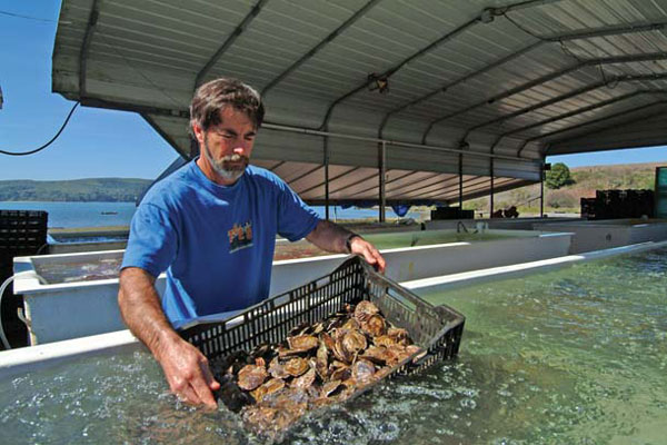
The Hog Island Oyster Company in Tomales Bay is part of the California Shellfish Initiative, which tries to ensure a healthy marine environment for hard-shelled species at risk of ocean acidification.
Calculate

Take a few minutes to find out your carbon footprint with the EPA's carbon calculator. Then take steps to reduce it!
Donate
Become a sanctuary supporter through the nonprofit Greater Farallones Association, with a membership or targeted donation for specific projects in the fields of conservation science, education, and ocean stewardship.
Observe
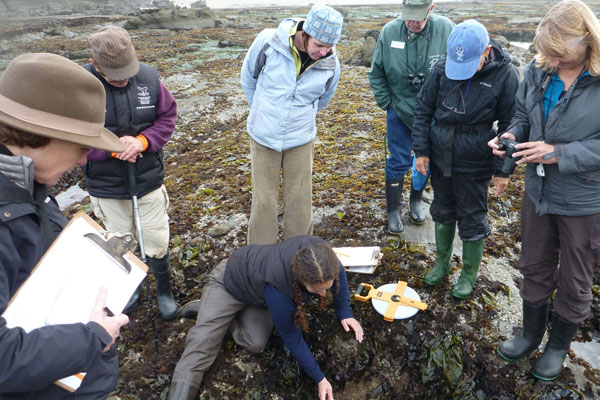
Join volunteers and naturalists from the California Academy of Sciences to document California coastal biodiversity through the Academy's innovative citizen science program.
Sign
Sign up to be a "marine protected area champion" and learn more about the Ocean Conservancy's efforts to support California's ambitious network of marine protected areas.
About
This series explores the unique and critical role of the eastern Pacific Ocean and California Current in creating and sustaining the world we know -- and the way dramatic changes over the last few years have left even scientists uncertain about the future.
Sea of Troubles is a project of the Bay Nature Institute, and was funded by a gift from the Schwemm Family Foundation.
Editor
Eric Simons is the editorial director at Bay Nature Institute, where he's created web series on El Niño, biodiversity conservation in the Anthropocene, and fire recovery on Mount Diablo. He is the author of two books: The Secret Lives of Sports Fans, and Darwin Slept Here.
Writer
Brendan Buhler is an award-winning science writer and co-author of the book Follow Your Gut: The Enormous Impact of Tiny Microbes. He has written for California, Bay Nature, and The Los Angeles Times, and had his work anthologized in the 2012 Best American Science and Nature Writing. Visit him on the web at brendanbuhler.com
Filmmaker
Jason Jaacks is a filmmaker and photographer focused on social and environmental issues. His most recent film, Silent River, follows a young woman as she defies death threats to save one of the most polluted rivers in Mexico. He has produced video for National Geographic, MSNBC, Discovery Digital, PBS, and Fusion.
Web Developer
Laura’s been in the IT field for more than 20 years and working on websites for 15+. Her business, Modo Web Design, focuses on sites for non-profits and the arts. She's also a visual artist who creates nature-influenced art. She wishes she could be outdoors all the time.