It is a chilly autumn day and I am scudding over the water of Liberty Island, or Liberty Lake as it might be called, with biologist Brad Burkholder of the state Department of Fish and Game, talking about a place where the future is the present. We are in a fan boat, pushed along by a noisy above-water propeller, and able to skim right over low vegetation. Right here, though, the water is deep, cold, turbid, ruffled by strong wind. It is not inviting, unless you are an endangered fish.
Liberty Island, on the northwestern fringe of the Delta, is one flooded tract whose demise nobody seems to regret, an accidental restoration that has yielded unexpected, and encouraging, results.
Diked in the 1920s, the tract lies at the lower end of the managed floodplain called the Yolo Bypass, an overflow zone for Sacramento River waters. By the time the reclaimers got around to this stretch, the state authorities were requiring that levees here be built low enough so that the floods of heavy winters could overtop them. Nonetheless, the island for years bore good crops of corn, wheat, and tomatoes; the Liberty Farms Company canned its own asparagus.
In 1995, a more than routine flood occurred, as a big chunk of levee at the island’s southern tip crumbled into Cache Slough. Repaired, it failed for good in 1997. In 1999, the Trust for Public Land acquired the tract, which it still owns.
- Aerial view looking north across open water expanse of southern Liberty Island. The remains of the island’s broken levee border Cache Slough (foreground), which meets the Sacramento Deep Water Ship Channel at the tip of the island. Photo by Patrick Kelly, sfoap.com.
What was created inside the breached circle of levees was a vast tidal lake, its floor sloped like a swimming pool from diving depths at the south to wading depths at the north. Within a few months of the break, tules were colonizing the northern shallows. In 2003, biologists began to sample the new habitat for fish. As they hoped, they found lots of longfin and Delta smelt, Sacramento splittail, and striped bass. But then came the surprises.
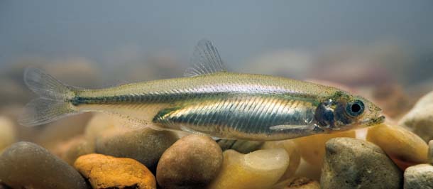
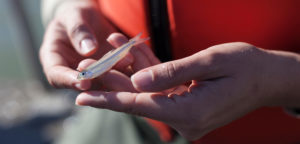
- The tiny and endangered Delta smelt–“poster fish” for the plight of the Delta–is the subject of numerous court decisions, rescue operations, and angry editorials. Photo by Dale Kolke, CA Dept of Water Resources.
The researchers had focused at first on the northern, shallow end of the island, called “the largest and most cost-effective tidal marsh restoration project” in the Delta. They had thought the southern end was too deep for some species of interest, not deep enough for others, and very likely to be colonized by the prolific invader Egeria.
But Egeria did not appear, and the native fish species seemed to like the southern waters best. As for the smelt, they did something quite unexpected. They stuck around.
Biologists had thought they had this critter figured out. Like a tiny, silvery salmon, the smelt shuttles between salinities. It hatches in fresh water, soon moves downstream to the brackish zone; and returns upstream to spawn and die. Most of its short life is spent near the line where salinity is two parts per thousand, called in the jargon X2. This zone shifts, moving upriver in dry years, downriver in wet years.
But X2 is never anywhere near Liberty Island–yet the smelt that hatch here, or many of them, never leave.
What is different about Liberty? For one thing, it is about as far away as it is possible to get from the pull of the major water export pumps. For another, as part of the Yolo Bypass system, it is periodically on the receiving end of lots of muddy water. For a third, it gets a lot of wind. Finally, Liberty Island is a rare dead end in the channel system of the Delta. Elsewhere, tides tend to make leisurely circles around islands; here, they pump in and out the way they came, often very quickly. Apparently, this combination serves the smelt and other sensitive fishes well, while discouraging Egeria.
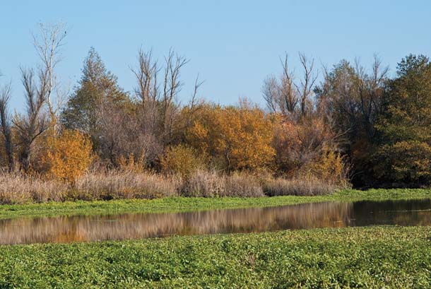
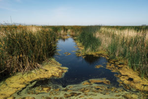
- This former beaver pond on the northern edge of Liberty Island is now being taken over by the aggressive nonnative water primrose. Photo by Stephen Joseph, stephenjosephphoto.com.
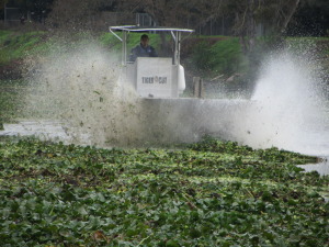
If one exotic doesn’t get you, however, there is always another. Approaching the north end of the island, our boat leaves open water for an inviting labyrinth of tules. Soon, though, a new texture becomes apparent: masses of a floating plant called water primrose. It is a recent arrival, and like its invasive peers, it covers channels, traps sediments, and calms currents. We skim across a former beaver pond turned primrose mat. This end of the island, once so promising for native fish, is now the domain of the exotic black bass, bluegill, and carp.
Northern Liberty Island, Burkholder says, needs a dose of the same medicine that has worked for the southern reaches: disturbance, in the form of more exposure to the seasonal floods. Removal of the remnant northern levee and alteration of an upstream weir would open the island wider to scouring, life-giving flows from the Sacramento River and Yolo Basin.
Such ideas are part of an emerging larger vision for Liberty and adjacent lands and waters. Several nearby islands may be added to the flooded zone. Sloughs that are now linked, producing tidal loops, may be severed to produce the dead-end embayments that seem good for fish. Someday this island-become-a-lake could be the core of a broad corridor of floodplain, marsh, and open water, an entire estuarine system, reproducing on a small scale what the whole Delta once was in large.
The example of Liberty Island resonates beyond this corner of the Delta. “The flooding of Liberty has changed our minds a bit,” says Ted Sommer of the Department of Water Resources. “Flooded islands can be okay, under the right circumstances. The recent data gives some hope.” Carl Wilcox of the Department of Fish and Game takes it a little further. “Liberty Island,” he says, “is our new paradigm.”

.jpg)

