Along the gentle arc of the northern San Pablo Bay shoreline, one of the region’s least loved highways traverses one of its most fascinating landscapes. California Route 37, the 21-mile link between Vallejo and Novato, is a fast, straight road that in its eastern half becomes a slot between concrete medians and bone-rattling, textured shoulders designed to keep your mind on your driving. Better to be in the passenger seat, for the country you are traversing deserves far more than a stolen glance. Rich, flat, laced with shining waters, very nearly uninhabited, it is one of the three regions adjoining San Francisco Bay where vast historic wetlands could be brought back to life—and are.
At two places along the route, the road rises slightly to cross ridgelines running southeast toward the Bay: Black Point in Novato—between the valley of Novato Creek and the Petaluma River, and Sears Point—marking the divide between the Petaluma Valley and the region drained by Tolay Creek, Sonoma Creek, and the Napa River. Why call these modest heights “points,” you may wonder. A look at 19th-century maps makes things clear. Sears Point and Black Point were once points indeed, long fingers of dry ground intruding into a watery world.
At the time of European contact, San Francisco Bay was bordered by tidal marshes around much of its complicated perimeter. In three places, that spongy fringe bulged landward into marsh complexes miles deep. One of these great wetlands enwrapped the southern arm of the Bay. A second extended north from Suisun Bay on the fringe of the Central Valley. The third bordered San Pablo Bay from Point San Pedro in Marin County to the mouth of the Carquinez Strait at present-day Vallejo. The three areas were of similar size, each originally close to 70,000 acres. Today, the original tidal marsh landscape in each has almost entirely disappeared. Each area has nonetheless retained substantial value as habitat, especially for birds. And in each area the task of the new century is to build on what has survived, bringing back chunks of the still-greater richness that was.
The Rise and Fall of the Marshes
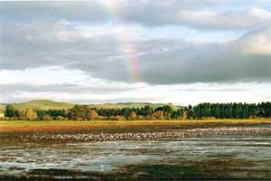
- While much diminished from its former extent, the great arc ofwetlands north of San Pablo Bay is still a significant destination onthe Pacific Flyway for large numbers of shorebirds and waterfowl, asseen here at Petaluma Marsh. Photo by Scott Hess.
San Francisco Bay was not always encased in marshes. When the sea began to poke in through the Golden Gate at the end of the last Ice Age, it gained ground rapidly, flooding the series of linked valleys that make up the floor of the modern Bay. Any peripheral wetlands that formed were quickly inundated. By 3,000 years ago, however, sea level rise and the advance of the waters had slowed. Mud banks on the margins of the Bay were colonized by cordgrass, alkali bulrush, pickleweed, and other plants adapted to life half-in, half-out of variably salty water. Once established, the marshes could keep pace with continuing sea-level creep. They thickened themselves, shedding their own dead growth to build ever deeper peat soils; they also shifted horizontally, expanding upslope, making up for any territory eroded at the open water margin.
At the moment of European contact, the San Pablo Bay marshes were an impressive sweep indeed. They also contributed a good share to the biological wealth of the region. Pouring bits of themselves into adjoining waters, they nourished a proletariat of invertebrates and small fish and, through them, all the animals higher up the food chain. Within their confines, the marshes contained a special habitat of wandering, branching, mud-floored sloughs. These provided shelter and food for young fish, including Chinook salmon and steelhead; for crustaceans like Dungeness crab; and for birds such as diving ducks and the California clapper rail. The higher lying parts of the marshes, “the marsh plains,” had their own communities of marsh-dependent animals, like the San Pablo Bay song sparrow and the salt marsh harvest mouse. Before there were man-made salt evaporation basins, there were natural ones—shallow pools, or “pannes” set into the marsh plain that intermittently filled and dried out, attracting salt-loving birds like eared grebes and avocets. At the land edge, the marshes merged into other damp environments: brackish and seasonal wetlands, moist grasslands, and willow groves and thickets along creeks. This mosaic of habitats helped make San Pablo Bay a major destination and stopover on the Pacific Flyway, that heavily traveled avian thoroughfare between summer breeding grounds to the north and wintering grounds to the south.
The Human Imprint
The Native American groups of the region, speakers of Miwok and Patwin, had important village sites on the rims of the marshes, such as Olompali at Novato and a major settlement at Vallejo. They harvested food and fiber from the wetlands and plied the channels in tule boats. After conquest and colonization, the new masters planted their settlements at the same peripheral locations, natural transfer points between commerce on land and on water.
Soon, though, the settlers wanted less water and more land. Beginning in the 1850s, they began diking off marsh areas between the sloughs and converting them into islands for agricultural use. Dredges moved along the waterways, lifting loads of mud and depositing them on the adjacent marsh border. It took several goopy passes to create a reasonably stable levee. A final breach would be closed at a low tide, when as much water as possible had drained from the new land. In about two years, the soil would be dry enough to work.
The heyday of “reclamation,” as this process was called, was the last third of the 19th century. In the summer of 1870, 12,000 acres were being leveed off on the west side of the Napa River. In 1890, it was the turn of the marshes along Sonoma Creek. By 1930, the last major dike had closed.
Just one big piece of original marsh along San Pablo Bay was left intact. Along the Petaluma River, there remained 4,000 acres of bulrush and cattails, pickleweed and saltgrass, laced with sloughs and dotted with perched, salty pools. Surrounded by unusually deep waterways, this tract survived the boom years of dredging and then passed into the hands of duck-hunting clubs who liked it the way it was. As a result, the Petaluma Marsh is the largest block of prehistoric tidal marsh remaining in California. Here scientists carried out the first large studies of West Coast marshes to see how they function in a relatively natural state.
In addition to this and a few smaller relicts, the region acquired some newly made marsh. Nineteenth-century hydraulic mining in the Sierra Nevada sent a billion cubic yards of sediment moving slowly down the rivers tributary to the Bay. Much of this settled out in northern San Pablo Bay, creating mudflats where none had been before. When Highway 37 was constructed in 1922, much of its course still ran right at the bay’s edge, where a wave-constructed berm served as the fundament for a road-bed. Soon the road was buffered by a new marsh strip. Formed very quickly, this wetland lacks the intricate circulation system and habitat variety of a Petaluma Marsh. But unlike many such second-generation marshes, this one was not, in its turn, diked and drained. By default, it became a last stand for such creatures as the salt marsh harvest mouse and the black and clapper rails.
After 1930 the outlines of the modern landscape were set, but subtler alterations continued. With the closing off of marsh regions that once flooded and drained with each tide, the sloughs carried less and slower-moving water. As a result, they silted in, narrowing and shallowing. Waterways once navigable on any tide were not so any more, or could be maintained only by expensive dredging.
On the newly made land, too, a process set in that is observed whenever marshes are “reclaimed.” Exposed to the air, the soil began to oxidize and disappear, a kind of slow fire. The old marsh plain lay about three and a half feet above sea level. The typical farm field in the region now lies four or five feet below. In the first decades, fields could be kept dry by opening simple valves at low tide, allowing ponded water to exit into the bordering sloughs. From the 1950s on, active pumping was required.
Fortunately for the birds, the drying-out program was never fully realized. Some owners allowed their land to “pond up” in the fall for the benefit of ducks and duck hunters, several were permanently reflooded for the same purpose, and other chunks reverted to wetland (if not to fully tidal marsh) as the primitive dikes around them sprang leaks.
In 1952, Leslie Salt purchased a rank of ranches along the Napa River and converted them to an open-air salt factory. In a system that operated for 40 years, San Pablo Bay water was tapped and transported northward through a series of ponds, growing ever more saline by evaporation. It was a miniature version of the great salt operation in the South Bay. As in the South Bay, these ponds drew birds by the thousands.
The Choice for Conservation
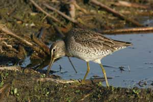
- Dowitchers are among the many shorebirds that spend their winters inthe marshes and mudflats of the San Pablo Baylands. Photo by Rick Lewis.
By the 1960s, the North Bay margins were an utterly different world from the one the Indians and colonizers knew. They remained, nonetheless, a world apart and somehow out of mind. Cities boomed at either end of Highway 37; to the north, at the old wetland margins, vineyards expanded their grip on the landscape. But the land along California 37 looked much the same in 1978 as it did in 1958: tawny hayfields, a few duck clubs, glints of water in sloughs, and plenty of “No Trespassing” signs. The highway offered no inviting exits for exploration. Hunters and some bird-watchers knew the ways into the depths of the region, mostly from the north, where narrow roads reached landings on the banks of obscure channels. Naval installations at Mare Island near Vallejo and at Skaggs Island, a secret communications complex on Sonoma Creek, also helped preserve the status quo.
But the land was too close to the metropolis for this stasis to hold. Though not very well suited to conventional development, the territory invited urbanization in the particular form of the “lagoon residential community,” with fingers of filled land for house sites, dredged channels and locks for boats, and a dock in every backyard. The first of these communities in the North Bay, Bel Marin Keys on Novato Creek just south of Highway 37, was started in the late 1950s. A second, the Bahia neighborhood west of the Petaluma River, was begun ten years later. In the 1980s, a huge lagoon residential plan for the Cullinan Ranch, adjoining Highway 37 just west of the Napa River, seemed headed for construction until conservationists blocked it in court.
It was this controversy that really focused the region’s attention on the San Pablo Baylands. Clearly a broader initiative to protect this valuable zone was called for, including more acquisitions, agricultural conservation easements, and cooperation with farmers to increase the value of their fields for migratory birds.
Government agencies and private land trusts had in fact been assembling property in the region since the 1970s. In 1974 the San Pablo Bay National Wildlife Refuge was created, covering mostly the “new” marsh and mudflats south of Highway 37. In 1978 the California Department of Fish and Game (DFG) purchased the heart of the old Petaluma Marsh, and has been building its holdings in the area ever since. In the 1980s, the Sonoma Land Trust began putting together a cluster of lands at the mouth of the Petaluma River. In 1991, Cullinan Ranch was added to the federal refuge. In 1994, DFG became the owner of the most extensive piece of all: the 10,000 acre salt pond system.
In the new century, two controversies, one at the west end of the baylands and one smack in the middle, brought citizen activists out in force and cemented the region’s future as a conservation zone.
At Bahia on the Marin side of the Petaluma River, only part of the planned lagoon residential community had been completed, and there weren’t enough waterfront home-owners to pay for the frequent dredging required to keep channels open. Boats lay heeled over on the mud. A developer, supported by the City of Novato, now proposed to round out the half-built boater’s paradise. The Marin Audubon Society led the dogged opposition. In 2003, after Novato’s voters revoked the development approval in a referendum, Audubon engineered the purchase of the undeveloped portions of the sprawling property, including wetlands and a stretch of rare blue oak woodlands.
Another scare came in 2002, when headlines announced a plan for a casino on Highway 37 at Sears Point, a site held for decades by increasingly frustrated speculators. The group behind it was the Federated Indians of Graton Rancheria, which, as a federally recognized tribe, enjoyed immunity from normal government land-use controls. Once made aware by conservationists of what their plan would do to prospects for restoring the San Pablo Bay shoreline, the tribe graciously ceded the field to the Sonoma Land Trust, which—with the help of many partners and donors—was able to buy the land.
With these acquisitions, the jigsaw puzzle of preservation around San Pablo Bay was rapidly coming together. “We’ve turned the corner,” says Beth Huning of the San Francisco Bay Joint Venture, the umbrella group of private, public, and nonprofit baylands stakeholders. “The big central pieces have been preserved. Now it is time to restore them.”
The Remaking of a Landscape
But what form would that restoration take? Could the old wetlands, now known as the “San Pablo Baylands” and recognized as keys to the ecosystem’s future health, simply be brought back, and to what extent should they be? What about salt ponds and other managed waters of recognized value to fish and birds? How would farms fit in?
In 1999, the conversation was crystallized in a document dryly titled Baylands Ecosystem Habitat Goals. A better title might have been Turning Back the Clock, or maybe You Can Go Home Again (Almost). What is proposed is a substantial undoing of a century of land “reclamation,” a massive breaking of dikes, and surrender of hard-won terrain to the tides of San Francisco Bay. Regionwide, total salt marsh acreage would more than double. For every two acres of fully tidal marsh, about an acre of managed wetlands would also be retained and improved.
Along San Pablo Bay, marsh area would grow from 16,000 to 38,000 acres. The expanded marsh would sit on the dome of the bay rather like a three-pointed crown: a wide strip along the entire bayfront, with major prongs up the Napa River on the east, Sonoma Creek in the center, and the Petaluma River to the west. Alongside and sometimes within the spreading marshes, large areas would remain as pools, “muted” marshes with controlled tidal flows, or seasonal wetlands. The various habitat restoration projects in the area—60 at last count—are now to be seen as aspects of one great undertaking: the building of a diverse new landscape.
Twenty years from now, drivers along Highway 37 will be seeing more marsh, more bird-studded open water, more riparian vegetation, more wild hillside. They should also have better access to what they see. At a minimum, it will be safe, in more places, to stop and look around. The “North Bay Flyway Highway,” as it is now being styled, will be more worthy of the name. The Bay Trail, mostly on diketops south of the highway, should be complete as an alternative, nonmotorized corridor. Canoers and kayakers will have more places to launch on journeys into the sloughs and the bay.
And what about 50 years from now? By then we will know the outcome of the great gamble implicit in all of today’s efforts at ecosystem repair: that restoration will be able to keep up with, and reduce the damages of, global warming. The latest report of the Intergovernmental Panel on Climate Change predicts a 20-inch rise in sea level over the next half-century. That’s the midrange estimate; it might be more, but that is quite enough. In places around the Bay where marshes, old or regenerated, are thin strips alongside structures like roads and seawalls, they are likely to be pinched out of existence. Will Travis of the Bay Conservation and Development Commission expresses the fear: “The Bay by default will become a big reflecting pool.” Hope lies in a few places like the San Pablo baylands, where the undeveloped zone is wide and where marshes, if established early, can thicken and shift their margins inland as they need to.
The rising sea may also disrupt the planned two-to-one proportion of tidal marshes and managed wetlands. Diked pools and muted marshes lack the wild marsh’s ability to adjust to a changing environment; they require maintenance, and the costs of that may climb along with the water level. But true marshes also earn their keep as soft seawalls, absorbing the energy of waves and high tides, and as spongelike absorbers of water in flood events, which are expected to become increasingly frequent.
In the long run, the recent strange perturbation of the North Bay wetland fringe—its decimation by diking, its brief augmentation by sediment eroded from faraway mountains, its hollowing-out by subsidence, its dramatic re-flooding and restoration—may look like a brief interruption in a millennial marshland story.

.jpg)
