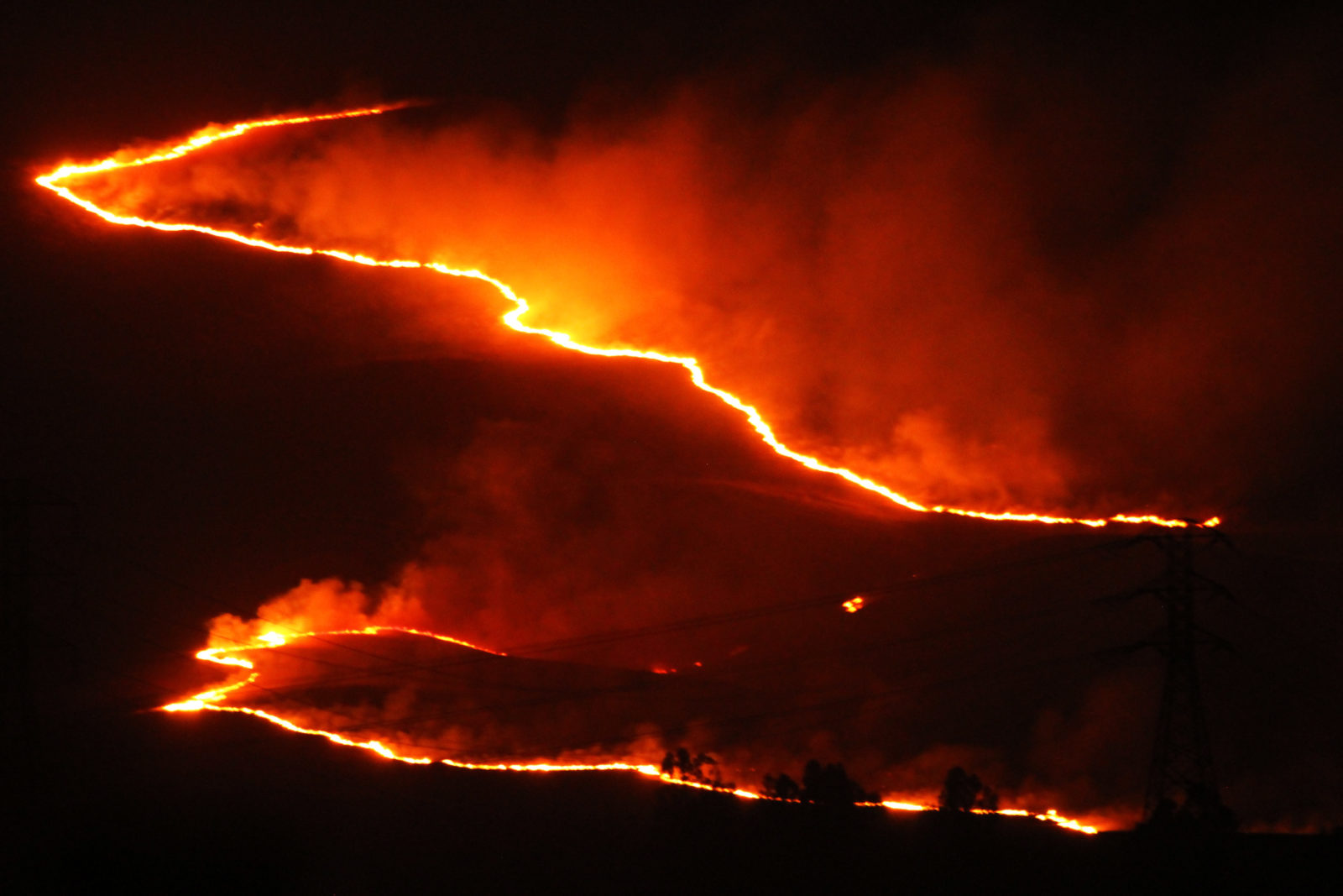
Thin, glowing traces of lightning passed through the skylight above my bed and circumvented my eyelids to etch their way directly onto my brain as I slept. I awoke with an unpleasant start, my first thought being: this can’t be right!
My science brain tried to soothe and deny: we don’t get lightning in the Coast Ranges, or at least not this kind. Historically lightning strikes in our region are incredibly rare.
But what good is history these days? As my unease continued through the dark wee hours, thousands of ignitions by lightning across California began to unfold in a fiery dance. The race for resources and our survival was on, regardless of what I had the luxury of considering “normal” up to that point.
But what good is history these days?
For more than ten years, I have helped to guide expert teams in “downscaling” climate data to make it useful at regional levels, which has included working with natural resource agencies to support fire preparedness, response and recovery. For a Coastal Conservancy project called Climate Ready North Bay, completed just at the onset of our “megafire” seasons, we projected how and where fires could become more frequent and severe as our climate gets hotter and drier. Regrettably, these projections have turned out to be right. Scientists usually like to be right, but as the fires ignited by that flurry of lightning burn on, I find myself unprepared for the truth I helped foretell.
As a graduate student 30 years ago, I never could have conceived that the climate change threats, whose models then were just in development, would become a reality in my lifetime. So despite significant mental preparation, this mind, so accustomed to crunching numbers, identifying and analyzing spatial patterns, running computer scenarios, and physically monitoring species’ response to wholesale disturbance, cannot really take recent events all in.
Two years ago, the 3,200-acre reserve Pepperwood manages in Sonoma County, in the heart of one of the high fire probability zones we mapped, was almost completely burned in the Tubbs Fire, which destroyed our staff homes, barn, field office, and an astronomical observatory. In November 2019 our property burned again in the Kincade Fire; it also served as a hub for first responders who relied on our fire cameras and our well-managed wild lands as a base for operations, which enabled them to hold the line and protect our fire-rebuild construction sites! We know from historical ecology that this corridor also burned in 1964, 1923, and 1870–as the Mark West Creek canyon that runs East-West in the Mayacamas range is perfectly oriented to capture, funnel and accelerate the Diablo winds that make fire weather.
Now, over the last few weeks, we have been watching with our hearts in our mouths as the Walbridge Fire burns the Sonoma Mountains to our West, and the Blue-Ridge Berryessa range burns to our East. More than half the members of the Pepperwood team were evacuated from their homes, while intolerable air quality at the reserve halted our operations, already reduced due to COVID-19 restrictions. Thousands of our neighbors and conservation partners have been displaced or worse by these recent LNU Lightning Complex conflagrations: the reports are still trickling in as the first responders start their withdrawal and we wrestle with the unhealthy air.
The collective emotional state of my team, and our whole community, is fragile. We both count our blessings this time and mourn the cumulative toll on friends and family members, their homes and their businesses. We know how much strength and resolve it takes to return to a scorched piece of earth to rebuild and to help the land heal. While nature always starts recovering right away, only recently have we seen substantive signs of our devastated community rebuilding itself from past fires, never mind this new damage.
Intellectually I know that fire can definitely strike twice, so it shouldn’t surprise me that this is happening again. Though Pepperwood was 95 percent burned by the Tubbs Fire, there was still plenty of fuel waiting, including dead standing trees killed but not consumed in 2017, just waiting for the Kincade in 2019. Had the Walbridge or Berryessa conflagrations spread to Pepperwood, we could have burned again in 2020.
So while I helped predict these fires, I surely did not expect to live through them in such quick succession. Only gradually will we grasp the full ramifications. How much fire can the landscape take? Can we ever recover the kind of balanced relationship Native Americans had with this land, when they so effectively used fire to steward these lands for millennia?
And how much fire trauma can our people take? Since 2015, fire survivors of the North Bay have dwelled inside a slowly recovering disaster zone, just a commute away from normalcy. We are once again dwelling inside a “smoke bubble” generated by the wildfires surrounding us. And we are doing our best to prepare for the inevitable power outages that will come with the fire season: memories of driving through pitch-black valleys with a darkened horizon remain fresh, and creepy. We remain over-reliant on technology, depending on an energy system that laces live power lines through drought-stressed trees, mere threads ready to snap into live fuses as the aptly named Diablo winds make their annual visit. Like many others, we are still sorting out energy backup options for Pepperwood that won’t consume more fossil fuels or create new ignition hazards.
While a couple of years of mega-fire are not yet a trend, they suggest our projected trajectory.
The Northern California ecosystem is fire-adapted, with many species evolved to thrive with regular burning. California’s fire science community has been predicting for years that wildfire events would be more frequent and more severe. While a couple of years of mega-fire are not yet a trend, they suggest our projected trajectory. Thanks to global warming, we are exacerbating both the flammability of our forests and the velocity of these fires, with recent fires having covered distances up to eight times faster than historic fires in similar footprints.
The key to a resilient future may be revealed via a deeper excavation of our past. Our situation in Northern California is directly linked to the suppression of Californian indigenous burning practices starting in the late 1700s. European settlers introduced cattle to the landscape and outlawed indigenous burning practices to protect their forage. In turn this triggered a proliferation of invasive grasses, which still dominate our landscape and are more flammable than native grass species.
California Indians light low-intensity fires to control the growth of vegetation, to favor certain oaks and other resources they rely on for food, to improve habitat for wildlife, to create safe passage routes, and to keep their communities protected. Historically, small encroaching Douglas-fir trees were cleared out in these fires, while our big iconic oak trees, with deep bark and roots reaching deep into the groundwater, were untroubled.
Today at Pepperwood, we are carefully re-introducing fire into this landscape in partnership with both Native advisors and CalFIRE. With our Terrestrial Biodiversity Climate Change Collaborative (TBC3.org), we are actively researching what factors drive today’s fires, through the lens of the “fire triangle” of weather, forest condition, and ignition hazard (like lightning or malfunctioning power lines). We have been analyzing what makes a fire burn very hot and very fast, and the signals are clear. One factor is the effective “overstocking” of our forests due to fire suppression, which leaves thousands of skinny trees in the understory as “ladder fuels” capable of feeding a ground-fire into the forest’s canopy. At Pepperwood, historically our forests supported about 100 trees per acre, whereas today we count over 1,000 per acre. This forest condition creates a powder keg when combined with more intense droughts and the introduction of ignition hazards resulting from human encroachment into wild lands.
How can we can retrofit this landscape, as swiftly as possible, yet with long-term resilience in mind? Our trauma today connects with a historical trauma, the loss of indigenous culture and land stewardship, 300 years in the making. These historical traumas will never be erased. Yet there is still hope for healing. Together we need to recalibrate our vision of California’s Eden as a functional pyroscape, a thriving ground of fire, and we may well have to light small ones to keep the big ones at bay. The stakes are higher than ever: let’s take on the challenge of framing collaborative solutions for large landscape conservation, whereby we can look beyond parcel and county boundaries to frame effective forest management strategies for ecosystem health, climate resilience, and our community’s public safety.


