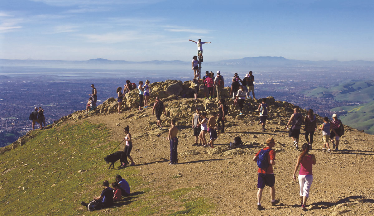
On a clear day from the 2,517-foot summit of Fremont’s Mission Peak Regional Preserve, there’s a telltale panorama of the Bay Area. Many of the East Bay Regional Park District’s 65 parks and preserves are visible to the north—green islets of calm amid greater San Francisco’s creeping sprawl. To the south rises tree-covered Mount Hamilton, towering over the asphalt and glittering high-rises of San Jose.
In 1976, when the Mission Peak preserve was established, the view from the summit was of a pastoral-like landscape below. Since then, more than 2.5 million people have moved into the Bay Area. Driven by a torrid economy, the boundaries of Silicon Valley have bled northward along the margins of the Bay. Today, the San Francisco-Oakland-San Jose nine-county Bay Area is home to almost 7.7 million residents, making it the 6th largest urban region in the country.
But in the last 50 years, the acreage of the Bay Area’s regional and county parks has also grown significantly, so that today, the inventory of protected lands stands at more than 1.3 million acres—a swath of land that, if combined, would be larger than one-and-a-half times the size of Yosemite National Park. Only a region whose people are passionate about the environment would protect that much land in the face of so much growth.
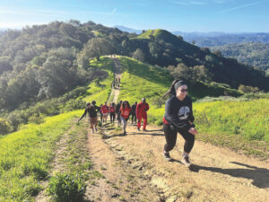
On Mission Peak that swelling population and love of the outdoors have clashed. Just like the urban hardpan over which it looms, Mission Peak is showing signs of increasing human pressure. Last year the mountain saw a total of 274,000 visitors. That’s roughly 750 visitors per day competing for the trailhead parking lot’s 43 spaces. Badly eroded spur trails run up from the wide main trail, shortcutting its switchbacks. “Social” trails have grown so ubiquitous on one severely eroded section of the peak, known as “Scarface,” that an extensive revegetation effort is underway.
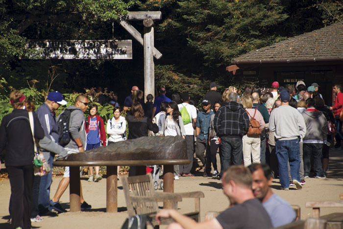
Mission Peak is certainly not alone. At iconic Muir Woods, designated as a national monument by president Theodore Roosevelt in 1908, visitors today stroll amid teeming crowds and the tailpipe emissions from hundreds of passenger cars and idling buses. In 2016, some 1.1 million people passed through the Muir Woods gates, while last year more than 15 million people visited Golden Gate National Recreation Area—a collection of sites scattered across Marin, San Francisco, and San Mateo counties including Muir Woods, Marin Headlands, Crissy Field, and Alcatraz Island. (By comparison, that’s triple the number who went to Yosemite National Park in 2016.) GGNRA is the most visited park in the entire National Park Service inventory. The Bay Area’s regional parks, too, seem to be getting more of an influx. East Bay Regional Park District visitation has jumped by almost 80 percent since 2000, with the annual number of visits now exceeding 25 million (more than the annual attendance to all seven of the Bay Area’s major sports teams’ games combined).
With the uptick in visitors has come an oft-repeated storyline: Across the Bay Area, as more hikers, runners, cyclists, picnickers, and other users seek out the region’s open space parks, they’re finding more people—and more conflict—along the trails. “The pressure is mounting,” says Steve Abbors, general manager of Midpeninsula Regional Open Space District, which oversees 63,000 acres of land between Pacifica and Santa Cruz. “We’re seeing more pressure on trails in places like Rancho San Antonio, which is our biggest preserve and serves around 700,000 people a year. You can’t park there on weekends.”
Our trails, it would seem, only stand to get busier. According to the Plan Bay Area 2040 report issued by the Metropolitan Transportation Commission, the Bay Area will add another 2.4 million residents over the next two decades. With such growth projections, some like Abbors are asking whether the fundamental mission of the parks—seeking to improve access and increase visitation while also preserving ecosystems and solitude—is self-defeating. By encouraging more visitors do we risk loving our parks to death? Are there ways to manage larger crowds that both enrich the park experience for more people and protect the natural resources for future generations? Could larger, more diverse crowds, in fact, be essential to the future of open space in the Bay Area?
Most of us who’ve visited Muir Woods or Yosemite National Park on a weekend in June might not have a formal definition of overcrowding—but we know it when we see it. The hallmarks are unmistakable: endless streams of cars and buses, jam-packed trails, impossible-to-book campsites. Park managers, however, use more formal metrics, including “carrying capacity,” a technical term borrowed from population biology, which refers to the maximum population a particular ecosystem can sustain before suffering negative effects. In relation to parks, the definition of “carrying capacity” is more fluid, referring to the maximum number of visitors a particular park can handle. According to management policies promulgated under the National Parks and Recreation Act of 1978 it means “the type and level of visitor use that can be accommodated while sustaining the desired resource and visitor experience conditions in the park.”
Another more in-vogue concept known as “limits of acceptable change” (or LAC) seeks not to assign a maximum number of visitors to an area but instead devise “scenarios” meant to quantify the impacts caused by a park’s array of users. The basic premise of LAC is that activities are not equal when it comes to their toll on the land: For example, a dozen bird-watchers sticking to a short segment of trail in a park’s front-country are likely to have less impact than a single camper bestride a thousand-pound pack animal plodding deep into the backcountry. “Limits of acceptable change looks at finding trade-offs and evaluating scenarios rather than some hard and fast number,” says Tom Robinson, director of conservation, science, and innovation at the Bay Area Open Space Council. “It’s more of a dialog than a mathematical exercise.”
While the methodologies differ, both metrics share an overarching goal—to determine just how much use a particular park can withstand before its resources or the “natural” experience of its guests are degraded. With this information, park managers determine how many permits to issue each year for a particular backcountry destination, say, or for sites in a particular campground. In extreme cases, such as Utah’s Zion National Park—where a 61 percent increase in visitation since 2010 has users waiting in hours-long traffic jams to reach the entrance during high season—officials are relying on carrying capacity figures to potentially limit the total number of visitors allowed in the park. At Muir Woods, park managers in December announced a new reservation and permit system. Resulting from a 2016 memorandum of understanding between the National Park Service and Marin County, the system aims to improve the water quality of Redwood Creek and reduce traffic and parking congestion along the shoulder of Muir Woods Road, which sees as many as 400 parked cars during peak visitation times. Starting this fall, visitors must call ahead to obtain one of a limited number of permits. Park managers plan to reduce the number of annual visitors by 176,000 from 2015—a 16 percent decrease. Mission Peak park managers have implemented a similar permit system, restricting parking on residential streets at the height of the weekend rush.
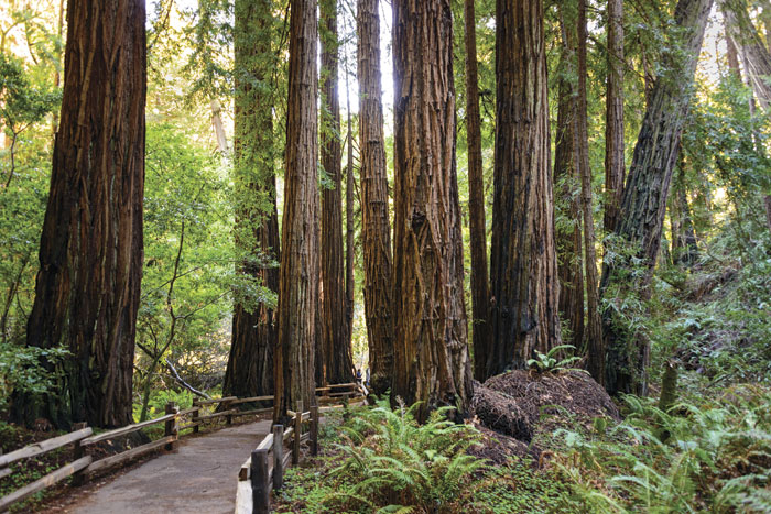
But gross visitation statistics often don’t tell the whole story. It’s just as important, says John Dell’Osso, chief of interpretation and resource education at Point Reyes National Seashore, to know where, when, and why people are visiting. “We’re located an hour away from eight million people in the Bay Area—that makes us very much a weekend destination,” says Dell’Osso. “We may average 200,000 visitors per month, but a large percentage of those visitors come on weekends and holidays.” They also congregate in certain areas, Dell’Osso says, such as the Point Reyes Lighthouse, a small prime attraction. Similarly, the vast majority of visitors to nearby Muir Woods National Monument crowd onto a roughly mile-long segment that follows Redwood Creek, under the towering redwood canopies of the Bohemian and Cathedral groves, and venture no farther. In other words, the perception of overcrowding suffers from a self-reinforcing effect. When more people flock to a small collection of popular sites at high visitation times, they see greater numbers of people doing the same thing. “At Point Reyes, we have over 150 miles of trails,” says Dell’Osso. “It’s five or six segments that are seeing heavy use, not the entire system.” Instead of determining carrying capacity and quotas for the entire park, Dell’Osso and his colleagues evaluate impacts at “hot spots” and then recommend strategies to reduce crowding there.
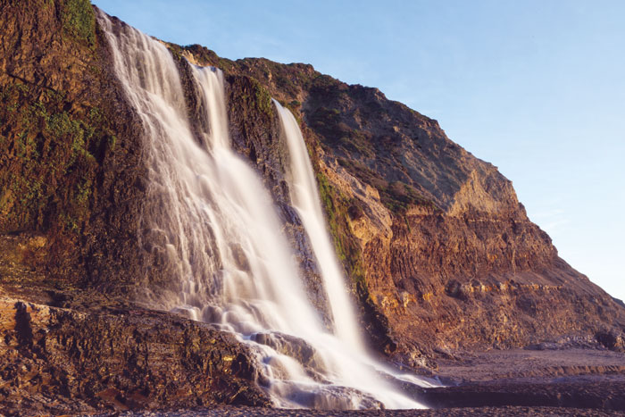
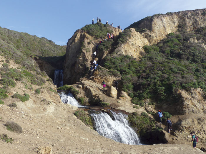
The rise of social media—notably, the selfie phenomenon among other trends—has created some of those hotspots. Dell’Osso points to Alamere Falls, situated along the southern edge of the park. The striking seaside cascades have seen a surge of visitors in recent years. “People get to the waterfalls and take their selfies and post their videos to YouTube,” he notes. To counter the large and often underprepared crowds, the park has taken an “if you can’t beat them, join them” attitude. It’s embarked on a social media campaign and a new docent program, urging people to bring water and sturdy shoes and—on the busiest days—to avoid the Alamere Falls trail altogether. “Eventually, we started to catch on,” he says. “We realized we could use Twitter and Instagram to make recommendations about where to go and how to have a safe experience once you get here.” So far, says Dell’Osso, it’s been hard to measure the effectiveness of the outreach efforts. But at the very least, the posts and docents have helped educate visitors about the basics—namely the importance of staying on trail and the overall length of the hike. “Before we began writing our posts, many people we spoke with at the Palomarin Trailhead thought the hike was between four and six miles, round-trip, when it’s actually between 12 and 13,” he says. “More and more people we talk to these days come knowing the length of the hike.”
Creative crowd management strategies notwithstanding, Midpeninsula’s Steve Abbors says the crowds are detracting not only from the natural “aura” of these places but from the integrity of ecosystems. Akin to the city’s “lungs,” large open space parks perform critical ecological roles, including removing carbon and other pollutants from the atmosphere and creating corridors for wildlife within the ever-expanding footprint of the city, Abbors says. “We don’t tend to see urban parks in this light,” he told me. “But that’s what these spaces are—the city’s life support system. How much use can the land sustain before we start seeing effects that damage its ability to serve these other ecosystem functions?” The Bay Area’s parks are not merely life support systems for the city’s human denizens—they are habitat for thousands of species of plants and animals, including 35 endangered or threatened species within the Golden Gate National Recreation Area. “Even many of the city parks maintain small but important pockets of biodiversity,” says Robinson of the Bay Area Open Space Council. “But the demand for these parks is significant. We have to understand that meeting the needs for larger human populations means increased responsibility for environmental stewardship.”
It’s tempting to draw a tidy connection between the Bay Area’s rapidly growing population and the experience of overcrowding and environmental threats to local parklands. But it’s not so simple. Indeed, some areas within some parks have seen a sharp uptick in visits in recent years. However, much of the visitation data suggests something else is going on. While that data is hard to come by, the existing information shows that visits to many Bay Area parks have not increased significantly in recent decades. For example, the number of people to Muir Woods National Monument was roughly the same in 2016 and 1978, while numbers in other parks have declined dramatically. In 2011, Henry Coe State Park, a rugged 136-square-mile preserve east of Morgan Hill, was almost shut down during the state parks crisis, citing low visitation and scant revenues. The peak in annual visits to Golden Gate National Recreation Area—often considered the epicenter of overcrowding in the Bay Area—occurred back in 1987, when 21 million visitors (roughly 5 million more than in 2016) came through its gates. And of course, even the busiest parks can offer plenty of solitude—if one is willing to walk a bit. As Dell’Osso points out, hundreds of places with wilderness-like solitude exist within the 71,000-acre confines of Point Reyes—including along popular stretches of shoreline, such as Drakes Beach. “You may see more than half of the parking lot full on a given weekend day,” he says. “As you approach the beach you might also see a lot of people. But if you walk 15 minutes in either direction it thins out incredibly quickly.”
So if population growth isn’t wholly to blame for the perception of too many people in our parks, what else is contributing to it? Some argue that overcrowding can be conflated with “user conflicts” that stem from an unwillingness among park managers to accommodate anything but “traditional” forms of outdoor recreation. “The park districts have acquired a lot of land but have closed off or severely limited access to all but a small group of people—mainly hikers and equestrians—while access for cyclists has decreased,” says Austin McInerney, president of the National Interscholastic Cycling Association. He cites East Bay Regional Park data showing that of the 200 miles of single-track trail in the park system, only 22 percent, or 44 miles, is accessible to bikes; by comparison, 57 percent, or 114 miles, is accessible to horses. “As a planner and someone who has seen what cycling can do for youth, that is frustrating.” McInerney asserts that most conflicts between mountain bikers and hikers and equestrians could be greatly diminished by building trails and other facilities to accommodate today’s diverse group of trail users. He notes that much of the East Bay Regional Park District’s network of existing trails is simply overlaid atop former logging and grazing access roads and is not engineered to safely handle bikes and walkers at the same time. But in parks such as Marin’s Camp Tamarancho and East Bay’s Crockett Hills, where purpose-designed bike “flow” trails have been built, user conflicts have declined substantially. “It’s entirely possible to design trails that invite fewer user conflicts,” McInerney says. “But you have to be proactive about it.”
To that end, park managers want to know just who is flocking to the parks—and what they like to do there. And though data is sparse, one study conducted by researchers at San Francisco State University suggests that first-time visitors comprise a large segment of the visitor population. The survey, carried out over two-and-a-half months at 20 different sites across San Mateo County, found that one-quarter of patrons interviewed were making their first trip to a particular location—roughly the same percentage of people who responded that they had visited more than 50 times in a year. Three-quarters of those surveyed in both Marin and San Mateo counties reported they were visiting the parks to “improve physical fitness,” and 64 and 75 percent, respectively, said they had come to “connect with nature.”
But the data also paints a stark picture of underrepresentation. An often-cited 2011 study conducted by the Department of the Interior found that between 2008 and 2009, 22 percent of visitors to national parks were non-Caucasian, even though they made up 37 percent of the U.S. population. The SFSU study revealed a similar pattern: Asian, Latino and African-American visitors comprised close to one-third of visitors in San Mateo County parks and only one-sixth in Marin County, even though members of these groups account for almost half of the Bay Area’s population.
In other words, the Bay Area’s parks are both overcrowded and underutilized. This is not a contradiction, but two sides of the same coin, divergent realities of life in a stratified region increasingly beset by income and social inequities. In the Bay Area, people’s disparate needs and priorities are reflected in their hopes for the commons. While some emphasize the overcrowding and ecological impacts in parks, others have drawn attention to these racial disparities and advocate for expanded use among a more diverse cross section of Bay Area residents. This latter perspective argues parks aren’t just for communing with nature, but are also potent economic engines that confer valuable social benefits—which are critical needs of the Bay Area’s underserved communities.
In other words, the Bay Area’s parks are both overcrowded and underutilized. This is not a contradiction, but two sides of the same coin, divergent realities of life in a stratified region increasingly beset by income and social inequities.
Earlier this year, Marin City, Marin County, the National Park Service, and several other agencies embarked on a “parks prescription” partnership program, which encourages underserved communities to improve their health by using the region’s trails and parklands. “By prescribing outdoor activities we’re actually getting positive health care results—reductions in depression rate, blood pressure, and diabetes,” says Marin County Parks & Open Space director and general manager Max Korten. “We’re not just addressing park disparities in these communities, but health disparities as well.” A recent East Bay Regional Park District study found that its open space generates $200 million of economic activity in local communities per year, including jobs, supporting working landscapes, and visitor spending, and close to $500 million in social “benefits” (a sum nearly four times the East Bay Regional Park District’s annual budget). According to the researchers, benefits include reductions in health care costs. The study estimates that regular exercise at the district’s parks help lower individual health care expenses by $300 per year for visitors under age 65 and $600 for those over 65, translating to a total savings of $21 million annually. The calculus here is simple: The greater the visitation, the greater the social and economic benefits derived.
Nina Roberts, professor of Parks, Recreation and Tourism at San Francisco State University (and a co-author of the San Mateo and Marin user survey study), argues that parks are democratic crossroads that derive their highest “value” from being accessible to all. Roberts often refers to open space and public parks as “catalysts for social change.” Like great communal spaces in large cities—New York’s Central Park, for example, or Chicago’s Lake Michigan waterfront—parks are places where people from different walks of life can mingle in a space that reflects a larger set of societal values. “In parks, people come together experiencing the common ground of park values,” Roberts told me. “There’s a greater exchange and interaction. These are the kinds of spaces that transform our lives and bring us together.”
Whitney Dotson, director of the East Bay Regional Park District’s Ward 1, echoes Roberts’ sentiment and says it is a main focus of his job to help get people out of neighborhoods—many of which are low-income and predominantly African-American and Latino—and into parks across the district. “We not only have a diverse population, we have a huge diversity of lands,” Dotson says. By experiencing that array of landscapes, he adds, a person gains a deeper and richer awareness of the community at large and of one’s place in it. To that end, he’s working to improve access and increase transportation options, such as van shares, to get people from low-income communities to parklands across the district: “People should be able to experience these places regardless of what neighborhood they live in.”
There’s certainly a balancing act between conservation and courting new park-goers, Roberts says. But she asserts that getting more people of color into the region’s open spaces is not merely a matter of equity—it is critical to the future survival of the region’s open space. “Demographics are shifting,” Roberts points out. “Park managers have to reckon with this. If we don’t have these communities of color supporting and screaming and writing letters saying ‘don’t mess with our parks,’ the likelihood of park protection is going to be diminished in the years ahead.”
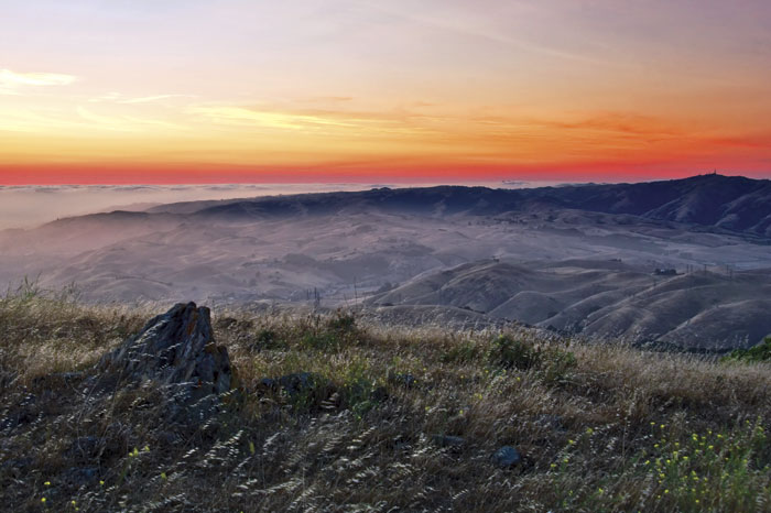
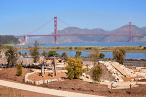
From atop Mission Peak, with the city’s sprawl far below, the scale of the Bay Area’s growth is perceptible, but not the demographic nature of it. Roughly 69 percent of the Bay Area’s population will be non-white by 2040, according to the recent Plan Bay Area report. As Roberts says, park managers and users have to come to terms with the demographic and cultural changes underway. Compromise and a careful consideration of priorities for each park seems to be the only way forward for the vast inventory of parklands as the region continues to grow, says Robinson of the Open Space Council. And it is the remarkable variety of the region’s open space that may prove the greatest asset in that effort, he adds. He points to San Francisco’s Crissy Field and the Sunol Regional Wilderness as opposite ends of a wide spectrum of open space. “Both are well-managed parks,” he says. “But Crissy Field is full of people in the heart of the city and Sunol is so remote that it’s easy to forget you are still in the Bay Area.” Both kinds of parks are vitally important, he adds—and require vastly different styles of management. “As managers, we need to continue asking ourselves: What does society need from this land? And what does nature need?” An embrace of the Bay Area parklands’ multifaceted mission will be essential in preserving them for future generations, Robinson insists. “We’ve done a good job, I think, of striking the balance on a park-by-park basis, between human needs and the needs of ecosystems,” he says. “That will have to continue in the future.”

