Sometimes it’s the little things…We all know the saying. And it happens to be true about a new half-mile stretch of trail that flanks Martin Luther King Jr. Regional Shoreline along Doolittle Drive in Oakland. It’s also the little things, we all know, that can take a lot of time and effort.
The new Doolittle Trail helps people on foot or bike get safely to work, the shoreline park, and a local events center. It provides better access to the water where people fish, boat, and swim. The new path makes it easier to choose not to drive. It also adds new access to the San Francisco Bay Trail and Bay Water Trail. Generally, it improves life a little bit in a lot of ways.
In August, the East Bay Regional Park District, which manages the trail, officially announced this newest addition to Martin Luther King Jr. Regional Shoreline, along with a renovated boat launch, providing safer and better access to the park and the waters of San Leandro Bay. According to EBRPD project manager Toby Perry, the project is about enhancing an area that is primarily industrial and yet still serves those who live closest to it.
“Here you have a beautiful thriving park in a part of Oakland that isn’t known for its open space and recreational opportunities, and I love that about it,” Perry says. “It’s about building a safer, multiuse trail along San Leandro Bay, connecting to the existing Bay Trail, and providing improved water access.”
Doing the work
The improvement project began 10 years ago, when a feasibility study was conducted to determine the practicality of building a new walking and biking path. Much of the shoreline park already had a clear, safe trail following the Bay inlet, however, there was only an “unofficial dirt path” that ran from Swan Way northwest along the adjacent Doolittle Drive. Cars zoom down Doolittle—also known as State Highway 61, where the speed limit is 45 miles per hour—to reach the Oakland International Airport and Alameda Island. The completion of the 12-foot-wide path with a guardrail separating it from traffic means that for the first time in the park’s 44 years there’s a safe, nonmotorized transportation route for people who live in and visit the area.
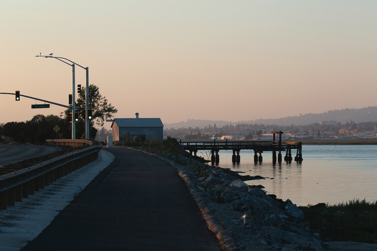
San Leandro Bay and the regional shoreline flank one side of Doolittle Drive, and on the other sit the Oakland Aviation Museum and the Oakland Airport. (Jacob Saffarian)
The north end of the trail concludes at the shoreline park’s “Boat Launch Area,” where there’s parking and the new launch. A few more steps to the northwest lies the Shoreline Center, a small rental facility overlooking the water, that supports community events. Across the channel lie Arrowhead Marsh and “New Marsh,” home to endangered Ridgway’s rails, salt marsh harvest mice, and many species of resident and migrant birds.
Costs for the trail reached $10.5 million and the demolition and replacement of the boat launch came to roughly $1 million. The construction for the trail began about 1.5 years ago, and Perry says that even before its “soft launch” in June, there was tremendous local interest in the path, boat launch, and parking lot.
“People have been watching the construction through the fence, eagerly awaiting its opening,” he says about the early excitement.
Lisa Brodtmann, the park supervisor for the Martin Luther King Jr. Regional Shoreline and San Leandro’s Oyster Bay Regional Shoreline, says that along with picnickers on weekends, the path is seeing foot traffic from people of all ages. “A lot of retirees come out because the trail is flat and paved” and “there are a lot of people who commute on bike,” adds Brodtmann, who has been assigned to this area for six years.
Perry, who’s been with the park district for seven years, says he was surprised when he started working on this project at how well utilized the trails along this part of the Bay were. “It’s an industrial area … people come for lunch, breaks, to the boat launch—one of the few places you can use motorized boats on this part of the Bay,” Perry says.
A small piece of a bigger idea
Nestled in between the I-880 freeway and Oakland International Airport, the Martin Luther King Jr. Regional Shoreline is leased by EBRPD from the Port of Oakland. The district opened the 748-acre park in 1979 with the goal of protecting what was left of the Oakland Estuary marshland and to provide the public with opportunities to hike, birdwatch, picnic, fish, and generally recreate.
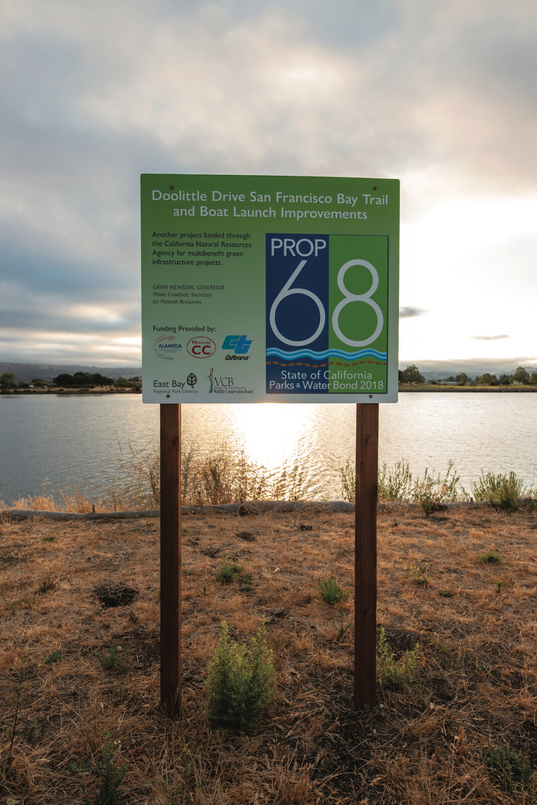
Voters in 2018 passed California’s Parks, Environment, and Water Bond, which included funds for rehabilitation of local parks. (Jacob Saffarian)
Formerly known as San Leandro Bay Regional Shoreline, the park was renamed in 1992 by a unanimous vote of the park district board of directors in honor of the late civil rights leader Dr. Martin Luther King Jr. And in 1993, with community support, a memorial grove was dedicated in King’s name. A cluster of trees and shrubs, including cottonwoods and coast live oaks, surrounds a grassy glade and a brick wall inscribed with donors’ names.
Other improvements to the Boat Launch Area included a litany of important changes: removal of the old boat ramp and replacement of the existing two-lane boat launch; parking lot resurfacing and re-striping; shoreline protection; construction of one acre of new salt marsh habitat at what is referred to as the “New Marsh” near where San Leandro Creek flows into the Bay; and putting in the ground more than 17,000 planting plugs of the native salt marsh plants, such as saltgrass, fleshy jaumea, and pickleweed in the one-acre area.
Before you explore the shore
» On Doolittle Drive, look for the sign for Martin Luther King Jr. Regional Shoreline “Boat Launch Area.”
» The park opens at 8 a.m. daily and closes at sunset.
» Public restrooms, water fountains, and free parking, including ADA spots.
» Dogs must be on a leash (six-foot maximum) in the park; however, they are not allowed in marsh areas.
» For more details, visit: EBParks.org/parks/martin-luther-king.
What many may not know is that this newest stretch of pathway is only a small piece of an oddly shaped puzzle. The Metropolitan Transportation Commission oversees the San Francisco Bay Trail, a network of pathways bordering the entire Bay, stretching from Santa Clara County in the south to Sonoma County in the north. When completed, it will total about 500 miles, of which more than half has already been built.
“Everyone is working on little pieces here and there,” says Perry, explaining how trail projects are managed by the counties and municipalities that border the water of the Bay and all its inlets.
The Doolittle project included construction of about “a half mile of new Bay Trail, as well as a quarter mile of existing Bay Trail that was widened and resurfaced, all of which reduces a critical Bay Trail gap along Doolittle Drive in Oakland,” says Perry. There is still a short and unsafe gap in the Bay Trail between the Doolittle Staging Area and Bay Farm Island, which Perry says the park district hopes to someday address.
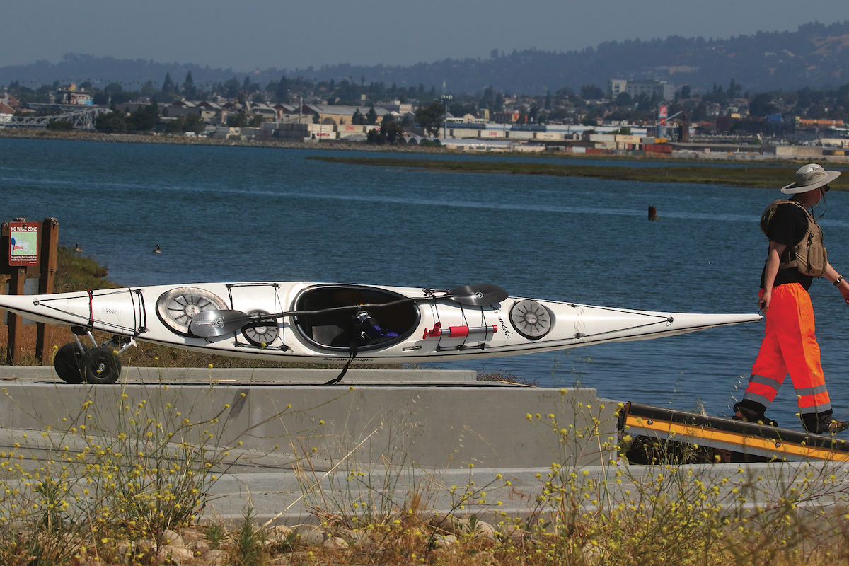
Because of the new boat launch—which includes a floating dock for paddlers and a boat ramp for motorized vessels—the Boat Launch Area is now a “trailhead” on the San Francisco Bay Area Water Trail, a constellation of nonmotorized boat launches all over the Bay. The State Coastal Conservancy leads a consortium of state and local agencies that host a Water Trail website, which includes maps, routes, Bay conditions, and information about launch sites to encourage and help paddlers explore the region. The launch site also provides a rinsing station for cleaning down kayaks, canoes, and paddleboards.
Both Perry and Brodtmann are excited to talk about the improvements and agree the safety of all who visit is a priority for the park district. “The district has its own public safety division, which has police,” Perry says, adding this takes some of the strain off local jurisdictions—in this case the Oakland Police Department.
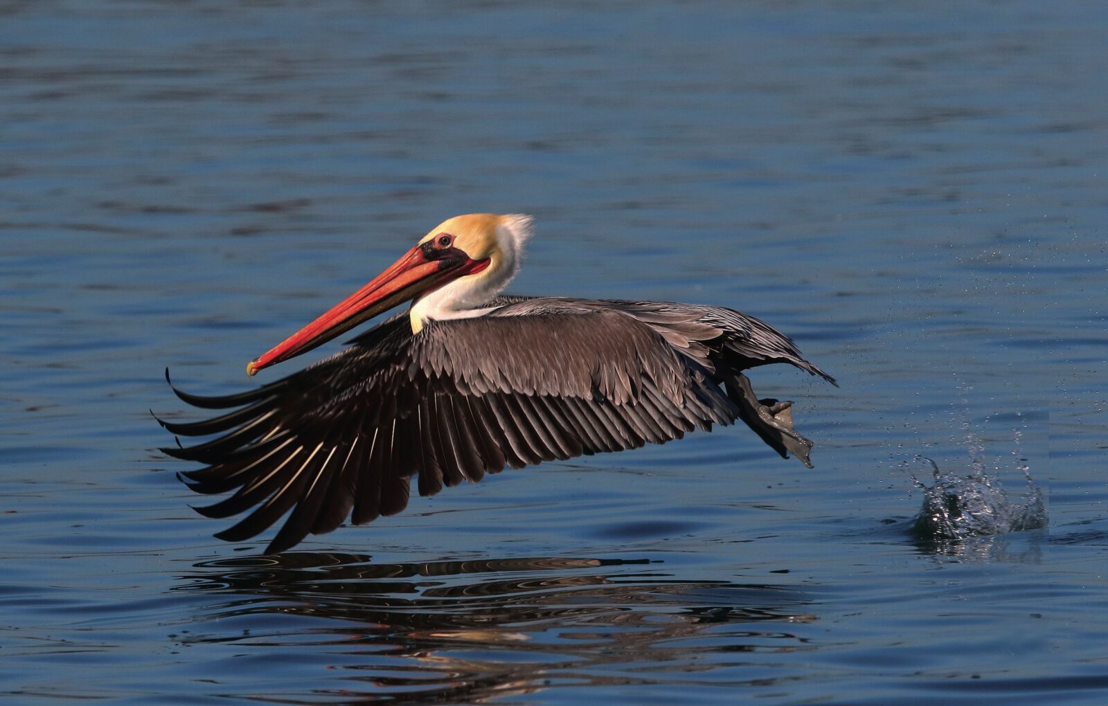
“There are migratory birds coming and nesting birds,” Brodtmann says of what she enjoys about the transformation the entire park has undergone. “Seeing people out here with the telescopic lens and people checking off what birds they have seen…it’s kind of a destination park.”

MLK Jr. Regional Shoreline
Every city has a place that some of its residents don’t know exists. A hidden trail, a scenic view, or a spot that provides recreation. A place where people can come for solace, to exercise, and to gather and celebrate with family and friends. In Oakland, that place is Martin Luther King Jr. Regional Shoreline. As people walk the 4.5 miles of pathways around the shoreline, here are some highlights to look for:
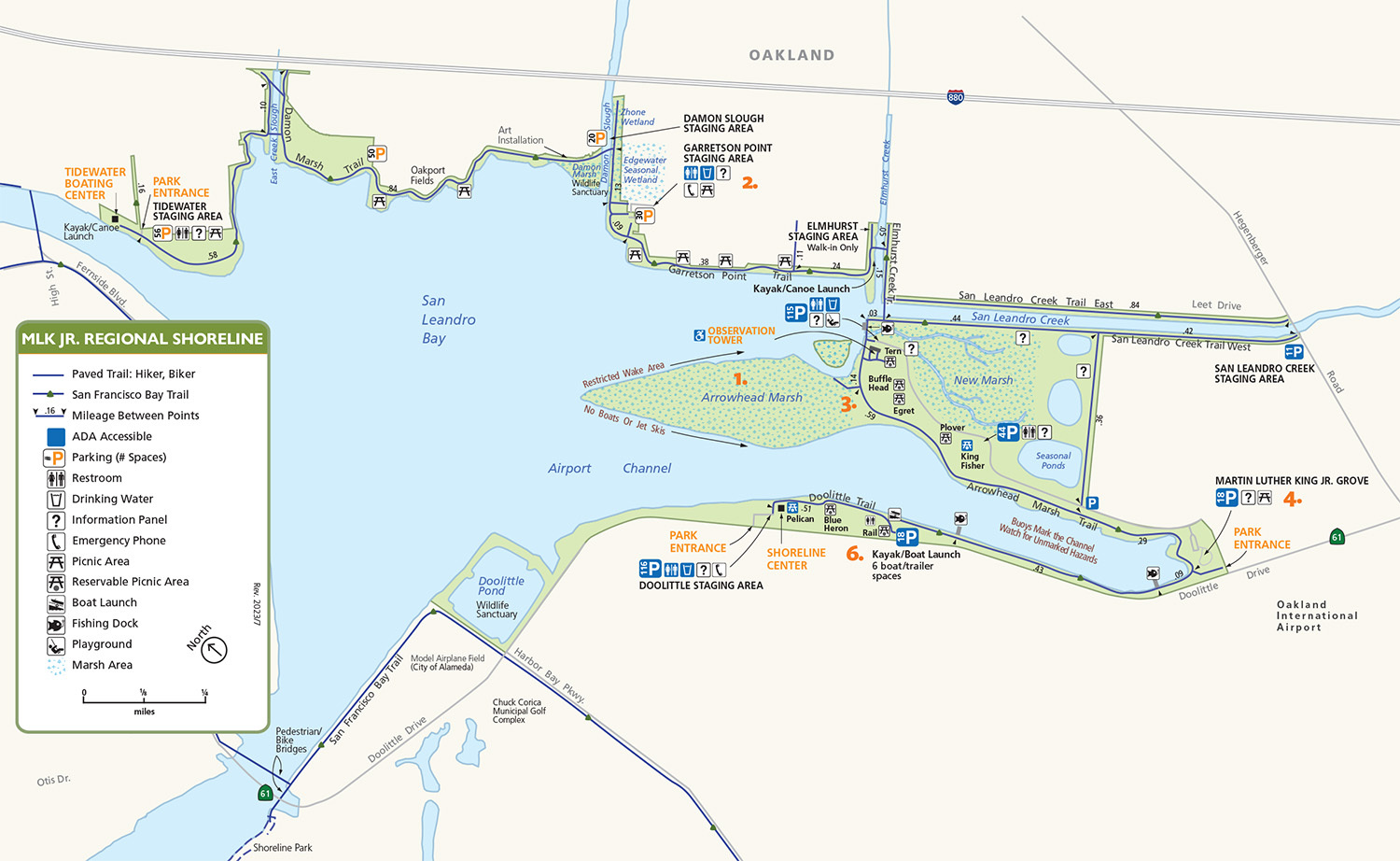
1. The 50-acre Arrowhead Marsh, which stretches out into the San Leandro Bay, is a stopover on the Pacific Flyway, which extends from the Arctic tundra to the South American wetlands. The marsh gets its name for its resemblance to an arrowhead. Visitors can find a short boardwalk extending over the marsh where pickleweed and saltgrass grow thick.
2. Garretson Point, east of Arrowhead Marsh, is named in honor of the late Fred Garretson, an award-winning Oakland Tribune reporter who wrote pieces that called for the preservation of the Bay, the Oakland Estuary, and the coastal wetlands and is credited with helping start the conservation movement to save San Francisco Bay.
3. The Duplex Cone sculpture, located at Arrowhead Marsh, is by Roger Berry, a native California artist whose work is displayed across the country. Berry created dual round pieces from corten steel, which has a rust-like appearance. Rising from the marsh, the smaller cone’s rim tracks the path of the sun on the winter solstice; the larger cone does the same on the summer solstice.
4. In 2015, Martin Luther King Jr. Regional Shoreline was dubbed Best Place for Family Bike Rides by the East Bay Express, for its accessibility and “flat bike trails amid a natural landscape.” EBRPD anticipates the new trail will draw more users, increasing the daily number of bicyclists to 565 (up from about 237) and 1,363 pedestrians.
5. Some of the birds that can be seen year-round include the marsh wren, Ridgway’s rail, sora, and Virginia rail, as well as the ducks, geese, and other shoreline birds commonly in the area.
6. The new half-mile trail connects the Martin Luther King Jr. Memorial Grove, and its parking lot, to the “Boat Launch Area” parking lot. While walking along the shore, look for flocks of black-bellied plovers, killdeer, and many other shorebirds.

